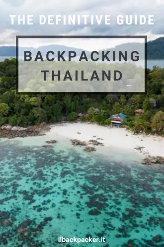
Thailand Travel Guide
Thailand was likely the first country in Southeast Asia to welcome travelers, and it has now become one of the most popular tourist destinations in the world.
Over the years, some regions have perhaps become overly touristy, but if you are looking for an exotic, affordable, and safe destination, Thailand is the perfect place to visit. Precisely because millions of tourists visit Thailand every year, traveling within the country is really easy—even for less experienced travelers.
From Buddhist temples, markets, and beautiful beaches to delicious cuisine, Thailand has something to offer for everyone. I spent several months backpacking through the country. In this guide, you will find a lot of useful information and tips to better plan your trip to Thailand.
Quick menu
- When to visit Thailand
- Documents and vaccinations to enter Thailand
- What to do and see in Thailand
- Suggested itineraries in Thailand
- How to get around in Thailand
- Backpacking Thailand: costs
- Backpacking Thailand: safety
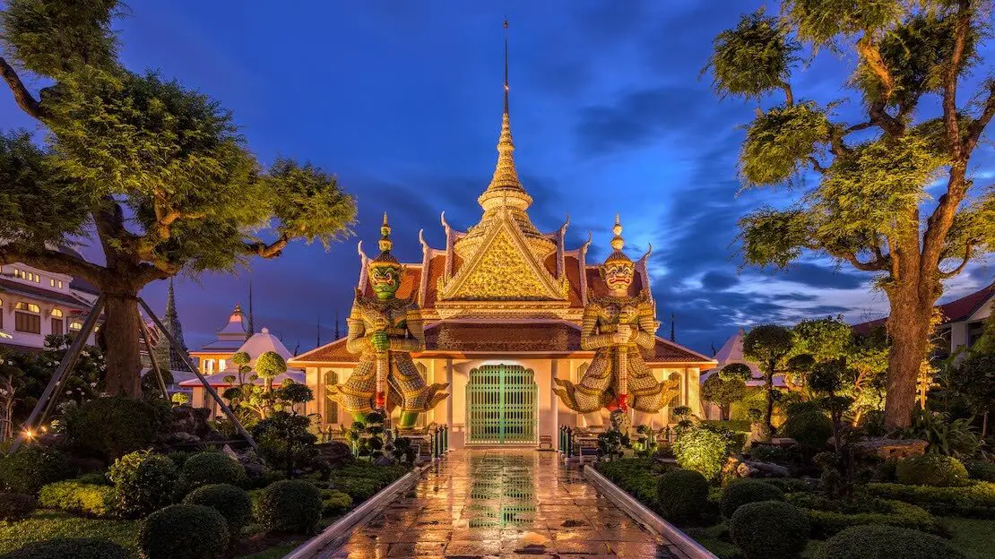
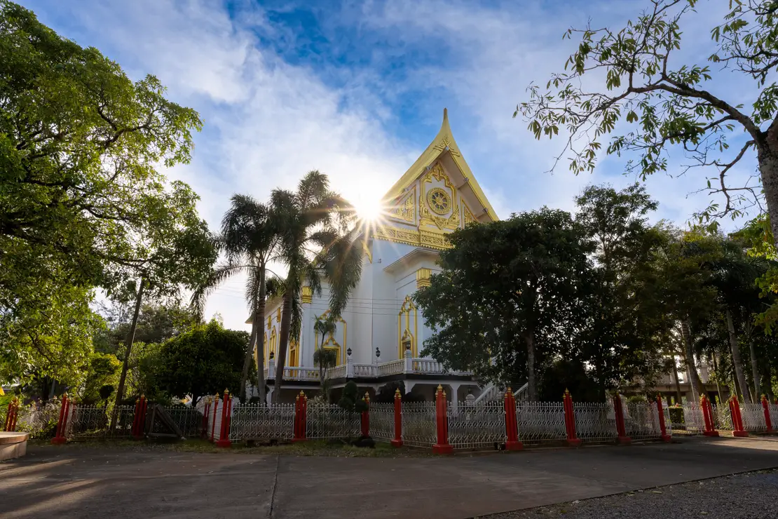
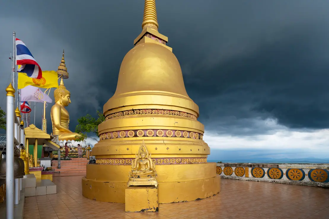
Wat Arun.
When to visit Thailand
Three seasons can be roughly identified in Thailand: the rainy season (May-October), the “cool” season (November-February), and the hot season (March-May).
The rainy season (May-October) is the least predictable of all. Generally, it rains every day, but these rains are often concentrated during a few hours in the afternoon or at night, with a greater concentration starting in July-August and peaking in September-October.
The cool season (November-February) is not actually cold. In fact, it is considered the high season and the best time to visit Thailand, with temperatures that can easily reach 30 degrees Celsius during the day.
The hot season (March-May) is indeed very hot, with temperatures that can easily exceed 35 degrees Celsius, especially in the cities.
There are some regional variations to consider. For example, the southern part of the country is more prone to a rainy season that sometimes lasts into November-December, while in the north, especially in the mountainous areas, temperatures tend to vary more drastically from season to season and even from day to night.
Documents and vaccinations to enter Thailand
Most passport holders with at least six months of remaining validity can receive a free 60-day tourist visa upon arrival by air or when crossing the border by land.
The free 60-day visa can be obtained a maximum of two times during the same calendar year if entering by land or sea. However, there is no limit if you arrive by air.
In addition to exiting and re-entering the country—doing the classic “visa run”—it is possible to renew this visa for another 30 days at the immigration office in major cities, resulting in a total of 90 days. This extension costs THB 1,900 (about 50€).
Here you can find the official website which is actually really helpful.
Thailand does not require mandatory vaccinations, but Hepatitis A and Hepatitis B vaccinations are always recommended.
What to do and see in Thailand
In this guide, prices are often expressed in the local currency. The official currency of Thailand is called “Thai Bath” abbreviated as “THB” or simply “B.”
The exchange rate, at the time of publishing this article, is 1€ = 37 THB. For the current exchange rate, I suggest you look at this page.
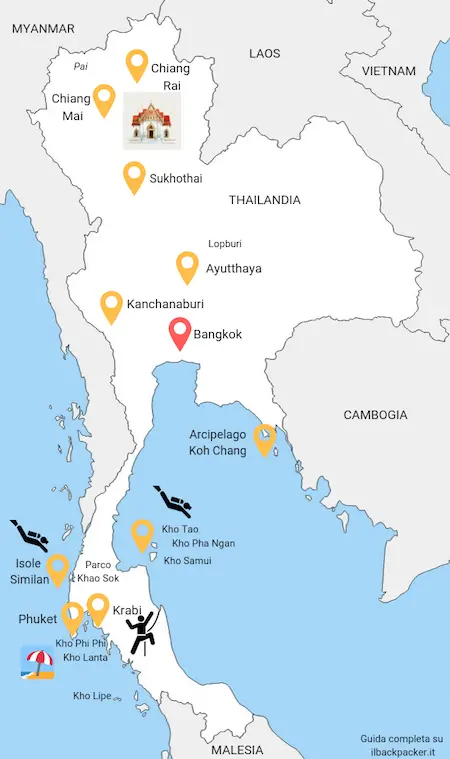
As you can see from the map, Thailand can be divided into three distinct regions: the north, the center, and the south. The north is known for its historical and cultural sites, while the south is famous for its stunning beaches. In this guide, I have divided the various destinations according to these regions, starting with the center of the country.
N.b. Several times throughout the guide you will find links to https://www.alltrails.com/. If you want to use offline navigation directly from the Alltrails app you need to upgrade to the pro version. However, you can get around this by downloading the coordinates from the desktop version of the site in “Google Earth KML” format and then uploading them to Organic Maps, which is by far one of my favorite travel apps.
CENTRAL THAILAND
Bangkok
Bangkok is the capital of Thailand and, with a population of over 11 million, it is by far the country’s largest city. The city is characterized by traffic congestion, intense heat, and a vibrant nightlife. However, it also boasts distinctive temples, palaces, and markets. Despite its challenges, Bangkok is a fascinating city and, in many ways, more enjoyable than most other large Southeast Asian cities.
What to do and see in Bangkok
Below, I focus on the main tourist sites, which are primarily royal residences, palaces, and Buddhist temples erected by the Siamese dynasty. If you are more interested in nightlife, then Khao San Road (Google Maps) is undoubtedly the place to be. This street is lined with numerous clubs and bars. If that’s your kind of thing, I’m sure you’ll enjoy it.
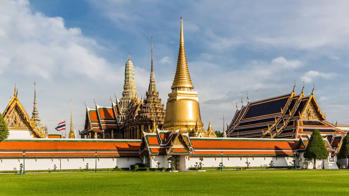
The grand royal palace and the temple of the emerald buddha
The grand royal palace (Google Maps) and the adjacent Emerald Buddha Temple (Google Maps) are probably the two most visited and impressive sites in the city. They can be extraordinarily crowded and I recommend visiting them early in the morning so as to avoid both the heat and the crowds. Plan to spend at least a few hours. The most practical and inexpensive (if shared) way to get to the palace is probably a taxi.
Opening hours 8:30 a.m.-3:30 p.m., entrance fee 500 THB (includes both sites).
Wat Phra Kaew.
Wat Pho
Wat Pho or Temple of the Lying/Sleeping Buddha (Google Maps) is located not far from the royal palace and can be easily reached on foot. Once an educational center of traditional medicine and the birthplace of classic Thai massage, it is now home to a giant 46-meter-long golden buddha enshrined inside an equally impressive temple.
Opening hours 8:00 am – 6:30 pm, entrance fee 100 THB.
Wat Arun
From the riverbank near Wat Pho it is possible to take the ferry (4 THB) at this point and reach the other bank where Wat Arun (Temple of Dawn) is located (Google Maps). This is the highest temple in the city, and the view once you get to the top is excellent.
Opening hours 8:30 a.m. to 5:30 p.m., entrance fee 50 THB.
These just listed are the most popular sites and can be visited easily within the same day, being conveniently located really close together.
Floating market
I only visited the Damnoen Saduak floating market (which is about 100 km away and is the largest and most touristy). I joined a tour and it was okay. If you are interested you can actually visit it on your own as described on this guide. If you want a more authentic experience I recommend looking into other options. You can find a good guide here.
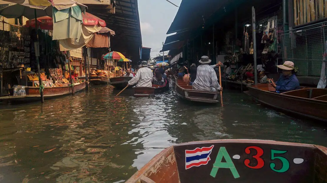
Damnoen Saduak floating market.
Chatuchak Market
There are many markets in Bangkok but with over 200,000 people visiting it every weekend, Chatuchak Market (Google Maps, Maps.me) is the largest weekend market in the world. There are over 15,000 stalls and 26 sections ranging from food to antiques. Some sections are also open during the week but the entire market is only open on Saturdays and Sundays from 9am to 6pm, so I think it is really worth visiting only on these days. To get there, the easiest and cheapest way is by subway, the “Kamphaeng Phet” stop is literally at the entrance of the market. In any case you can find all the relevant information on the official website.
If you are not in Bangkok on the weekend, a nice though certainly not as impressive alternative is the Jodd Fairs night market (Google Maps, Maps.me). Again, this can be easily reached by subway thanks to the nearby subway stop.
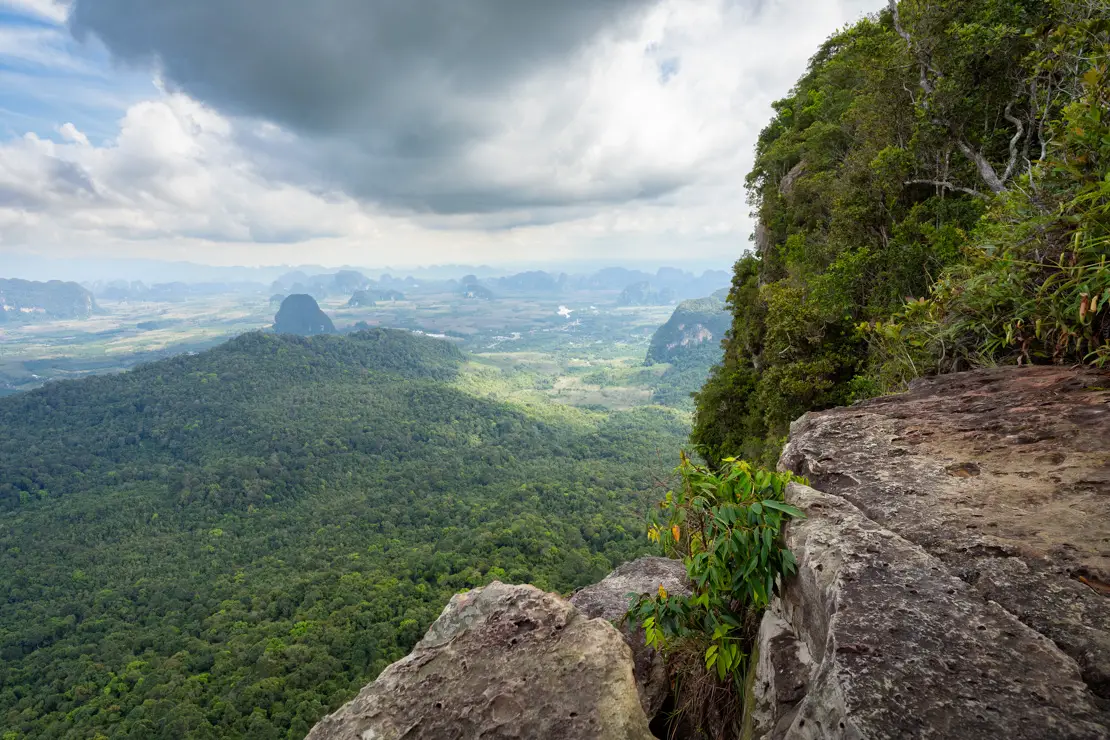
Khao Yai National Park
I will preface this by saying that I have not personally visited the park, which is about three hours north of Bangkok. However, as the second-largest national park in Thailand and a UNESCO site since 2005, it is definitely worth mentioning.
The park is located along the road that connects Bangkok to Nakhon Ratchasima (Korat). Based on my research, it is best to get off at Pak Chong, the nearest town to the park entrance. This involves a 3-4 hour bus ride from Bangkok’s Victory Monument.
From Pak Chong, you can rent a motorcycle to explore the park independently or hitchhike, which seems to be relatively easy within the park. Alternatively, you could rent a car in Bangkok.
If you are interested, you can find an article about the park here. If you opt for an organized tour, I recommend booking it directly on the site.
Finally, I recommend visiting Chinatown (Google Maps) which is a really nice place to stroll around especially at night. Yaowarat Road (Google Maps) is the main street. If by chance you haven’t had enough temples and palaces, I suggest you check out Wat Traimit (Google Maps) close to Chinatown and Wat Saket (Google Maps) not far from Khaosan Road.
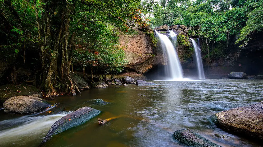
Khao Yai National Park.
Where to sleep in Bangkok?
Many people decide to stay around Khao San Road. When I first visited Bangkok I slept at Mind Day Hostel Khaosan, nothing exceptional but it is cheap and the location is great, the environment is clean and there is air conditioning in the room. If budget is not an issue, check out Nappark, it won the award for best hostel in Asia in 2011, I got to go there because a friend was staying there and it is actually really cool.
During my last few visits to Bangkok I always stayed at Ama Hostel and I highly recommend it, modern and clean in a quiet area within walking distance of Chinatown and especially well connected to major public transportation hubs thanks to the nearby subway stop. Another good hostel I recently stayed at is Pinto Hostel.
How to reach Bangkok?
Virtually every destination within the country has direct connections to the capital. If you are arriving from the airport a cab to Khao San Road should cost 350 to 400 THB, with public transportation the fastest method is to take the train to Makkasan Station from where you can board the “BTS” or “Skytrain” and the “MRT” subway that connects downtown Bangkok. You can find an interesting article on how both work here.
Kanchanaburi
Kanchanaburi is not part of the typical tourist itinerary and is mainly visited by backpackers looking for a place to relax for a few days. The city itself is unremarkable, but its main attraction is definitely the bridge over the River Kwai, made famous by the movie of the same name.
The bridge is part of the infamous Burma-Thailand railway, also known as the Death Railway. Approximately 13,000 prisoners of war died during its construction during World War II, and their bodies were buried along the railway. You can find an interesting article on the history of the bridge and the railway here. Additionally, there are numerous sites in town related to this historical period.
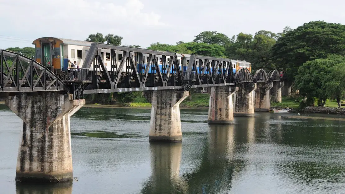
The famous bridge.
What to do and see in Kanchanaburi
Besides seeing the famous bridge there are a number of activities that can keep you busy for a couple of days.
The pass of hellfire
This is an excavation through the mountain made practically by hand to run the death railway that has been converted to a memorial thanks to Australian government funds. You can follow a short self-guided walking tour (4 km) that starts here (Google Maps) and visit the museum on site (Google Maps). The site is certainly not spectacular but undoubtedly of profound significance; admission is free.
To get to the pass starting from Kanchanaburi, if you wanted, you could take the bus to Sangkhlaburi (50 THB) and get off at the entrance to the memorial and then simply wait for the return bus across the street, the last one should be at 5 p.m.
Alternatively, you could enjoy the train ride from Kanchanaburi to Nam Tok (2 1/2 hours) and then take the bus to the memorial (about 20 minutes). Or rent a scooter. If you wanted to on the same day, you could visit the Hin Dat hot springs (Google Maps) located about 40 km further north, also along the main road connecting Kanchanaburi Sangkhlaburi.
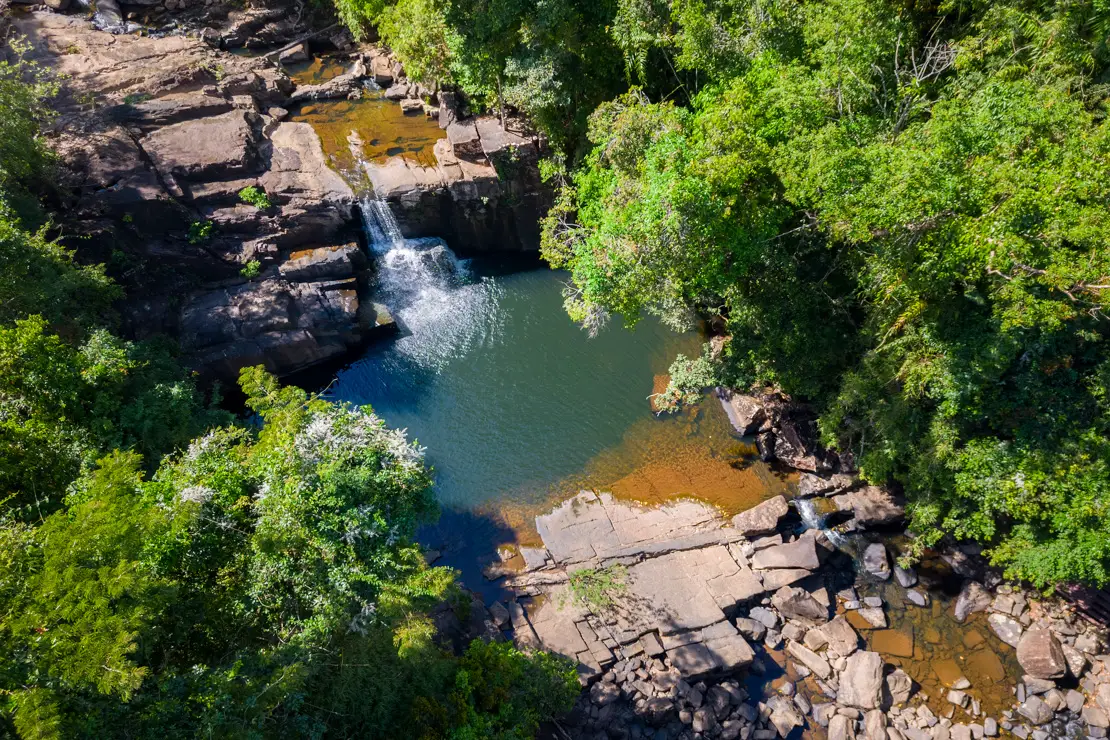
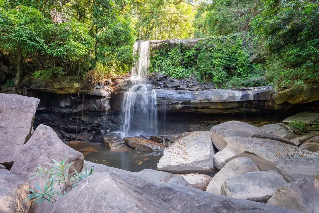
Erawan Falls
Erawan Falls (Google Maps) are considered among the most beautiful waterfalls in Thailand. There are a total of seven levels and to explore them all takes at least a couple of hours, admission costs 300 THB. You can actually work your way up to the 7th level (Google Maps).
To reach them, there is the public bus 8170 that leaves from the Kanchanaburi terminal (you can catch the bus along the main road, ask at your accommodation) about every 50-60 minutes from 8:00 am to 5:00 pm, 50 THB, about 90 minutes. Try to leave early to avoid tourists.
Alternatively you could rent a scooter. Besides having more freedom, if shared it is also more convenient than the bus.
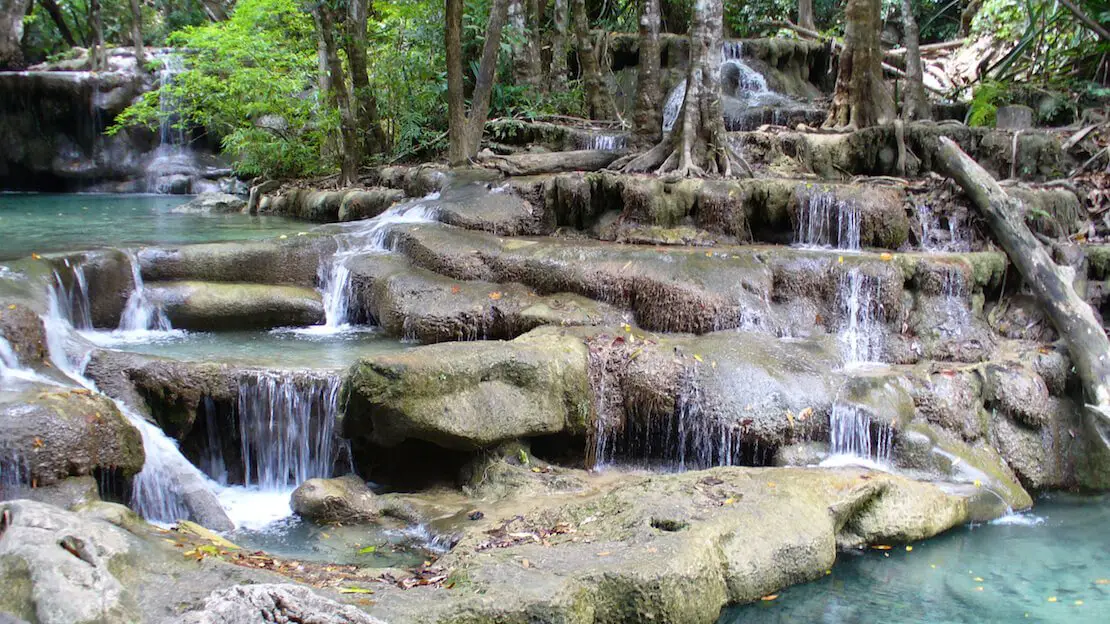
Erawan falls.
Where to sleep in Kanchanaburi?
Asleep Hostel, excellent hostel with a relaxed atmosphere, neat and clean environment, good value for money.
How to reach Kanchanaburi?
From Bangkok there are several options, the public bus (line 81) departing from the south terminal (Sai Tai Taling Chan) (Google Maps), with departures about every 20 minutes, 2-hour trip. There are also tourist mini buses leaving from Khao San Road at 1:30 pm and 6:30 pm.
Ayutthaya
Founded in 1350, Ayutthaya became the second capital of the Siamese Empire after Sukhothai. Over the centuries, due to its strategic location, it first became the commercial capital of the Asian continent and around 1700, it was the largest city in the world with about one million inhabitants.
Today, very little remains of the splendor of its golden years. Numerous temples and palaces, the only buildings constructed of stone during that period, are still visible.
From Bangkok, the city can be visited on a day trip.
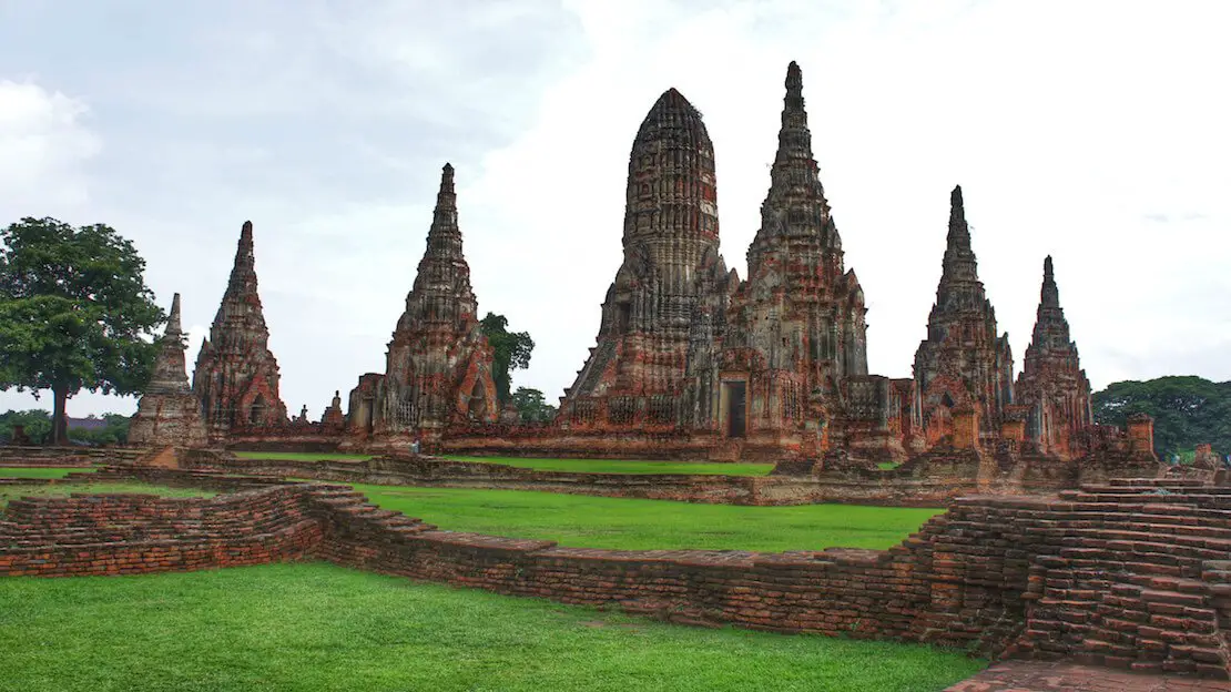
Wat Chaiwatthanaram.
What to Do and See in Ayutthaya
The main archaeological area is located on the island in the center of the city and is best explored by bicycle (40-50 THB). For those who prefer not to bike, it is also possible to get around by tuk-tuk. Biking is also an option off the main island where there are other sites of interest.
Upon arriving at the bus terminal (located off the island), you could rent a bike directly, but it is preferable to take a tuk-tuk to the center of the island, specifically to Wat Maha That (Google Maps), from where you can begin the following itinerary that covers the main buildings (admission to the various temples generally costs THB 50):
Wat Maha That: Famous for having a buddha head wrapped in trees (Google Maps).
Wat Ratchaburana: One of the best preserved temples, it is possible to go down inside the crypt (Google Maps).
Wat Thammikarat: This temple is still used by monks, and there are hundreds of rooster statues that the locals bring as offerings following a legend about a rooster fight during which a Burmese prince was defeated by an Ayutthayan one. Near the temple is also a building with a reclining Buddha inside (Google Maps).
Wat Phra Ram: Not the most impressive temple, but since it is often snubbed by major tours, it is possible to explore it at leisure (Google Maps).
Wat Phra Si Sanphet: This was the city’s most important temple (Google Maps).
Your tour may end here. As mentioned above, these are all sites within the main island, but outside the island, there are numerous other sites. The most impressive, in my opinion, are Wat Phu Khao Thong (Google Maps) and Wat Chaiwatthanaram (Google Maps) and you could also cycle all the way to Queen Sri Suriyothai Memorial, which is not too far away and less busy. Here you can find the Queen Monument (Google Maps), built in 2000.
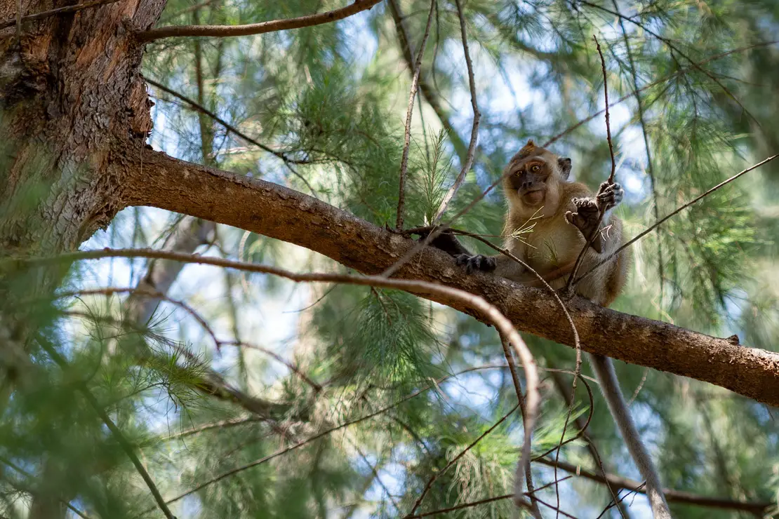
Lopburi
I will preface this by saying that I have not personally been there. Nevertheless, it is one of the oldest cities in Thailand and served as its capital for a time.
The city is famous for the hundreds of crab-eating macaques that live within the old city, where all the major historical sites and the train station are located. Being only an hour’s train ride from Ayutthaya, it could make for a great day trip to see something different.
Here you can find a short guide about it.

Lopburi.
Where to sleep in Ayutthaya?
If you decide to spend the night here and perhaps continue your trip north without returning to Bangkok then Early bird Hostel is great hostel in the middle of the island, good price and breakfast included. It also provides bike rental service.
How to reach Ayutthaya?
From Bangkok-Hualamphong station (Google Maps) the train is the cheapest and most scenic way to reach the city. The trip takes about two hours and in third class (seats are not guaranteed) costs only THB 15-20, while in second class with air conditioning it is THB 250-350.
By bus from the north terminal Mon Chit (Google Maps) there are departures about every 20 minutes, 50-60 THB, about 2 hours.
NORTHERN THAILAND
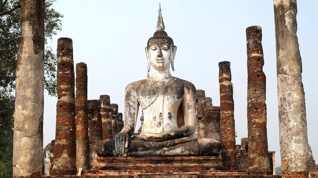
Sukhothai
Sukhothai is now a small city of about 30000 in north central Thailand but was the first capital of the Siamese Empire and still retains many temples and monuments dating back to the 13th century.
What to do and see in Sukhothai
Sukhothai Historical Park (Google Maps) is situated about 12 km west of New Sukhothai and is one of Thailand’s UNESCO World Heritage sites. The park, which covers approximately 70 square kilometers, is renowned for its well-preserved ruins of the ancient Sukhothai Kingdom. You can reach the park by local bus or songthaew (shared taxi) from New Sukhothai. Bicycles can be rented at the entrance for around THB 30-60 per day, making it easier to navigate the large area.
The park officially opens from 6 a.m. to 6 p.m. daily. It is divided into three main zones: Central, Northern, and Western. Each zone requires a separate entrance fee of THB 100, with an additional THB 10 for bicycles, THB 30 for motorcycles, and THB 50 for cars.
While the official opening hours are from 6 a.m., if you arrive slightly earlier you can actually enter for free. Similarly, entering the park just before closing time, particularly after 5:30 p.m., might allow for free access to catch the sunset.
Central Zone: This is the most visited area, featuring the iconic Wat Mahathat (Google Maps), the largest and most important temple in the park, known for its impressive Buddha statues and intricate architecture. This is a very popular spot for sunrise. Other notable sites in this zone include Wat Si Sawai (Google Maps), Wat Sa Si (Google Maps), and the King Ramkhamhaeng Monument (Google Maps).
Northern Zone: The Northern Zone houses Wat Si Chum (Google Maps), famous for its large seated Buddha, and Wat Phra Phai Luang (Google Maps), which dates back to the pre-Sukhothai era and features significant Khmer architectural influences.
Western Zone: This zone is less frequented due to its dense forest and fewer prominent ruins, with Wat Saphan Hin (Google Maps) being a notable exception. This temple requires a short hike and offers a beautiful view but can be skipped if time is limited.
Sukhothai.
Where to sleep in Sukhothai?
Aenguy Hostel is a good hostel in the center of the new town, breakfast is included in the price. Perfect Resort Sukhothai offers cheap private rooms.
How to reach Sukhothai?
From the Mo Chit terminal in Bangkok (Google Maps) it is about 6-7 hours. From the Arcade terminal in Chiang Mai (Google Maps), on the other hand, it is about 4 hours.
Chiang Mai
Chiang Mai is considered the most important city in northern Thailand and the most visited. With over 1 million people in the metropolitan area, it is the country’s fifth largest city. Surrounded by forests and mountains, it is home to many expatriates and digital nomads who prefer it to the more chaotic Bangkok.
What to do and see in Chiang Mai
Chiang Mai is particularly famous for its giant night market (Google Maps) that takes place every night where you can find literally anything. If you are around during the weekend you might consider visiting two other markets, the one along Wualai Street on Saturday (Google Maps) and along Ratchadamnoen on Sunday (Google Maps), which are considered by some to be more “authentic.”
The ancient city, which is easily recognizable as it is bordered by a canal and in some places by the remains of ancient walls, is easy to visit on foot and-just for a change! – there are numerous temples that can be visited (over 300 in and around Chiang Mai). Most popular are Wat Phra Singh (Google Maps) and Wat Chiang Man (Google Maps) but there are many others scattered in and around the city. In each case you will find an exhaustive list with photos and details here.
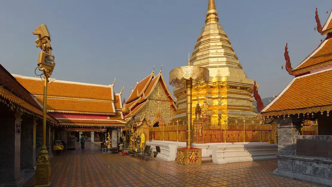
Wat Phra That Doi Suthep
This is considered the city’s iconic temple and is located on top of a hill, about 15 km outside the city (Google Maps). You can reach it by scooter, taxi, or even aboard a Songthaew (the red pickup trucks with benches in the back) that leave regularly just outside the zoo or, alternatively for the more active, you can walk up in about two hours following the “monks’ trail” (All Trails).
Admission to the temple costs only THB 30 and is open to the public from 8:30 am to 3:30 pm. The temple itself is very impressive and the view of the city is quite nice.
Wat Phra That Doi Suthep.
Visit an elephant sanctuary
I want to clarify that I haven’t visited any elephant sanctuaries myself, especially considering the numerous reports of mistreatment and poor living conditions. However, it’s important to note that there are facilities that prioritize ethical practices, focusing solely on the care and rehabilitation of these creatures. Some even offer opportunities for volunteering.
I encourage you to conduct your own research. Here is a link to a facility recommended to me by some friends.
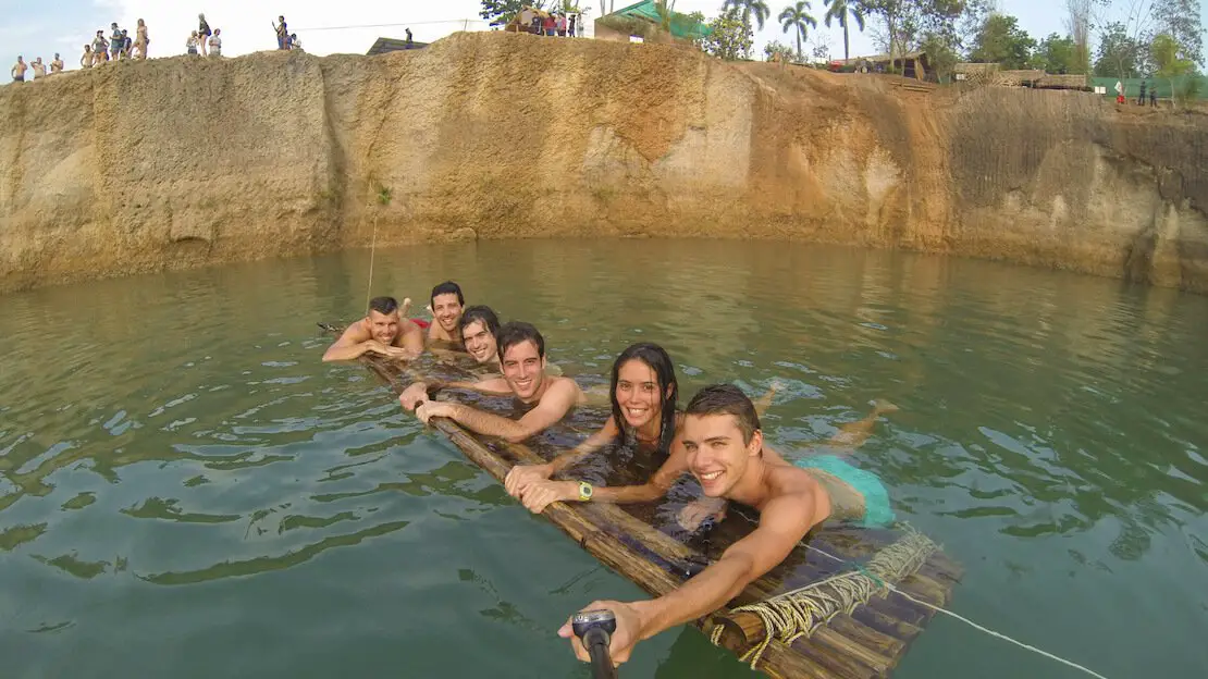
The canyon of Chiang Mai
What is now called a canyon is essentially a former water-filled quarry. It is located just outside Chiang Mai and is an extremely popular place to spend a relaxing day, escaping the heat of the city (Google Maps).
It is by no means a must-see attraction, but it is definitely a great way to spend a day jumping off the “canyon” walls or just soaking up the sun. There are also several restaurants. I went there by scooter but I am sure it is also possible to get there by taxi/Songthaew, entry costs 50 THB.
Update: This place has changed significantly since my first visit. They now charge 800 TBH, but the area is filled with inflatables, and they also offer wakeboarding. While it seems like a lot of fun, budget travelers might find it a bit too expensive.
Finally, I went to Huay Tung Tao Lake (Google Maps), which I would not reccomed. Other popular activities to do in and around Chiang Mai are cooking classes, excursions to nearby Doi Inthanon National Park and Bua Thong Falls (Google Maps).
Hanging out at Chiang Mai Canyon.
Where to sleep in Chiang Mai?
Potae’s House excellent really cheap hostel just a short walk from the centre. Jeune Hostel is another great hostel just outside the center, only three dorms, extremely quiet and clean, laundry costs only 30 THB then you can hang out your clothes on the terrace.
How to reach Chiang Mai?
From Bangkok it is about 12 hours by bus, 400-800 THB depending on the type of service, it is also worth taking a look at flights especially with Nok Air as they can be really cheap. Train is the cheapest option by far but it is almost 16 hours of travel. From Sukhothai it is only 4 hours while from Chiang Rai it is about 3 hours.
Pai
This small village nestled in the mountains of northern Thailand has transformed from a favorite among hippies to a prominent stop on many travel itineraries in the country. Despite a significant increase in tourism over the years, the atmosphere retains its relaxed charm.
The village is also a key stop on the “Mae Hong Son circuit,” a popular route especially favored by bikers, linking Chiang Mai, Pai, and other destinations across the region. For a detailed guide, check out this page.
What to do and see in Pai
You don’t have to be a hippie to enjoy your stay in Pai. There are numerous interesting activities to explore in the surrounding area. My advice is to rent a scooter for maximum freedom of movement. There is very little traffic, so even less experienced riders should have no problem getting around.
Pai Canyon (Kong Lan)
It is located about 8 km from Pai (Google Maps) and, rather than a canyon, it is a red earth ridge up to 50 meters high with forest as a backdrop on both sides. There are a number of trails to follow and some viewpoints from which the view of the surrounding area is excellent.
It’s not exactly the Grand Canyon but it’s definitely worth a visit, count on spending a couple of hours there at most, I recommend visiting in the late afternoon so you can watch the sunset from here, admission is free. Another popular place to watch the sunset is the Two Huts Pai bar (Google Maps) while at dawn many decide to go to the Yun Lai Viewpoint (Google Maps).
Pai Canyon.
Pai Falls
There are three waterfalls around Pai:
Mo Paeng (Google Maps) is the most popular. Here it is possible to ascend to the second level of the waterfall and then descend by sliding down the rock. Mae Yen (Google Maps) is the “hardest” one to reach as, if you reach the beginning of the trail by scooter, the walk is 4-5 hours round trip. If you start walking from Pai instead, add at least an hour; the waterfall is certainly not impressive but the walk is pleasant.
Finally Pam Bok (Google Maps) is located not too far from the canyon. You have to walk a short distance but nothing too challenging.
N.b. Ideally, you should visit the falls at the end of the rainy season as they are much less impressive during the dry season.
The hot springs of Pai
At Tha Pai Hot Springs (Google Maps), don’t expect much. It simply offers pools where thermal water mixes with cooler stream water, making the temperature more comfortable. You can also enjoy mud baths. Admission costs THB 300. For those seeking more refined amenities, I recommend visiting a nearby resort (Google Maps) where you can access facilities without staying overnight. Admission costs THB 150.
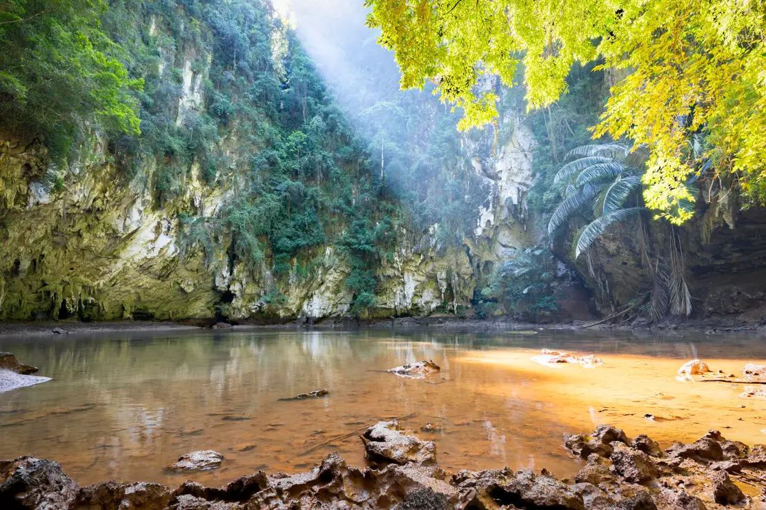
Tham Lod Cave
This giant cave system (Google Maps) is located about forty minutes by scooter from Pai. The road through the mountains is really scenic and the cave itself is quite impressive. Inside there are a series of wooden board walks that allow you to go deeper into the cave system. There are also “guides” more than willing to take you inside and show you all the curious rock formations. If you wish, you can board rafts made of bamboo and travel along the watercourse that flows inside.
Update: Guides seem to be mandatory now. 1 cave = 300 Baht, 2 caves = 500 and 3 caves = 600 for a group of three people.
Lastly, I recommend visiting Kho Ku So Bamboo Bridge (Google Maps), a picturesque bamboo bridge spanning across rice fields leading to a small Buddhist temple—a great spot for photography!
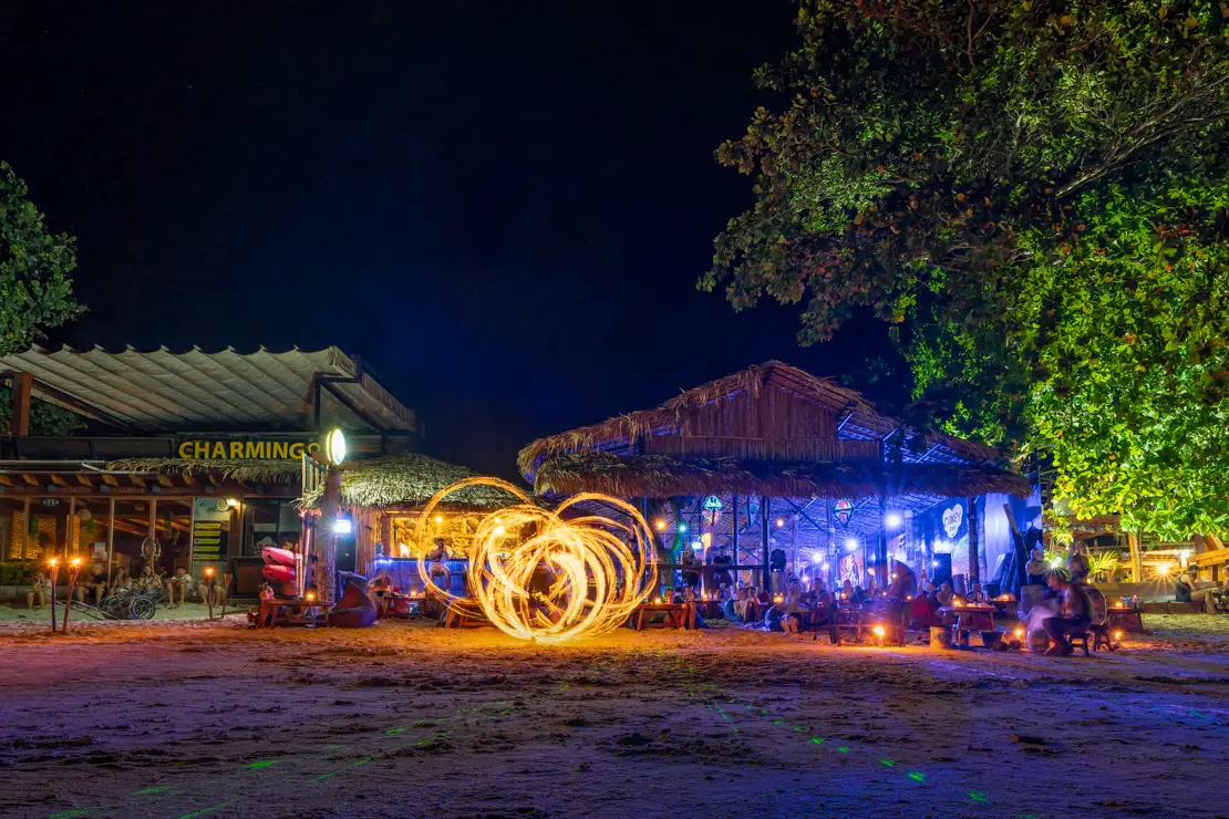
In the evening, don’t miss Pai Circus, a hostel located atop a hill just outside Pai (Google Maps). Every night, it hosts a lively party atmosphere with fire shows resembling a circus. You don’t need to stay at the hostel to join in the fun.
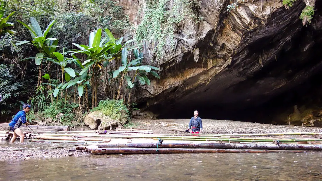
Tham Lod cave.
How to reach Pai?
To reach Pai basically you have to go through Chiang Mai where there are public buses (only one at 7 am, THB 80) and minibusses (THB 150) that leave frequently. You can also arrange “pick up” directly to your accommodation. It’s a 3-4 hour drive along a really scenic road and that’s why a lot decide to make the trip by motorcycle. You can find a good guide here.
Where to sleep in Pai?
UP2U Guesthouse it’s nice place to stay just ooutside the cente.
Chiang Rai
Less touristy than Chiang Mai, it is a great destination if you are looking for something more authentic in northern Thailand. Chiang Rai has a relaxed atmosphere and some interesting attractions, including some contemporary Buddhist temples that are really different from others in the country.
What to do and see in Chiang Rai
Although it does not reach the size of Chiang Mai’s market, Chiang Rai’s Evening Bazaar (Google Maps) is definitely worth a visit, both for classic shopping and for eating delicious street food.
The temples of Chiang Rai
The three most impressive (and touristy) temples are:
The White Temple (Wat Rong Khun) is definitely the symbol of Chiang Rai (Google Maps). It is a modern temple covered with thousands of pieces of glass that give it a very unique look. What makes it extremely unique is the presence of several murals with images of “Hello Kitty” and “Neo” from The Matrix just to name a few…see to believe! In the middle of the garden there is also a statue of one of the characters from “The Predator”!
The temple is open daily from 8 a.m. to 5pm. Admission costs THB 100, and to get there just take the public bus from platform 8 of the station, about 30 minutes, THB 20.
Blue temple (Wat Rong Suea Ten) (Google Maps) is still under construction but has the main span completed. It is another example of contemporary art with a more restrained style than the White Temple. Entrance is free but it cannot be reached by public transportation, so rent a scooter or take a tuk tuk.
The Black House Temple (Baan Dam Museum) (Google Maps) is technically not even a temple although it definitely has the features of one. It is a building that is part studio and part museum. It too is the creation of a local artist.
It is open daily from 9:00 a.m. to 5:00 p.m. (closed from 12:00 p.m. to 1:00 p.m.), admission costs 80 THB, and to get there just take the public bus from platform 5/6 of the station, about 30 minutes, 20 THB. From the stop it is about 500 meters.
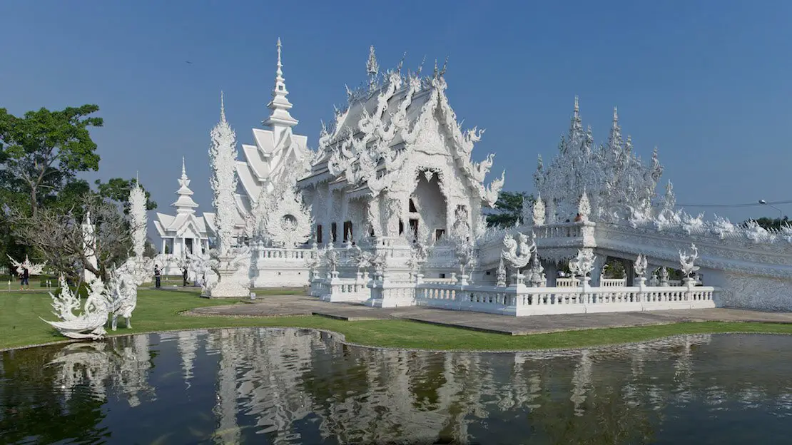
White Temple.
Mae Salong
It’s a small village located about 40 minutes from town in the mountains surrounding Chiang Mai, offering excellent views of the valley below. Founded in 1949 by Chinese rebels, the village still retains a strong influence.
While there isn’t much to do in the village itself, the road leading there (I recommend renting a scooter) offers stunning scenery, passing through tea plantations where educational tours may be available like this one and this one. It’s definitely a great way to spend a day exploring the surroundings of Chiang Mai on a scooter.
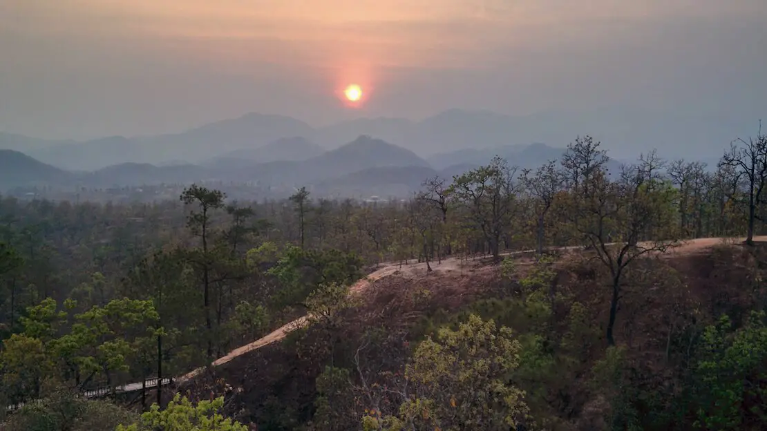
Phu Chi Fa
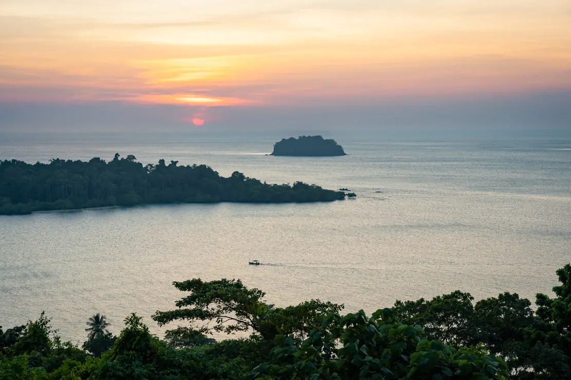
Finally, about two hours east of Chiang Rai, along the border with Laos, is a mountain range that offers some very impressive views of the valley below and the Mekong River. The best time to admire this view is at sunrise when clouds/fog often form at low altitudes creating a very striking effect.
The most popular viewpoint is definitely the one at Phu Chi Fa, although Phu Chi Dao, Doi Pha Tang and Phu Pha Sawan-from what I have read-are good alternatives. This is not a cheap experience at all because it is impossible to reach any of these places by public transportation. One must therefore rely on organized tours or private transportation, or alternatively take the bus during the day, spend the night in a guest house and return the next day.
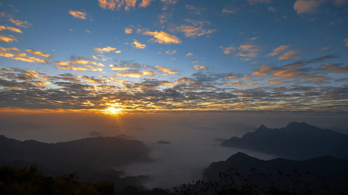
Phu Chi Fa sunrise.
Where to sleep in Chiang Rai?
Mercy Hostel excellent hostel with nice common areas, air conditioning in dorms. Stay in Chiang Rai is another great option slightly cheaper and not far from the station, great staff and great breakfast included in the price.
How to reach Chiang Rai?
It is good to know that there are two terminals in Chiang Rai, the first one in the center (Google Maps) is the domestic one and serves destinations within the region, plus Chiang Mai, with the Green Bus company, while the second one is about 7 km outside the city and serves mainly more distant destinations within the country (Google Maps). There is a songthaew (minibus) that connects the two terminals frequently, THB 15.
N.b. From Chiang Rai (if you wish you can also arrange transfer from Chiang Mai and Pai) it is possible to cross the border into Laos aboard a “slow boat” it is a trip that many people make and is said to be a good experience (I have not done it), I leave you the link to this page where everything is explained in detail.
Chanthaburi
Chanthaburi is not exactly a tourist destination, but I think it is an interesting destination especially for those who want to break the trip from Cambodia to the Koh Chang archipelago.
Wat Pailom.
What to do and see in Chanthaburi
The area known as the Waterfront (Google Maps, Maps.me) has a lot of historic buildings and the riverside setting make it especially nice. I also recommend visiting Chanthaburi Cathedral (Google Maps, Maps.me) and Wat Pailom (Google Maps, Maps.me), a temple complex not far away.
Waterfront.
How to reach Chanthaburi?
From Bangkok there are direct buses leaving from Ekkamai terminal (Google Maps). Toward the Cambodian border at Bae Lem there are four daily departures 8:00 am, 11:00 am, 2:00 pm, and 5:00 pm, the trip takes about 1:30 hour and I really think the minivan comes back shortly after so adjust accordingly if you want to travel in the opposite direction. 200 baht. If you arrive from Koh Kood or Koh Chang, there are songthaews at the pier waiting for boats and ferries to arrive and take you to Trat station for 70 baht, from Trat station for 80 baht there are frequent minivan departures to Chanthaburi.
Where to sleep in Chanthaburi?
I slept at Chernchan Hostel and recommended it. Literally one of the nicest hostels I’ve slept in in Thailand and amazingly, given Chanthaburi’s lack of popularity as a destination, I was the only guest in the dorm!

Chanthaburi Cathedral.
SOUTHERN THAILAND
Southern Thailand can be divided into two regions:
- West Coast (Andaman Sea): This region is generally more developed, particularly around Phuket, which is famous for its numerous resorts and popularity as a destination for organized travel. The west coast also tends to experience a longer and more intense rainy season.
- East Coast (Gulf of Thailand): This region has fewer islands but benefits from a shorter rainy season, making it pleasant to visit almost year-round.
Below, I list some of the most accessible and popular islands and archipelagos. Of course, listing them all is unthinkable—there are almost 1,500 of them!
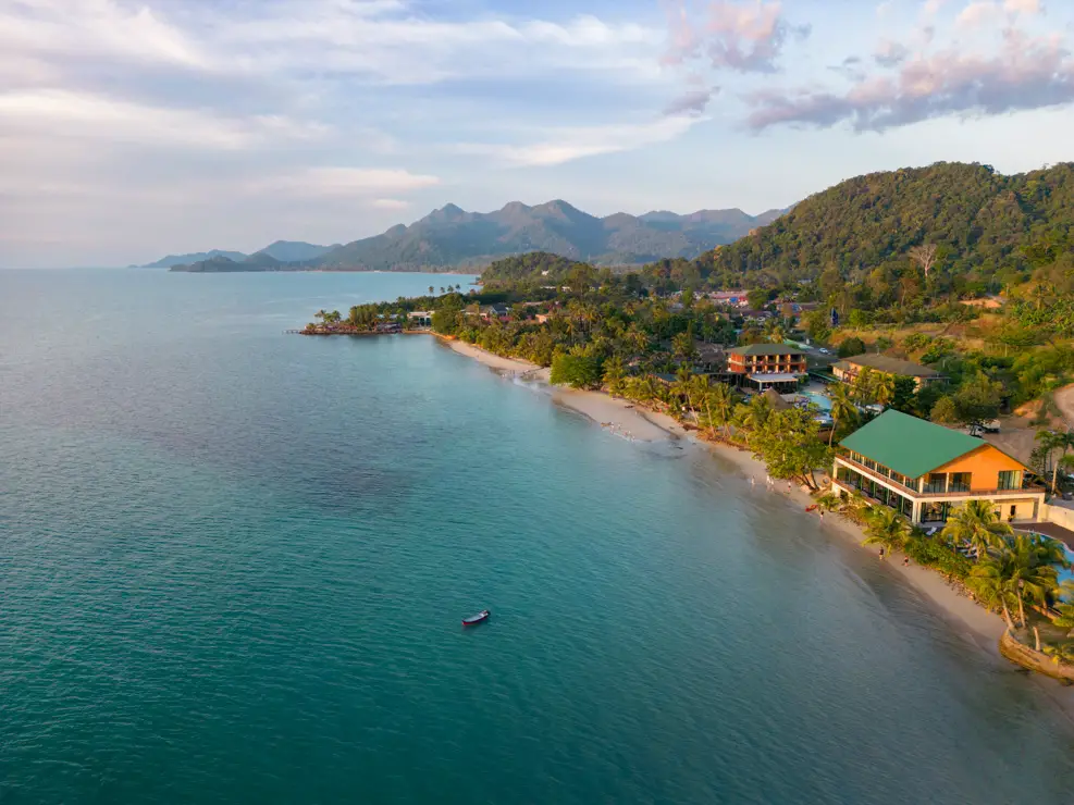
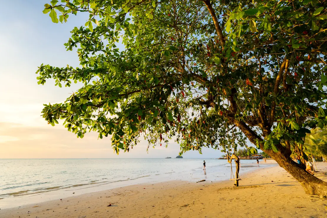
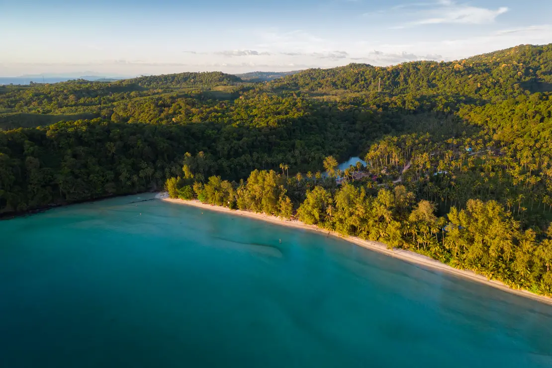
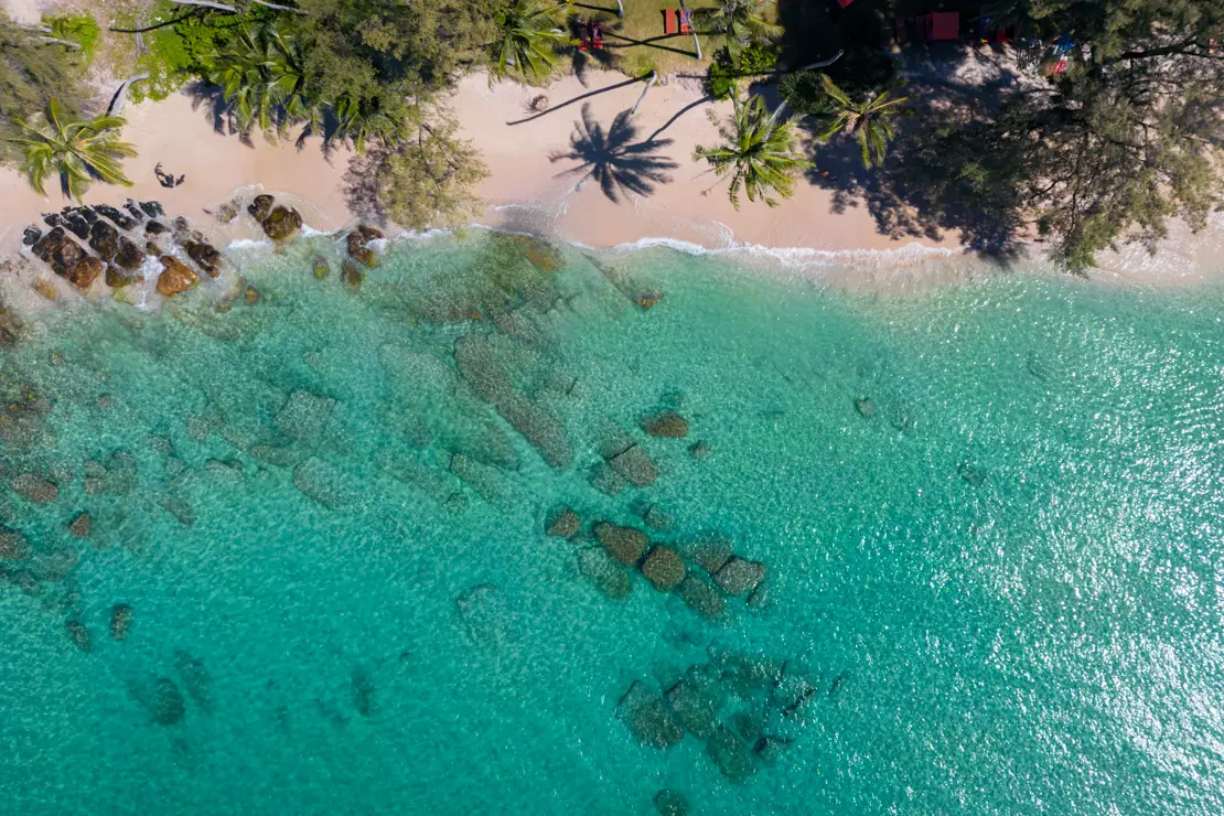
White Sand Beach, Koh Chang.
Since I no longer run ads, if you found this article helpful, please consider purchasing your travel insurance through one of the links on this site. Doing so supports my work at no additional cost to you. For EU and UK residents, I recommend True Traveller. For everyone else, I recommend HeyMondo, which offers a 5% discount. Thank you for your support!
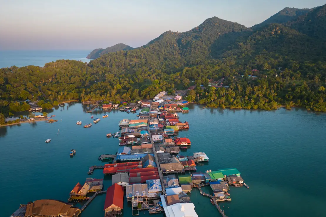
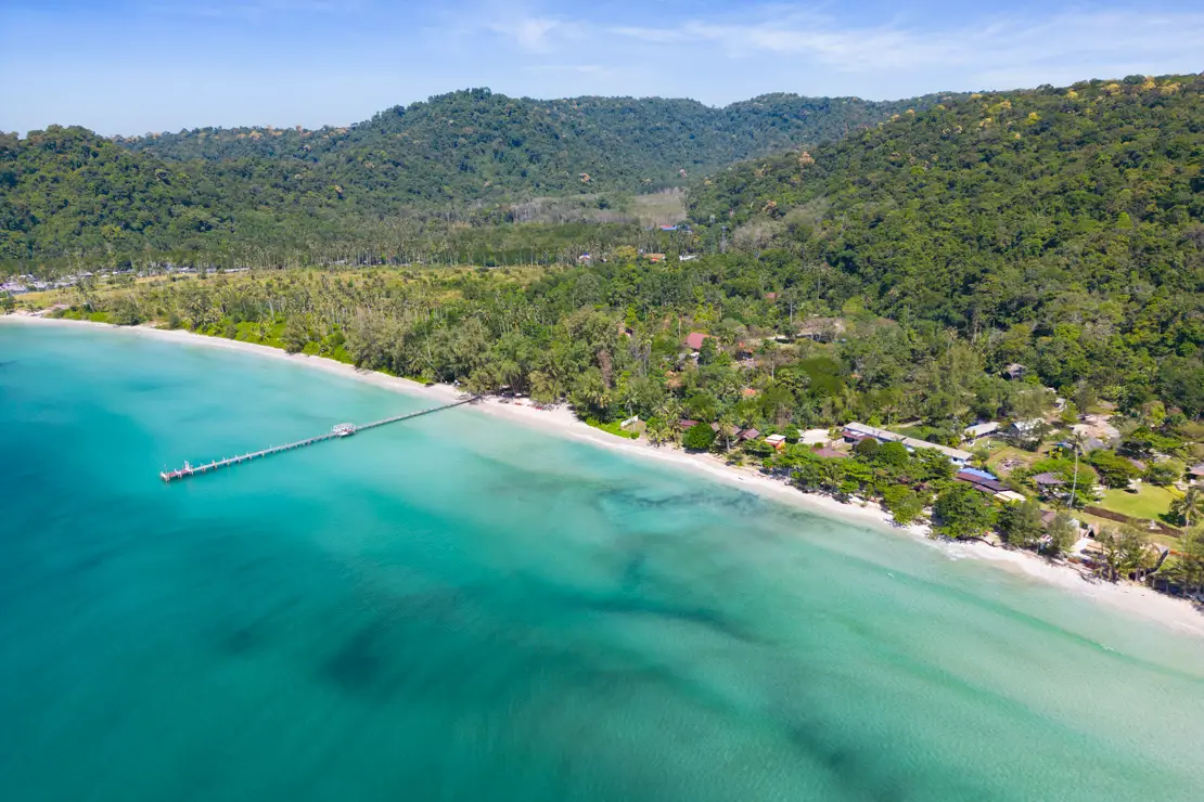
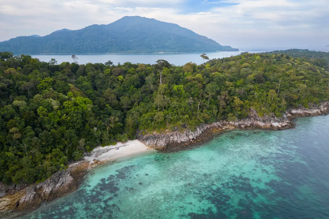
Koh Chang Islands Archipelago
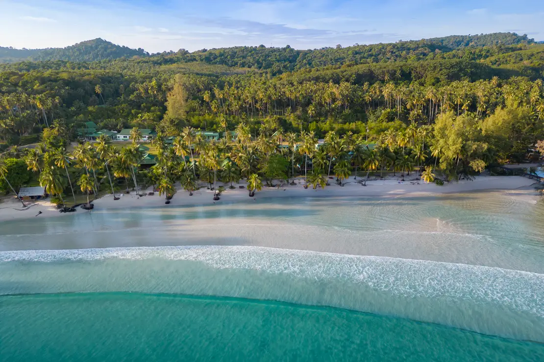
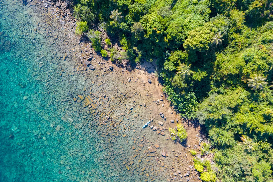
This archipelago, consisting of a group of islands near the border with Cambodia, is less popular and well-known than the islands further south. I spent almost two weeks between Koh Chang and Ko Kut (also known as Koh Kood), and I must say that I was pleasantly surprised, particularly with Ko Kut. Other islands in the archipelago include Koh Mak, the third largest island, which is completely private and owned by a family group that promotes sustainable tourism, as well as Koh Wai and other smaller islands that are mostly visited on day trips.
What to Do and See on Koh Chang
Koh Chang, the largest island in the archipelago and the third largest in all of Thailand, is relatively developed and attracts a good number of tourists each year. However, it is large enough to offer plenty of uncrowded beaches. The best beaches are all along the west coast and are very similar, especially in being very narrow at high tide. The ideal way to get around is to rent a scooter, which starts at 200 baht a day.
Lonely Beach, Koh Chang.
The beaches of Koh Chang
White Sand Beach (Google Maps, Maps.me) is the northernmost of all and perhaps my favorite. The most convenient access I’ve found is this place (Google Maps, Maps.me).
Klong Prao Beach (Google Maps , Maps.me). You can leave the scooter at this point (Google Maps, Maps.me) and walk on. Chai Chet Beach (Google Maps, Maps.me) just north of Klong Prao Beach (technically I think it should be considered the same beach) you can leave the scooter at this spot (Google Maps, Maps.me) and walk on. Kai Bae Beach (Google Maps, Maps.me) . You can literally leave the scooter along the beach at this point (Google Maps, Maps.me). From any of these three beaches you can easily reach the two islets you can see offshore by kayak, Koh Rom and Koh Suwan. I have not been there but apparently the snorkeling is not bad at all.
Lonely Beach.
Finally Lonely Beach (Google Maps, Maps.me) whose most practical access as is often the case is through a resort, park here (Google Maps, Maps.me) and walk on. This is the most popular beach among backpackers. It is wider than the others but, in my opinion, less attractive. In the evening, especially during happy hours, there is quite a bit of activity, much more than at the other beaches.
Kai Bae Beach, Koh Chang.
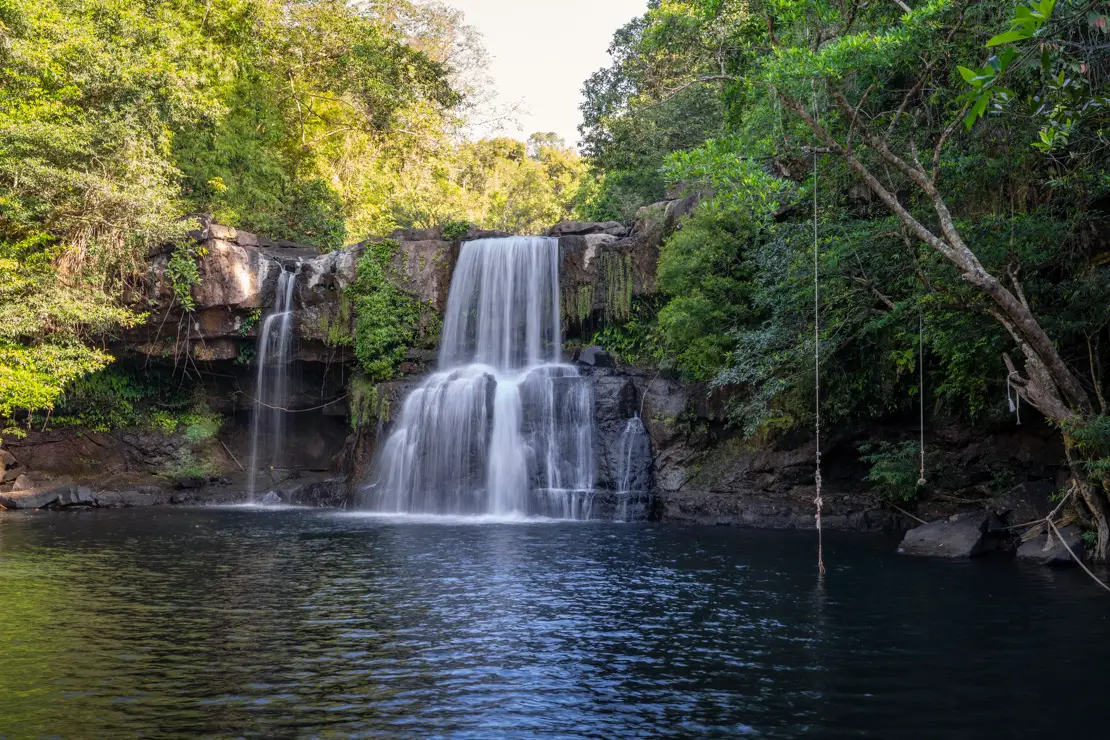
The waterfalls of Koh Chang
There are several noteworthy waterfalls on the island, the most popular being Klong Plu Waterfall (Google Maps, Maps.me), which, however, being within the national park requires an entrance fee of 200 baht be paid-which for the record is five times what locals pay. I have not been there but was told it is extremely crowded during the day so if you decide to go, try to arrive early in the morning. The other waterfall within the national park is Than Mayom Waterfall (Google Maps, Maps.me), here from what I read you cannot even swim.
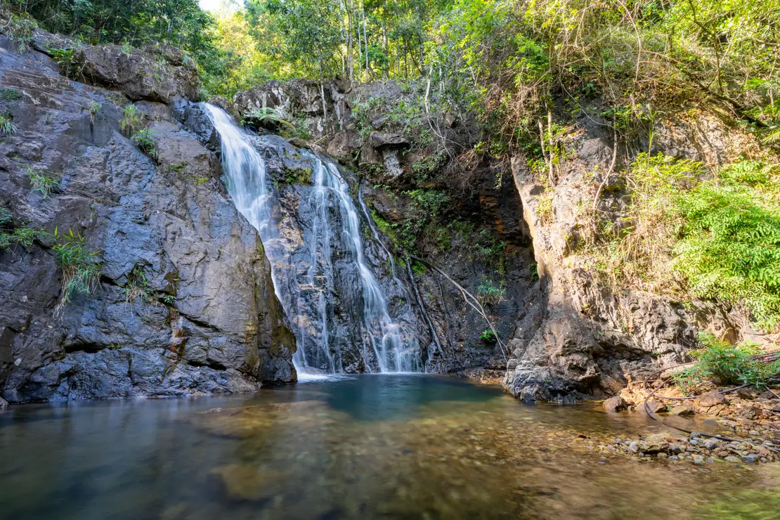
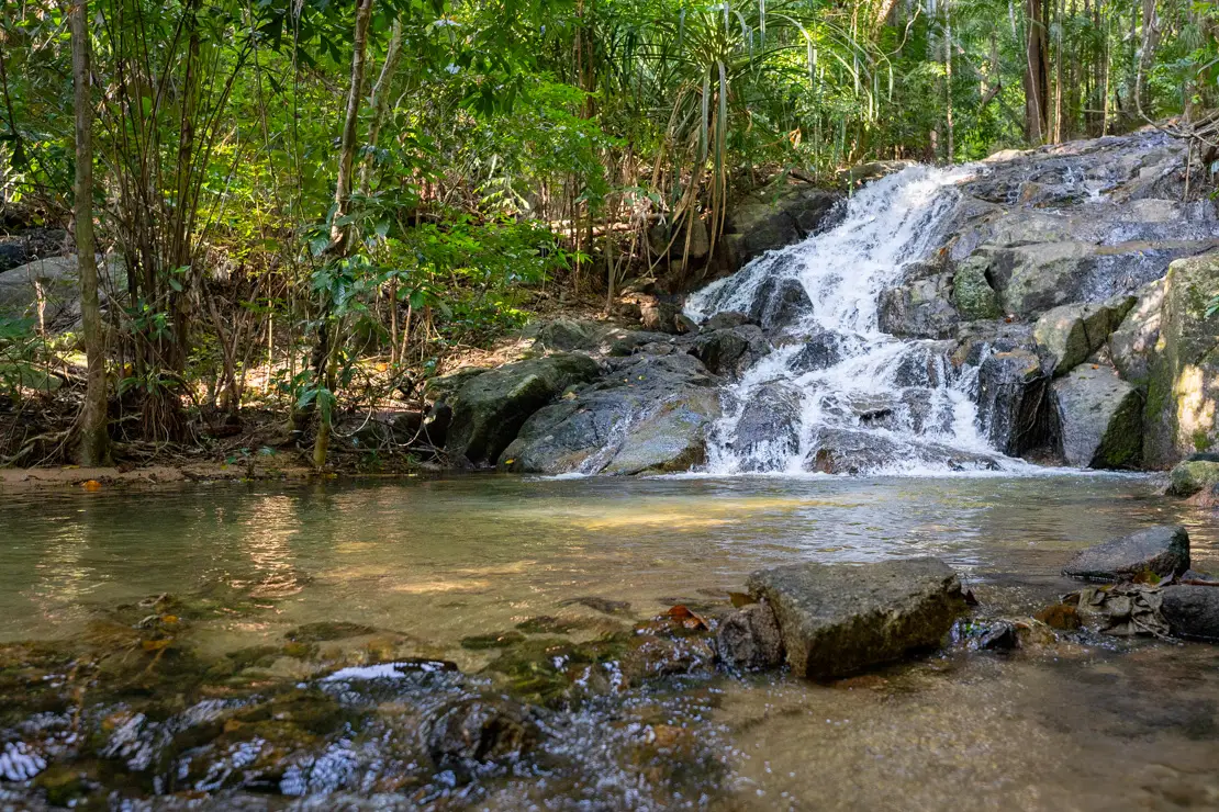
Khlong Nonsi Waterfall.
The waterfall I recommend visiting is Klong Nonsi Waterfall (Google Maps, Maps.me). I arrived in the morning around nine o’clock and there was no one there, the entrance was free and it was really pretty. Don’t stop at the first waterfall, continue along the path on the left to the main waterfall!
Klong Jao Leuam Waterfall (Google Maps, Maps.me) on the other hand disappointed me a bit, it is a series of tiny waterfalls (seven, according to the directions) not really impressive and to make matters worse at a certain point the path becomes really difficult to follow so much so that I couldn’t get to the last level which on maps.me is marked as “level 7.” The entrance costs 40 baht. The last part of the road is not good but not too bad either.
Kai Bae Waterfall (Google Maps, Maps.me) is my favorite and also the closest to the area where most people decide to stay. At this spot (Google Maps, Maps.me) there is a parking lot where you are required to pay the 40 bath entrance fee. 15- 20 minutes walk to reach the falls. I arrived early in the morning around 8:30 and had it all to myself. Recommended!
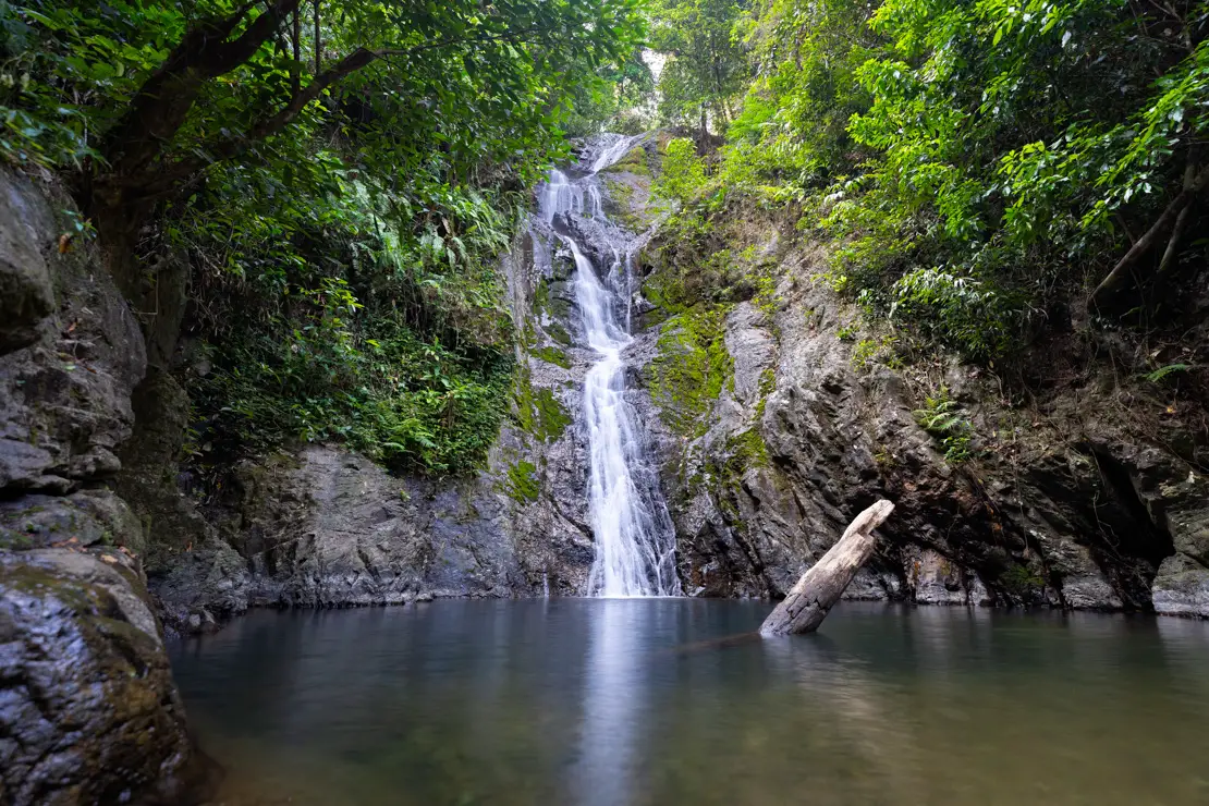
Kai Bae Waterfall.
Boat excursion with snorkeling
I have not participated in any tours; however, I imagine they are quite good, especially if you haven’t done any snorkeling in Thailand before. The most popular itinerary appears to be the half-day tour that takes you to Koh Yakyai, Koh Rang Beach, Koh Mapping, and Koh Yak Lek. It costs about 600 baht, plus an additional 200 baht to enter the national park.
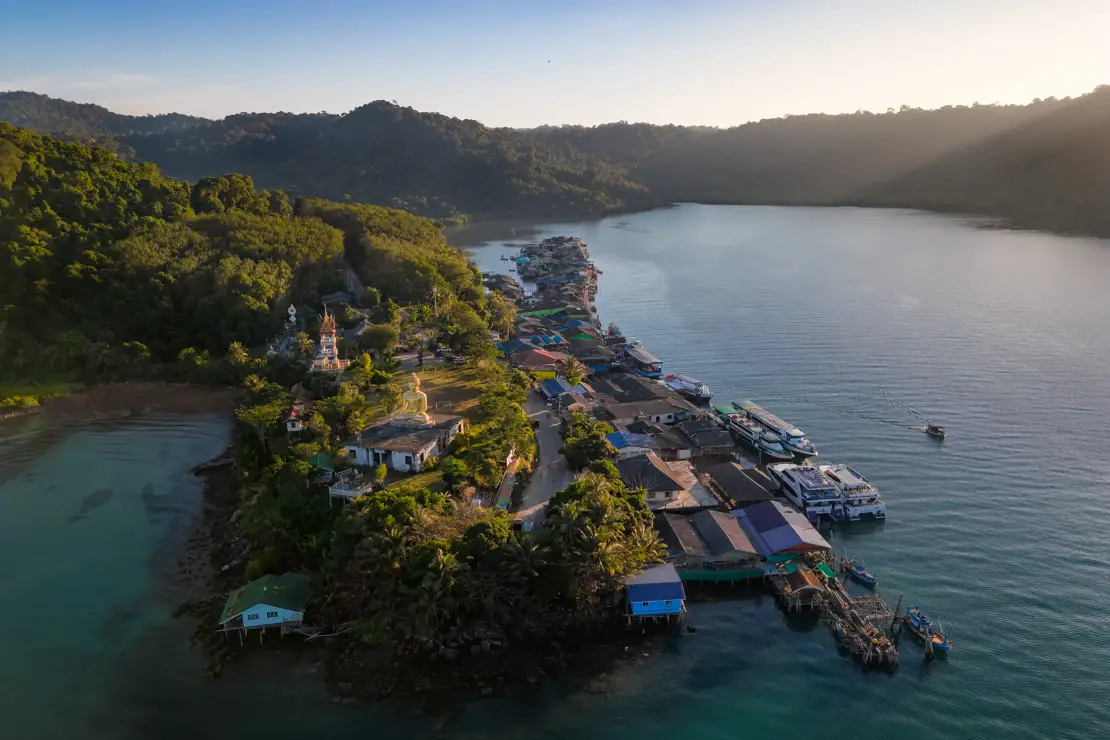
The floating village of Bang Bao
It’s more than just a floating village; it’s a village developed along the pier, stretching for a few hundred meters. Not much remains of what was likely a simple fishing village, as it now primarily consists of souvenir stores and restaurants. Nonetheless, it remains fascinating, especially when photographed from above.
Bang Bao village.
Viewpoints
Kai Bae View Point (Google Maps, Maps.me) is the most popular viewpoint on the island and a great place to watch the sunset. There is a small restaurant/bar on site and ample parking. Many people don’t realize that if they want, there is a second platform slightly higher up. Another nice viewpoint is at this location (Google Maps, Maps.me).
Finally, if you are in an adventurous mood, there is a trail to the top of Khao Salak Phetch, the highest mountain on the island, which you will find described in detail on this page. Recent comments described it as overgrown with vegetation and discouraged me in light of some experiences I had in previous weeks, but it could still be an interesting hike.
Kai Bae View Point.
Where to sleep in Koh Chang?
I slept at 7 Guesthouses paying about 10€ per night for a private bungalow thanks to an offer on Booking. At that price I absolutely recommend it. As for hostels, Cafe del sunshine is a popular option not too far from Lonely Beach. In general, if you plan to rent a scooter (as I recommend) one place is worth the other.
How to reach Koh Chang?
Transfers are offered from Bangkok that include minivan and ferry departing from Khao San Road but you can save a few hundred baths by taking the handy 999 bus. The bus has two departures, 7:45 a.m. and 9:45 a.m. from Bangkok Ekkamai Bus Terminal (Google Maps, Maps.me) which can be easily reached by the BTS Skytrain, 292 bath including water and snacks, about 6 hours travel time. The bus fills up quickly so ideally it is best to buy your ticket the day before by going directly to the station or booking online. The bus also stops at Suvarnabhumi Airport and Chanthaburi.
You are dropped off at Ao Thammachat pier (Google Maps, Maps.me) often called “Laem Ngop” which is actually the name of the village. From here the ferry leaves about every hour, 80 baht. Once you disembark in Koh Chang there are Songthaew waiting to take you wherever you want, the cost varies depending on the destination, I paid 150 baht. If you want to go directly to Koh Kood you have to stay on the bus and get off at the “next pier,” in any case the driver and his helper are really helpful and when you leave they ask where you want to go.
Another option is to reach Trat, where minivans at the bus station go to the pier and vice versa. This option is convenient if the 999 bus is full or if you prefer not to wait for its arrival when returning from Ko Chang or Koh Kood.
Ko Chang sunset.
Koh Kood
Koh Kood or Koh Kut is definitely less developed and touristy than Koh Chang but in my opinion much more beautiful. Along with Koh Lipe it is my favorite island in Thailand. To get around the island, ideally you should rent a scooter, it starts from 200 baht per day.
What to do and see in Koh Kood
In Koh Kood, for many visitors, the main activity is relaxing on the beach. Similar to Koh Chang, the best beaches are along the west coast. In fact, much of the east coast can only be reached by boat.
Ao Takhian.
The beaches of Koh Kood
Secret Beach or Klong Han (Google Maps, Maps.me) is the northernmost beach. It is really nice and quiet, practically only hotel guests are there. However, not being within a protected bay, if the sea is even slightly rough, it is not ideal.
Yai Kee (Google Maps, Maps.me) is slightly further south. You can park here (Google Maps, Maps.me) and continue along the short path on the left that leads to the beach, where if you wish you can rent the kayak to reach Koh Rat as I discuss below.
Ao Tapao (Google Maps, Maps.me) is my favorite beach. There are lots of swings, a hammock in the middle of the sea, and a platform where you can sunbathe or dive.
Ao Tapao.
Khlong Chao (Google Maps, Maps.me) is perhaps the busiest beach on the island, considering the nearby village of the same name as the main tourist center of Koh Kood. However, it remains pleasant and not overly crowded, especially convenient to reach on foot if you’re staying nearby, as many visitors do.
Bang bao (Google Maps, Maps.me) is very pretty and sheltered within a wide bay. It is a really narrow beach that at high tide leaves very little room to maneuver. Also, maybe it was just the wrong day, but a guy in the hostel was literally devoured by sand flies.
Ao Takhian (Google Maps, Maps.me) except for one resort is basically a deserted beach. Certainly not the most beautiful on the island but still nice and recommended for anyone who wants a piece of paradise just for themselves.
Ao Khlong Hin (Google Maps, Maps.me) a little further south and located within a bay is definitely the most beautiful. There is plenty of shade and the water is very shallow even far from the shore. Maybe even too much at low tide!
Ao Khlong Hin.
Ao Jak (Google Maps, Maps.me) is similar to Ao Khlong Hin, a sheltered bay and shallow water for several meters from the shoreline. Also, while not exceptional, the snorkeling along the northern part of the beach is not so bad.
Ao Phrao (Google Maps, Maps.me) is the southernmost beach on the island, and being uncrowded and extremely wide and dispersed, perfect for anyone who wants to have the feeling of being partly isolated from the world!
In conclusion, if you are at one of these beaches in the south, Ban Cheongkao is a good restaurant with honest prices (Google Maps, Maps.me).
Ao Phrao.
The waterfalls of Koh Kood
Khlong Chao Waterfall (Google Maps, Maps.me) is the most popular waterfall on the island and the most impressive. There is a large natural pool at its base and from what I was told the water flows year-round. The waterfall is reached at the end of a short walk of about 10 minutes through the forest. Alternatively you can go up the river by Kayak and walk only the very last stretch. If possible, arrive early in the morning and you will have it all to yourself. Admission is free.
Khlong Chao.
Khlong Yai Kee (Google Maps, Maps.me) is less popular than Khlong Chao but still very pretty. However, I would like to point out that as early as mid-December there was not much water and-from what I was told-for much of the dry season the waterfall dries up completely. Admission is free. If you decide to go, I recommend eating at Mr. & Mrs. Coconut (Google Maps, Maps.me), great food and fair prices. They make good coconut ice cream, too!
Khlong Yai Kee.
Huang Nam Keaw Waterfall (Google Maps, Maps.me) is the most inconvenient of the three to reach. While it is very beautiful, the natural pool at the base of the waterfall is not at all inviting so much that I did not bathe. Again, I really think it dries up completely as the season progresses. If you have time, however, you can still check it out and also stop at the Macca Tree (Google Maps, Maps.me). This is a really big tree that seems to have some religious significance. The last part of the road is unpaved but not too bad.
Huang Nam Keaw.
Reach Koh Rat by Kayak
This is a good way to spend a half day and do some great snorkeling without joining some organized tour. To do this I recommend going to Yai Kee beach as described above. Here I rented a Kayak for 100 bath. It takes about 20 minutes to reach Koh Rat. Parking the kayak is a bit of a pain: lots of rocks, little beach and you have to watch out for urchins. In any case, while snorkeling, I left it exactly at this spot (Google Maps, Maps.me). The best area for snorkelling is marked by buoys so you can’t really go wrong. Alternatively you could just join one of the many snorkeling trips that are offered, at PD Guest House they were being sold for 800 bath all inclusive.
Koh Rat.
Ao Salat
Ao Salat is the village located in the northeast of the island, where most boats arrive from the mainland. The coast is mostly rocky, there are no breathtaking beaches, so most travelers prefer to stay elsewhere. But if you have time on your hands you can take a scooter ride there. There is a giant statue of the Buddha (Google Maps, Maps.me) and somewhat like Bang Bao in Koh Chang it looks like a sort of floating village. I spent a few hours there to take a couple of photos and ended up playing soccer with some local kids. It was nice but certainly not a must-see destination. However, one can breathe a more authentic atmosphere than in other parts of the island.
Ao Salat.
In conclusion, the island doesn’t offer much of a nightlife and maybe that’s why I fell in love with it. But I strongly recommend Tawan Eco Bar (Google Maps, Maps.me). Every night the owner plays live music and often some travelers join in, there is no staff whatsoever, you serve yourself and leave your money in the till, if you want you can dine following the same self service model, great atmosphere.
Where to sleep in Koh Kood?
I spent the first night at BB Dorm Koh Kood (on the spot they charge 250 baht) and all in all it is not that bad but for the rest of my stay on the island I shared a double room at PD Guesthouse with a guy I met in the hostel. It was not only slightly cheaper (450 baht for the room) but definitely more comfortable. Bungalows overlooking the inner garden cost 650 baht, if I am not mistaken. In high season they open the dormitory for 250 baht per person. The owner “Pat” is really nice and friendly. Another interesting option is Cozy House, 750 baht breakfast included and free kayaks to use along the river. Whether you decide to stay at PD Guesthouse or not, I strongly recommend the nearby Koh Kood Aroi Aroi Restaurant (Google Maps, Maps.me), the food is great, the prices honest and the staff is lovely.
Macca Tree.
How to reach Koh Kood?
If you want to get to Koh Kood without going through Koh Chang, as mentioned earlier, you can simply stay on board the 999 bus, which, after unloading passengers bound for Koh Chang, continues on to the pier from where boats bound for Koh Kood depart. The cheapest option should cost 350 baht or at least that is what I paid traveling in the opposite direction when I left the island, the price also included the transfer from the guesthouse to the pier.
From Koh Chang I took the “wooden boat” that leaves every day at 9:00 a.m. from Bang Bao. It costs 700 baht including transportation from the pier to your accommodation on the island. The trip takes about 4 hours. This is also the boat to take if you want to reach Koh Wai (about an hour) and Koh Mak (about 2 hours). If you want, there are speed boats, but they cost about twice as much.
Bang Bao.
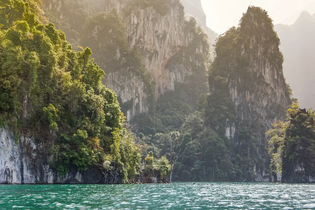
Khao Sok National Park
Khao Sok Park is considered one of the most spectacular in the country. The landscape often seen in photos features a large lake and giant limestone monoliths emerging from the water and dense forest. In addition, from January to February it is possible to see the world’s largest flower, the rafflesia!
What to do and see at Khao Sok National Park
The park can be divided into two parts: the area where the iconic Cheow Lan Lake is located and the area around “Khao Sok village,” where virtually all travelers stay.
Trekking in Khao Sok National Park
If you want to limit yourself to trekking in the park then you can do it on your own starting from Khao Sok Village. But I definitely recommend downloading maps.me, especially if you want to reach the more remote waterfalls. The entrance to the national park is located down the road at this point (Google Maps, Maps.me).
From here you have several options, the most popular seems to be just to get to this point (Maps.me) which on the map at the park entrance is number 6, here is a small café/ranger station, along the way there are a couple of small waterfalls and opportunities for swimming.
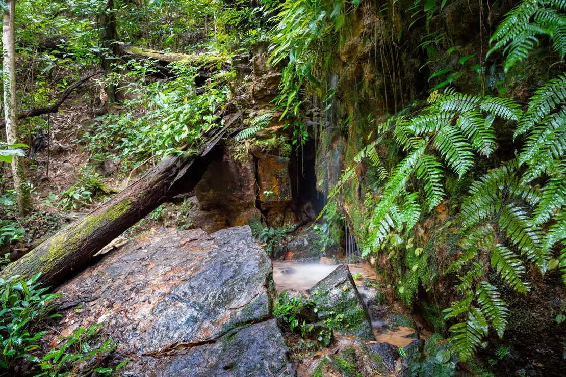
One of the small waterfalls before arriving at the ranger cafe/station.
At the ranger cafe/station there is a sign politely asking to continue only if accompanied by a guide but no mention that it is mandatory. So I continued to the Ton Kiol waterfall (Maps.me) but in fact the trail is not exactly in good shape and in some sections difficult to follow. Without the help of the gps I highly doubt I would have reached my destination and in any case it took me almost three and a half hours. On the way back, knowing what was in store for me and walking at a brisk pace without making any detours for photos, it still took me just over two hours. To reach Tan Sawan (Maps.me) you even have to ford the river, which was still quite deep at the end of the rainy season, and with my camera equipment I did not trust it. Basically, this is not a hike I would recommend to just anyone, especially without a guide, I think many people would not feel comfortable.
Another somewhat accessible waterfall is Sip et Chang (Maps.me). The trail starts at the park entrance in the opposite direction from Ton Kiol. I tried to reach it within the same day and after walking for about an hour I got about 1 km from the waterfall but it started raining and it was getting dark so I preferred to turn back. Again, except for the first part, the trail is not exactly in very good condition.
I would also like to point out that it may have been the end of the rainy season, so there was still a lot of water and moisture, but over the course of the day, I probably removed at least 30 leeches!
Ton Kiol waterfall.
Boat Tour on Lake Cheow Lan
From my experience, 99 percent of travelers opt for the boat tour without even considering the treks I mentioned. In fact, the lake seems to be a truly unique place, while the rainforest trekking, though enjoyable, is an experience that can be replicated elsewhere. I had planned to visit the lake indipendetly, as described below, but due to time and weather constraints, I had to give up, leaving without seeing the famous lake.
In any case, if you prefer the do-it-yourself approach, you can get to the pier located here (Google Maps, Maps.me) by renting a scooter for 200/300 baht, about an hour’s drive, and once you get there, the boat should cost 1700 baht to divide by the number of participants-so if you make a group it can be really cheap. To all this should be added the 200 baht entrance fee to the park.
If you are alone and don’t want to try your luck at the pier hoping to find someone to share the boat with, at Khao Sok village the day tour costs 1500 bath + 200 bath for park entrance. Departure around 9:00 am and return around 6:00 pm. Included is transportation to the pier from where you take the boat to the famous floating bungalows, Kayak ride, lunch, short waterfall/forest excursion, afternoon snack and return to Khao Sok village.
The most popular tour by far is the two-day, one-night tour that includes overnight stay in the floating bungalows, departure around 9:00 a.m. and return around 2:00 p.m. the next day. The program on the first day is the same as the one-day tour while on the second day there is a boat ride just after sunrise, breakfast, relaxation/kayaking/swimming, lunch, return to Khao Sok village all for the modest amount of 2500 baht + 200 bath for park entrance.
Finally, you can visit the elephant sanctuary (Google Maps, Maps.me) located not far from Khao Sok village.
Cheow Lan lake.
How to reach Khao Sok National Park?
You can reach the park from most tourist destinations in southern Thailand (find an overview here) including a direct bus from Bangkok. The minivan station is located just outside the village at this point (Google Maps, Maps.me). Here you can book transfers to Surat Thani on your own.
Where to sleep in Khao Sok?
Hostels are incredibly cheap, likely because most travelers end up booking expensive tours. This creates a race to the bottom for lodging, offset by the tour fees. I have slept at Coco Khao Sok Hostel and recommend it, another popular and even cheaper option is Khao Sok Jungle Hostel.
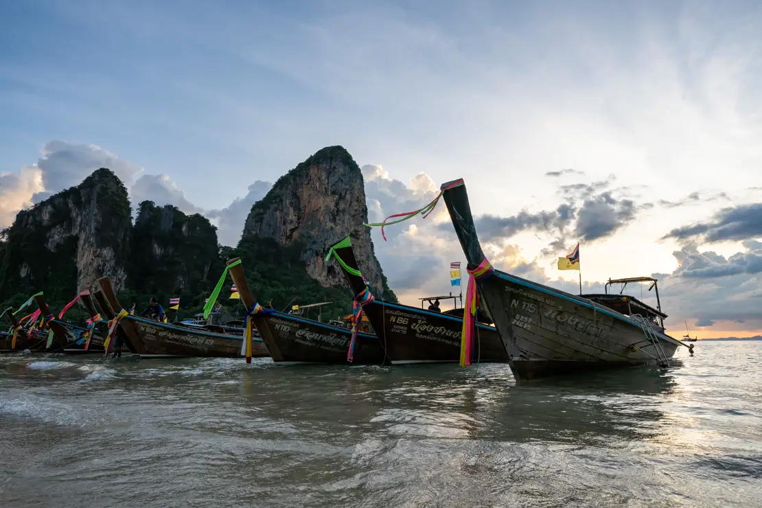
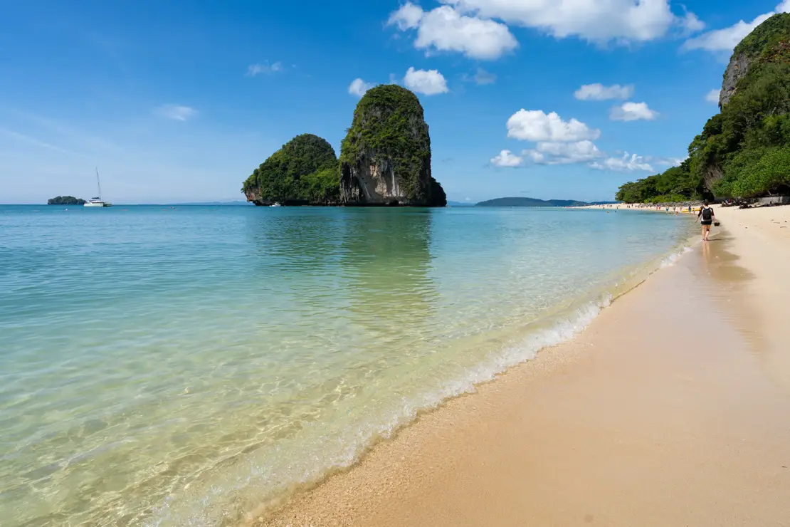
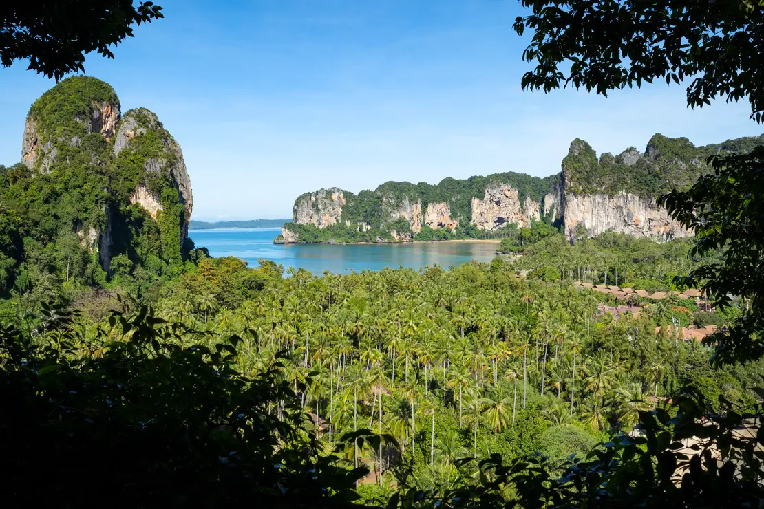
Krabi, Ao Nang and Rai Leh
Krabi town is not exactly of tourist interest, but the nearby beaches (about 15 km outside of town) are really nice and characterized by huge cliffs and limestone monoliths overlooking the sea, the two most iconic being Ao Nang and Rai Leh (Railay).
What to do and see in Krabi, Ao Nang and Rai Leh
When most people talk about Krabi they are actually referring to Ao Nang and Rai Leh. The following implies that you decide to base yourself in Ao Nang (as a recommendation) but no one prohibits you from opting for Krabi or Rai Leh.
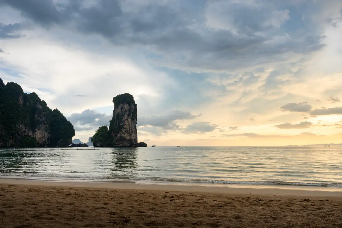
Rai Leh Beach.
Rai Leh Beach
Rai Leh can only be reached by boat from Ao Nang beach, 10-15 minutes, 200 THB if the boat is full. The ticket should be bought at the office here (Google Maps, Maps.me) and as soon as the boat is full you leave. Especially in the high season there is very little waiting. The return is included in the ticket and you just have to show it to board any of the many boats waiting in Rai Leh. Technically, if I remember correctly, no later than 6 pm. The beach here is nice but I recommend walking to Phra Nang Beach (Google Maps, Maps.me) which in my opinion is nicer. And if you’re feeling in the mood for an adventure hike to the Princess Lagoon (Google Maps, Maps.me) and the viewpoint (Google Maps, Maps.me).
Princess Lagoon.
The trail starts here and climbs through the jungle, almost vertically in places, so much so that there are ropes to facilitate the ascent and descent, 20-25 minutes. Some may find it really challenging so much so that the day I went I met people who had decided to turn back. I definitely recommend doing it with a pair of shoes and avoid just after heavy rain. Also, if possible try to go at high tide when the lagoon fills up, I have been there at low tide and although it is still a fascinating place let’s say the conditions were not optimal. Another interesting trail is the one leading to Bat Cave (Google Maps, Maps.me), again, some may find the trail too challenging.
Phra Nang Beach.
To conclude, the area is famous for climbing. There are numerous schools offering lessons or alternatively you can simply rent equipment and attempt one of the many routes.
Pai Plong Beach.
Pai Plong Beach
Pai Plong Beach (Google Maps, Maps.me) is reached at the end of a short trail called “Monkey Trail” that starts at the end of Ao Nang beach. The path through the forest is really pleasant and once you arrive at your destination the beach is not only prettier than Ao Nang but also less crowded, recommended.
Pai Plong Beach.
Dragon Crest Mountain
This is the hike inside Mount Khao Ngon Na National Park where until a few years ago it was possible to take the iconic photo on the rock outcrop whose access has been closed to the public for safety reasons. You will no longer be able to take cool photos but I think it is still worth going, the views are breathtaking and the path up through the jungle is pleasant.
Dragon Crest Mountain.
The entrance to the park is at this point (Google Maps, Maps.me), from here to the top of Hang Nak Mountain (Google Maps, Maps.me) is about two hours, an hour to descend, find the trail described on this page. There are at least a couple of detours that take no more than about ten minutes, the first leads to Hang Nak waterfall (Google Maps, Maps.me) while the second to a spring to which a legend is attached (Google Maps, Maps.me). The waterfall is pretty, the spring is not. To reach the park entrance I recommend renting a scooter for 200 baht. The entrance to the park costs another 200 baht.
Hang Nak waterfall.
Some people combine the excursion with Tha Pom Son Nam (Google Maps, Maps.me) where you can rent kayaks to navigate the canal system but from what I understand it is not even possible to swim so I preferred to do something else. The entrance fee is 100 baht.
Tiger Temple
Instead of going to Tha Pom Pom Son Nam I preferred to go to the top of Tiger Temple (Google Maps, Maps.me), it took me exactly 21 minutes but what a struggle!!! 15 minutes or so to go down. For some people it could be a real torture, some flights of stairs are almost vertical but once you get to the top you are rewarded with a great view! Admission is free and there are other nice temples at the base that you can visit. I personally have not been there but many people combine a visit to Tiger Temple with the Huay To waterfall (Google Maps, Maps.me) further north, entrance costs 100 baht plus 20 baht to park the scooter.
Tiger Temple.
Hot spring e Emerald Pool
Over the course of another scooter day you could combine a visit to Emerald Pool also known as Crystal pool (Google Maps, Maps.me) and the hot springs (Google Maps, Maps.me). I haven’t been there myself, so I won’t speculate, but the photos look really nice. Admission to the Emerald Pool costs 200 baht, while the hot springs charge 100 baht, with an additional 10 baht for parking.
Sunset from the Tiger Temple.
Boat tour of the islands with snorkeling
Another popular excursion is the classic boat tour to some islands around Ao Nang. I did not participate because after a while these tours all start to look the same! A close friend however told me that Koh Hong is really quite beautiful while Koh Lao is small and extremely crowded so it is something you might consider when going to evaluate a potential tour.
In conclusion, if you are looking for a good restaurant with honest prices in Ao Nang, I recommend Family Thaifood & Seafood (Google Maps, Maps.me). It is really popular so try to avoid peak hours otherwise you will almost certainly queue to sit down.
Pai Plong Beach.
How to reach Krabi / Ao Nang?
If you don’t decide to opt for a tourist transfer, getting to Ao Nang often requires going through Krabi or at least its station/port/airport. Connections in any case are really frequent and cheap during the day. There are songthaew that shuttle from the bus station to Ao Nang frequently for 60 baht.
Where to sleep in Ao Nang?
I spent a couple of nights in Pop-In Aonang and all in all it was not bad. But if budget allows then I recommend TAN Hostel x Cafe, clearly a better hostel. The cafe on the ground floor is not exactly cheap but the food is great.
On the way to the Princess Lagoon.
Phuket
Phuket, arguably the epicenter of mass tourism in Thailand, is undoubtedly the country’s most visited island. Although I haven’t been there myself, beaches like Patong, Kata, and Karon are known to be quite crowded. However, beaches further north, such as Nai Yang, Nai Thon, and Mai Khao, are reportedly less touristy. If you’re interested, a comprehensive guide about the island can be found here.
That said, Phuket, or perhaps even better, Khao Lak further north, are excellent bases for exploring the nearby Similan Islands—a renowned paradise considered one of the world’s best diving and snorkeling destinations. However, a well-traveled diving friend of mine wasn’t impressed, so I recommend doing thorough research before making plans. If you’re interested, a comprehensive guide about the island can be found here.
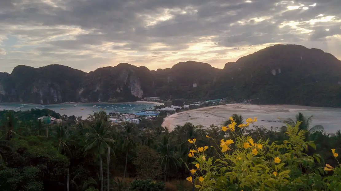
Koh Phi Phi
It’s a famous archipelago located between Phuket and Koh Lanta in the Andaman Sea, and was once considered one of the world’s most spectacular and accessible destinations. Unfortunately, mass tourism has taken a significant toll on its beauty.
The iconic “Maya Bay,” where the movie “The Beach” was filmed, was closed indefinitely in June 2018 due to environmental damage. I visited about a year before the closure, and the degradation was already evident, although it remained a beautiful place.
While the archipelago is still spectacular, don’t expect a pristine paradise. Koh Phi Phi Don, the main and only inhabited island, is heavily developed, with most buildings concentrated along a narrow strip of land, far from a heavenly sight.
Though I believe Thailand offers better destinations, Koh Phi Phi remains a viable option, particularly for those who enjoy nightlife.
If you decide to visit Koh Phi Phi, I would still recommend taking the classic boat trip to Maya Bay and visiting one of the viewpoints (Number 1, Number 2, Number 3). Another lovely beach that is easy to reach is Long Beach (Google Maps). Additionally, I recommend hiking to Nui Beach (Google Maps). Be cautious as access can be tricky during high tide. You can also reach there by boat or kayak.
Koh Phi Phi.
How to reach Koh Phi Phi?
There are several daily sea connections from all major destinations in the area including Phuket, Ao Nang, Krabi and Koh Lanta.
Where to sleep in Koh Phi Phi?
Lodging tends to be pricier here compared to the rest of the country. I shared an affordable room with a friend at a guesthouse that wasn’t listed online, so I can’t recall its name. Personally, I would recommend avoiding the main area and opting to stay a bit further away, like at Sweed Dee Hostel.
Koh Lanta
Koh Lanta may not be as visually dramatic as other islands in the region, lacking towering limestone formations and sheer cliffs. However, it offers pleasant beaches, lower prices, and a laid-back atmosphere.
The island is quite large and best explored by scooter. Long Beach, considered the “main” beach (Google Maps), is the most developed and vibrant. While I’ve explored the “Tiger cave” in the past, it’s now closed off, but you can still visit nearby Tham Khao Mai Khew (Google Maps), another popular cave which requires a guide costing 300 baht.
Heading south, you can enjoy a brief hike to Khlong Chak Waterfall (Google Maps), along the way check out the Bat Cave (Google Maps). Access to the trail costs 200 baht. I have not visited it but the nearby Elephant Sanctuary is also highly rated (Google Maps). Further along, Khlong Chak Beach (Google Maps) is worth a visit on the route to the waterfall.
Although I haven’t personally visited, many travelers drive all the way to the lighthouse located within the national park (Google Maps), requiring a 200 baht entry fee. If you do go, there’s a short nature trail loop you can hike (All Trails).
In essence, Koh Lanta is an ideal destination for budget-conscious travelers seeking an accessible island with stunning beaches and a relaxed vibe.
Tramonto a Long Beach sull’isola di Koh Lanta.
How to reach Koh Lanta?
By boat or ferry, there are direct connections to Koh Phi Phi, Ao Nang, and Krabi, as well as to Koh Lipe to the south. However, if you’re traveling from southern Thailand, it’s often cheaper to travel overland. Direct buses from Bangkok and Hat Yai at the Malaysian border can be booked through 12go.
Where to sleep in Koh Lanta?
Hub of Joys Hostel good inexpensive accommodation with in-room air conditioner within walking distance of “Long beach” the most popular beach.
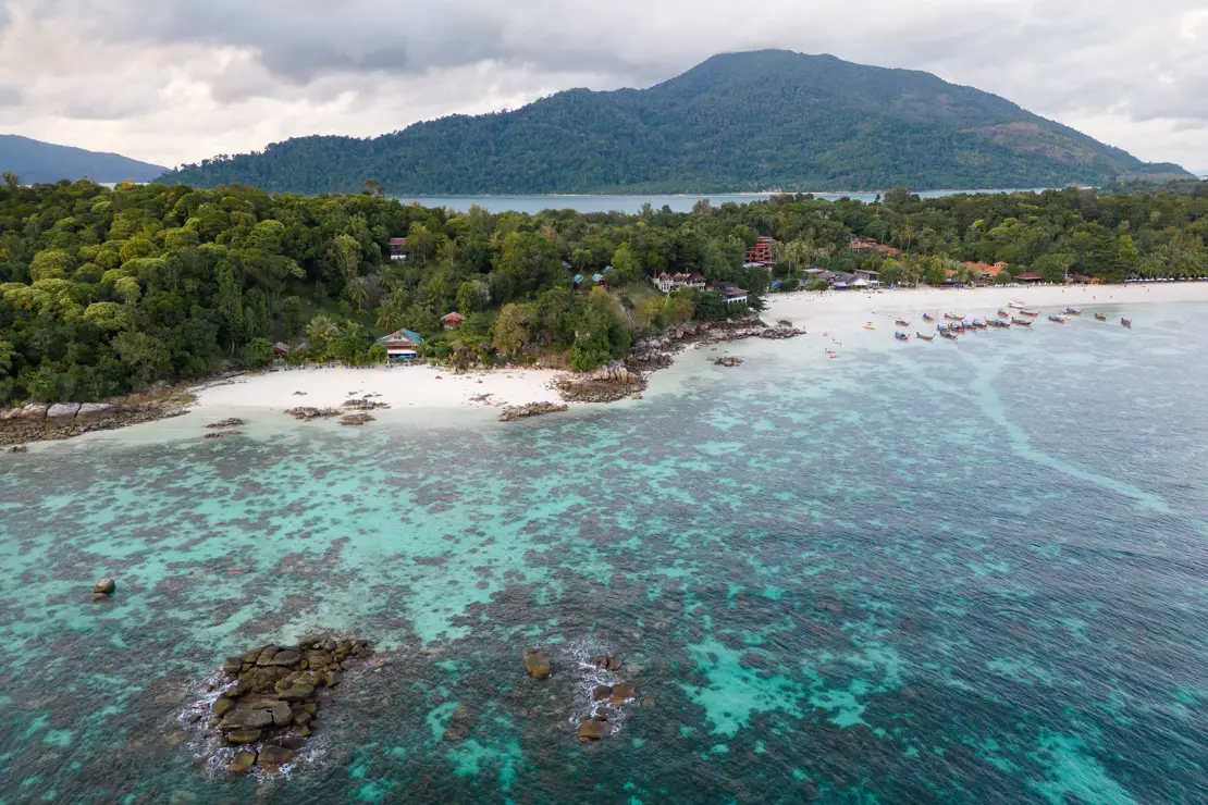
Koh Lipe
Koh Lipe, a small island near the Malaysian border, remained largely untouched by mass tourism for years and has only recently experienced a significant increase in popularity.
Its location outside the jurisdiction of the neighboring Tarutao National Park has allowed for tourism development that is not entirely sustainable, which can be seen as both fortunate and unfortunate, depending on one’s perspective.
Regardless, the island is a true tropical paradise, boasting white beaches, crystal-clear water, a car-free environment, and a relaxed atmosphere. Moreover, the coral reef, spared from the 2004 tsunami, remains in excellent condition. Perhaps it was the wonderful group I met at my hostel, or the island’s undeniable beauty, but Koh Lipe is one of the destinations in Thailand that holds a special place in my heart.
Sanom Beach, Koh Lipe.
What to do and see in Koh Lipe
The island is really compact and you can easily get around on foot. For many, the main activity is to spend the day at the beach. The nicest is undoubtedly Sunrise Beach (Google Maps, Maps.me), where unfortunately there are a lot of boats but if you walk to the north end of the beach there is a nice area bordered by buoys where you can swim.
The other popular beach on the island is Pattaya Beach (Google Maps, Maps.me). This is where speed boats and ferries arrive. The beach is very lively in the evening with many bars and restaurants overlooking it. If you are looking for something a little more quiet, I recommend walking to Sanom Beach (Google Maps, Maps.me), which is reached at the end of a short path from Pattaya Beach.
If you are looking for an even more remote beach, reach Pollo/Galah beach (Google Maps, Maps.me). The afternoon I went there with some guys from the hostel, there were only two other people. Unfortunately there is quite a bit of trash but it is still a lovely place. On the last stretch to get down to the beach you have to walk along a path through the forest but still nothing challenging.
Pollo/Galah beach.
Finally, Sunset Beach (Google Maps, Maps.me) as the name suggests is the ideal place to watch the sunset. But it is probably the ugliest beach on the island so I recommend going only in the late afternoon just in time to enjoy the last moments of daylight.
Sunrise Beach.
Reach Koh Jolona by Kayak
Koh Jolona (Google Maps, Maps.me) is one of the two islets that can be seen from Sunrise Beach and can be easily reached by Kayak (even swimming) and is a great way to spend half a day. There are at least a few stores that rent kayaks at Sunrise Beach. Together with two other guys we paid 200 baths each for 3 hours plus 100 baths for masks and snorkels.
Snorkeling at Koh Jolona is great so much so that it is a stop on many boat tours. Basically, park your kayak on the beach and then swim around the islet. We limited ourselves to Koh Jolona but from what I was told the other islet is just as nice.
Sunset Beach.
Excursion to Koh Adang
A nice day trip to take is to the nearby island of Koh Adang. The island is within the national park, there are only a couple of structures, and it is much wilder than Koh Lipe. Taxi boats leave from Sunrise Beach and cost 200 baht per person, unless special requests are made, you are dropped off at the ranger station (Google Maps, Maps.me). For the return you can agree on the time or alternatively you can just call the boat, in any case no later than 6 pm if I remember correctly. I recommend leaving early in the morning and if you care about the budget, take water and food with you. There is at least one restaurant near the ranger station but it is quite expensive.
Koh Adang viewpoint.
Once on the island, you could just spend the day at the beach in the company of the monkeys (watch out for the food!) but I think it’s worth going up to the viewpoint (Google Maps, Maps.me) from which you have excellent views of Koh Lipe. It takes about half an hour and I did it in flip-flops but I think it is advisable to bring a pair of shoes. There are actually three viewpoints so if you don’t feel like going up to the last one you could stop earlier, the higher you go though the better the view gets.
Monkey in Koh Adang.
Another way to spend a couple of hours is to go to Pirate Waterfall (Google Maps, Maps.me), a really pretty waterfall in the middle of the forest that is about a 45-minute walk from the ranger station.
Pirate Waterfall.
Boat Tour with Snorkeling
At least a couple of different “standard” itineraries are offered, in the course of which 4-5 islands are visited. I don’t remember exactly which one I took partly because, due to unexceptional weather, we had to change it on the way. In any case, the tours are sold for 600-800 baht per person including lunch, mask and snorkel. With three other guys from the hostel we opted for a private tour since it ironically cost less and paid 500 baht each (2000 baht for the boat).
To conclude, eating on the island can be relatively expensive, especially compared to the mainland. Two cheap restaurants that I would recommend are Madam Yoo Hoo (Google Maps, Maps.me) and Banana tree restaurant (Google Maps, Maps.me). Also worth trying are the coconut donuts that the gentleman in front of 7 eleven sells, you can’t go wrong! 🙂
Sanom Beach and Pattaya beach, Koh Lipe.
Where to sleep in Koh Lipe?
I have slept at Nest Hostel Lipe and I cannot recommend it enough! “Pino” the owner is a woman of unparalleled kindness and hospitality. There is free drinking water, tea, coffee, cookies and bananas at the reception. Another great option literally a stone’s throw away is Bloom Cafe & Hostel, I had a look there when I arrived before opting for Nest Hostel and went for breakfast a couple of times, the staff seemed really friendly and the dorm is not bad. Finally, Sang Chan hostel is a slightly cheaper option that is literally in the middle. It is a good hostel but at least during my visit the dorm had no air conditioning which can be a problem.
How to reach Koh Lipe?
There are direct speedboat or ferry connections to Koh Lanta and Koh Phi Phi in the north but transfers are sold to virtually any other destination. While to the south it is possible to go directly to Langkawi Island in Malaysia.
If you arrive by land, you have to go through Hat Yai from where you then have to continue on to Pak Bara where the pier with speed boats bound for Koh Lipe is located, the Hat Yai minivan station is out of town at this point (Google Maps, Maps.me) but I really think it is one of those times when taking a tourist transfer is more practical and not necessarily more expensive. Across from the Hat Yai train station at this point (Google Maps, Maps.me) there is an agency that picks up most of the travelers arriving by train, they wanted 1100 bath and then dropped to 1000 bath for the minivan + speedboat combo, it still seemed too much according to what I had read and moreover they were not friendly at all. After wandering around a bit I found an agency at this spot (Google Maps, Maps.me) that offered me the exact same transfer for 800 baths. In any case, it is about two hours by minivan plus another two hours or so by speed boat.
If you are coming from Malaysia without passing through Langkawi, the most practical way is to take the direct train to the border town “Padang Besar.” You could also just take a direct minivan from Penang that you can book on 12go. Once you cross the border, there are both trains and minivans bound for Hat Yai. You can find more information on this page. In any case, when you enter the embarkation area at Pak Bara port you have to pay both the national park entrance fee of 200 baht and the port fee of 20 baht.
Pattaya beach.
Chumphon Archipelago
The Chumphon archipelago is located within the Gulf of Thailand and thus enjoys a shorter rainy season than the islands in the Andaman Sea.There are three main islands: Koh Phangan, Koh Samui, and Koh Tao.
Koh Tao
Koh Tao has the highest concentration of diving schools on the Asian continent, and possibly in the world. Due to the high level of competition, it is likely one of the cheapest places globally to get certified. On my most recent trip, the cost for an open water certification was about 9,000 baht. If you do get certified, try to organize a trip to Sail Rock. It’s a bit expensive, but it’s regarded as the best dive site in the area.
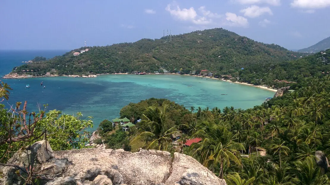
John-Suwan viewpoint.
What to Do and See in Koh Tao
The island is less developed and has a more relaxed atmosphere compared to the larger islands, Koh Samui and Koh Phangan. In my opinion, the beaches are better than those on Koh Phangan and Koh Samui, and even if you don’t plan to dive, I find the island to be the most beautiful. There is also a fair amount of nightlife along Sairee Beach (Google Maps).

Aow Luek Beach.
Some beaches I recommend checking out are Freedom Beach (Google Maps), which costs 50 baht to enter and includes access to the nearby John-Suwan Viewpoint (Google Maps). Ao Hin Wong (Google Maps) is a cute bay with nice snorkeling on the left side, and Ao Leuk (Google Maps) is quite similar. Haad Sai Daeng (Google Maps) is maintained by a resort but free to access. Shark Bay (Google Maps) almost guarantees spotting baby sharks on the left side of the bay. Ao Laem Thian (Google Maps) beach is reached after a short hike and you’ll most likely have it all to yourself. Finally, I recommend Aow June Juea (Google Maps), especially at sunset; it’s very quiet. I took the trail along the coast, but I think it might be possible to drive a scooter there. Talking about sunset, two great spots I recommend are the Secret Bar (Google Maps) and the Horizon Bar (Google Maps). There are many other great viewpoints on the island; you can find an overview online.

Koh Tao.
To conclude, even though I’ve been to Koh Tao twice and spent several weeks on the island overall, I never took one of the snorkeling boat trips they offer, but I’m pretty sure it is a good way to spend the day. The tours normally start around 10:00 and end around 17:00, visiting five different spots with lunch included, costing about 650 baht. Another popular boat trip is to the iconic Koh Nang Yuan Viewpoint (Google Maps), which I personally don’t think is worth it considering how busy the whole little island gets.
Where to sleep in Koh Tao?
I highly recommend staying at The Dearly Koh Tao Hostel. It is one of the best hostels I have ever experienced. However, if you prefer to be closer to the nightlife of Sai Ri Beach, I suggest the Savage Hostel Koh Tao.

Aow June Juea.
Koh Phangan
Famous for the legendary Full Moon Party that attracts tens of thousands of people each month, Koh Phangan is a destination I recommend even to those who aren’t into such events and are looking for something different.
The Full Moon Party, Half Moon Party, and Jungle Party occur only a few days each month and impact only a small part of the island. The rest of the island, particularly in the north, remains relatively undeveloped, with many uncrowded beaches and some waterfalls worth visiting.
What to do and see in Koh Phangan
The beaches may not be as heavenly as those in Koh Lipe, but they are still quite good. My favorite is Bottle Beach (Google Maps), located in the north of the island and accessible only by foot or boat.
Rent a scooter and drive to the starting point. From there, you have two hiking options to reach Bottle Beach: a longer coastal route that takes about 2 hours or a shorter one through the woods that takes about 1 hour. Once at the beach, you can also climb to the viewpoint for a great view (All Trails). If you don’t want to hike back, you can take a taxi boat for 150 baht to Haad Khom, which is also a very nice beach (Google Maps).
Zen Beach (Google Maps) is another nice and popular beach, especially for sunset, with a very hippy vibe. Haad Yao (Google Maps) and Haad Salad (Google Maps) are also quite nice beaches along the west coast.
There are also three waterfalls worth checking out as long as you are visiting the island not too far into the dry season. While they may not be impressive, they are a nice place to go for a refreshing swim. Paradise Waterfall (Google Maps) has a 30 baht entry fee but is kept clean, Phaeng Noi Waterfall (Google Maps) is the biggest and most popular one, has a 30 baht entry fee, and finally, Wang Sai (Google Maps) has a 20 baht entry fee.
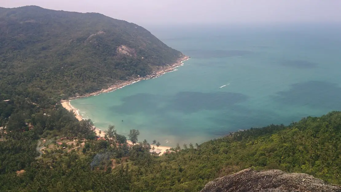
Bottle Beach.
Ang Thong Marine Park
About one hour from both Phangan and Samui by speedboat is the Ang Thong National Marine Park, a world-renowned archipelago of small islands considered a natural wonder. Though I’ve never visited the marine park, the snorkeling and diving are reputed to be excellent. Boat tours, lasting about seven hours and including lunch, snorkeling, and other activities, are offered from both Koh Phangan and Koh Samui.
Where to sleep in Koh Phangan?
If you want to stay close to the port area, I recommend Hao Norn Hostel. Otherwise, go straight to Sarana Bungalow. Although it’s a bit expensive for what it offers, it still provides good value for money.

Koh Samui.
Koh Samui
Koh Samui is the second most visited island in Thailand after Phuket. After avoiding it for many years, I finally decided to give it a chance, but it was somewhat disappointing.
What to Do and See in Koh Samui
If you decide to visit the island anyway, I recommend renting a scooter and checking out the following:
In my opinion, the best beach is Crystal Beach (Google Maps). Other commonly recommended beaches, such as Lamai Beach (Google Maps) and Choengmon Beach (Google Maps), are too developed and busy for my taste, but it depends on what you are looking for.
You can also check out Na Mueang Waterfall (Google Maps) and Na Mueang Waterfall 2 (Google Maps), which are very close to each other. If you are visiting towards the end of the dry season, don’t expect much water. Another waterfall worth checking out is Hin Lat Waterfall (Google Maps).
Wat Khunaram Ko Samui (Google Maps) is the island’s most famous temple, known for its mummified monk on display. The mummy is the body of a very revered former abbot of the temple who was also a meditation master and apparently able to predict his own death.
Finally, you can catch the sunset from the Big Buddha (Google Maps) and then grab some food in the Fisherman’s Village Walking Street (Google Maps), which becomes very lively at night.
Where to sleep in Koh Samui?
I stayed at KoHabitat Samui and would highly recommend it. Great value for money.

Bang Kao Beach.
How to reach Koh Phangan, Koh Samui and Koh Tao?
All three islands are connected to each other daily by ferries. Only Koh Samui has an airport with daily flights to Bangkok. The cheapest way to reach them, however, is by land/sea; packages are offered that include bus, port transfer, and ferry from virtually any tourist destination within the country.
If you are for do-it-yourself, the port of call for Koh Tao is Chumphon while for Koh Phangan and Koh Samui is Surat Thani. If you are coming from Bangkok, i recommend booking the night train to Chumphon. On arrival at Chumphon in the morning you can then take a joint bus and ferry service direct from outside the railway station to Koh Tao offered by Lomprayah. Depedning on the time of year the Songserm company also provide transfer services to Koh Tao.
When i took this route, the train arrived almost an hour late but I still managed to catch the 7:00 boat; there was a Lomprayah pickup that made the runs to get to the dock. The transfer officially leaves at 6:00. 900 baht in total (750 boat + 150 minivan). For the bus transfer from Bangkok they charge 1500 baht.
If you want to go to Koh Phangan or Koh Samui i instead raccomed booking the train to Surat Thani where you can get the same kind of transfer (minivan to the port + ferry).
Finally, if you are coming to Koh Samui by boat from Koh Tao with Lomprayah, they offer a transfer to anywhere on the island for 150 baht once you arrive at Pralarn Pier (Google Maps). I tried booking a Grab motorbike without any luck, so I ended up taking the “expensive” transfer.
Since I no longer run ads, if you found this article helpful, please consider purchasing your travel insurance through one of the links on this site. Doing so supports my work at no additional cost to you. For EU and UK residents, I recommend True Traveller. For everyone else, I recommend HeyMondo, which offers a 5% discount. Thank you for your support!
Suggested itineraries in Thailand
Below, I list possible 2-, 3-, and 4-week itineraries. Take these as inspiration and modify them according to your interests and budget. Remember to consider the time of year you visit Thailand!
Two-week itinerary in northern Thailand
This itinerary essentially covers the highlights of northern Thailand.
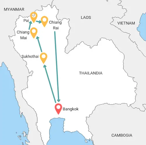
Bangkok (3 nights)
Day 1:
Recover from the jetlag and maybe walk through the Chinese Quarter.
Day 2:
Follow the classic tourist route: royal palace -> Wat Pho -> Wat Arun. Khaosan Road at night?
Day 3:
Visit a floating market or perhaps join an organized tour to Khao Yai Park.
Overnight train/bus to Sukhothai to save time.
Sukhothai (1 night)
Day 4:
Explore the ruins of Sukhothai.
Chiang Mai (4 nights)
Day 5:
Transfer to Chiang Mai in the morning. Explore the historic city center.
Day 6:
Visit Wat Phra That Doi Suthep, maybe take a dip in the canyon in the afternoon. Visit the night market.
Day 7:
Visit the elephant sanctuary.
Day 8:
Spend the day as you like, you could visit Doi Inthanon National Park, Bua Thong Falls, attend a cooking class, etc. etc.
Pai (3 nights)
Day 9:
Transfer to Pai.
Day 10:
Visit Tham Lod Cave.
Day 11:
Explore the falls and go to see the canyon at sunset.
Chiang Rai (2 nights)
Day 12:
Pai -> Chiang Mai -> Chiang Rai transfer. Visit the night bazaar.
Day 13:
Visit the temples in the city.
Day 14:
Return to Bangkok.
Two-week itinerary in southern Thailand
This itinerary essentially covers the highlights of southern Thailand. I’ve assumed that the starting and ending point is Bangkok, but you might also consider Phuket, as flights there can sometimes be very cheap.
Avoid this route during the peak of the rainy season (July-November), especially the islands in the Andaman Sea.
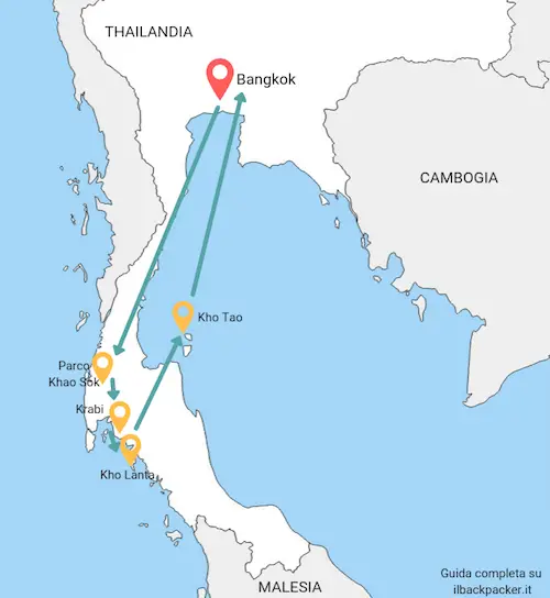
Bangkok (3 nights)
Day 1:
Recover from the jetlag and maybe walk through the Chinese Quarter.
Day 2:
Follow the classic tourist route: royal palace -> Wat Pho -> Wat Arun. Khaosan Road at night?
Day 3:
Visit a floating market or perhaps join an organized tour to Khao Yai Park (to DIY in the day is to risk spending all day on a bus).
Night train/bus to Surat Thani to save time.
Khao Sok National Park (2 nights)
Day 4-5:
Surat Thani -> Khao Sok bus. You can join an organized tour or take day trips on your own starting from Khao Sok village.
Krabi (2 nights)
Day 6:
Khao Sok bus -> Krabi -> Ao Nang beach. Spend the rest of the day at the beach.
Day 7:
One-day excursion to Rai Leh, don’t miss the viewpoint and lagoon.
Koh Lanta (3 nights)
Day 8 – 9 – 10:
I recommend three days in Koh Lanta rather than Koh Phi Phi (assuming you are not interested in nightlife).
Koh Tao or Koh Phangan (3 nights)
Day 11 – 12 – 13:
Break your trip back to Bangkok by visiting one of these two islands. My preference falls on Koh Tao but of course the choice is yours.
Day 14:
Return to Bangkok.
Three-week itinerary in Thailand
With three weeks to spare, my advice is to follow the itinerary for northern Thailand described above and add a week of beach time in the islands of the Gulf of Thailand (Chumphon Archipelago or Koh Chang) or the islands of the Andaman Sea (Koh Phi Phi, Koh Lanta, etc.).
Preferring the former-especially during the rainy season from May to September when the weather is markedly better-than the Andaman Sea. In October and November it is best to avoid southern Thailand.
Four-week itinerary in Thailand
With four weeks to spare, I recommend that you simply combine the two-week itinerary in the north with the two-week itinerary in the south.
How to get around in Thailand
Getting around is really easy, even for inexperienced travelers. Any accommodation or agency (found on virtually every corner of any touristy destination) can book your transfers to almost any other destination within the country.
For those who don’t want to deal with the hassle, packages are available that include various means of transport, such as bus + ferry to a particular island. These packages often include “pick-up” directly from your accommodation. AirAsia also offers such packages in combination with domestic flights.
This is a very practical way to get around but certainly not the cheapest. With a bit of research, it’s possible to replicate all the travel using only public transportation or at least skipping the middleman. The choice ultimately depends on your preference and budget.
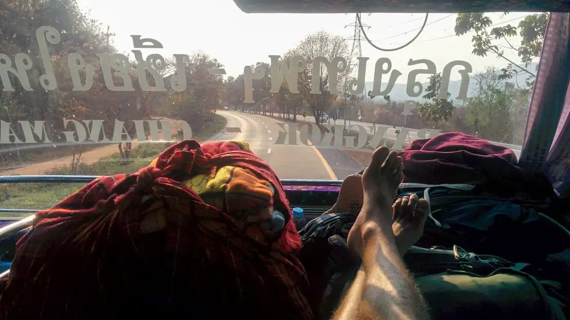
Bus to Chiang Mai.
Buses in Thailand
Buses are generally a good compromise to slower and cheaper trains and more expensive air travel. It is generally possible to book buses online although it is almost always cheaper to show up directly at the terminal and buy the ticket on the spot.
Rides are frequent and you should not run the risk of being stranded. To get an idea about prices and times you can take a look at 12go but remember that certain options may not show up in your search.
Trains in Thailand
The rail network is relatively extensive and is often the cheapest and most convenient option. It is advisable to book your tickets a couple of days in advance, especially if you want to travel by sleeper train at night or during the high season.
The reference site for the railways, where you can consult schedules and departures, can be found here. To book directly online without paying extra fees (provided you use a card without currency exchange fees), you can do so at this link, just register and you’re done. Be wary of those who say it is not possible and recommend using services offered by third parties.
If you are traveling at night, I think the best value for money is the second-class berth with air conditioning. For some extra space, choose the lower bed, but I have always been comfortable on the upper bed as well.
Domestic flights in Thailand
In many cases, especially if booked in advance, flights can be relatively inexpensive, with the Bangkok – Chiang Mai route costing as little as €30 if you travel with only carry-on luggage. The two low-cost airlines par excellence are NokAir and AirAsia.
Other airlines operating domestic flights are BangkokAir and ThaiAirways.
Taxi, tuk tuk and Songthaew
Taxis, tuk-tuks, and songthaews (pickups with two benches in the back) are found literally everywhere and are very cheap by European standards. Taxi meters are rarely used, and only in Bangkok and Chiang Mai. Remember to establish the price before boarding to avoid surprises.
Songthaews sometimes act as taxis but are often used as minibuses and are, for all intents and purposes, part of public transportation, with fixed fares.
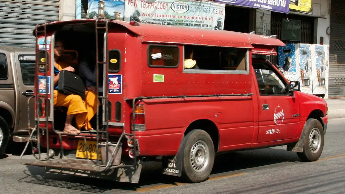
Songthaew.
Backpacking Thailand: costs
A trip to Thailand can vary in cost, but generally, it’s not as inexpensive as it was about 20 years ago, especially in Bangkok, recently named the second most expensive city in Southeast Asia after Singapore.
There’s a noticeable cost difference between the north (much cheaper) and the south, where some islands can be 3-4 times pricier than Chiang Mai, especially during high season.
For budget travelers, a daily budget of around €30 (possibly closer to €40 in the south) should suffice. This budget assumes eating at local restaurants where a cheap meal generally costs around 40-50 baht on the mainland and 80-100 baht on the islands, staying in inexpensive hostels or guesthouses, and using public transport. For example, during my last 32-day stay, I spent exactly €942.93, averaging €29.47 per day.
Other costs (withdrawals and sim cards)
Unfortunately, Thailand is one of those countries where it’s impossible to avoid withdrawal fees charged by local banks, which are typically around 220 baht per withdrawal nowadays. I recommend using a good travel card to minimize fees from your bank and withdrawing larger amounts at once. Most banks have a withdrawal limit of 20,000 baht, but Krungsri bank allows up to 30,000 baht per withdrawal. Another option is to bring cash from home; Superrich has foreign exchange offices scattered all over Bangkok with great exchange rates.
For a local SIM card, I recommend choosing between AIS and True, which have the best coverage. You can easily purchase one at any of the many 7-Eleven stores around the country or directly from their official stores. Bring your passport. Tourist packages tend to be more expensive than buying a SIM card and signing up for plans independently.
Backpacking Thailand: safety
Thailand is definitely a safe destination, even for families with children. While crime incidents can happen, using common sense will generally prevent any feeling of “danger” that you might experience in some Latin American cities.
One thing to be cautious about is scams targeting tourists, which range from overpriced taxis to “double menus” at restaurants charging tourists more than locals. Another issue can arise with scooter rentals, where rental shops may claim damage or charge excessive fees upon return. It’s important to inspect the vehicle thoroughly, perhaps by taking a video, and assert your rights if you’re certain you’re being treated unfairly.
Unfortunately, renting without leaving a passport can sometimes be difficult, and some may take advantage of this. However, such practices are not the norm at all, and with a bit of savvy, you should have no problems.
Are you planning a trip to Thailand? Check out these posts:
Do you have any questions? Updated information? Feel free to leave a comment or message me on Instagram!
Since I no longer run ads, if you found this article helpful, please consider purchasing your travel insurance through one of the links on this site. Doing so supports my work at no additional cost to you. For EU and UK residents, I recommend True Traveller. For everyone else, I recommend HeyMondo, which offers a 5% discount. Thank you for your support!
For donations/pizzas and virtual beers 🙂
Did you like the post? Pin it!