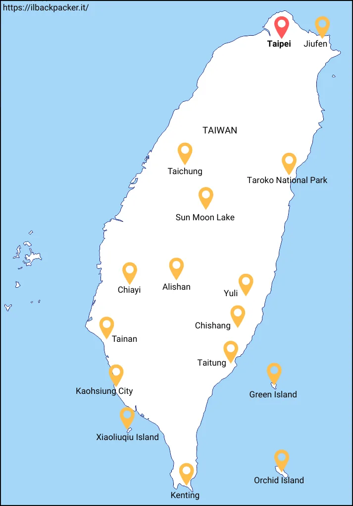
Taiwan Travel Guide
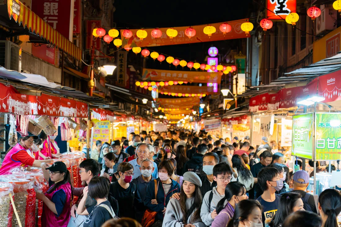
Taiwan strikes the perfect balance between vibrant cities steeped in history and culture, breathtaking natural landscapes, and exceptional cuisine. Whether you’re wandering through Taipei’s buzzing night markets, hiking the dramatic gorges of Taroko National Park, or unwinding on its pristine beaches, this island has something for every kind of traveler.
I spent nearly two months backpacking through the heart of the country, and in this guide, you’ll find plenty of practical tips and insights to help you plan your trip to Taiwan with confidence.
Quick menu
- When to visit Taiwan
- Documents and vaccinations to enter Taiwan
- What to do and see in Taiwan
- Possible itineraries in Taiwan
- How to get around Taiwan
- Backpacking Taiwan: costs
- Backpacking Taiwan: safety
Lord Handan, Taitung.
When to Visit Taiwan
The best time to visit Taiwan is between October and April, when the weather is cooler and more pleasant, with mild temperatures and low humidity. Summer (May to September) can be very hot and muggy, with frequent rainfall and the risk of typhoons—especially from July to September. Spring and autumn probably offer the best climate overall, with ideal conditions for exploring both nature and cities, while avoiding the intense summer heat and the chill of winter.
I personally visited Taiwan between January and March. Some days were cool, and I never swam in the sea, but overall, the weather was very comfortable. In the end, it really depends on what kind of trip you’re planning. The only time I’d recommend avoiding is June to September—unless you’re a fan of hot, humid weather.
Note: Be especially mindful of Chinese New Year, which can fall anywhere between January 21 and February 20, depending on the year. During this period, the entire country goes on holiday and many locals travel, so it’s essential to book accommodation well in advance!
Sun Moon Lake.
Documents and Vaccinations for Entering Taiwan
Most passport holders with at least six months of remaining validity are granted a free 90-day tourist visa on arrival. However, travelers must complete an online arrival form beforehand. Taiwan does not require any mandatory vaccinations for entry.
Note: Taiwan officially requires proof of onward travel within the limits of your visa. This usually isn’t an issue if you have a return flight or a ticket to another country, but it might be if you’re arriving on a one-way ticket. Border checks are up to the discretion of the immigration officer. Personally, I wasn’t asked for anything, but I’ve read accounts where proof was requested.
My advice? Rent a valid onward ticket through a service like OnwardTicket (a real, paid option). You can check out this article for a deeper dive into the topic.
Taroko National Park.
What to Do and See in Taiwan
Given Taiwan’s geography, I think it makes the most sense to structure this section starting with the capital, Taipei, and continuing clockwise around the island. That said, there are several international airports—personally, I arrived and departed from Kaohsiung. Either way, circling the island (clockwise or counterclockwise) is a great way to explore it efficiently.
Throughout this guide, prices are listed in the local currency. Taiwan’s official currency is the New Taiwan Dollar, abbreviated as TWD. At the time of writing, the exchange rate was approximately €1 = 34 TWD. For the most up-to-date rates, I recommend checking a currency conversion site like this one.
Note: You’ll find links throughout this guide to AllTrails. To use offline navigation in the AllTrails app, you’ll need to upgrade to the Pro version. However, there’s a workaround: from the desktop site, you can download trail coordinates in Google Earth KML format, then upload them into Organic Maps—by far one of my favorite travel apps.
Taipei
Taipei, the capital of Taiwan, is a fascinating city where old meets new: modern skyscrapers stand side by side with centuries-old temples and bustling night markets.
What to Do and See in Taipei
A couple of days is enough to cover the city’s main highlights, but Taipei also makes a great base for day trips to the surrounding areas. As with any major city, I recommend joining a free walking tour to get oriented—I did one through GuruWalk, and overall it was a fun and informative experience.
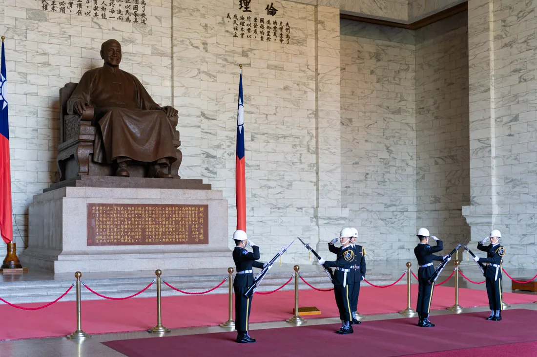
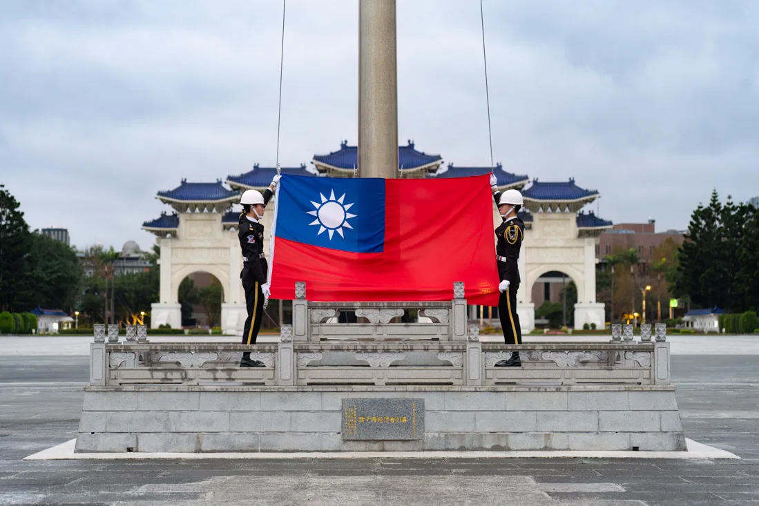
Chiang Kai-shek Memorial Hall.
Chiang Kai-shek Memorial Hall
The Chiang Kai-shek Memorial Hall (Google Maps) is one of Taipei’s most iconic landmarks. It honors Chiang Kai-shek, the Nationalist leader who retreated to Taiwan after losing the civil war to the Communists and is widely regarded as the founder of modern Taiwan.
Admission to the memorial is completely free. On the lower floor, there’s a small museum with exhibits—though most of the information is in Chinese. Don’t miss the changing of the guard ceremony, which takes place every hour from 9:00 a.m. to 4:00 p.m. Arrive a bit early if you want a front-row spot; even on weekdays, it can get crowded.
The hall is surrounded by beautifully maintained gardens and opens onto Liberty Square (Google Maps), where you’ll also find the National Theater (Google Maps) and the National Concert Hall (Google Maps). It’s a lovely area to walk around.

Chiang Kai-shek Memorial Hall.
Elephant Mountain & Xinyi District
Elephant Mountain offers one of the most iconic views in Taipei, with Taipei 101 dominating the skyline. The trail starts here (Google Maps) and is easily accessible by MRT. It’s not difficult to follow, but if you want extra details, you can check out this AllTrails page (All Trails).
Most visitors stop at the main viewpoint, but there are plenty of lesser-known trails and lookout points further up that are well worth exploring. If you want a more structured hike, you can follow this route on AllTrails (All Trails).
For a quieter alternative with just as impressive views (and far fewer people), I recommend Fuzhou Shan Park (Google Maps). Take the MRT to Linguang Station (Google Maps), then walk uphill to this viewpoint (Google Maps), where you’ll find a scenic terrace—and if you’re lucky, you might have it all to yourself.

Elephant Mountain.
Still in the Xinyi District, where Elephant Mountain is located, you can also head up to the observation deck at the top of Taipei 101 (Google Maps). Located on the 89th floor, it offers sweeping views of the city. I didn’t go myself, but I’ve heard it’s well worth the €20 entry fee—tickets can be purchased online.
Nearby, I also recommend stopping by the National Dr. Sun Yat-Sen Memorial Hall (Google Maps). Sun Yat-Sen (1866–1925) was a key figure in the fall of the Qing Dynasty and the founding of the Chinese Republic. Similar to Chiang Kai-shek Memorial Hall, you might catch a changing of the guard and some free exhibitions here.
To wrap up your day, head over to the Linjiang Night Market (Google Maps) nearby for a taste of Taipei’s fantastic street food scene.

Dr. Yat-Sen Memorial Hall.
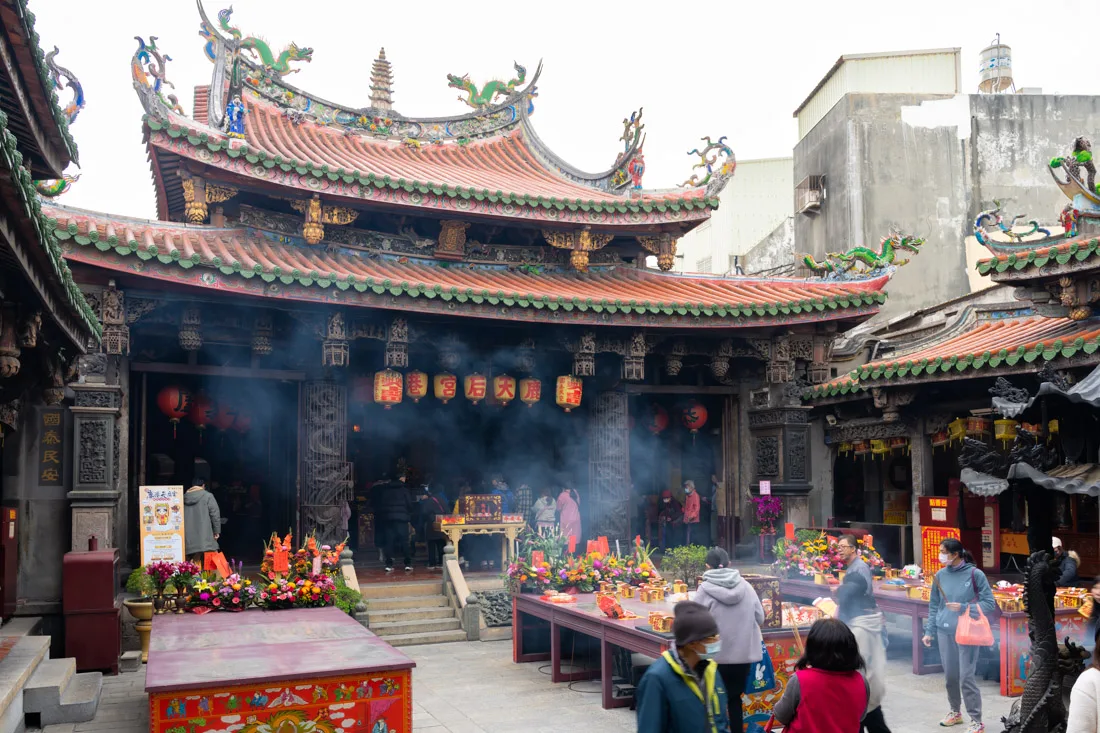
Temples in Taipei
Taipei is home to dozens of temples, and your interest in visiting them may vary depending on how much time you’ve already spent on the island or in similar places. That said, a few stand out and are definitely worth a visit.
I recommend starting with Mengjia Longshan Temple (Google Maps), especially early in the morning—between 6:00 and 8:00 a.m.—when it’s busiest with locals attending prayer. I left around 8:30 and there was still a steady stream of worshippers, which added to the atmosphere.
Mengjia Longshan Temple.
Another well-known site is Xingtian Temple (Google Maps). I arrived around 9:00 a.m. and it was still active with morning prayers. Not far from here, you can also swing by the Taipei Fish Market (Google Maps) for a completely different kind of experience.
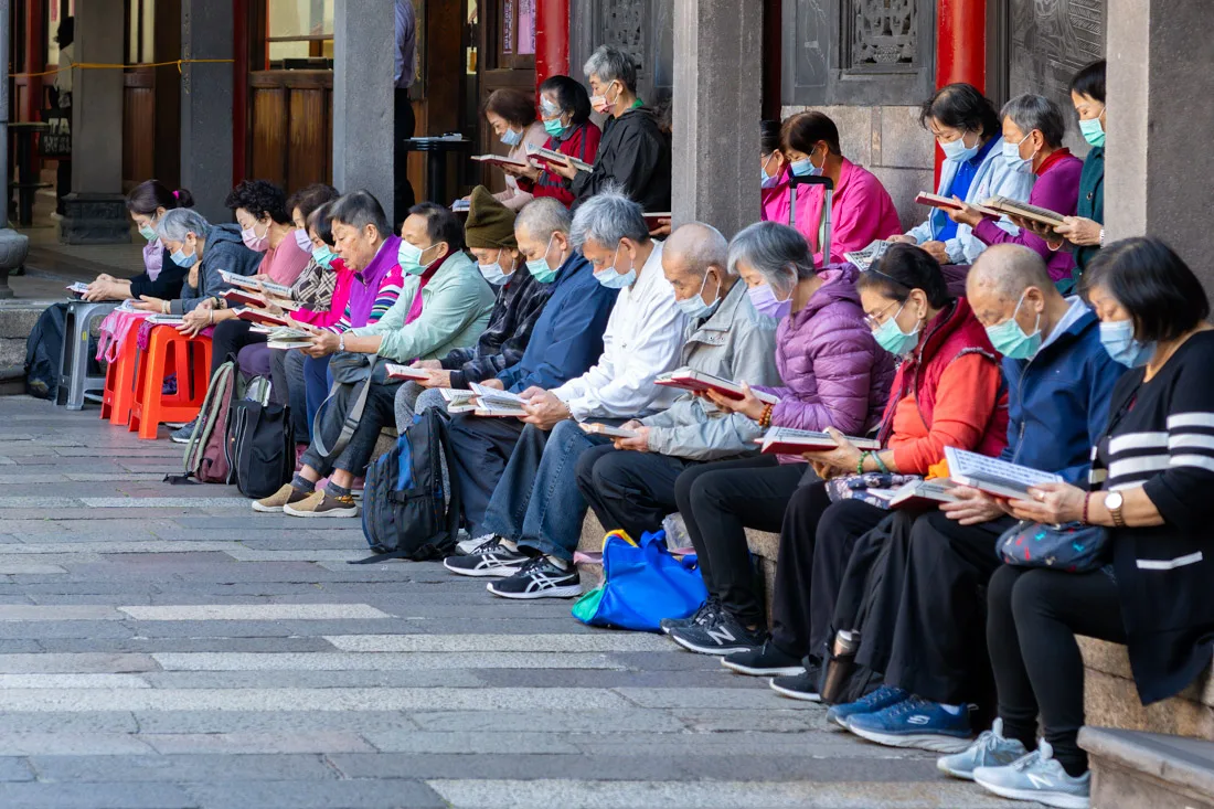
For something a bit more traditional and peaceful, head to the Taipei Confucius Temple (Google Maps) and the nearby Dalongdong Baoan Temple (Google Maps). These two are right next to each other, making them an easy combo to visit.
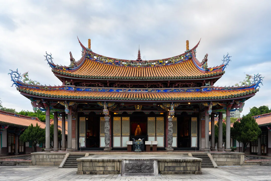
Taipei Confucius Temple.
Ximending
Ximending (Google Maps) is one of Taipei’s liveliest and most youthful neighborhoods—often compared to Tokyo’s Shibuya or Harajuku. It’s famous for its neon lights, street performers, clubs, and trendy shops. I especially recommend visiting in the evening, when the area around the Red House (Google Maps) comes alive with nightlife and open-air performances.

Ximending.
While technically in a different part of town, you could spend the late afternoon exploring the 228 Peace Memorial Park (Google Maps), dedicated to the February 28, 1947 incident. From there, walk by the Presidential Palace (Google Maps), Yuanling Street (Google Maps), and Chengzhong Market (Google Maps) before heading over to Ximending.
To wrap up the night, head a little farther north to Dihua Street (Google Maps) —one of the oldest and most charming pedestrian streets in Taiwan—and don’t miss the nearby Ningxia Night Market (Google Maps), one of the best places in the city for street food.
Dihua Street.
Huashan 1914 Creative Park
Also worth a visit in Taipei is the Huashan 1914 Creative Park (Google Maps). Originally a century-old sake factory, it’s now a cultural hotspot filled with art galleries, studios, and creative spaces. You’ll find everything from contemporary art exhibitions and design stores to installations, performances, and cafés.
On weekends, a flower market (Google Maps) is held nearby, and Daan Park (Google Maps)—Taipei’s largest urban green space—is just a short walk away.
Check the official website for upcoming events, including film screenings, live music, and cultural festivals. If you enjoy this kind of creative vibe, consider visiting Treasure Hill Artist Village (Google Maps), a repurposed hillside community that now hosts artists’ studios and experimental art projects.
Beitou and Northern Taipei
Beitou is undoubtedly one of the most popular day trips from Taipei. Known for its natural hot springs, the district is perfect for a relaxing break from the city. If you leave early, you can easily combine Beitou with several other highlights in northern Taipei.
Start by taking the MRT to Xinbeitou Station (Google Maps). From there, it’s a short walk to the hot springs area. You’ll find several bathhouse options: The Beitou Public Hot Spring (Google Maps) is the cheapest and often recommended, but be aware—they have very specific rules about swimwear. According to them, mine didn’t meet the requirements, so I ended up across the street at Long Nice Hot Spring (Google Maps). Here, you bathe nude, so swimsuits aren’t an issue! The pools are gender-separated, the staff is friendly, and the atmosphere is quiet and traditional. I actually recommend coming here directly, but if you’re willing to spend more, there are plenty of other choices in the area as well.

Thermal Valley.
After soaking in the hot springs, continue to Thermal Valley (Google Maps), a steamy geothermal pool with eerie, swirling mist—admission is free and it’s a unique sight. Also nearby are:
- The Beitou Hot Spring Museum (Google Maps) – free and a quick, interesting stop.
- A small but peaceful Buddhist Temple (Google Maps).
- The Beitou Museum (Google Maps) – I didn’t go in, but it looked worth a visit if you have time.
To wrap up your visit to Beitou, consider heading up to Sulfur Valley (Google Maps). I walked there, but a bus is also available. Entrance is free, and you can soak your feet in warm, mineral-rich pools while admiring the volcanic landscape dotted with steaming fumaroles.
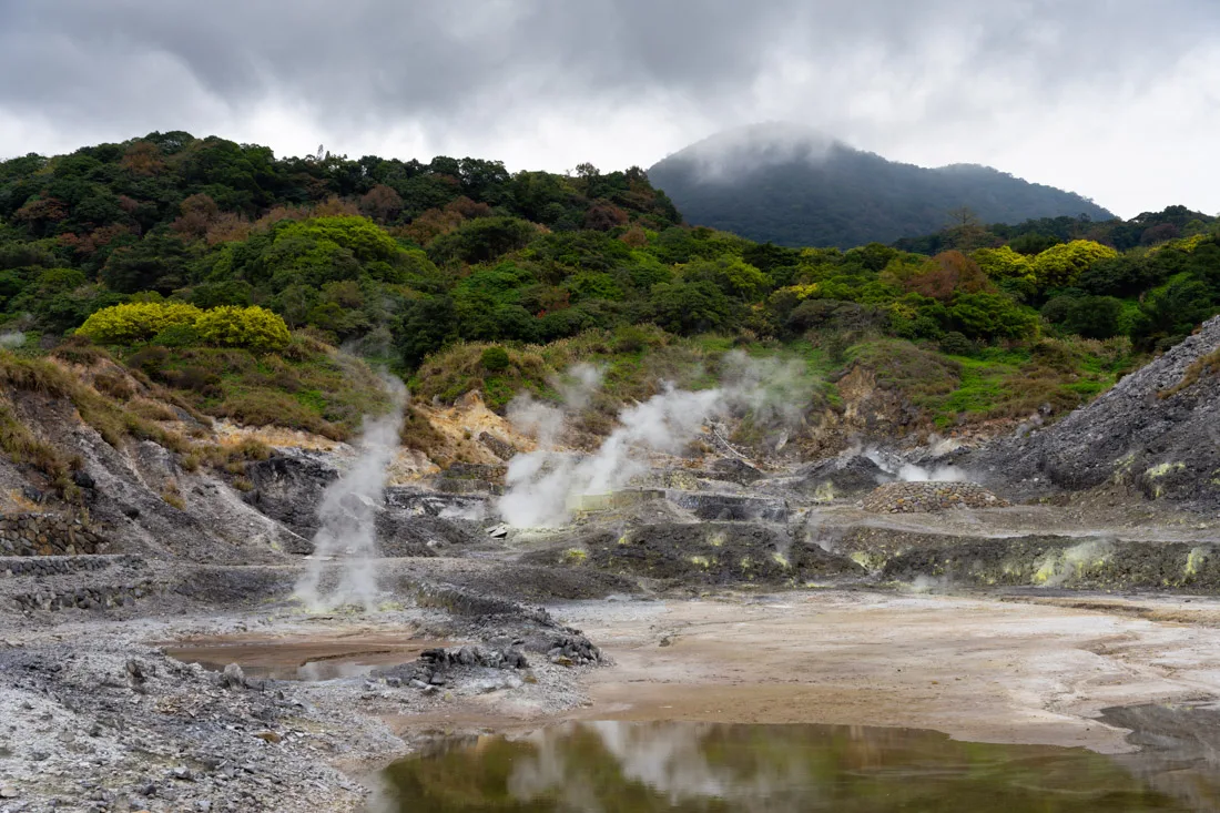
Sulfur Valley.
Optional Add-Ons After Beitou
Depending on your time and energy, you’ve got a few solid options for continuing the day:
- Take the MRT to Tamsui (Google Maps) to stroll the scenic riverside boardwalk filled with street food stalls and small shops. From there, you can take the ferry across to Bali (Google Maps), but personally, I found it underwhelming—pleasant, but skippable if you’re short on time.
- Instead, I recommend heading to Guandu Temple (Google Maps), one of the most impressive temples in Taipei. It was under renovation during my visit but still striking.
Guandu Temple.
- For sunset, head up to the Old Place Airplane Observation Deck (Google Maps), which offers panoramic views of the airport and Taipei skyline. To get there, take the MRT to Jiantan (Google Maps) and follow the trails mapped in Organic Maps.
- Alternatively, the Jinmianshan Trail (Google Maps) leads to the famous Scissors Rock viewpoint (Google Maps). It’s a bit trickier to reach from Beitou and offers similar views, so I’d only recommend it if you’re specifically interested in that hike.
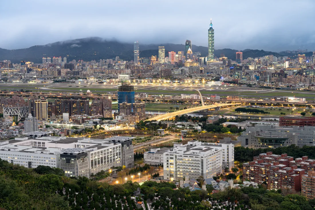
Old Place Airplane Observation Deck.
After sunset, wrap up the day at Shilin Night Market (Google Maps), one of the biggest and best night markets in Taipei.
If you’re more of a museum-goer, consider substituting your post-Beitou plans with a visit to the National Palace Museum (Google Maps), which houses the world’s largest collection of ancient Chinese artifacts.
As you can see, there are plenty of great ways to spend a full day exploring the north side of Taipei!
Shilin Night Market.
Yehliu Geopark
Although I didn’t personally visit, Yehliu Geopark (Google Maps) is a well-known day trip from Taipei. The park is famous for its bizarre and fascinating rock formations, sculpted over millennia by wind and sea erosion. A close friend of mine visited and said it was definitely worth the trip.
If you decide to go, consider also stopping by the nearby Guihou Fish Market (Google Maps)—a great spot for fresh seafood and local snacks.

Shifen
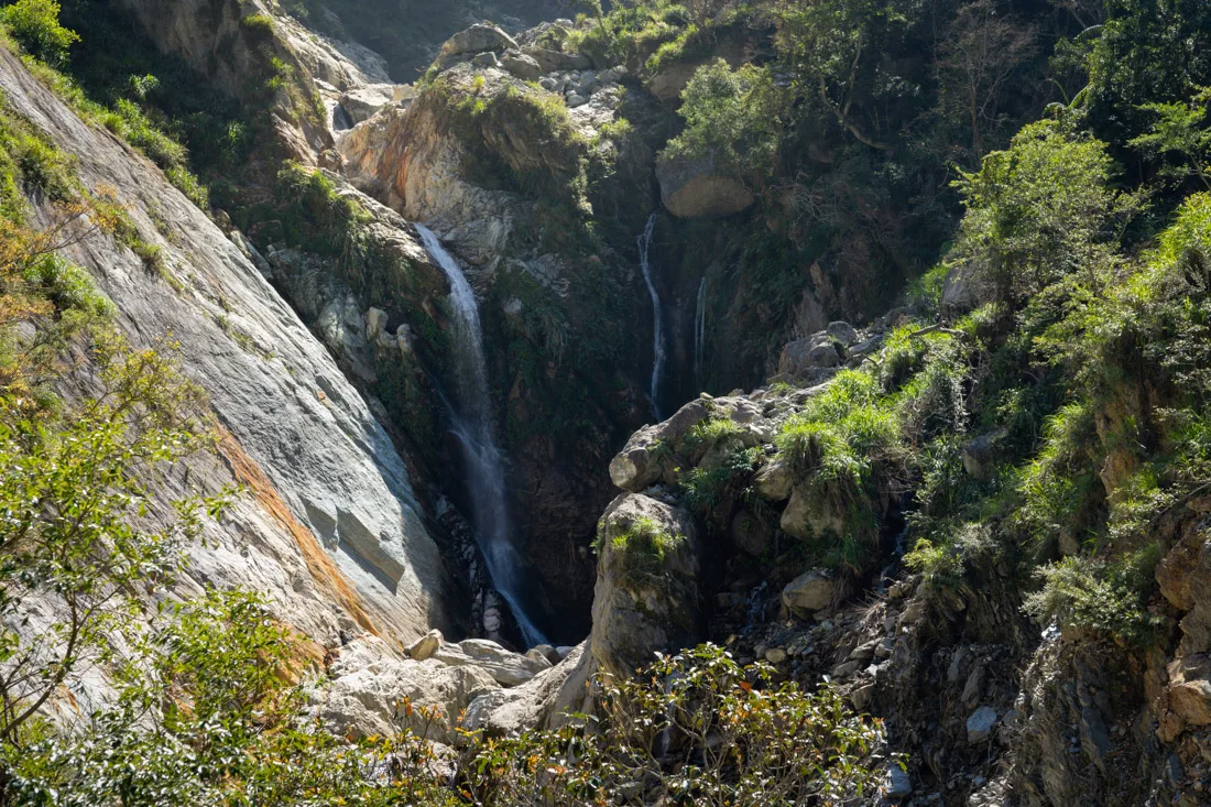
Shifen is another popular destination for a day trip from Taipei. I’ll be honest—I didn’t go, because I felt the area didn’t offer enough to justify a visit. However, many travelers enjoy it, especially for:
- Shifen Old Street (Google Maps).
- Shifen Waterfall (Google Maps), one of the largest and most impressive waterfalls in Taiwan.
If you’re looking for something more active, consider:
- Hiking up to Mount Wufenshan (Google Maps) – you can find a detailed route on (All Trails).
- Taking the train to Sandiaoling (Google Maps) and hiking the Sandiaoling Trail (All Trails), which passes three waterfalls.
Many travelers combine Shifen with Jiufen (more on that below), doing Shifen in the morning and Jiufen in the afternoon/evening. You could even spend the night in Jiufen if you want a slower pace.
Where to Sleep in Taipei?
I had originally wanted to stay at Star Hostel Taipei Main Station, which came highly recommended by friends, but it was fully booked during my trip. Instead, I stayed at 4Plus Hostel—great value for money and quite well located. I’d definitely recommend it if you’re on a budget.
How to Reach Taipei?
Taipei is extremely well connected to the rest of the country:
- Trains: Regular trains link Taipei with most major cities.
- High-Speed Rail (HSR): Runs down the west coast all the way to Kaohsiung and cuts travel time significantly.
- Air: Taipei is home to Taiwan Taoyuan International Airport, the country’s main international hub, with direct flights to many global destinations.
For more detailed information on transportation, check out the travel logistics section of this guide.

National Theater & Concert Hall.
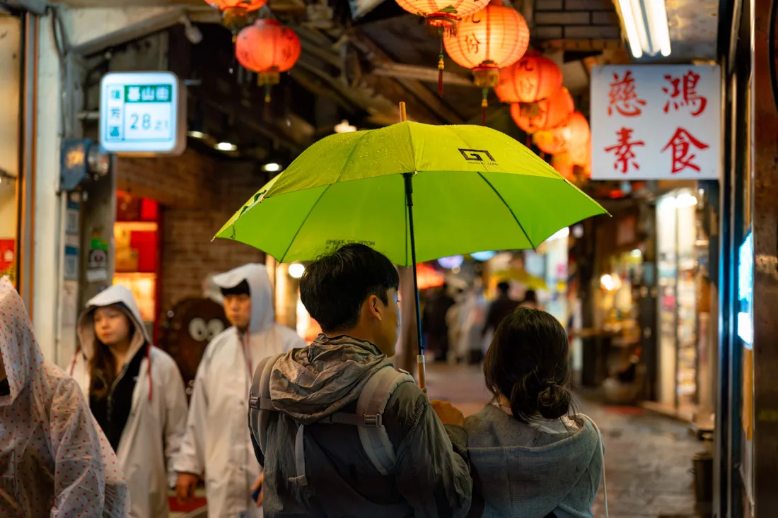
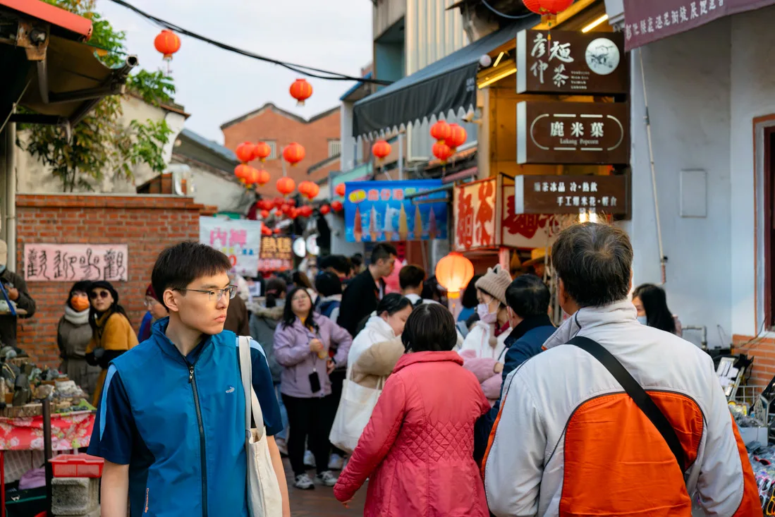
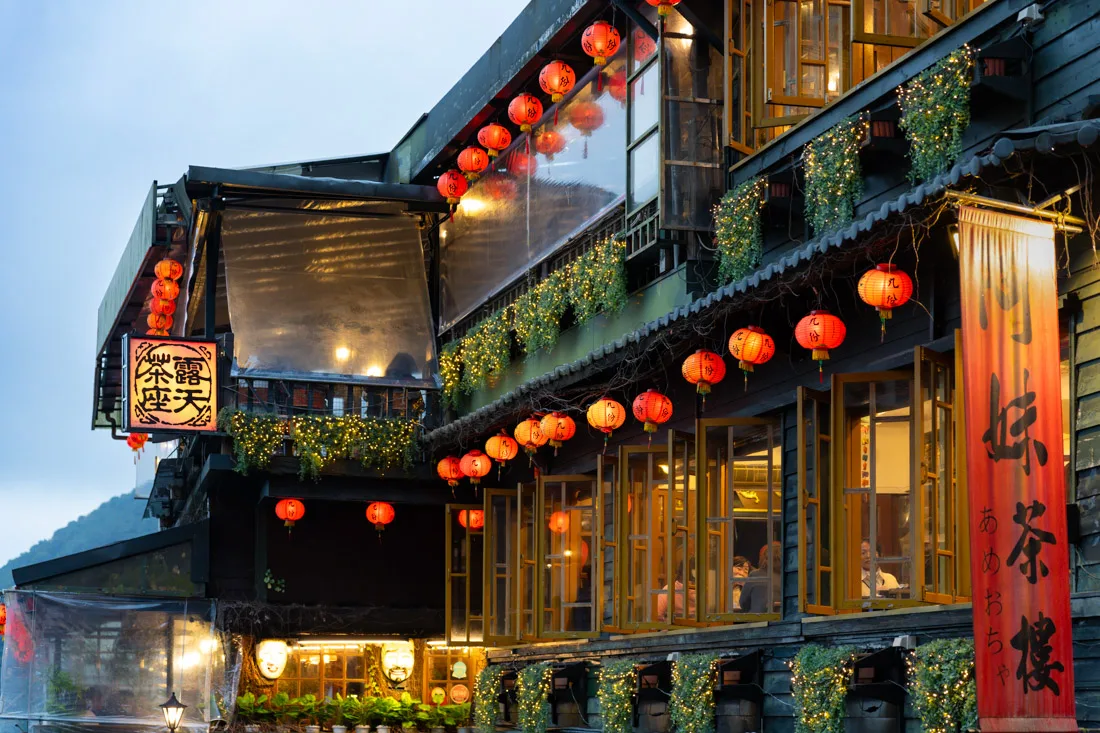
Jiufen
Perched in the misty hills of northern Taiwan, Jiufen was once a gold mining town. Today, its narrow alleys captivate visitors with old-world charm and a magical atmosphere that famously inspired the film Spirited Away.
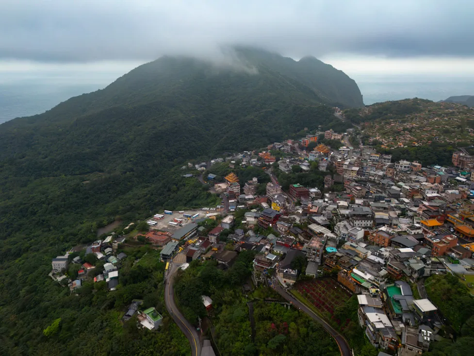
Jiufen.
What to Do and See in Jiufen
Though Jiufen has become quite touristy in recent years, its streets remain incredibly photogenic—especially in the evening when the lanterns glow and the fog rolls in. I visited on a rainy Monday and it was still packed, so I can only imagine the crowds on weekends! Still, wandering the main street (Google Maps) is a must-do.
One of the town’s most iconic sights is A-Mei Teahouse (Google Maps), often photographed for its classic red lanterns and traditional architecture.
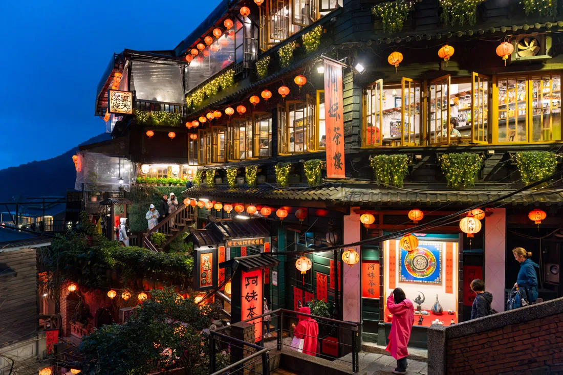
A-Mei Teahouse.
Gold Museum
The Gold Museum (Google Maps) isn’t just one museum, but a collection of exhibitions focused on the town’s mining past and the geology of the region. Admission is only 80 TWD, and I found it well worth it. For an additional 50 TWD, you can also visit a restored mining tunnel. I personally skipped it, but considering it’s just over a euro, it might be worth a look.
To get there from Jiufen, catch a direct bus to Jinguashigong Station (Google Maps), which drops you off right at the museum entrance. Buses run frequently. There’s also a FamilyMart inside the museum (Google Maps) if you need food or supplies.
If you have time, you can also hop back on the bus or walk to visit the nearby Golden Waterfall (Google Maps)—a short trip and visually striking.

Jiufen.
Hiking Near Jiufen
Unfortunately, the weather during my visit was dismal—it rained for two days straight, so I had to scrap some plans. That said, based on my research, there are two worthwhile hikes in the area:
- Mount Keelung Trail (All Trails): A relatively short hike with panoramic views of Jiufen and the coast.
- Teapot Mountain Loop (All Trails): This more ambitious trail starts near the Gold Museum and offers dramatic scenery. For experienced hikers, there’s also a longer route available (All Trails).
Where to Sleep in Jiufen?
I stayed at Linyuan Village—a cozy guesthouse run by an elderly couple who don’t speak English but were wonderfully hospitable. The rooms were clean, affordable, and within walking distance of the old town. Highly recommended if you’re looking for authentic local hospitality.
How to Reach Jiufen?
The easiest way to reach Jiufen is to take a train to Ruifang Station (Google Maps), from where you can catch a frequent bus directly to Jiufen. Get off at this stop (Google Maps) which is closest to the old town.
For more detailed transport tips, refer to the travel section of this guide.
Jiufen.
Jiaoxi
From Jiufen, I went directly to Hualien, but if you’re looking for a relaxing stop along the way, Jiaoxi is a great option. Easily accessible from Taipei, it’s popular for its hot springs, similar to those in Beitou, and can also be visited as a day trip from the capital. There are options here to suit all budgets and preferences—you can find a detailed guide here. Nearby, there’s also a waterfall worth visiting (Google Maps).
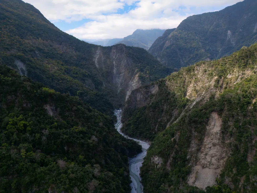
Hualien & Taroko National Park
Note: This region was severely affected by the 2024 earthquake, which occurred just a few months after my visit. As of this writing, parts of Taroko National Park remain closed, and bus services are partially disrupted. I highly recommend checking the official website for the most current updates before planning your trip.
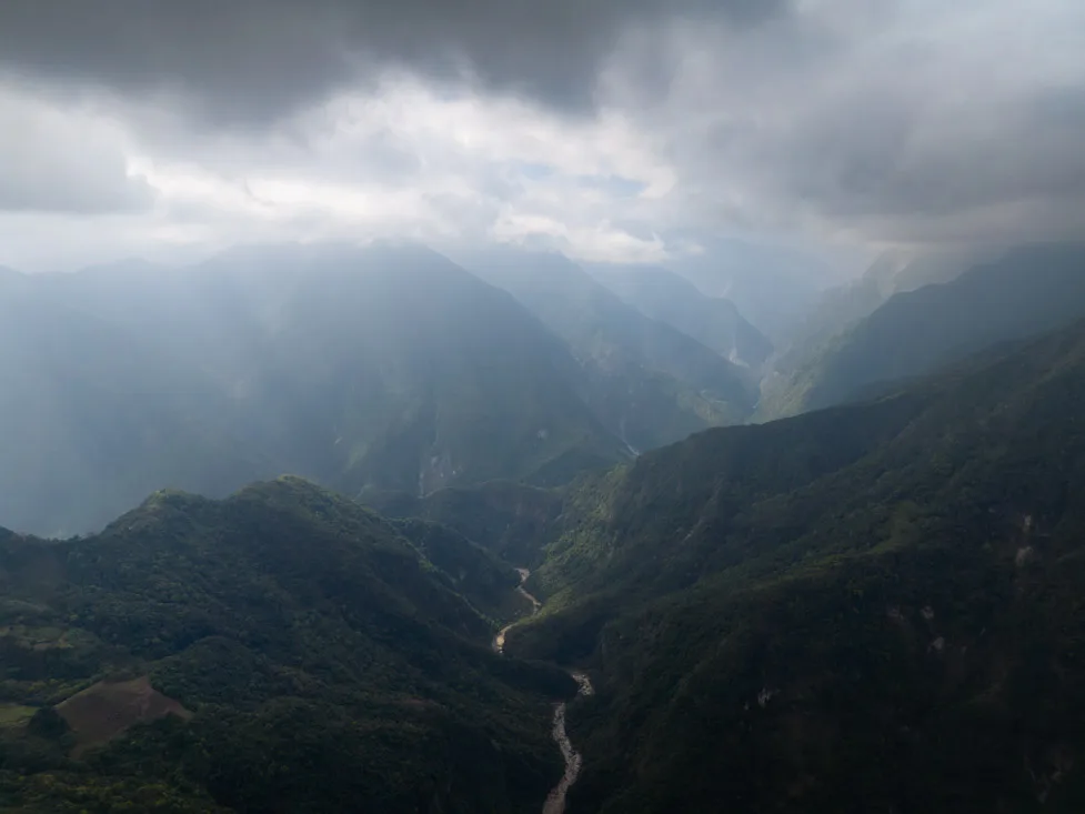
For many travelers, Hualien serves primarily as the gateway to the iconic Taroko National Park—one of the country’s natural jewels, famous for its dramatic gorges, lush forests, and towering marble cliffs. It’s easily one of the highlights of a trip to Taiwan.
Taroko National Park.
What to Do and See in Hualien & Taroko National Park
Although many visitors only spend a single day inside the park, you can easily extend your stay depending on your interest in hiking and exploring nearby areas. There’s more than enough here to fill several days.
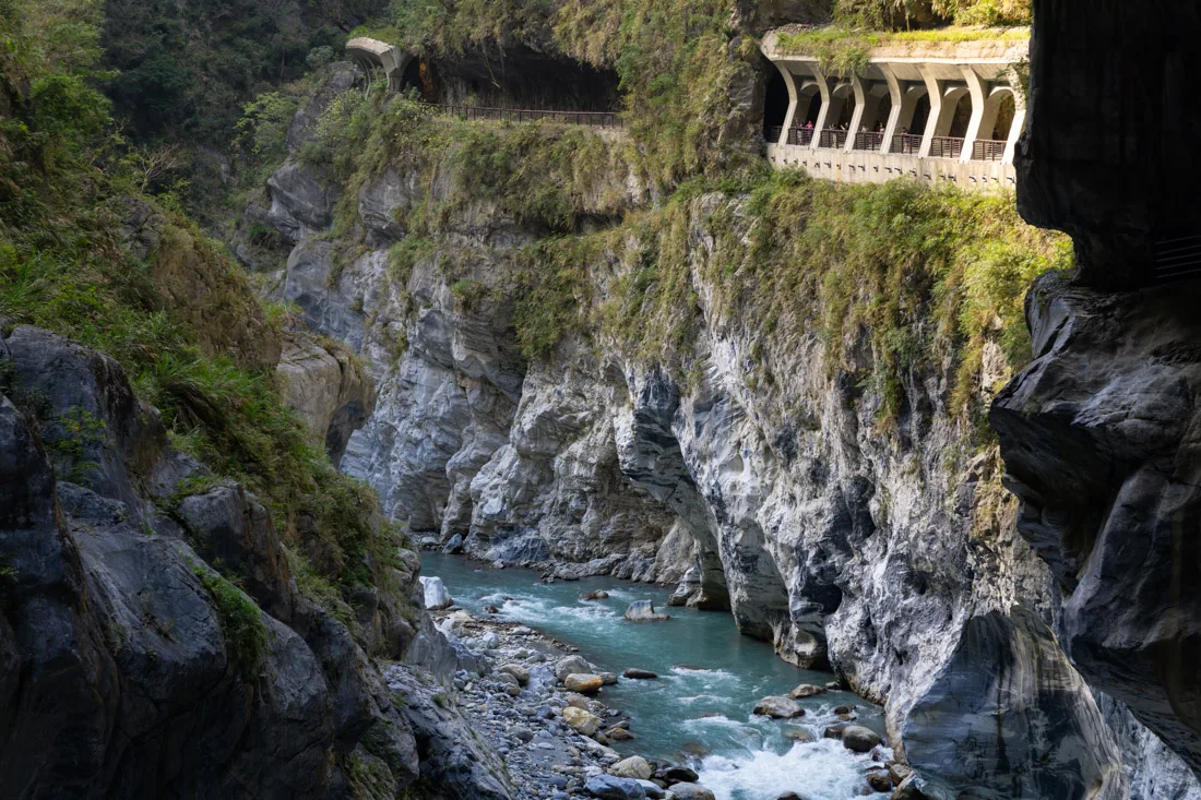
Taroko National Park
The main tourist zone runs along the Taroko Gorge, carved by the Liwu River, with a scenic road connecting various trailheads, viewpoints, and historical sites. Whether you’re in the mood for an easy walk or a more demanding hike, you’ll find plenty of choices. Below is a list of recommended stops and trails, roughly ordered from east to west—that is, from the sea toward the mountains.
Taroko National Park.
Shakadang and Tongli Loop
For an easier hike, consider just doing the Shakadang Trail (All Trails) up to Sanjianwu (Google Maps). The trail is mostly flat, runs right along the gorge, and is truly scenic—but expect crowds, especially midday. From Sanjianwu, simply turn back the same way.
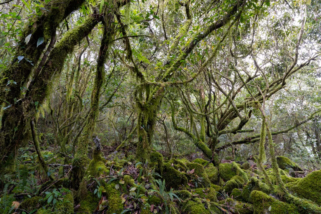
That said, if you’re up for about 1500 meters of elevation gain, the Shakadang and Tongli Loop (All Trails) was hands down my favorite hike in the park. I recommend starting and finishing at the Visitor Center (Google Maps). Unlike the default AllTrails route, I suggest including the summit of Mt. Liwushan (Google Maps)—there’s no view, but the moss-filled forest is stunning.
Don’t miss this viewpoint (Google Maps), offering jaw-dropping coastal views where mountains plunge straight into the sea. Bring plenty of food and water, as there’s nowhere to restock along the way.
Liwushan.
I took the first bus out of Hualien and started the hike at 7:15 a.m., finishing back at the visitor center at 2:45 p.m.—moving quickly with only short breaks.
If that sounds like too much, consider staying overnight in Datong Village (Google Maps)—here are a few guesthouse options (Google Maps) (Google Maps). I’m not sure how reservations work, but you could try messaging the Facebook pages listed on Maps. If you spend the night, hiking up to the viewpoint for sunrise (Google Maps) is absolutely worth it.
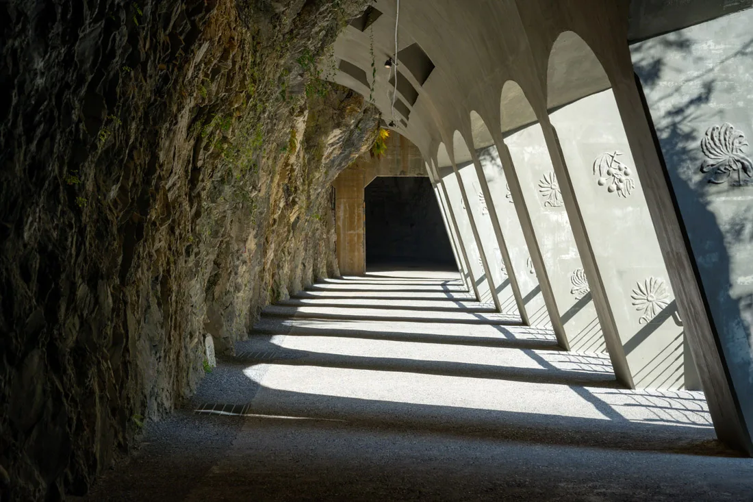
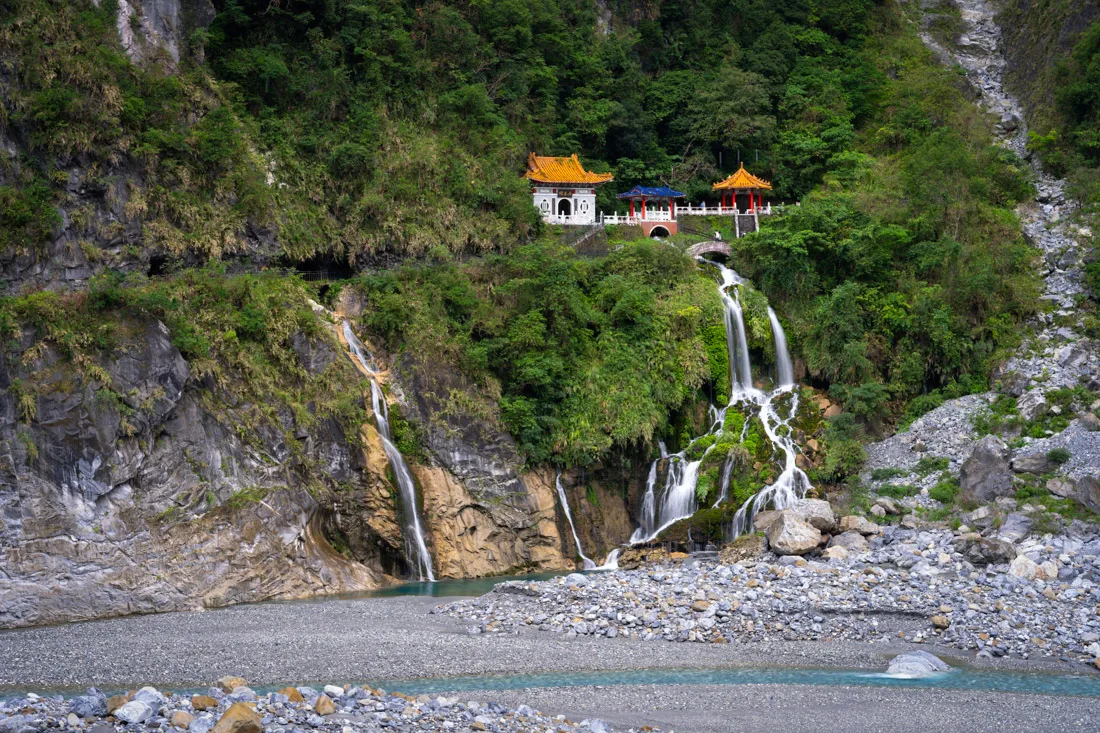
Changchun Shrine (Eternal Spring Shrine)
This picturesque temple (Google Maps) was built to honor workers who died during construction of the Central Cross-Island Highway. A short trail leads to scenic viewpoints and nearby shrines. It’s a peaceful and symbolic stop.
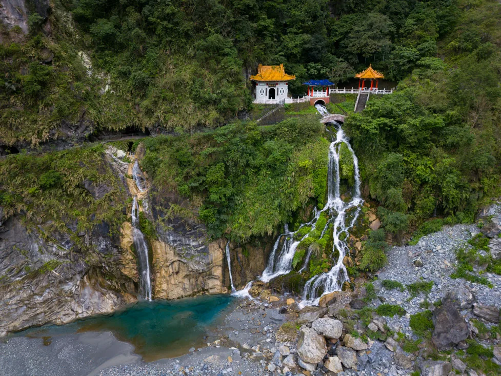
Changchun Shrine.
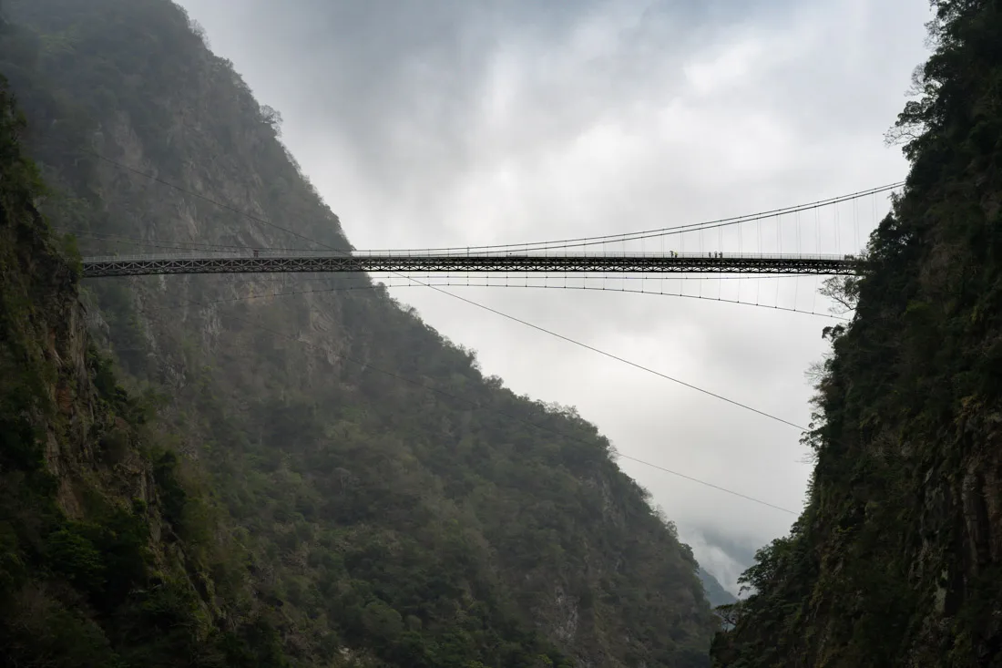
Zhuilu Old Road
The Zhuilu Old Road (Google Maps) (All Trails) is a famous and highly scenic trail—but you need to apply for a permit in advance. I discovered it too late and couldn’t enter. The trail begins with a suspension bridge and hugs the cliffs for jaw-dropping views.
- Permit cost: 200 TWD
- Entry time: 7:00 a.m. to 10:00 a.m. only
- Info & permits: official website
Shallow Grotto
Located right beside the road at the Zhuilu Old Road entrance, this short walk (Google Maps) (All Trails) follows what used to be the old road. It’s more of a walk than a trail but offers a nice break if you’re passing through.
Tunnel of Nine turns
The Tunnel of Nine Turns (Google Maps) (All Trails) is another section of the old road now turned into a short, accessible walking path. Scenic and very easy—perfect for those who prefer minimal hiking.
Tunnel of Nine turns.
Luishui-Wenshan Trail
This longer trail (All Trails), about 3 hours, can be combined with the Lushui Trail (All Trails) for an extended hike. It’s a series of steep ups and downs, with occasional rewarding views. Start at the Lushui Service Station (Google Maps).
I barely saw anyone else on this trail—just a couple of other hikers—which made it feel pretty serene. I’d recommend it if you have extra time, but if you’re limited to one day, you might want to prioritize more iconic trails.
At the end of the trail, there used to be access to the Wenshan Hot Springs (Google Maps), but these are officially closed. The stairs have been cut off, and access is now illegal and very dangerous, especially in wet weather. I passed by and a group of French hikers told me just how sketchy the descent was. Not recommended.
Luishui-Wenshan Trail.
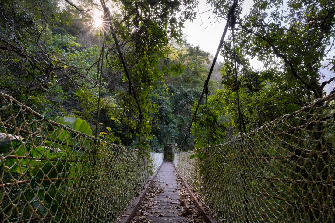
Baiyang Waterfall Trail
This is one of the more popular and accessible trails in the park (Google Maps) (All Trails). It’s mostly flat and begins with a walk through a long tunnel, leading to the Baiyang Waterfall and Shuilian Cave (Google Maps), known for its “water curtain” effect.
Honestly, the trail itself didn’t impress me much—the waterfall is fine, and the cave was underwhelming—but locals seem to love it. Even midweek, there were plenty of people.
Baiyang.
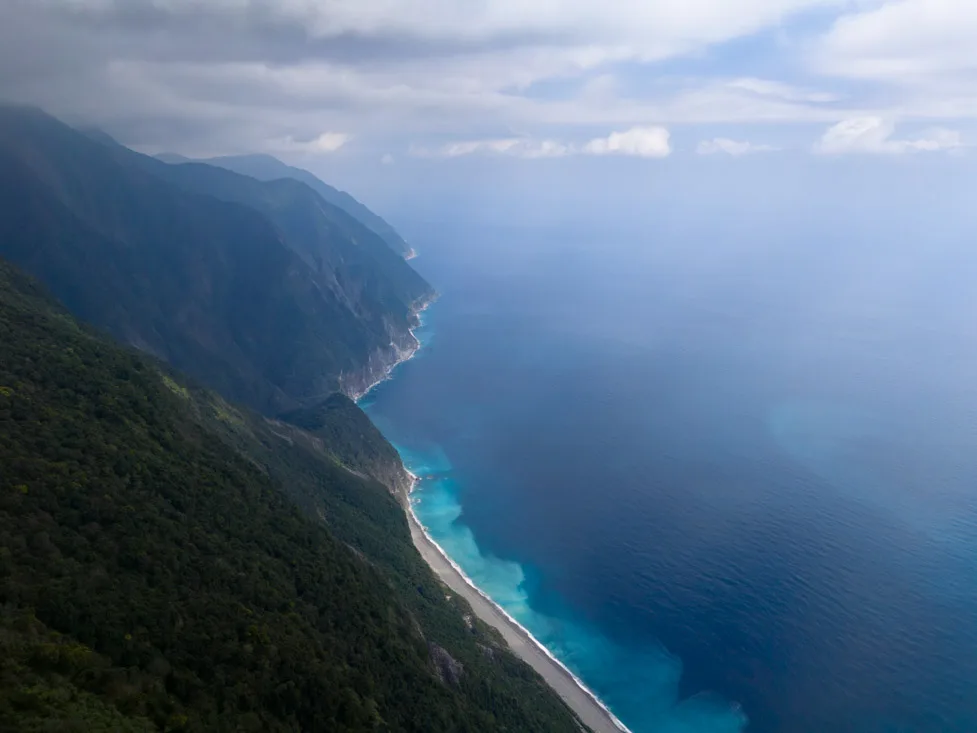
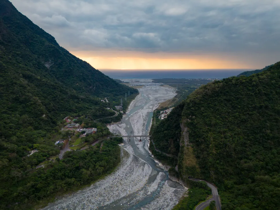
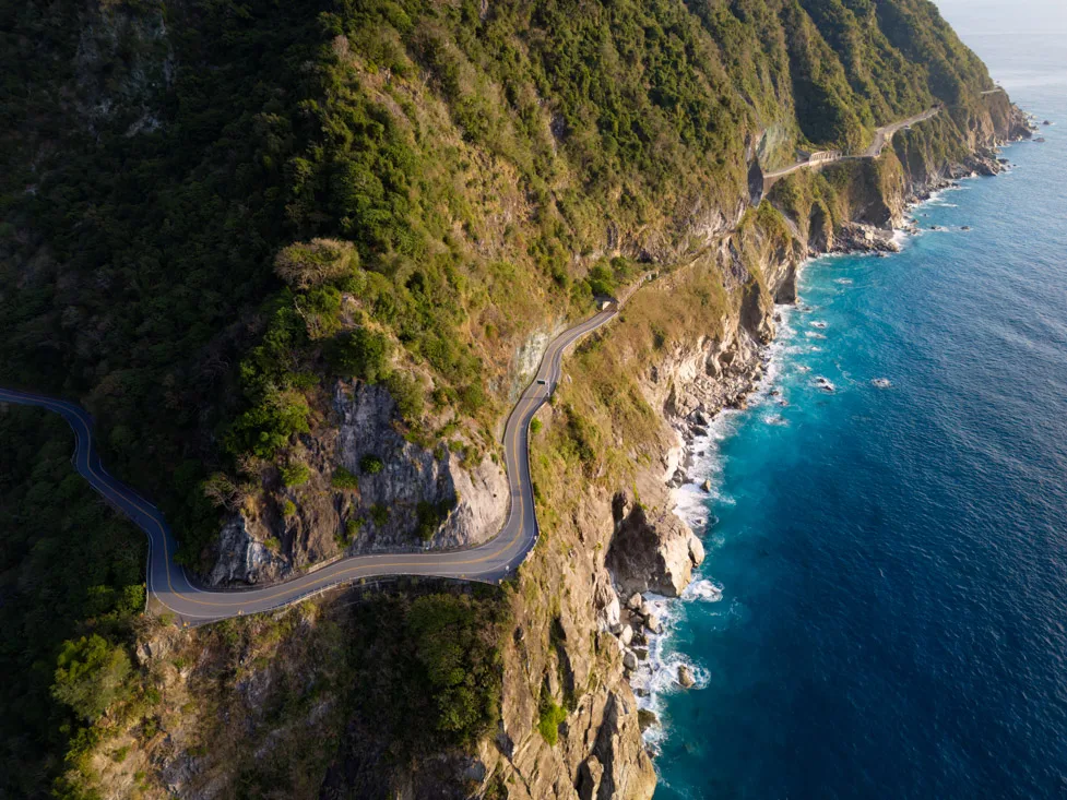
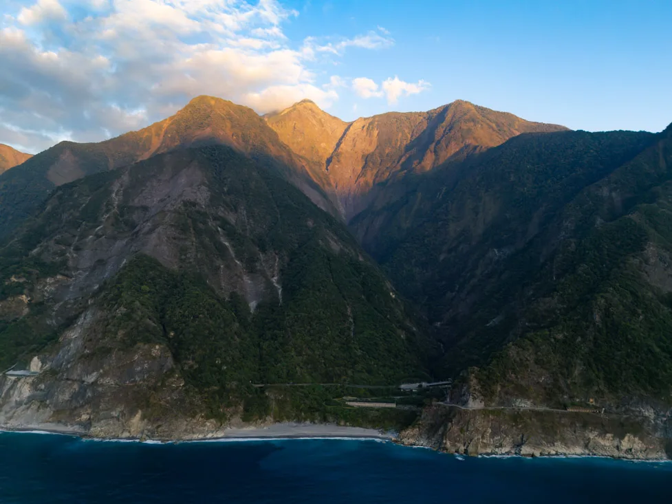
Qingshui Cliffs
The Qingshui Cliffs (Google Maps) are one of Taiwan’s “Eight Natural Wonders”, stretching over 21 km along the dramatic coastline. If you have your own vehicle, this is an unforgettable scenic drive with plenty of places to stop.
Since I didn’t have a car, I took the 5 a.m. train to Heren Station (Google Maps) and walked 4 km to this viewpoint (Google Maps), where I flew the drone at sunrise. The first part of the walk follows the highway, but then you switch to a quiet coastal road—very pleasant.
If walking along the road doesn’t feel like enough, you could instead take the train to Chongde Station (Google Maps) and walk to Banxia Beach (Google Maps). From there, follow the coastal trail marked on Organic Maps, ending on this scenic route (All Trails). I didn’t do this myself, so I can’t comment, but it looks promising.
Qingshui Cliff.
Other Destinations In and Around HualienIn addition to Taroko National Park, there are several other worthwhile spots to explore in the Hualien area:- Qixingtan Beach (Google Maps). Not particularly inviting in February when I visited, but in warmer months, it’s likely a great place to enjoy a refreshing swim. Easily accessible from the city.

Qixingtan beach.
Hualien City Highlights:
- Dongdamen Night Market (Google Maps) – A lively spot for street food.
- Hua Lien Xiang Bian Shi (Google Maps) – Delicious dumplings you shouldn’t miss.
- Deep-fried Egg Scallion Pancakes – Yellow Truck (Google Maps) – A unique local snack worth trying.
- Hualien Martyrs’ Shrine (Google Maps) – If you have time to spare, this peaceful shrine is a nice detour.
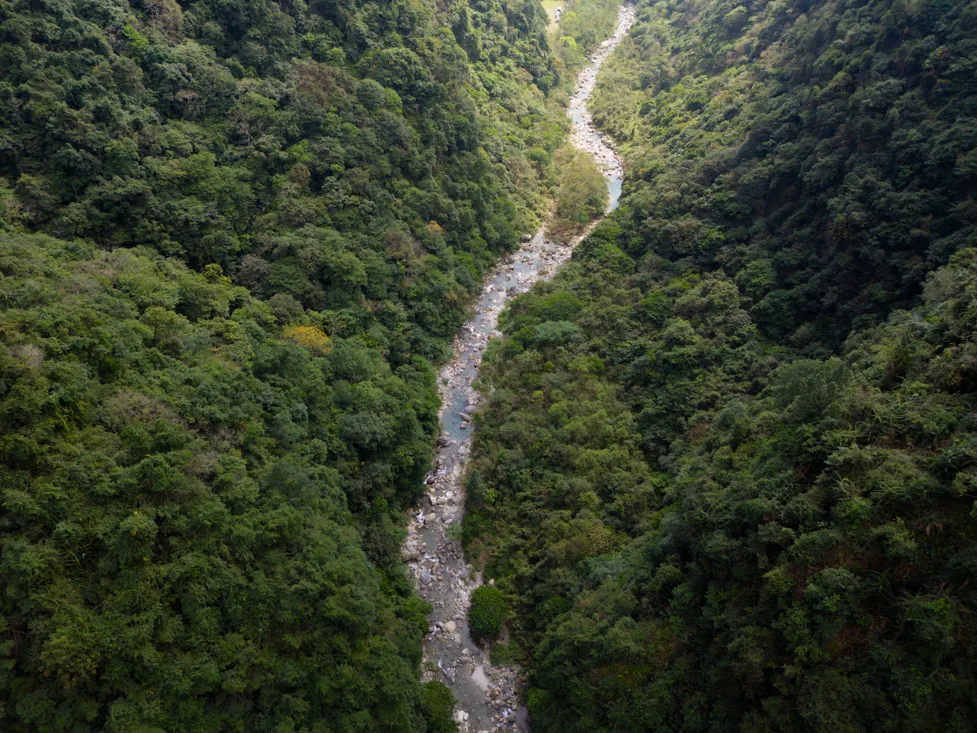
Emerald Valley (Google Maps). More of a swimming spot than a hike. I skipped it due to bad weather in February. Note that part of the trail has been closed for years due to a landslide. I recommend checking recent Google Maps reviews for up-to-date conditions. From Hualien, there are buses to Tongmen (Google Maps). If you want to explore further, head north to visit:
- Wanyue Gorge (Google Maps)
- Zimu Waterfall (Google Maps)
Where to Stay in Taroko National Park?
There are a few places to stay inside the park, such as the more upscale Silks Place Taroko Hotel. However, for budget travelers, I strongly recommend staying in Hualien or Xincheng.
Recommended Budget Options:
- Just Walk Backpacker Hostel. A cozy hostel with a super friendly owner. It’s conveniently located near both the train and bus station—ideal for getting around. Highly recommended.
- Station Sea B&B. I stayed here during Chinese New Year when most places were fully booked. It’s very affordable, fairly basic, but the owner is extremely kind. If you stay multiple days, she even lets you do your laundry for free!
How to Get to Taroko National Park?
The main gateway to Taroko is the city of Hualien, which is well-connected by train both north and south (Google Maps). Depending on your accommodation, you could also use Xincheng Station (Google Maps)—it’s even closer to the park entrance.
Getting into the Park
- Buses leave regularly from Hualien Station (Google Maps), stopping at Xincheng Station and then entering the park.
- With minimal planning, you can visit comfortably using public transport.
- Bus schedules are available on the official website and also shown on Google Maps.
- You’ll also find printed brochures at hostels or at the station.
If you’re more interested in sightseeing than hiking, consider getting a 1- or 2-day hop-on-hop-off bus pass, which lets you travel freely between the stops.
Getting Around Independently
Renting a vehicle in Hualien is another option:
- Scooter: The best choice in my opinion, weather permitting. It gives you more freedom and avoids parking issues.
- Car: Some travelers rent a car, but parking can be tricky.
- Bike or E-bike: If you’re in good shape, this could be a scenic and satisfying way to explore the park at your own pace.
For detailed info on transportation options, check the dedicated transport section of this guide.
Yuli
Yuli is a quiet rural town and not a typical stop on most itineraries. However, if you’re looking to spend a night or two in the Taiwanese countryside, it offers a peaceful atmosphere and access to a few worthwhile attractions.
Yuli.
What to Do and See in Yuli
The main draw in Yuli is its proximity to Yushan National Park, particularly as the starting point of the Walami Trail (All Trails). Originally part of the Batongguan Trail, this route was first established during the Qing Dynasty and later expanded by the Japanese colonial government to monitor indigenous resistance, especially from the Bunun people.
While a permit is required to complete the full 150 km trail, you can easily walk the first 5 km without needing any special permission. It’s nothing jaw-dropping, but it’s a pleasant and historically significant hike, perfect for a half-day adventure.
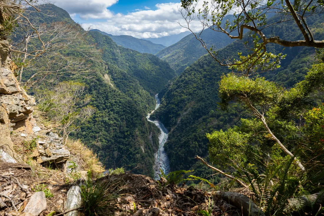
Yushan National Park.
Getting There by Bike or Scooter
I borrowed a bike from the hostel and reached the trailhead (Google Maps) in about an hour. On the way, I recommend stopping by the Nanan Waterfall (Google Maps) for a short break. From the waterfall to the trailhead, it’s all uphill, but manageable. Alternatively, rent a scooter for an easier ride and consider ending your day with a soak at the Antong Hot Springs (Google Maps).
Yushan National Park.
Where to Sleep in Yuli?
I stayed at On My Way Yuli Hostel– a fantastic choice just a short walk from the train station. Friendly and helpful staff, clean and comfortable facilities, free bicycle rental for guests. Highly recommended!
How to Reach Yuli?
Yuli lies directly on the eastern railway line, making it easy to reach from both the north and south. The train station is well-connected and conveniently located (Google Maps).
For detailed travel logistics, check the transportation section of the guide.
Yuli.
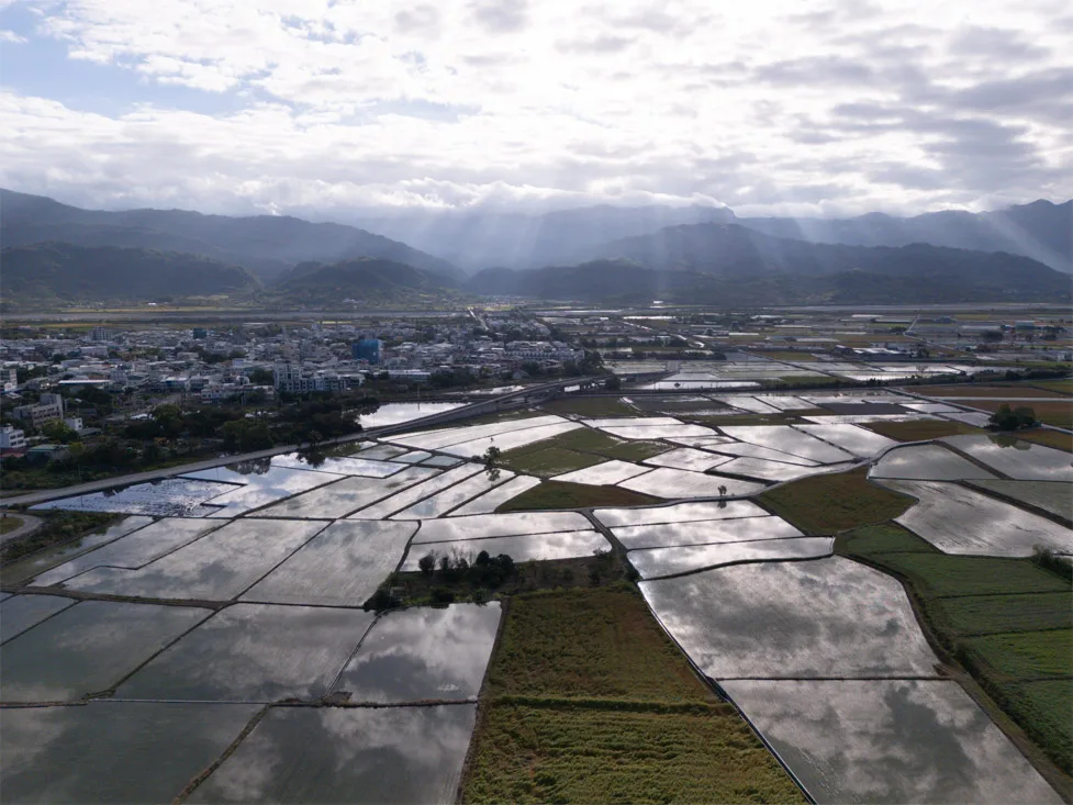
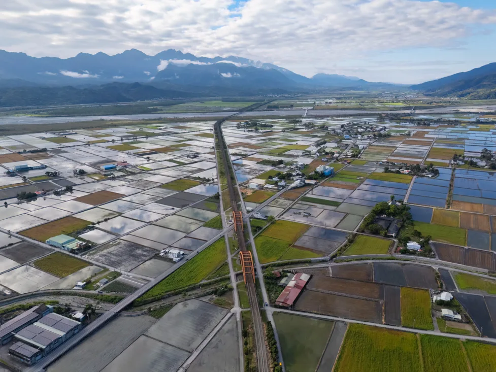
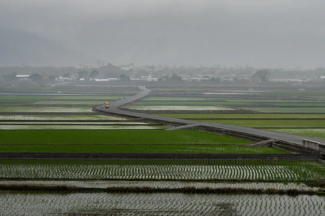
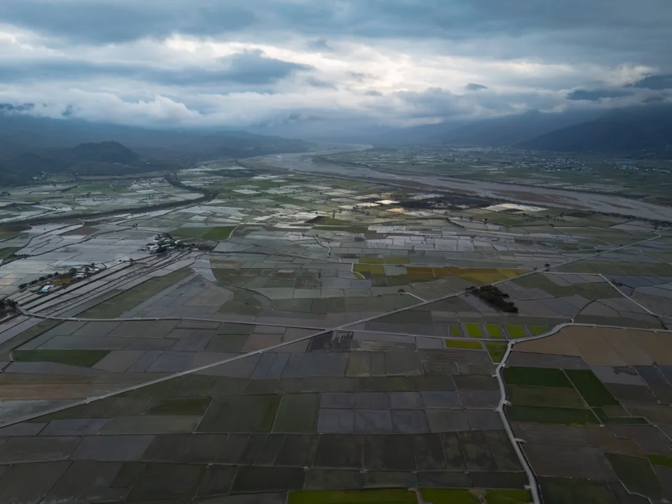
Chishang
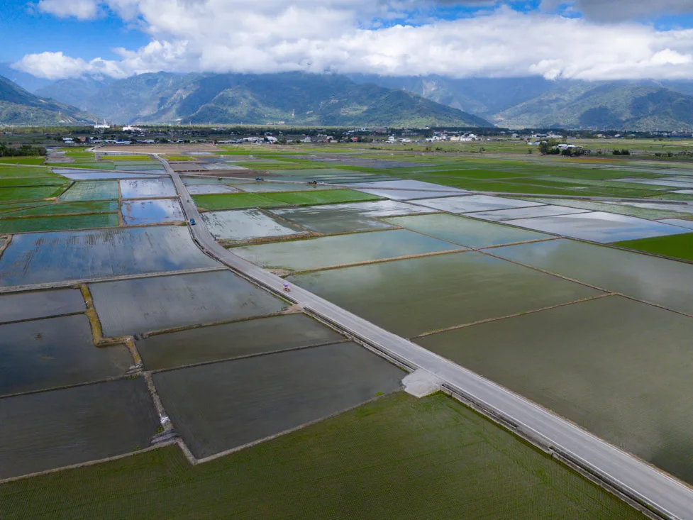
Similar to Yuli, Chishang is a small rural town that’s off the classic tourist trail but makes for a great stop to break up your journey and experience the peaceful charm of Taiwan’s countryside.
Chishang gained national attention in 2013 when EVA Air shot a commercial in the middle of its scenic rice paddies, featuring the beloved Japanese-Taiwanese actor Takeshi Kaneshiro. The ad’s success turned the once-sleepy town into a popular domestic destination. (You can find the video here).
Chishang.
What to Do and See in Chishang
If you’re on a tight schedule, Chishang is easily doable in a single day. Just leave your luggage in the station lockers, rent a bike, and follow this itinerary before hopping back on the train.
Suggested Bike Route in Chishang:
- Dapo Pond (Google Maps). A scenic starting point with a peaceful vibe. You’ll find a few quirky sculptures around the pond.
- Continue along the bike path through the rice paddies, stopping at: This viewpoint (Google Maps) and this one (Google Maps).
- Enter the famous Brown Boulevard (Google Maps), a picturesque road running through rice fields, home to: The iconic “Commercial Tree” (Google Maps) from the EVA Air ad.
- On your way back, take some time to wander freely through the surrounding farm roads. Notable spots include: A charming water wheel (Google Maps) and viewing platform with wide vistas (Google Maps).
Even at a leisurely pace, the entire ride can be comfortably completed in 2–3 hours.
Brown Boulevard.
Bonus Stops:
Chishang Art Museum (Google Maps) – Free entry, worth a quick visit.
BIKE DE KOFFIE (Google Maps) – Great place to grab a bagel or coffee post-ride.
While I didn’t personally go, the Lulu Hot Springs hike (Google Maps) is often recommended as a scenic trail from Chishang. There’s a very detailed online guide to the route, complete with GPS coordinates and descriptions – check it out if you plan to hike.
Chishang.
Where to Sleep in Chishang?
I stayed at Gift Box Hostel – a cozy place with friendly and helpful staff. Highly recommended if you’re staying overnight.
How to Reach Chishang?
Chishang sits directly along the east coast railway line, with frequent train connections north and south. The station (Google Maps) is central and makes both arrival and departure very convenient.
For more on transportation, refer to the hot to get around section of the guide.
Chishang.
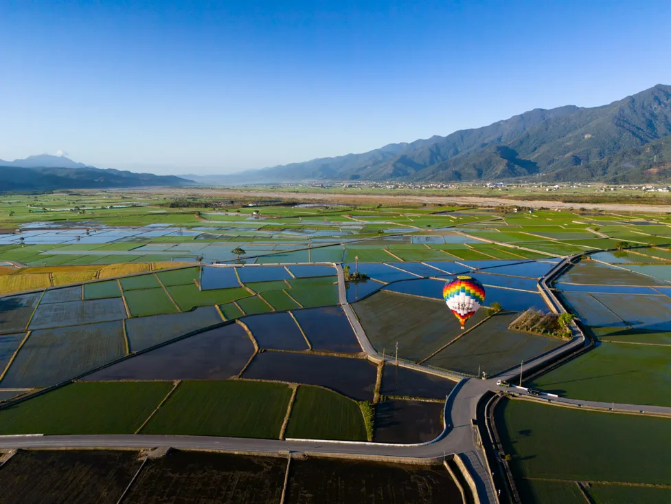
Luye and Dulan
Luye and Dulan are two other rural towns that may be of interest to travelers. I haven’t visited either personally, so I can’t speak from direct experience, but Dulan was recommended to me by a friend — you can find a guide at this page. Luye, on the other hand, hosts an international hot air balloon festival every year, which looks really beautiful. If you’re visiting Taiwan around that time, it’s definitely worth considering — you can check out the official event website.
Taitung
After Hualien, Taitung is the second-largest city on Taiwan’s east coast, and it’s also a key hub for travelers heading to Green Island or Orchid Island by ferry.

Lord Handan, Taitung.
What to Do and See in Taitung
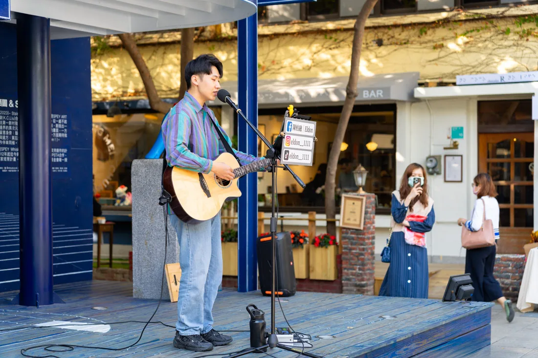
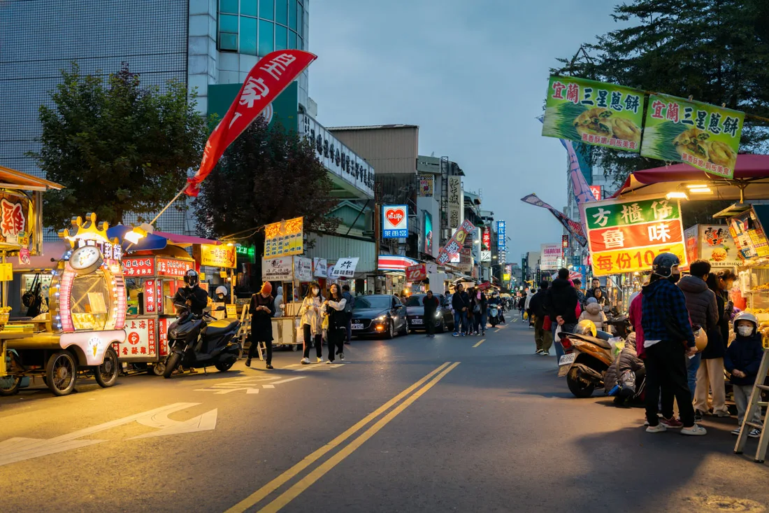
Despite its size, the city itself doesn’t have a lot to offer travelers. In the evening, you might want to stop by Tiehua Music Village (Google Maps) — the area is pleasant and filled with street performers and various food and craft stalls. Another option is the nearby Taitung Night Market (Google Maps), where you can grab a bite to eat.
For a view over the city, head up to Liyu Mountain Park (Google Maps), which features walking trails, temples, and pagodas.
Just outside the city, you can visit Fugang Geological Park (Google Maps), known for its unusual rock formations and short hiking trails. You can get there by bus or even bike, as it’s not too far. A little further north, you’ll find a stretch of coast dotted with quirky modern sculptures (Google Maps).
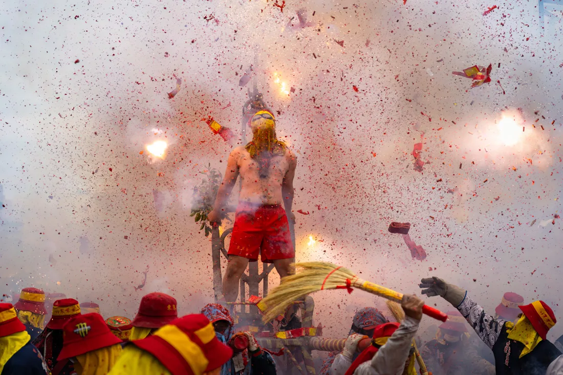
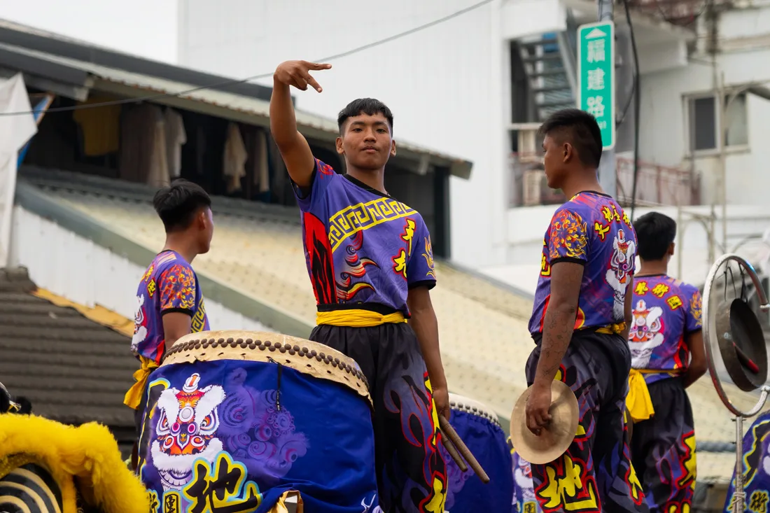
A Unique Festival Experience
I had the unexpected pleasure of visiting Taitung during the weekend of Lord Handan’s Bombing — one of Taiwan’s most spectacular festivals. I hadn’t even known it was happening! During the event, nearly naked men are paraded through the streets while crowds throw firecrackers at them — an unforgettable and truly unique spectacle.
If you’re in Taiwan around that time, I highly recommend going to Taitung to witness it. The date changes each year as it follows the lunar calendar, but it typically falls between February and March.

Taitung.
Where to Stay in Taitung?
I stayed at Hostel Who Knows — a nice, budget-friendly hostel with extremely welcoming staff. They speak excellent English and are more than happy to help with anything you need. Highly recommended.
How to Get to Taitung?
Taitung lies along Taiwan’s east coast rail line, and the train station (Google Maps) offers frequent connections both north and south. The train and bus stations are located slightly outside the city center (Google Maps), but regular buses connect them with downtown.
For more details about getting around, check the dedicated section of this guide.

Taitung.
Since I no longer run ads, if you found this article helpful, please consider purchasing your travel insurance through one of the links on this site. Doing so supports my work at no additional cost to you. For EU and UK residents, I recommend True Traveller. For everyone else, I recommend HeyMondo, which offers a 5% discount. Thank you for your support!
Green Island
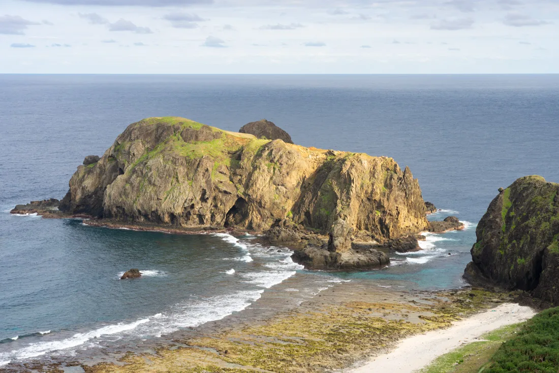
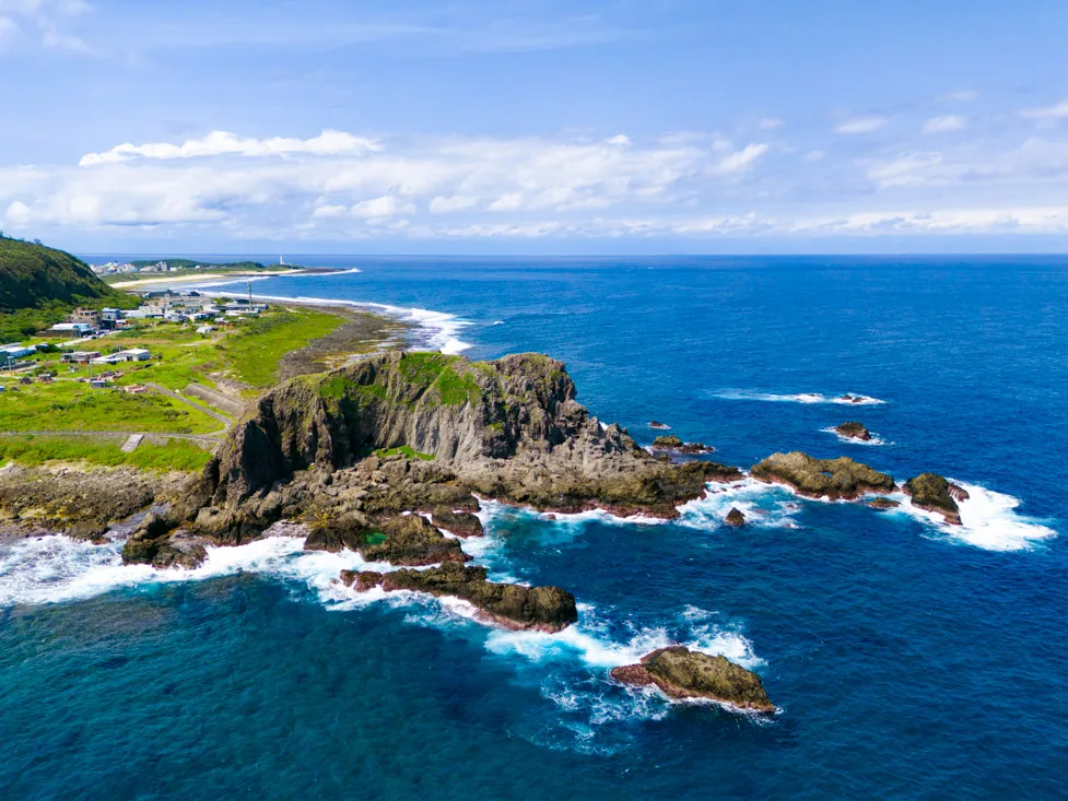
Green Island, or Lüdao (Lyudao), is a small island off the coast of Taitung. Once used as a penal colony, it’s now considered one of the top destinations in Taiwan for spending a few days by the sea — and it also offers some of the best diving sites in the country.
I visited in late February and found it rather quiet — I didn’t even go into the water. It was still a pleasant trip, but if you’re short on time, I’d recommend visiting only during the warmer months or at least avoiding the middle of winter.
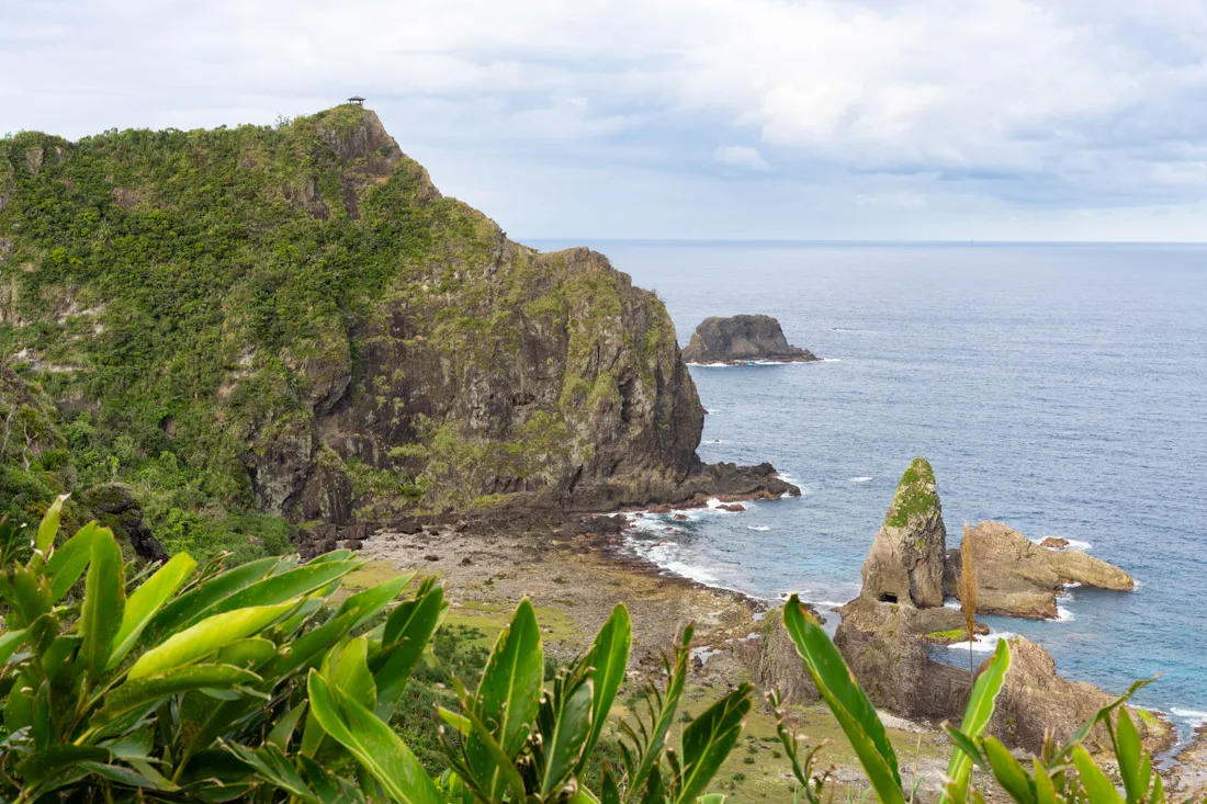
Green Island.
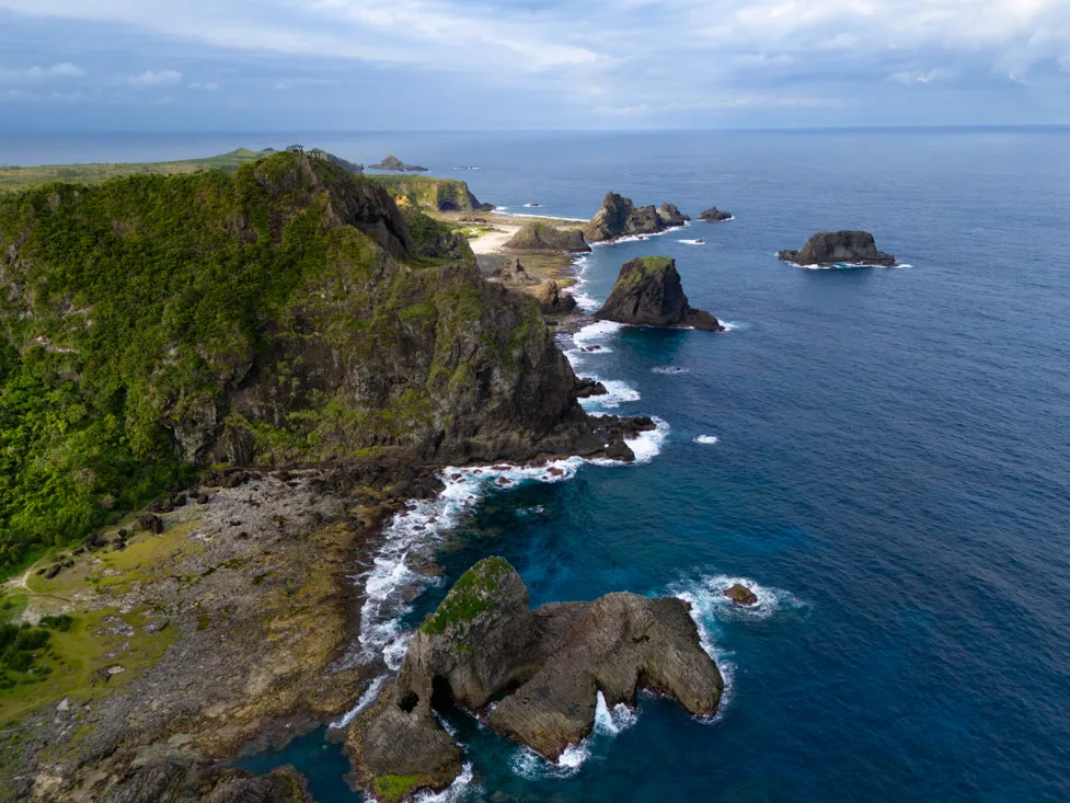
What to Do and See on Green Island
The island is fairly compact: the full loop along the coastal road is just over 20 km, so much so that I managed to walk it in a single day. Still, I’d recommend renting a scooter — especially if you plan to snorkel or simply prefer not to spend the whole day on foot.
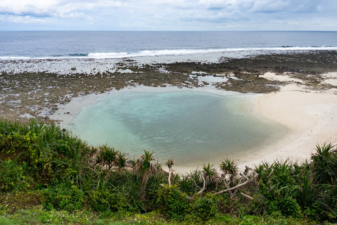
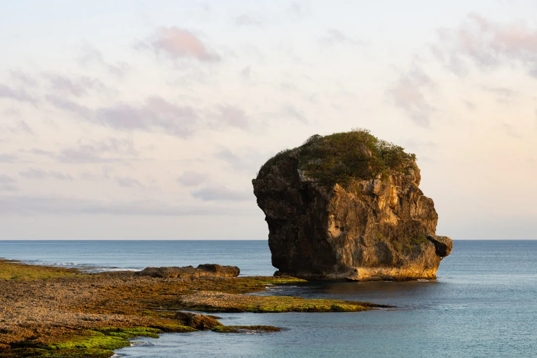
Lyudao Lighthouse lagoon.
That said, I suggest starting your tour clockwise, beginning with Lyudao Lighthouse (Google Maps) and the nearby lagoon (Google Maps), which, especially at low tide, forms a natural pool — great for children or anyone who doesn’t want to swim in the open sea. From there, continue to this small headland(Google Maps) for excellent coastal views. Not far from there, along the beach, are some unusual rock formations (Google Maps), including one that resembles an elephant (Google Maps).
Continuing along the coast, make a stop at the former political prison used during Taiwan’s White Terror period, now converted into a museum (Google Maps). Admission is free. A little further on, you’ll find another scenic promontory with great views (Google Maps).
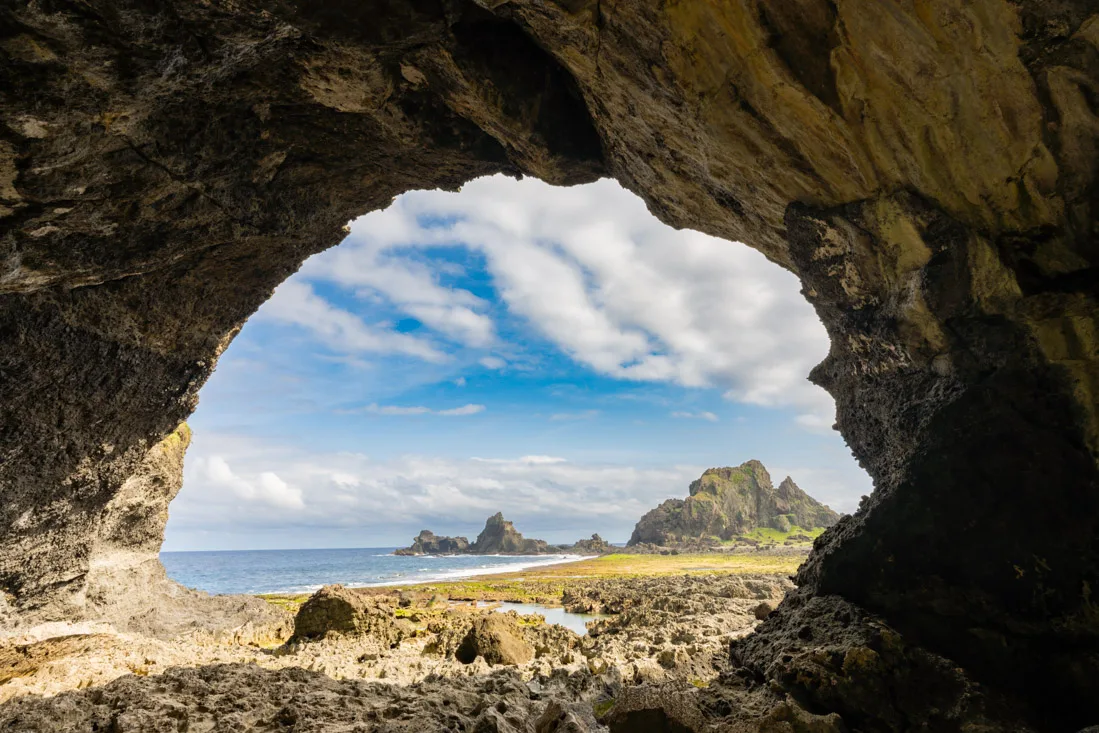
From here, if you’re curious, you could make a brief stop at a temple inside a cave (Google Maps). It didn’t seem especially remarkable, and I personally didn’t go in. Instead, I headed down to Youzihu (Google Maps), where the island’s volcanic origins have created a landscape full of strange rock formations, plus a couple of caves on both sides of the beach (Google Maps) (Google Maps).
Once you’re done there, return to the main road and head to this beautiful, easily accessible viewpoint (Google Maps). End your day at the famous Zhaori Hot Springs (Google Maps) — reportedly among the few saltwater hot springs in the world. Admission is TWD 250, and you’ll need to buy a bathing cap for an extra TWD 50. If you arrive in time for sunset, I recommend stopping by the headland next to the parking lot before entering the springs (Google Maps).
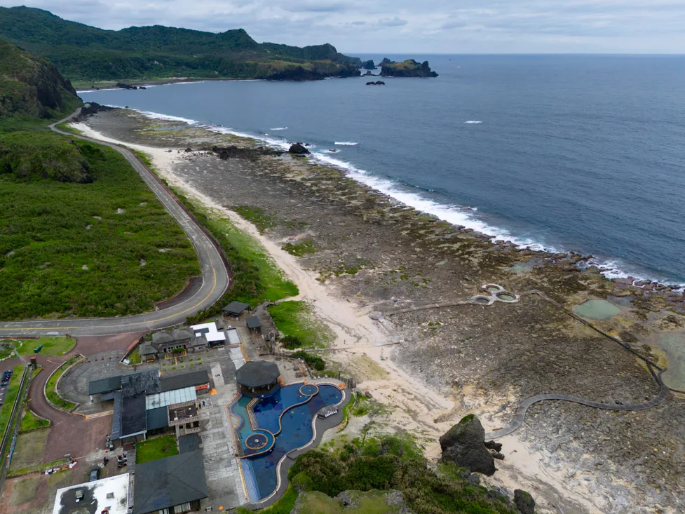
Zhaori Hot Spings.
Snorkeling and Diving
As mentioned, even though the weather was good, I didn’t go in the water during my February visit. However, if you’re there between late April and early October, it’s definitely worth going diving — or at the very least grabbing a mask and snorkel for a swim.
Shihlang (Google Maps), Dabaisha (Google Maps), and Chaikou (Google Maps) are the beaches most often recommended for snorkeling and shore diving.
Where to Stay on Green Island?
I stayed at the Good hostel. On the second night, I think I was literally the only guest there — so let’s just say the atmosphere was a bit quiet. Still, the hostel was clean and pleasant, and its location just a stone’s throw from the ferry pier was incredibly convenient.
Once you arrive, consider renting a scooter for the duration of your stay — it’ll give you the flexibility to choose your accommodation more freely.
Green Island.
How to Reach Green Island?
Ferries to Green Island’s Nanliao Harbor (Google Maps) depart from Fugang Harbor in Taitung (Google Maps). You’ll need a passport to purchase your ticket.
Just a heads-up — at least during my visit, the bus schedules shown on Google Maps for the Taitung–Fugang route were incorrect. This was the only such case during my two-month trip, and it may have been fixed since, but it’s something to be aware of.
I paid TWD 560 for a one-way ticket, purchased directly at the terminal. At the time, ferries departed at 9:30 AM and 1:30 PM, with return trips at 10:30 AM and 2:30 PM. The crossing takes about an hour. I strongly recommend confirming the departure times in person.
During peak season, several companies operate on this route, including Triumph, Uranus and Golden Star. Return tickets can be purchased here (Google Maps).
Green Island.
Orchid Island
Given my experience on Green Island and the lack of direct connections between the two islands during the off-season, I chose not to visit Orchid Island. That said, it seems like a truly fascinating destination — one of the most remote corners of Taiwan, where indigenous tribes have remained isolated for centuries, developing customs and traditions distinct from the rest of the country. You can find an excellent guide with more information on this page.
Kenting
At the southern tip of Taiwan, Kenting is a laid-back coastal town known for its scenic stretches of shoreline, attractive beaches, and lively night market. A bit like Green Island, my stay in Kenting was definitely enjoyable — but if you’re short on time, I’d recommend visiting during the warmer months or at least avoiding mid-winter if you want to fully enjoy what the area has to offer.
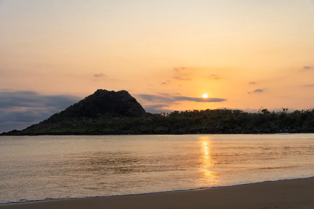
Little Bay Beach.
What to Do and See in Kenting
In Kenting proper, there isn’t a whole lot to do. The main attraction is the night market, which takes place every evening along the town’s main road (Google Maps). There are also two beaches within easy walking distance: Kenting Beach (Google Maps) and Little Bay Beach (Google Maps). In my opinion, the second is nicer — and from what I was told, the snorkeling there is quite decent.
Kenting National Forest Recreation Area
The Kenting National Forest Recreation Area (Google Maps) is located just outside town. I walked there, but if you prefer, you can rent a scooter — useful if you plan to visit other nearby attractions as well. The entrance fee is TWD 150. It’s a pleasant place to spend a couple of hours walking around, but personally, I didn’t find it particularly impressive.
There are a couple of caves worth a look — Fairy Cave (Google Maps) and Silver Dragon Cave (Google Maps) — along with some botanical gardens and a viewing tower that offers a nice 360-degree panorama (Google Maps). All in all, it’s a decent visit, but nothing especially memorable.
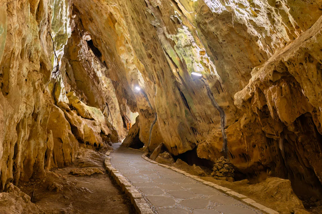
Fairy Cave.
If you do decide to go, you might also stop at the nearby Sheding Natural Park (Google Maps), where admission is free. There, you can follow the short Sheding Nature Trail (All Trails). There are a few good viewpoints along the way (Google Maps) (Google Maps), though the experience is fairly modest overall. You could finish this small circuit by heading down to Sail Rock (Google Maps), from where you can catch a bus back to Kenting.
Sail Rock.
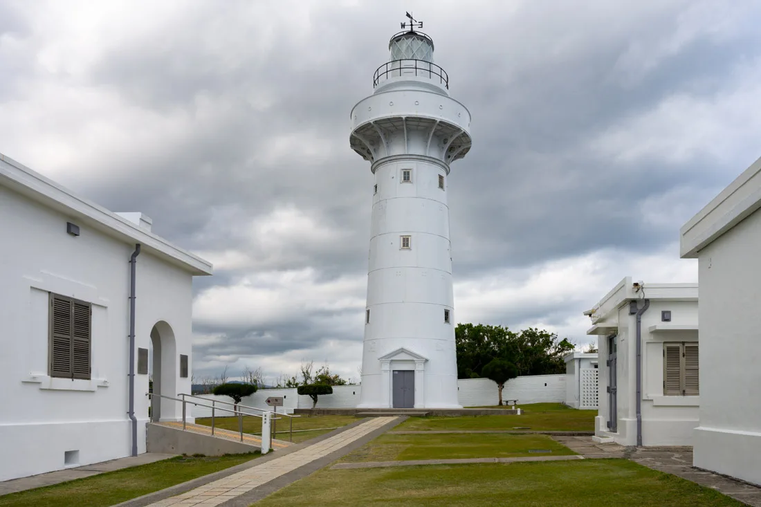
Cape Eluanbi
Cape Eluanbi (Google Maps) and the surrounding area make for another popular excursion from Kenting. I didn’t rent a scooter, but frequent buses run to this stop (Google Maps). From there, I walked down the road to Longpan Park (Google Maps), where you’ll find a scenic coastal trail that runs nearly to this point (Google Maps). The views are excellent, though you do have to walk a fair bit along the roadside — something to consider if you’re on foot. Alternatively, you could explore just the area around the lighthouse, which is a short walk from the bus stop.
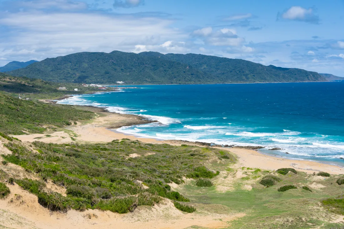
Longpan Park.
Admission to Eluanbi Park (Google Maps) costs TWD 60 and includes access to the lighthouse (Google Maps) and several short trails leading to viewpoints along the coast Google Maps) (Google Maps) (Google Maps).
Not far from here is Taiwan’s southernmost point (Google Maps), where a small monument marks the spot. However, to reach it, you must go through the adjacent Longkeng Ecological Reserve (Google Maps), which requires an advance booking on the official website. The guided tour reportedly costs TWD 400, and I’m not even sure if it’s offered in English — so I can’t say if it’s really worth it, as I didn’t go myself.
Nearby Beaches
If the weather cooperates, you might consider visiting some other beaches nearby. I didn’t go myself, but South Bay (Google Maps) and White Sand Bay Beach (Google Maps) are often recommended — especially if you have a scooter.
Also, if you do rent a scooter, you could drop by Qikong Falls (Google Maps). From the photos, it doesn’t look especially impressive, but it features a nice natural pool, and I imagine it could be a pleasant way to spend a few hours.
Where to Sleep in Kenting?
I stayed at Kenting My Home. Really comfortable — it felt like having your own small private room. Great location, just a short walk from the center of town, and the staff were friendly and helpful. Recommended.
How to Reach Kenting?
Kenting isn’t connected to the rail network, so if you’re using public transportation, you’ll have to go by bus. If you’re coming from Taitung or the east coast in general, take a train to Fangliao Station (Google Maps). Just outside the station, along the main road, you’ll find the stop for Kenting Express Line 9189 (Google Maps).
This same bus originates from Kaohsiung Zuoying Station (Google Maps), so if you’re already in Kaohsiung, it’s better to take it from there and avoid unnecessary transfers. For more details on getting around, see the transportation section of this guide.

Kenting National Forest Recreation Area.
Xiaoliuqiu Island
Xiaoliuqiu, also known as Lambai, is the largest coral island in Taiwan and lies just south of Kaohsiung. With limited time, an unfavorable weather forecast, and yet another destination not well suited to the time of year, I chose to head straight to Kaohsiung. That said, the island does seem like a very interesting place to visit. Below are essentially my research notes — keep in mind that this is not based on personal experience.
What to Do and See in Xiaoliuqiu
Starting from the north and circling the island counterclockwise, your first stop is Vase Rock (Google Maps), a striking rock formation that also offers good snorkeling and frequent turtle sightings. Continuing on, you’ll find Beauty Cave (Google Maps) and nearby Beauty Beach (Google Maps), both also known for turtle spotting.
Further south along the coast is the Wild Boar Trail (Google Maps), a short trail surrounded by nature. Not far from there is Venice Beach (Google Maps), which looks very scenic, though swimming is not allowed. At the southern tip of the island, there’s a viewing platform ideal for watching the sunset (Google Maps).
On the eastern coast, Secret Beach (Google Maps) is considered the best snorkeling spot on the island. Nearby are the Lighthouse (Google Maps) — which offers excellent views — and a century-old banyan tree (Google Maps). In the northeast, you can climb a viewing platform to watch the sunrise (Google Maps). In this same area, you’ll find another decent snorkeling spot (Google Maps) and Zhongao Beach (Google Maps).
How to Reach Xiaoliuqiu?
Note: Apparently, there are no ATMs on the island that accept international cards, so it’s best to bring sufficient cash with you.
Three ferry companies — Taifu, Tungliu and Leuco Sapphire — operate between Baishawei Port on Xiaoliuqiu (Google Maps) and the Dongliu Ferry Terminal on the mainland (Google Maps). This website aggregates the schedules from all three companies.
There is also a government-run ferry service with lower prices but less frequent departures. It also leaves from Dongliu Ferry Terminal (Google Maps) and arrives at Dafu Port (Google Maps) on the island. This should be the relevant company site.
Before boarding the ferry — or on your return — you might consider grabbing a bite at the nearby Huaqiao Fish Market (Google Maps).
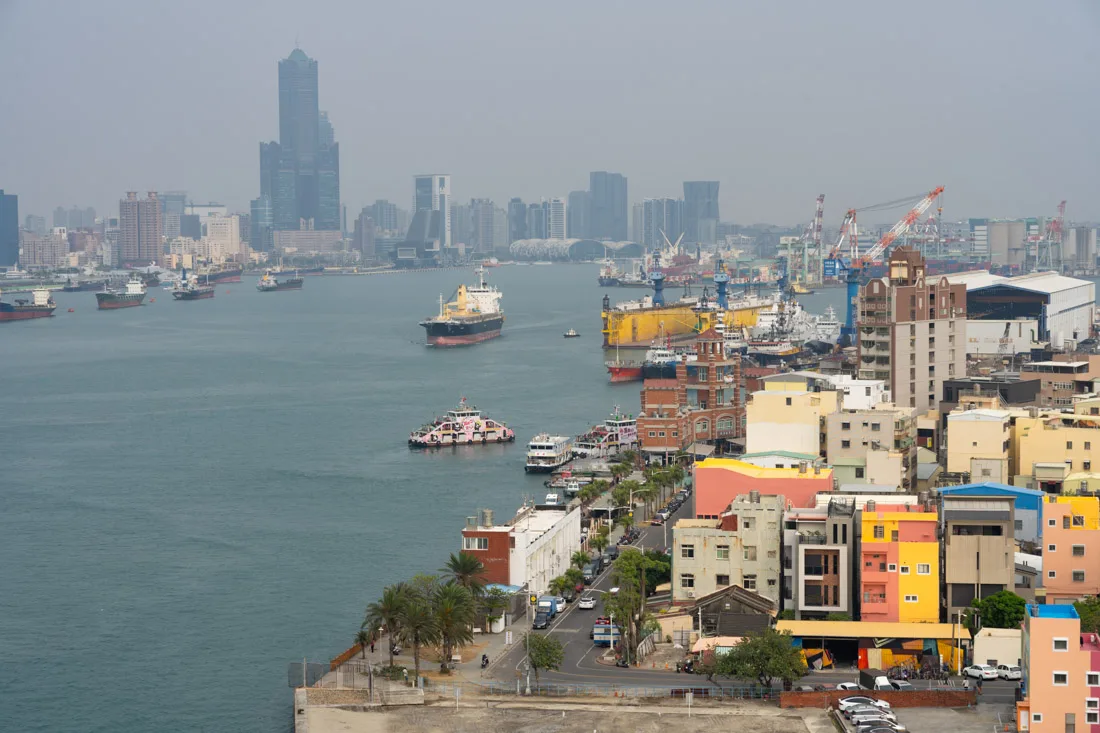
Kaohsiung City.
Kaohsiung City
Kaohsiung, Taiwan’s second-largest city and the country’s most important port, has developed primarily thanks to its harbor. While the city doesn’t boast a long or particularly ancient history, it remains a pleasant and interesting place to spend a couple of days.

Dome of Light.
What to Do and See in Kaohsiung City
Although much of Kaohsiung’s growth is relatively recent, the city has a vibrant atmosphere and several attractions worth visiting. In the city center, I recommend stopping by the Liuhe Night Market (Google Maps) for dinner, the Sanfeng Temple (Google Maps), which is especially atmospheric when the lanterns are lit in the evening, and the Dome of Light (Google Maps) in Formosa Boulevard Station (Google Maps). Created by artist Narciso Quagliata, this is the world’s largest glass artwork, consisting of more than 4,500 panels and measuring 30 meters in diameter.
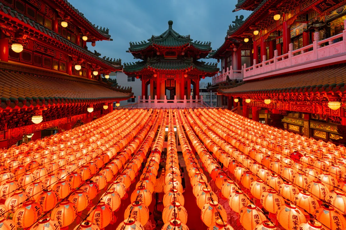
Sanfeng Temple.
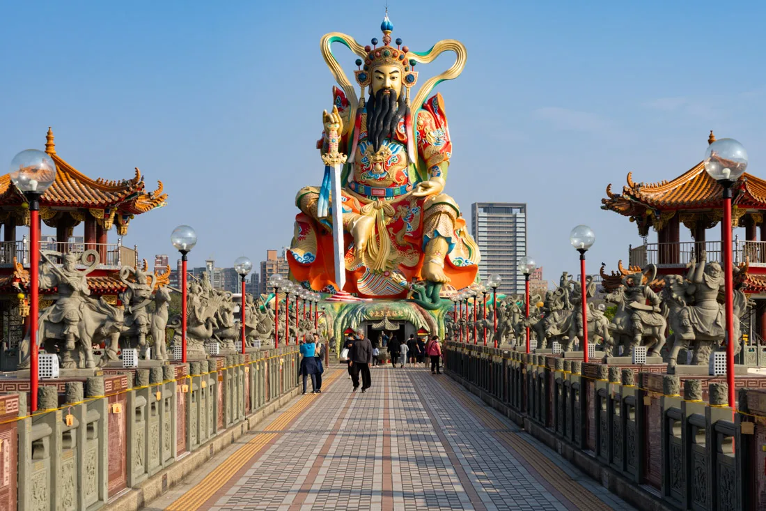
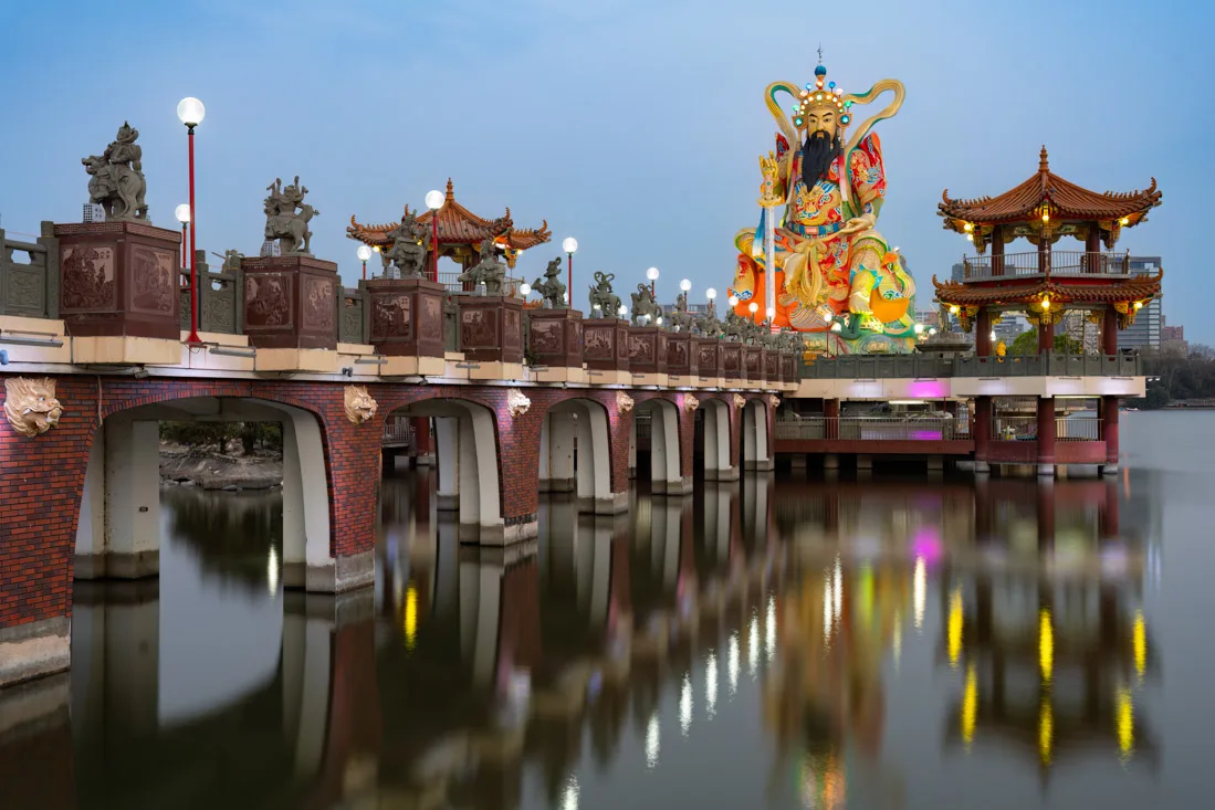
Lotus pond
The Lotus Pond (Google Maps) is located just outside the city and is easily reached by train — get off at Zuoying Station (Google Maps). The lake is surrounded by about half a dozen temples and pagodas. The most famous are the Dragon and Tiger Pagodas (Google Maps) and the Zuoying Yuandi Temple (Google Maps).
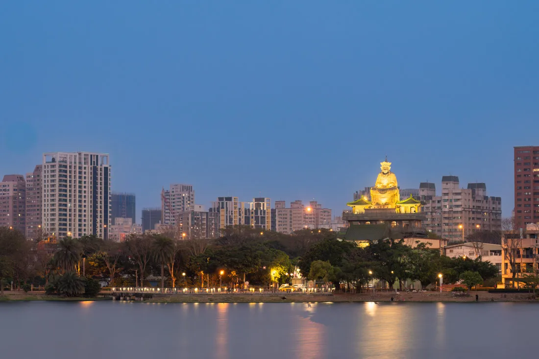
Lotus Pound.
It’s a great place to walk around for a few hours, and if preferred, you can also rent a YouBike. If you visit, consider also stopping by the Old Town Gate (Google Maps), and later you could head to the nearby Ruifeng Night Market (Google Maps) for dinner.
Lotus pound.
Foguangshan Buddha Memorial Centre
The Fo Guang Shan Buddha Memorial Center (Google Maps, official website) is a massive complex that includes Taiwan’s largest Buddhist monastery, multiple pagodas, a museum, and the largest Buddha statue in the country. Admission is free, and it’s easy to spend several hours exploring. The site is accessible via direct buses from the main station (Google Maps), using bus numbers 8010 and 8009.
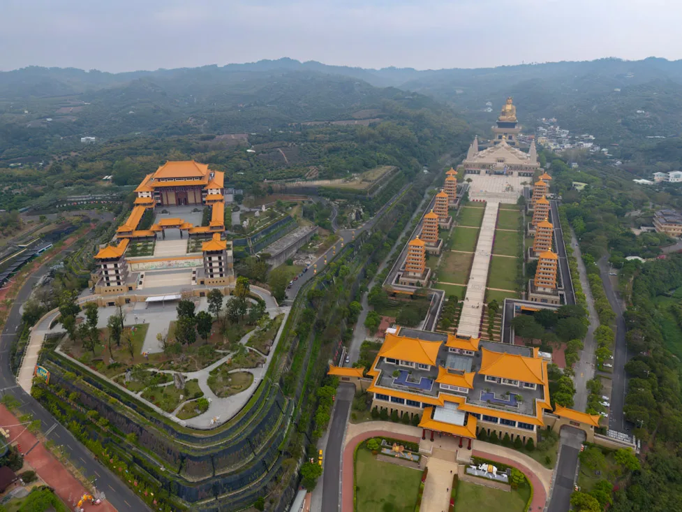
Foguangshan Buddha Memorial Centre.
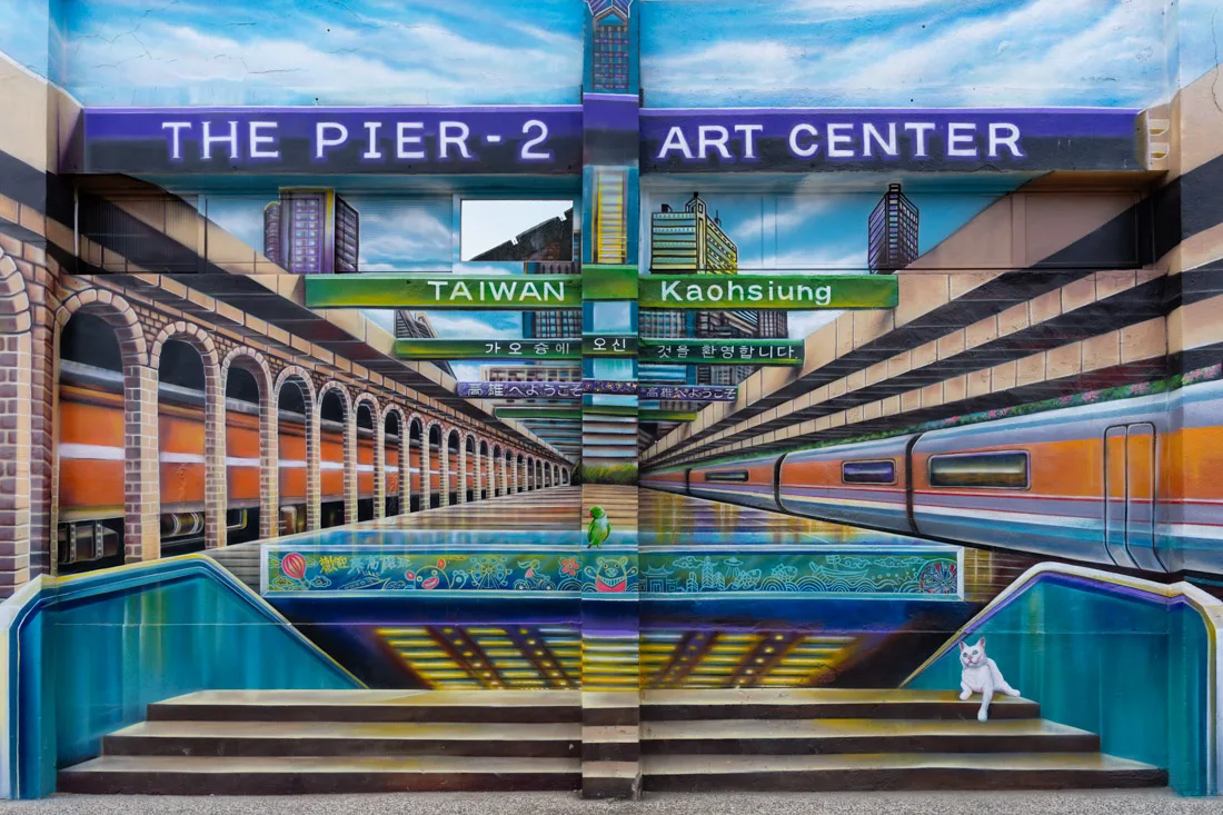
Pier 2 Art Center
The area surrounding the Pier 2 Art Center (Google Maps) used to be a collection of old port warehouses. It has since been transformed into a creative zone featuring museums, galleries, shops, restaurants, and art installations. I suggest taking the subway to Hamasen Station (Google Maps) and walking from there to the Kaohsiung Music Center (Google Maps), which is particularly striking at night when illuminated. Also nearby is the Shoushan LOVE Lookout (Google Maps), which offers a panoramic view of the city.
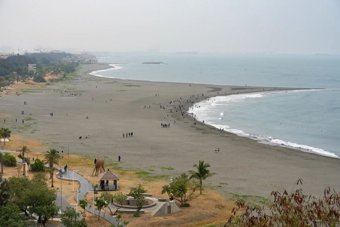
Cijin Island
Cijin Island (Google Maps) sits just across the water from the Pier 2 Art Center and makes for an easy half-day excursion. Ferries run frequently from Gushan Ferry Pier Station (Google Maps) to Cijin Ferry Terminal (Google Maps), take under 10 minutes, and cost only TWD 20 (payable with an EasyCard). Once on the island, you can walk or rent a bicycle. Notable spots include Qijin Old Street (Google Maps), Rainbow Church (Google Maps), the ruins of Cihou Fort (Google Maps), and the Cijin Lighthouse (Google Maps) , which provides a great coastal view. Weather permitting, consider spending some time at the beach (Google Maps).
Cijin Island.
Weiwuying Street Art Village
If you find yourself with extra time, consider a visit to Weiwuying Street Art Village (Google Maps). It’s a small neighborhood where nearly every building is covered in colorful murals, offering a very different side of the city.
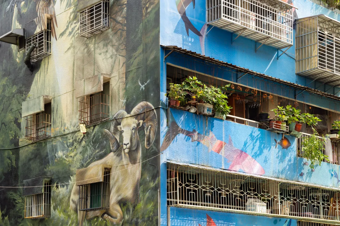
Weiwuying Street Art Village.
Where to Sleep in Kaohsiung?
I stayed in Kaohsiung both at the beginning and end of my trip and can recommend two places:
Ahiruyah Guesthouse – A great hostel with comfortable bunks, nice common areas, and a convenient location close to the metro.
Centre Hotel – A more basic option, but with private rooms at very competitive prices and an excellent location. If you’re looking for privacy on a budget, it’s a solid choice.

Kaohsiung Music Center.
How to Reach Kaohsiung?
Kaohsiung is well connected to the rest of Taiwan by both standard rail and the High-Speed Rail (HSR), which runs along the west coast all the way to Taipei. The city also has its own airport — Taiwan’s second largest — with connections to various regional destinations. Conveniently, the airport lies directly on one of Kaohsiung’s two metro lines. To use the metro, you can pay with most contactless cards.
For more transportation details, refer to the travel section of this guide.
Lotus Pound.
Tainan
Tainan served as the capital of Taiwan for over 200 years and remains a city rich in history and tradition. It is home to many of the island’s most important temples and historical landmarks. Many also consider it the gastronomic capital of Taiwan, known for its variety of local specialties.

Tainan.
What to Do and See in Tainan
Tainan’s tourist attractions are generally concentrated in two areas:
- Anping District, the city’s oldest neighborhood, first settled by the Dutch in the 17th century.
- West Central District, the historic core that developed during the Qing Dynasty and Japanese colonial period.
Note: At the time of my visit, there was a TWD 210 pass that included admission to several attractions listed below and offered discounts for others. It was extremely good value, though it appeared to be a temporary offer. Still, I recommend checking locally or visiting the official website for updates.

Anping District
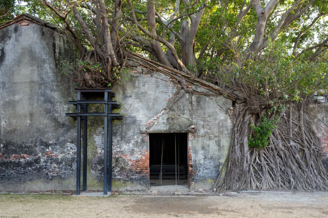
Merchant’s House (Google Maps) – A house museum from 1867 showcasing colonial trade and Western-style architecture. Behind it is the iconic strangler fig-covered structure (Google Maps). Entry: TWD 70.
Anping Fort (Fort Zeelandia) (Google Maps) – Built by the Dutch in the 1600s as a trading post and stronghold. The small on-site museum offers some insight into its history. Entry: TWD 70.
Just outside the fort, you’ll find a temple (Google Maps) and Anping Old Street (Google Maps) — ideal for strolling and sampling snacks.
From here, you can walk to the Eternal Golden Castle (Google Maps), a late 19th-century Western-style fort with moats and cannons. Entry: TWD 70. Suggested route: walk through Lin Mo-Niang Park (Google Maps); optionally, stop by the Navy Museum (Google Maps).
If you’re there in the late afternoon, watch the sunset on the beach (Google Maps). There’s also a popular viewing platform (Google Maps) further north.
Also nearby is the Sicao Green Tunnel (Google Maps) — a mangrove-lined canal navigable by 30-minute boat tours.
A bit farther north lies a large Chinese-style temple dating back to 1661 (Google Maps).
Chikan Tower.
West Central District
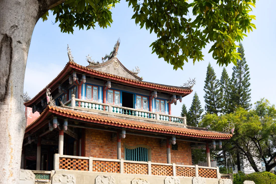
Chikan Tower (Fort Provintia) (Google Maps) – Built by the Dutch in 1653. The current structure is Chinese in style. The site lacks in-depth signage and most info is in Chinese. Entry: TWD 70.
Nearby are two small temples (Google Maps) (Google Maps) worth a quick visit.
Snail Alley (Google Maps) – A network of alleys decorated with murals.
Hayashi Department Store (Google Maps) – The first department store in Taiwan and the first building to have an elevator. The rooftop terrace offers a modest view. Not essential, but of historic interest.
National Museum of Taiwanese Literature (Google Maps) – Free entry, with a well-presented permanent exhibition in English. The temporary exhibits are in Chinese only.
Art lovers might also want to visit the Tainan Art Museum (Google Maps), located across the street.
For a short break, relax in Tainan Wu Park (Google Maps), or continue to the Confucius Temple (Google Maps). Entry: TWD 40.
Nearby, you can also visit:
- Linshui Lady Ma Temple (Google Maps)
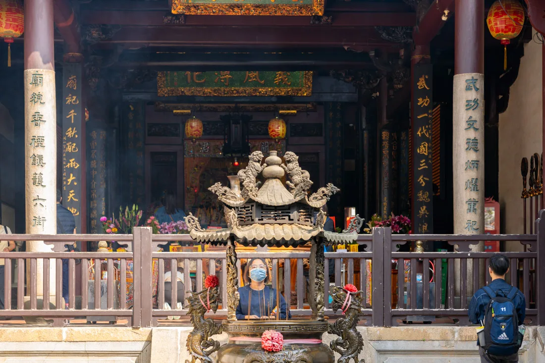
- Koxinga Shrine (Google Maps) – Both have free entry.
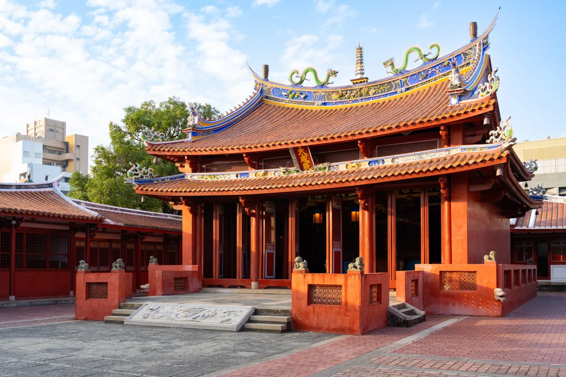
Confucius Temple.
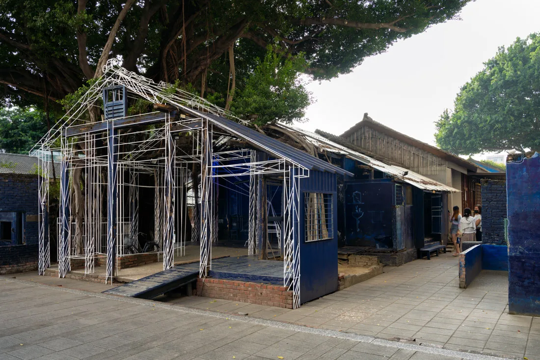
End your historical tour at the Great South Gate (Google Maps) and the Blueprint Culture & Creative Park (Google Maps), a trendy hub with murals, shops, and installations.
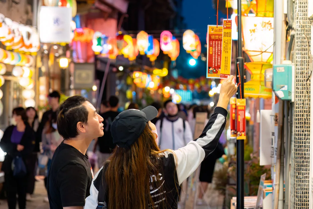
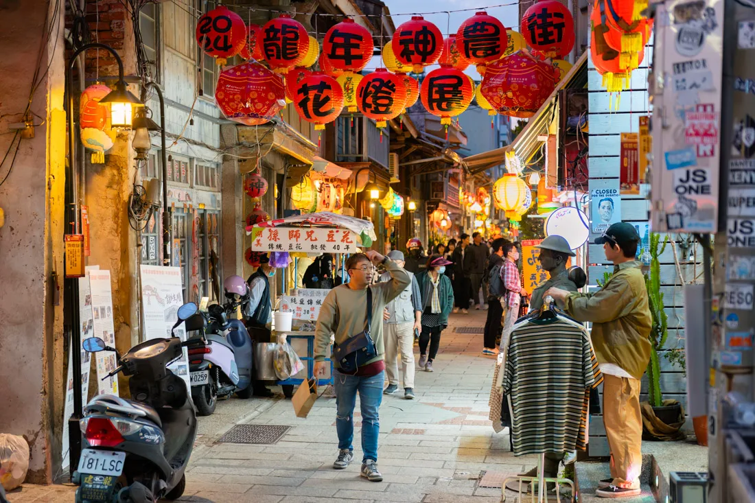
For a lively and photogenic evening, head to Shennong Street (Google Maps) when it’s lit up with lanterns.
Night Markets (depending on the day):
- Dadong Night Market (Google Maps)
- Wusheng Night Market (Google Maps)
- Garden Night Market (Google Maps)
Blueprint Culture & Creative Park.
National Museum of Taiwan History
Located outside the city (Google Maps), but I believe it’s well worth the 1-hour bus ride. The museum covers Taiwan’s entire history, from early settlements to the present. Entry: TWD 100 (reduced to TWD 50 with the pass). A VR show is available daily at 2:00 PM (registration required on-site). I didn’t attend due to timing, but it looked promising.
Blueprint Culture & Creative Park.
Chimei Museum
Chimei Museum (Google Maps) is grand museum featuring Western art, natural history, ancient weapons, and a large musical instrument collection — especially known for its violins. Admission: TWD 200 (included in the combo ticket during my visit).
I only explored the permanent exhibition and wouldn’t call it unmissable, but it’s certainly well-curated.
Don’t miss the “Walk-In Orchestra” — a short but immersive 5-minute performance that runs hourly from 10:00 AM to 5:00 PM.
Getting there: Take a train to Bao’an Station (Google Maps) or consider the bus, depending on your location. You can also visit the museum en route to or from Kaohsiung for efficiency.
Nearby: Ten Drum Cultural Village (Google Maps) — a Japanese-era sugar refinery turned into a cultural attraction after its closure in 2003.
Shennong Street.
Where to Sleep in Tainan?
I stayed at Hotel Leisure, a modern and newly built hotel with both dormitories and private rooms. I stayed in a dorm, but both options seemed excellent. Highly recommended.
How to Reach Tainan?
Tainan is well connected by regular trains (Google Maps) running frequently north (to Chiayi, Taichung, etc.) and south (to Kaohsiung).
The high-speed rail station is located slightly outside the city (Google Maps), but frequent buses connect it with downtown.
For more details on transportation, please refer to the travel section of this guide.
Shennong Street.
Chiayi
Chiayi is primarily known as a gateway to Alishan, offering a convenient and more affordable base for travelers heading into the mountains. While it’s often treated as a transit stop, the city does have a few interesting spots worth exploring if you have a few hours to spare before or after your Alishan visit.
Wenhua Road Night Market.
What to Do and See in Chiayi
If you find yourself with some time in the city, you can easily explore the main attractions within a few hours:
Song of the Forest (Google Maps) – A small park featuring a striking piece of public architecture. It’s a good starting point for a short city walk.
Alishan Forest Railway Garage Park (Google Maps) – Located nearby, this open-air exhibit is a sort of “train graveyard” where you can see historical locomotives used along the Alishan railway line.
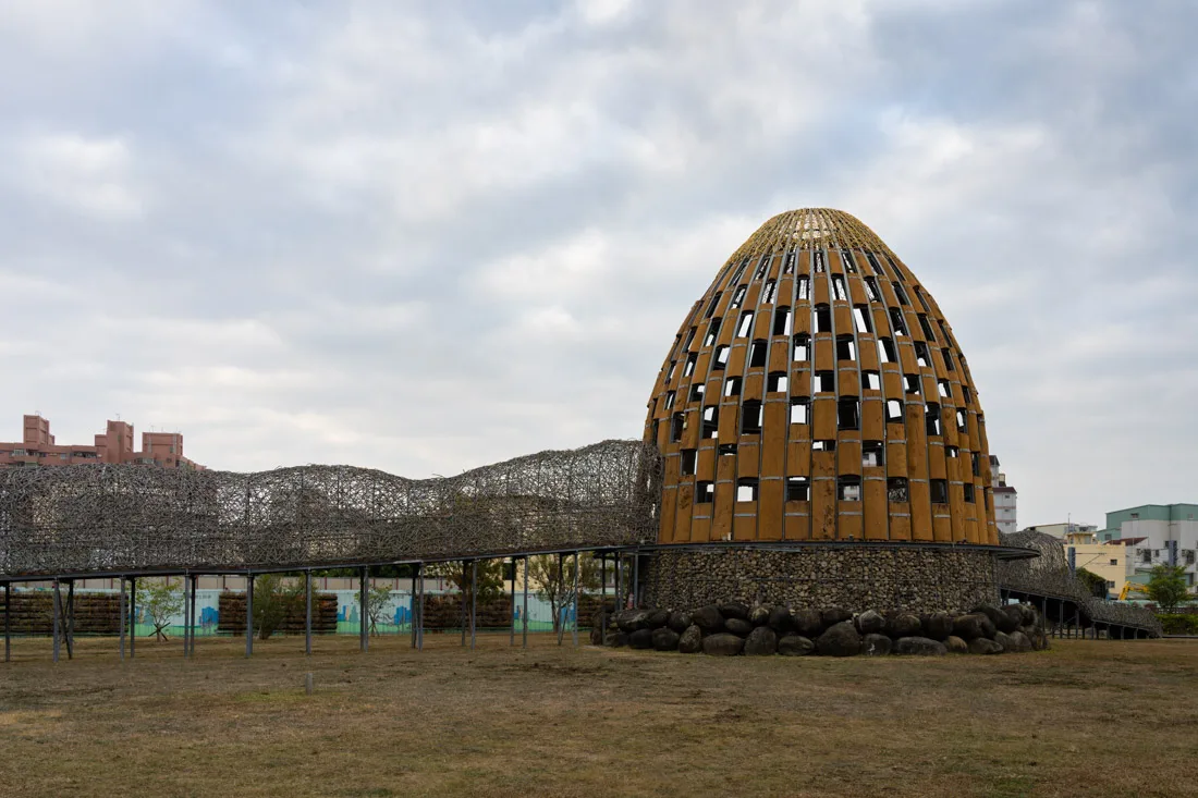
Song of the Forest.
Hinoki Village (Google Maps) – A charming area with over 30 restored Japanese-era wooden buildings. Originally constructed as a dormitory complex for forestry workers, it now houses shops, cafes, and small exhibitions.
Chiayi Prison Museum (Google Maps) – An old prison converted into a museum. It was closed during my visit, but admission is free, so it’s worth checking out if you’re nearby.
Chiayi Park (Google Maps) – A pleasant green space that includes a few temples and the Sun-Shooting Tower (Google Maps), a landmark structure offering views over the city.
Evening tip: Visit the Wenhua Road Night Market (Google Maps) for local snacks and a taste of the city’s evening buzz.
If you’re willing to go a bit outside the city:
Southern Branch of the National Palace Museum (Google Maps) – This branch focuses on Asian civilizations beyond traditional Chinese culture, with exhibits highlighting Chinese, Indian, Islamic, and Southeast Asian heritage. The museum emphasizes the theme of cultural exchange and can make for a rewarding half-day trip.
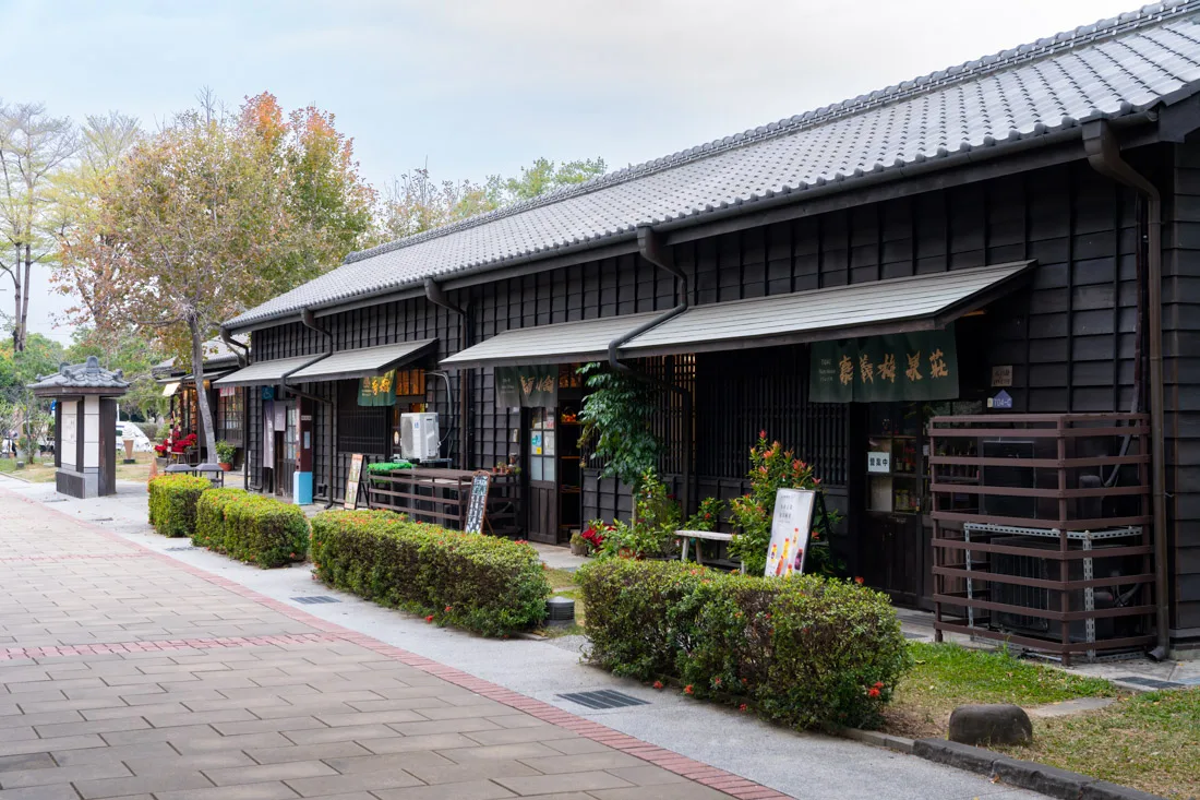
Hinoki Village.
Where to Sleep in Chiayi?
I stayed at KM Hostel, a well-located and highly recommended option about a 10-minute walk from both the train and bus stations. Ideal for travelers who prefer not to overnight in Alishan.
How to Reach Chiayi?
From Chiayi Train Station (Google Maps), there are frequent connections:
- Northbound: toward Taichung, Taipei, and other northern cities.
- Southbound: toward Tainan and Kaohsiung.
The High-Speed Rail (HSR) station is located slightly outside the city (Google Maps), but frequent bus services connect it to downtown Chiayi.
For additional travel details, refer to the transportation section of the guide.
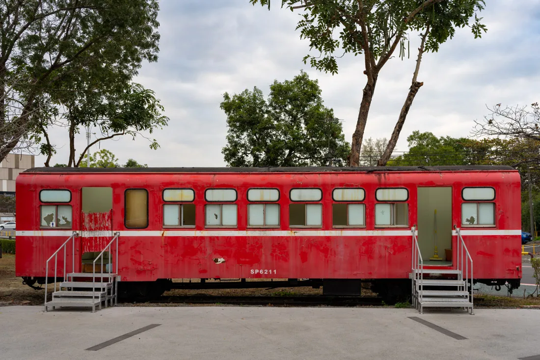
Alishan Forest Railway Garage Park
Alishan and Environs
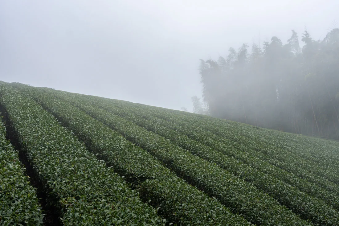
Alishan is one of Taiwan’s most iconic mountain destinations—famous for its spectacular sunrises over a “sea of clouds,” ancient cypress forests, and the historic Alishan Forest Railway, originally built during Japanese colonial rule to transport timber. The area is also known for its high-mountain tea plantations, spring cherry blossoms, and proximity to the Yushan Trail, which leads to Taiwan’s highest peak at 3,952 meters.
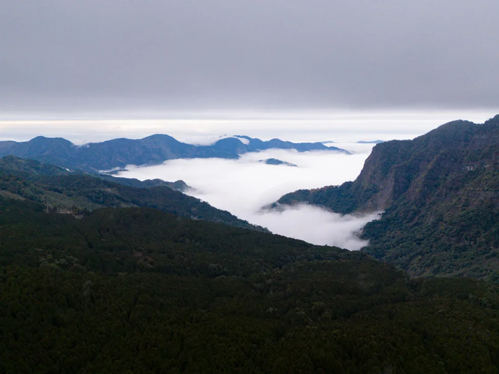
Sea of clouds
What to See and Do in and Around Alishan
There’s plenty to explore in and around Alishan, and I highly recommend spending at least two full days in the area, especially if you don’t want to limit your visit to the main Alishan National Forest Recreation Area. Here’s a map of the whole region that may help you plan.
Alishan National Forest Recreation Area
If you only have one day, I suggest taking one of the first buses in the morning. Schedules on Google Maps are generally accurate, but to be safe, you can also find a PDF version of the timetable here and consult the official website. Buses depart from Chiayi Train Station (Google Maps). When I went on a weekend, the bus was packed—I was lucky to get a seat. To avoid missing out, especially during weekends, holidays, or cherry blossom season, arrive early or consider booking your ticket online using this guide.
Alishan.
After a two-hour ride, you’ll arrive at Alishan Station (Google Maps). Entrance to the park costs TWD 300, but if you arrive by public transport, you get a 50% discount, so you’ll pay TWD 150. The bus staff will give you a voucher for the discount.
Once inside the park, you have several options:
- You can explore on foot (which I did), or
- Combine walking with short train rides—check this page for schedules
- Shuttle buses also run between some sights
If you need help planning your route, stop by the Visitor Center (Google Maps).
Tip: Download Organic Maps—the trails are clearly mapped and far more accurate than Google Maps inside the park.
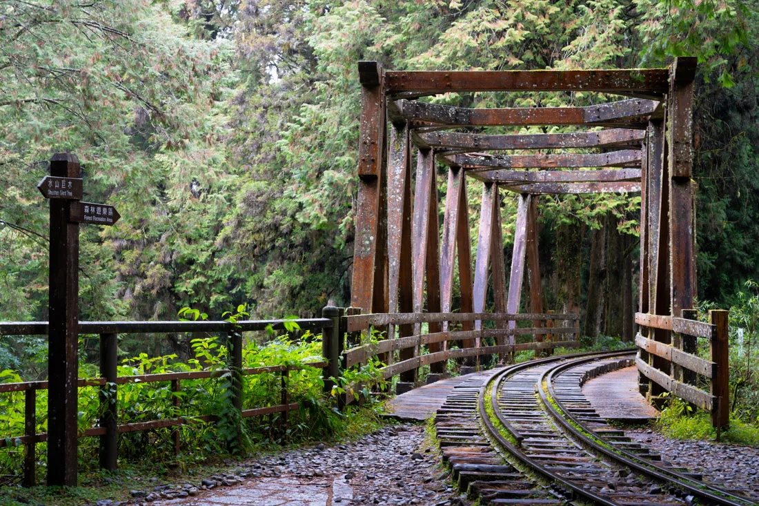
The old train line.
Suggested Itinerary for One Day
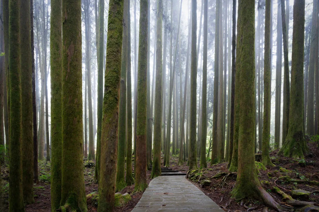
Start with the Giant Tree Cluster Trail (Google Maps), where boardwalks guide you through groves of towering cypress trees, some estimated to be thousands of years old. Nearby, you’ll also find:
- A small (Chinese-only) museum (Google Maps)
- A few temples and viewpoints (Google Maps)
From there, follow this suggested route:
- Walk down to Shenmu Station (Google Maps)
- Head up toward Tree No. 28 (Google Maps) —one of the park’s largest
- Continue to Shouzhen Temple (Google Maps)
- Make your way up to Sister Ponds (Google Maps)
- Descend to Zhaoping Park (Google Maps)
From here, you can choose:
- For a longer walk: Climb to Duigaoyue Viewpoint (Google Maps), then descend to the Shuishan Giant Tree (Google Maps), and follow the old railway trail back to Zhaoping.
- For a shorter route: Skip either Duigaoyue or Shuishan.
This loop makes for a full but manageable day hike, especially if done entirely on foot. Using the train or shuttle for one or two segments can lighten the load.
If Staying Overnight
If you spend the night in Alishan, you gain access to sunrise viewpoints—a major highlight:
- Tashan Trail (All Trails) – A moderate hike that rewards you with panoramic views and the classic “sea of clouds” at sunrise.
- Xiaoliyuanshan (Google Maps) – Reachable by foot or train (a special early morning train runs for sunrise).
- Duigaoyue Viewpoint (Google Maps) – Also suitable for sunrise and less challenging than Tashan.
Watching the sun rise over a blanket of clouds is one of the defining experiences of Alishan. It’s worth waking up early for, especially if the weather cooperates.
Fenqihu.
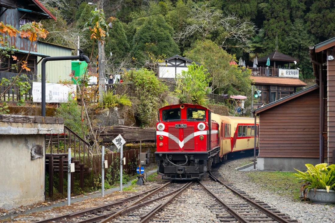
Fenqihu and Xiding
Fenqihu is a historic mountain village located along the Alishan Forest Railway. While the line is partially closed and no longer runs all the way to Alishan, you can still take the scenic train from Chiayi to Fenqihu.
I recommend booking your train ticket online via the official website. If you’re unable to secure a reservation online, a small number of tickets are made available for same-day purchase at Chiayi Station, even after online tickets are sold out. Note that if you buy your ticket online, you’ll need to show your passport at the station to collect it. The regular departure is at 9:00 a.m., with an additional weekend departure sometimes offered—this second train can only be booked in person on the day of travel.
The journey takes about two hours, and you’ll arrive in Fenqihu shortly after 11:00 a.m.
What to See in Fenqihu
Once you arrive, walk along the charming Fenqihu Old Street (Google Maps), explore the small park (Google Maps), and possibly stroll down this historic alleyway (Google Maps). For lunch, try one of the village’s iconic railway bento boxes.
After lunch, I recommend doing this short scenic hike (All Trails), which follows part of the Fenrui Historic Trail (Google Maps) and leads to the impressive Fenqihu Giant Tree (Google Maps).
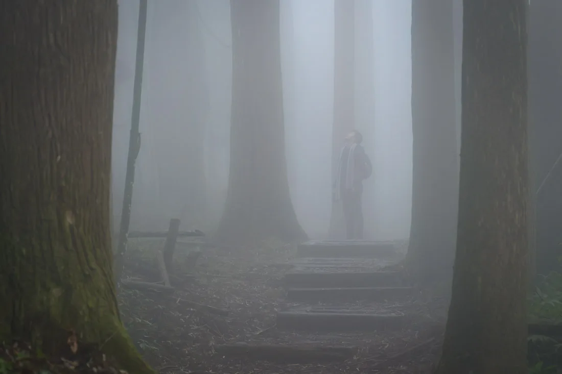
Tea Trail.
Exploring the Trails around Xiding
After your hike, return to the bus stop (Google Maps) and catch a bus toward Alishan. Get off at Shanyang Road Intersection (Google Maps).
From here, you can complete a loop trail that includes several connected scenic paths:
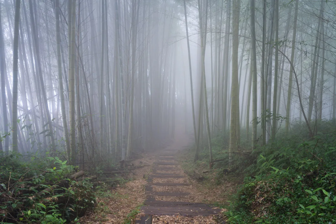
- Mist Trail (Google Maps)
- Tea Trail (Google Maps)
- Cloud Trail (Google Maps)
- Sakura Trail (Google Maps)
- Sunset Trail (Google Maps)
I skipped the Sakura Trail (the cherry blossoms weren’t in bloom yet) and only completed portions of the other trails, roughly following this route on (All Trails) that I personally created. The loop ends back at a bus stop (Google Maps) where you can board a bus heading from Alishan back to Chiayi.
Mist Trail.
Optional Detour: Eryanping Sunset Viewpoint
If you’re on schedule and weather conditions are favorable, you may have time to watch the sunset from the Eryanping Viewpoint (Google Maps). When I visited, low clouds blocked the view, so I stayed on the bus. But if skies are clear and you still have energy, you can:
- Get off at this stop (Google Maps) and hike the Eryanping Trail (All Trails), or
- Alight at Lincuo (Google Maps) and walk the Tea and Mist Trails (Google Maps) to connect with the Eryanping Trail, saving you some elevation gain.
Mist Trail.
Yushan (Jade Mountain)
As mentioned earlier, Mount Yushan is the highest peak in Taiwan at 3,952 meters. While I didn’t attempt the climb—winter conditions make it more technical and the local authorities require proper equipment and documentation—during warmer months, it’s a highly rewarding hike.
The ascent involves about 2,000 meters of elevation gain and can be done in 1–2 days, depending on your fitness level. You’ll find a detailed guide on this page and the GPS track on All Trails.
How to Reach Alishan?
For transportation to Alishan, refer to the previous sections. One additional tip: If you’re planning to continue on to Sun Moon Lake or vice versa, there’s a convenient direct daily bus service that saves you from having to return to Chiayi.
From Sun Moon Lake to Alishan: departs at 8:00 a.m.
From Alishan to Sun Moon Lake: departs at 1:00 p.m.
On weekends and holidays, there are additional runs at 8:30 a.m. and 3:30 p.m.
For reservations, follow the instructions provided in this guide.
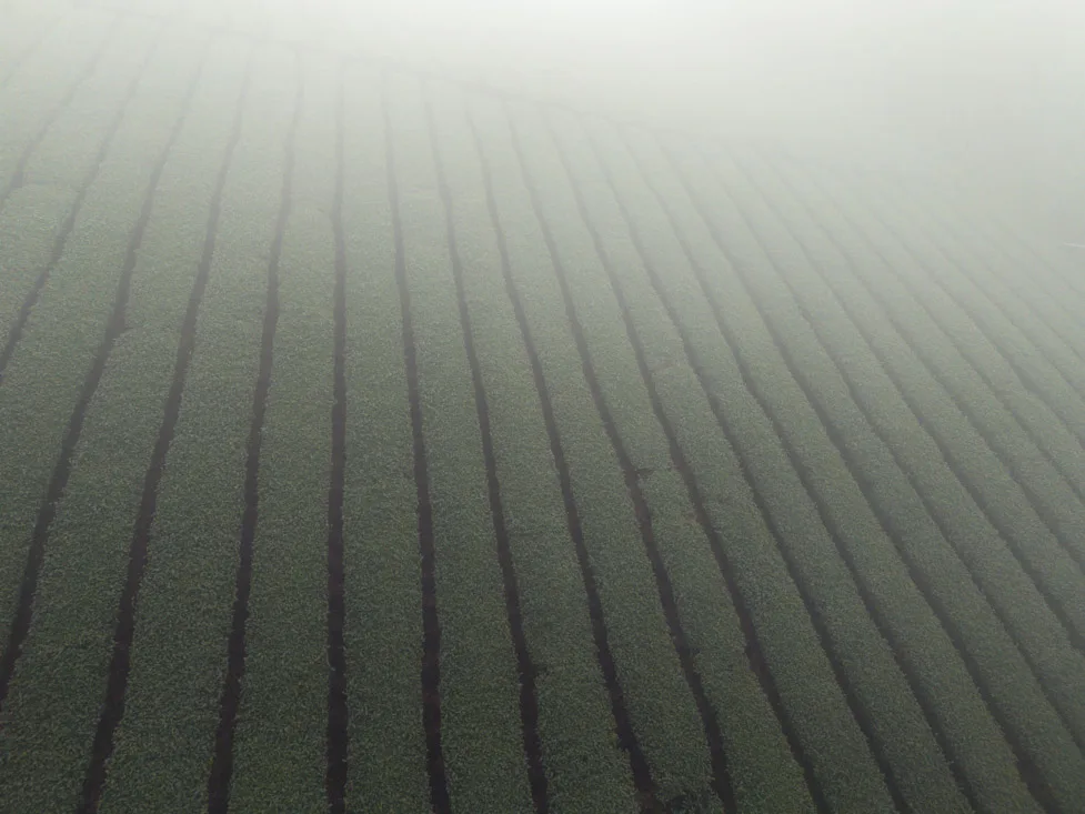
Tea Trail.
Where to Sleep in Alishan?
As mentioned earlier, I didn’t stay overnight in Alishan. However, if you plan to, book well in advance, especially during weekends and peak seasons like cherry blossom time—accommodation sells out weeks or even months ahead.
In Alishan proper, options are limited. Maria Hotel is reportedly the most budget-friendly. Alternatively, you might consider staying in nearby villages like:
- Xiding
- Shizhao
- Fenqihu
Or at one of the guesthouses along the main road, particularly if you have your own transportation.
Songlong Rock Waterfall and Sun-Link-Sea Nature Park
I haven’t visited this area personally, but if you have your own transportation, it’s worth considering a stop at Songlong Rock Waterfall (Google Maps), located roughly halfway between Alishan and Sun Moon Lake. The waterfall is part of the Sun-Link-Sea Nature Park, which offers a variety of scenic trails and natural attractions. You can find more detailed suggestions and activity options on this page.
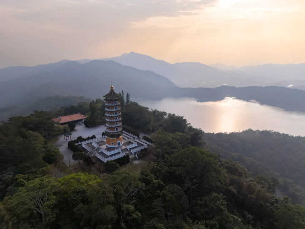
Sun Moon Lake.
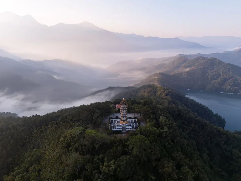
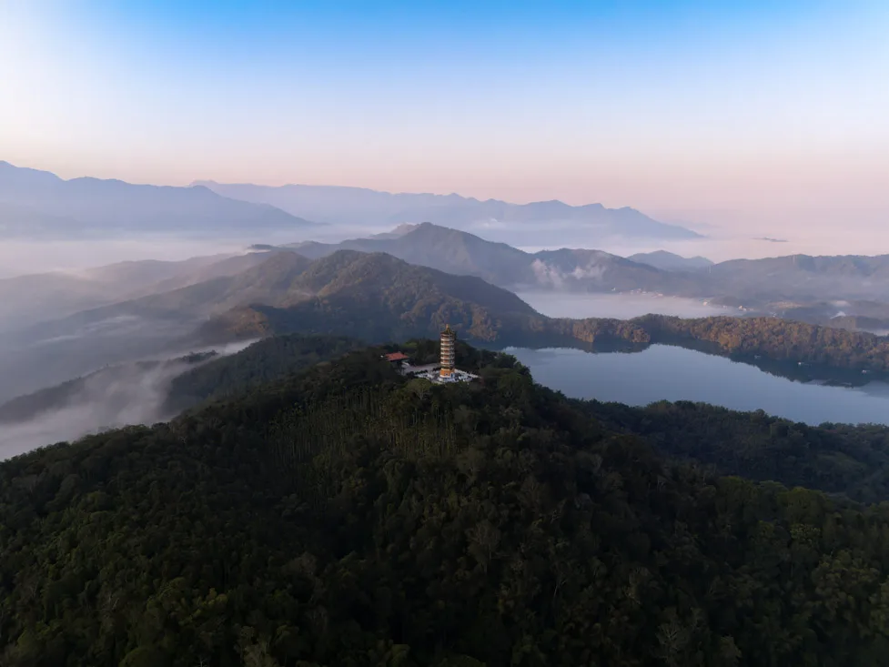
Sun Moon Lake
Sun Moon Lake is Taiwan’s largest natural lake, named for its distinctive shape—one side round like the sun, the other crescent-shaped like the moon. It’s one of the country’s most popular vacation destinations, especially among locals.
What to Do and See at Sun Moon Lake
While undoubtedly scenic and pleasant, the lake doesn’t offer a huge variety of activities. In my opinion, one full day—especially if spent biking around the lake—is more than enough.
Wenwu Temple.
Sun Moon Lake by Bike
As mentioned, I highly recommend renting a bike and cycling the loop trail that follows the lakeshore, stopping at points of interest along the way. The loop is about 30 km, mostly flat, and accessible to most people. You can also rent an electric bike or scooter if you prefer.
While there is a bus service that circles the lake, I found it to be a less rewarding way to explore the area.
I stayed in Ita Thao, so I’ll describe the route starting from there, riding counterclockwise. Of course, you can begin from any point, as the path forms a loop. I rented my bike here (Google Maps). Unlike some rental shops that require bikes to be returned by 5:00 p.m., this one was very relaxed—they simply asked me to leave it parked outside when I was done.
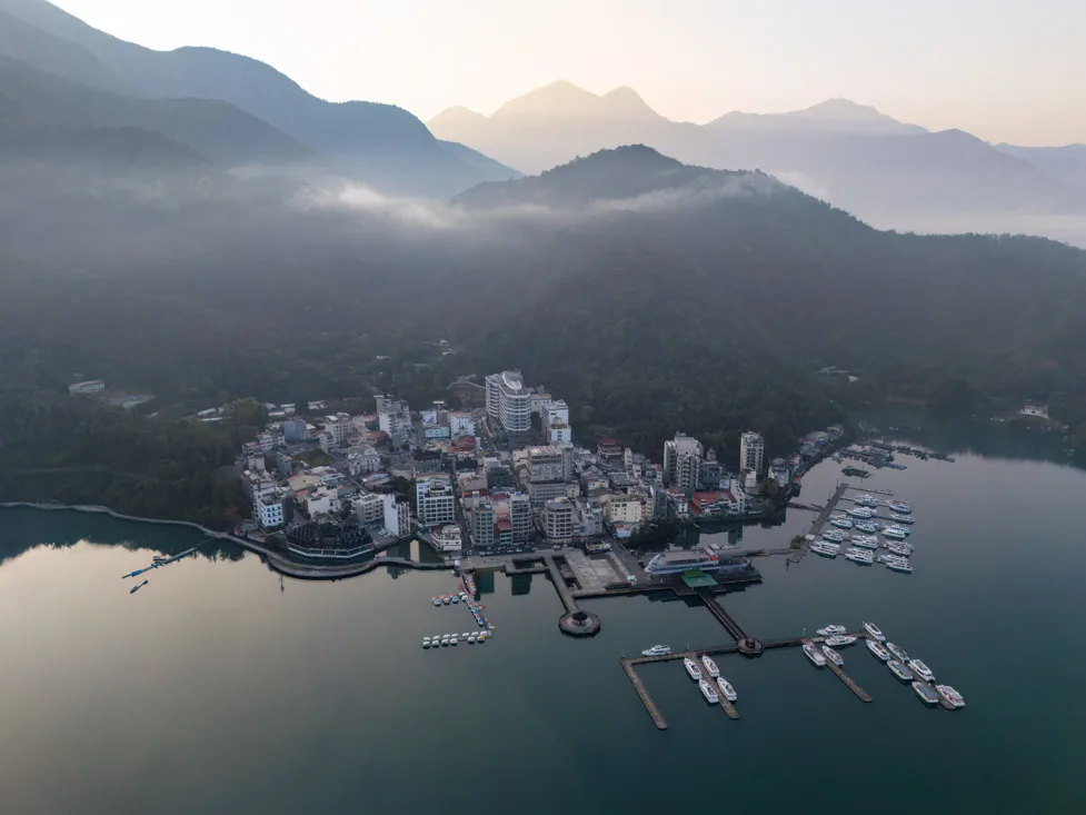
Ita Thao.
Suggested Stops Along the Route
Nine Frogs Stack (Google Maps). A small statue that serves as a water level marker. While the sculpture isn’t remarkable, the short trail to the viewpoint and the lake panorama make it a pleasant stop.
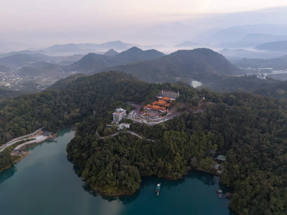
Wenwu Temple (Google Maps). An impressive temple complex perched above the lake. Try to arrive early to avoid the crowds.
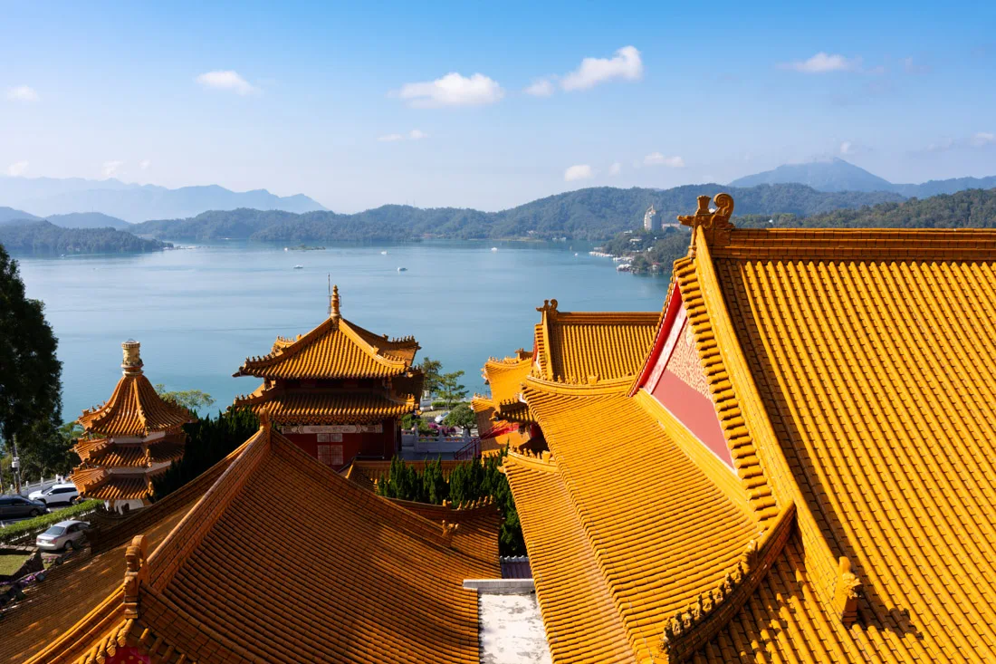
Wenwu Temple.
Xiangshan Visitor Center (Google Maps). A striking modern building with minimal exhibits inside, but architecturally worth the visit. You can grab a bite at Shuishe (Google Maps) along the way or bring food for a picnic by the lake.
Xuanguang Temple (Google Maps). A peaceful lakefront temple.

Xiangshan Visitor Centre.
Ci’en Pagoda (Google Maps). The climb here is the most challenging part of the loop, but the 360-degree view from the top is absolutely worth it. Note that it closes at 4:30 p.m., so it’s not ideal for sunset.
Xuan Zang Temple (Google Maps). A serene temple near the end of the loop, before returning to Ita Thao.
Ci’en Pagoda.
Other Attractions at Sun Moon Lake
I focused on the bike loop, but if you’re interested, consider these additional options:
- Boat tours from Shuishe Harbor (Google Maps).
- The Sun Moon Lake Ropeway (Google Maps), a popular cable car ride. I didn’t try it myself, and I suspect the views are comparable to those from Ci’en Pagoda, but others may enjoy it.
- The Formosan Aboriginal Culture Village (Google Maps), a large amusement park connected to the cable car. It’s quite expensive and not really my style, but it might appeal to others.
- For a more active option, consider this hiking trail on (All Trails), which offers excellent lake views if you’re up for a bit of exertion.
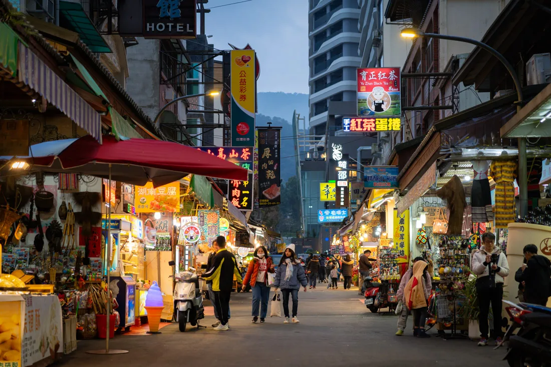
Ita Thao.
Puli
Puli is the last major town before reaching Sun Moon Lake. Many travelers stay here to save on accommodation, as lodging around the lake can be pricey. I chose to stay at the lake, so I didn’t explore Puli itself, but it offers a couple of notable attractions:
- Chung Tai Chan Monastery (Google Maps): the tallest Buddhist monastery in the world.
- Paper Dome (Google Maps): a church made entirely of paper.
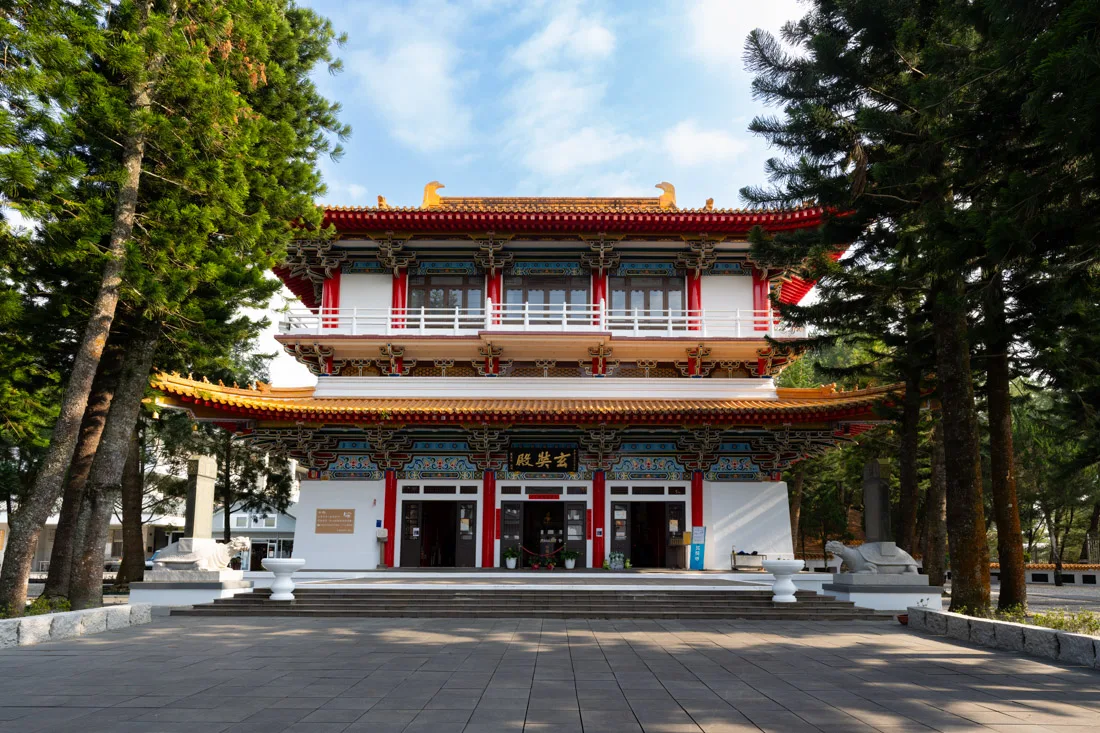
Xuan Zang Temple.
Where to Sleep at Sun Moon Lake?
I stayed at OWL hostel, located in Ita Thao. It was the most expensive stay of my trip, but also one of the most comfortable and beautiful. That said, if you’re on a budget, staying in Puli and visiting the lake for the day is a great alternative.
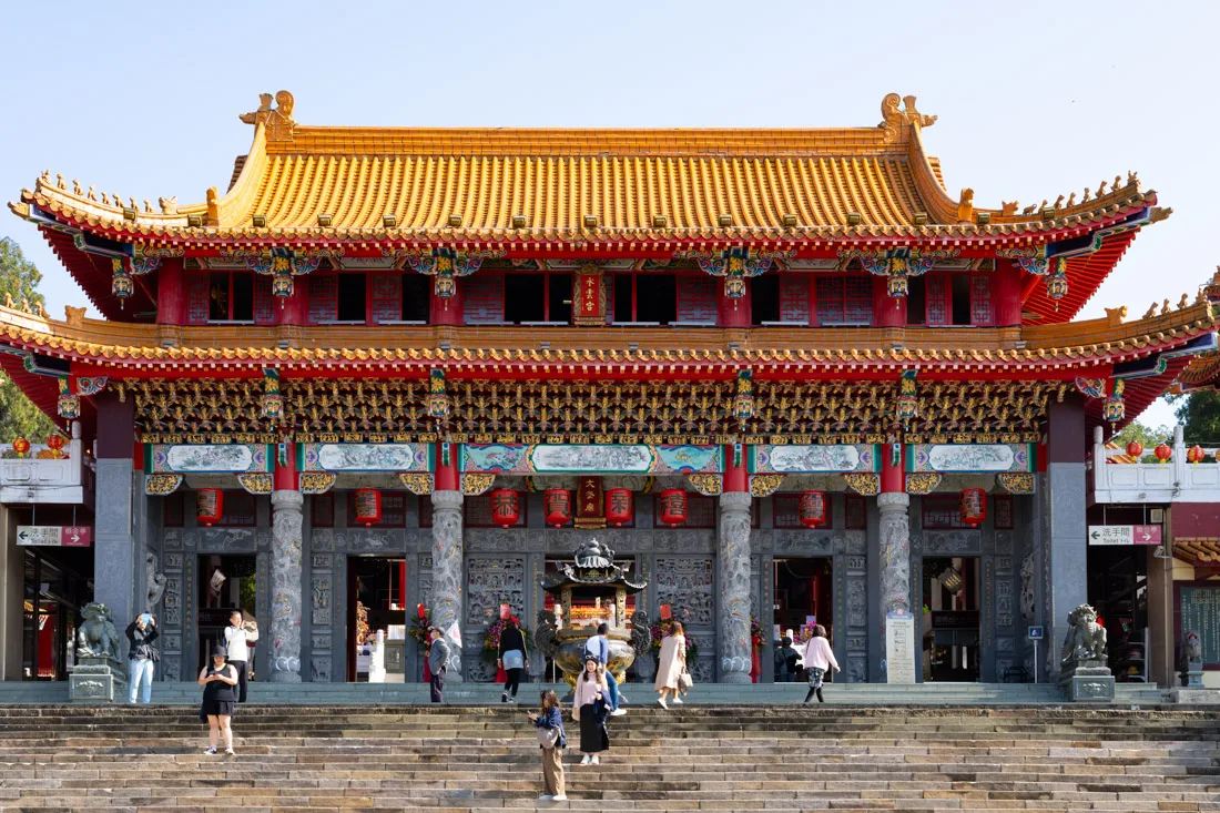
Wenwu Temple.
How to Get to Sun Moon Lake?
As noted earlier, there is a convenient daily bus service connecting Alishan and Sun Moon Lake:
- From Alishan: departs at 1:00 p.m.
- From Sun Moon Lake: departs at 8:00 a.m.
- On weekends and holidays, extra departures run at 8:30 a.m. and 3:30 p.m.
- To reserve seats in advance, refer to this guide.
An alternative route is via Taichung, which has frequent buses to the lake departing from around the train station (Google Maps). All buses arrive at the Shueishe Visitor Center (Google Maps), from where you can transfer to buses that circle the lake.
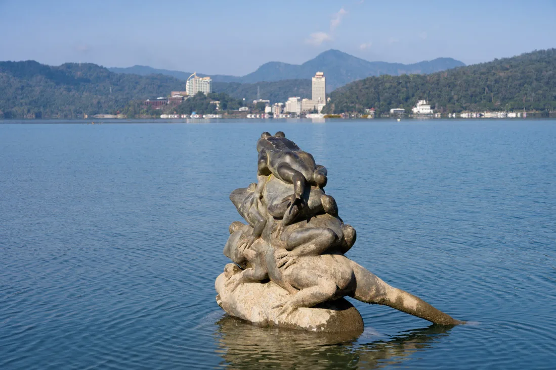
Nine Frogs Stack.
Taichung
Despite being Taiwan’s third-largest city after Taipei and Kaohsiung, Taichung doesn’t offer much for the average leisure traveler. Even a local friend who studied at university there described it as “extremely boring.”
Rainbow village.
What to Do and See in Taichung
As mentioned, if you’re short on time, you can easily skip Taichung without missing much.
However, if you decide to stay the night, here are a few worthwhile stops:
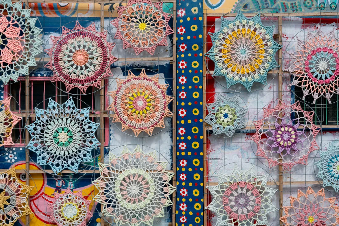
- Rainbow Village (Google Maps) A colorful former military housing area hand-painted by a retired soldier to save it from demolition. It’s small but photogenic and worth a quick visit.
- Taichung Prefectural Hall (Google Maps) One of the city’s most significant historical buildings.
- Painted Animation Lane (Google Maps) A small alley decorated with murals of classic Japanese anime characters—fun but brief.
- Nearby Park (Google Maps) A relaxing green space if you’re already in the area.
For the evening, depending on where you’re staying, choose between two of the city’s night markets:
- Yizhong Street Night Market (Google Maps)
- Fengjia Night Market (Google Maps) — the larger and more famous of the two.
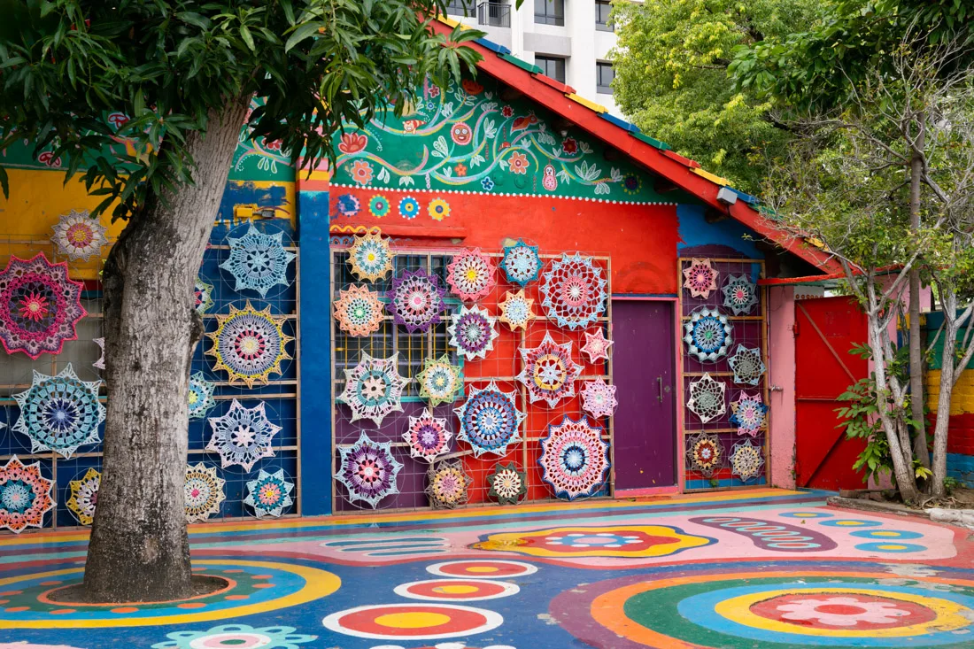
Rainbow village.
Where to Sleep in Taichung?
I spent a night at Kiwi Express Hotel-Taichung Station II, a solid budget option located within walking distance of the train station and close to the bus stop for Sun Moon Lake. Recommended for convenience and comfort.
How to Reach Taichung?
Taichung is well-connected by both regular and high-speed trains:
From the main train station (Google Maps), you’ll find frequent connections:
- Northbound to Taipei
- Southbound to Chiayi, Tainan, and Kaohsiung
- The High-Speed Rail (HSR) station is located slightly outside the city (Google Maps), so allow extra travel time if you’re using it.
For more details on transportation, see the dedicated travel section of this guide.
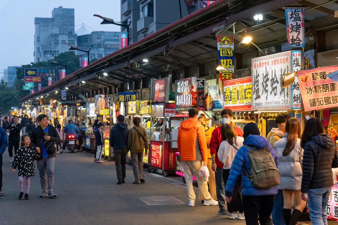
Yizhong Street Night Market.
Lukang
Lukang isn’t typically part of most tourist itineraries. I spent a night there because a local friend—who lives a bit further north—chose it as a place to spend the day together.
Mazu Temple.
What to Do and See in Lukang
If you’re short on time, Lukang probably isn’t worth a detour. That said, if you do visit, the old town with its narrow streets and traditional buildings is the most interesting part (Google Maps). I was there on a weekend and the area was lively, with plenty of people, street food, and various stalls.
Make time to stop at:
- Lukang Mazu Temple (Google Maps) A significant religious site in the town—my friend took me here to pray.
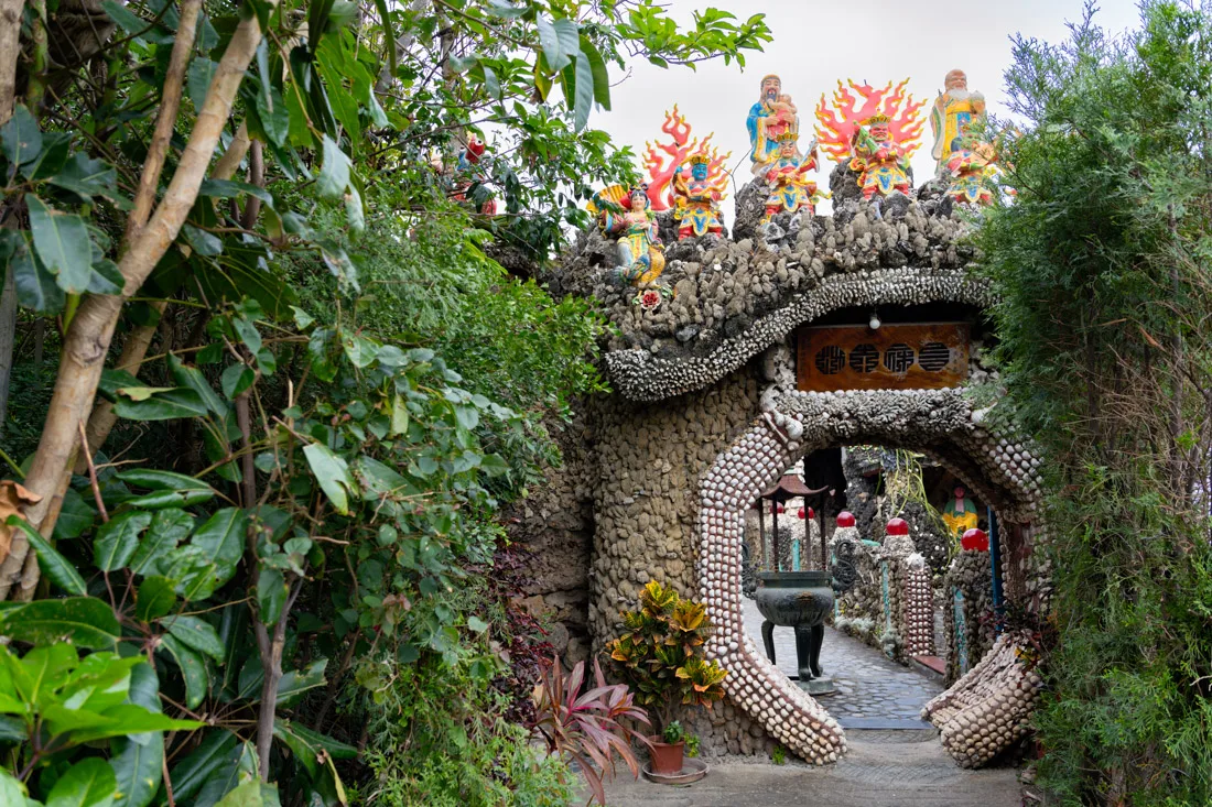
- The Narrowest Alley (Google Maps) A fun, quirky spot on the opposite side of downtown.
Just outside of town, we visited a very unusual temple (Google Maps), which even my local friend found strange. It features a mix of statues, artifacts, and even a mini-zoo with crocodiles—definitely not your typical temple experience.
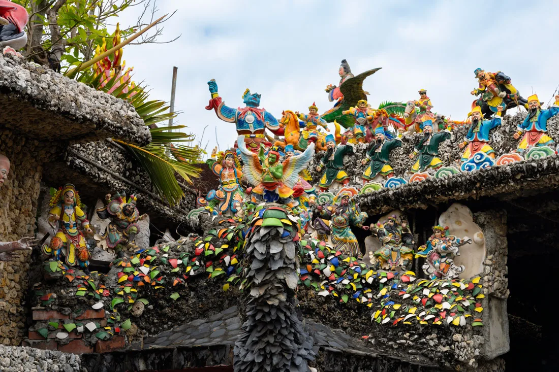
Tempio strano.
Where to Sleep in Lukang?
I stayed at Deer Park Hostel, a good, clean hostel located close to both the bus station and the old town. Recommended.
How to Reach Lukang?
There are frequent bus connections to and from Taichung. For full details, refer to the dedicated travel section of this guide.
Strange Temple.
Since I no longer run ads, if you found this article helpful, please consider purchasing your travel insurance through one of the links on this site. Doing so supports my work at no additional cost to you. For EU and UK residents, I recommend True Traveller. For everyone else, I recommend HeyMondo, which offers a 5% discount. Thank you for your support!
Possible Itineraries in Taiwan
Below are suggested itineraries for 1, 2, 3, and 4 weeks in Taiwan. Naturally, there is no “perfect” route—use these as a starting point, and feel free to adapt based on your interests, pace, and budget.
One-Week Itinerary: Focus on the Northeast
With just a week, I recommend focusing exclusively on northeastern Taiwan.

Taipei.
Taipei (3 nights)
Day 1: Arrive in Taipei. Visit Chiang Kai-shek Memorial Hall, climb Elephant Mountain, and explore the Xinyi District in the evening.
Day 2: Free walking tour, temple hopping, and Ximending by night.
Day 3: Visit Beitou and explore northern Taipei.
Jiufen (1 night)
Day 4: Transfer to Jiufen. Visit the Gold Museum, consider a hike, and enjoy the town in the evening.
Hualien (2 nights)
Day 5: Transfer to Hualien. If arriving early, spend the afternoon in Taroko National Park.
Day 6: Full day inside Taroko National Park.
Day 7: Return to Taipei.
Jiufen.
Two-Week Itinerary: Full Island Loop (with Some Compromises)
With two weeks, you can circle the island—though some stops will be brief.

Taipei.
Taipei (3 nights)
Same plan as above.
Jiufen (1 night)
Same as above.
Hualien (2 nights)
Same as above.
Chishang (1 night)
Day 7: Explore Chishang by bicycle.
Chishang.
Kaohsiung (2 nights)
Day 8: Transfer to Kaohsiung. Visit the Pier-2 Art Center in the afternoon, Liuhe Night Market in the evening.
Day 9: Visit Fo Guang Shan Buddha Museum in the morning and the Lotus Pond in the afternoon/evening.
Tainan (1 night)
Day 10: Transfer to Tainan. Explore Anping District and West Central District.
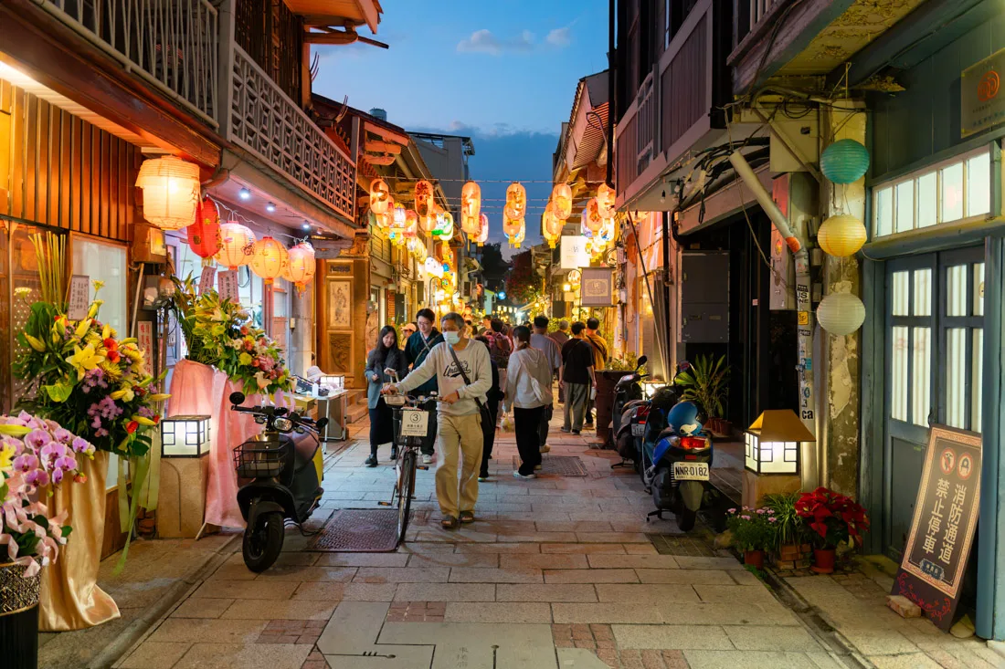
Shennong Street.
Chiayi (1 night)
Day 11: Visit the National Museum of Taiwan History or Chimei Museum (in Tainan) before heading to Chiayi in the afternoon.
Alishan (1 night)
Day 12: Take the bus to Alishan, spend the day exploring the trails, and stay overnight.
Sun Moon Lake (1 night)
Day 13: Catch the sunrise in Alishan, then transfer to Sun Moon Lake in the afternoon.
Day 14: Explore Sun Moon Lake by bike. Return to Taipei in the evening.

Taipei.
Three-Week Itinerary: The Same Loop at a Slower Pace
With three weeks, you can follow the two-week itinerary at a more relaxed pace. You’ll have more time for:
- Slower travel days
- Optional hikes and scenic detours
- Extra nights in places like Taroko Gorge, Tainan, or Sun Moon Lake
Depending on the season, consider adding one or two side trips:
- Kenting (for beaches)
- Green Island or Xiaoliuqiu (for snorkeling/diving)
Four-Week Itinerary: See It All
With a month in Taiwan, you can comfortably cover everything mentioned in this guide. Just follow the “What to See and Do in Taiwan” section step-by-step, adding or skipping destinations based on your energy level and the season.
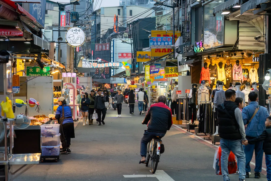
How to Get Around Taiwan
Taiwan has one of the most efficient and user-friendly public transportation systems I’ve ever experienced. The rail network, in particular, is well-developed and connects nearly all major cities and tourist destinations, as shown on this map. Google Maps generally works well for route planning, though on a few occasions bus schedules proved inaccurate.
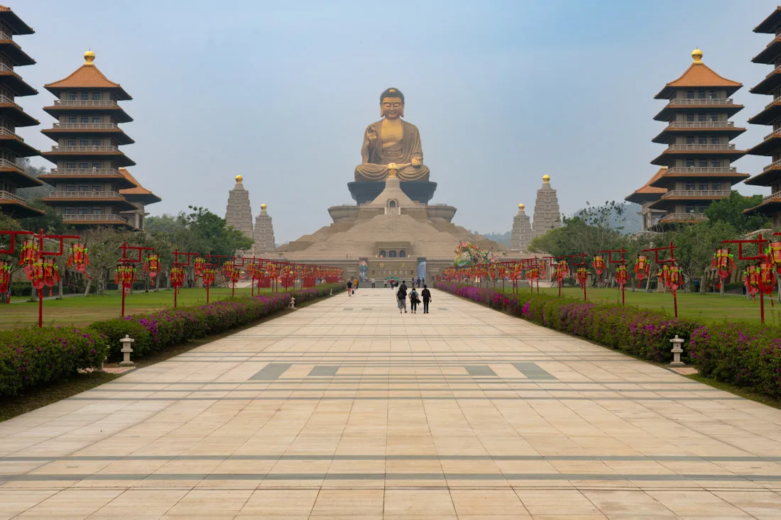
Foguangshan Buddha Memorial Centre.
EasyCard: Your Travel Essential
While it’s often possible to pay fares with a regular credit/debit card or via Apple/Google Pay, I highly recommend purchasing an EasyCard—a prepaid smart card that simplifies public transport.
You can use EasyCard on:
- Local and regional trains (excluding high-speed rail)
- Subways and buses
- YouBike rentals (bike-sharing service)
- Convenience stores and selected businesses
- 10% discount on train rides under 70 km
- 15% discount on subway rides in Kaohsiung
- Integration with YouBike rentals
Cost: NT$500 (approx. €15)
- NT$400 usable credit
- NT$100 non-refundable deposit
Where to buy:
Available at airports, most metro stations, and convenience stores (7-Eleven, FamilyMart, Hi-Life, OK Mart). These locations also offer top-up services using coins or bills. Metro stations often have vending machines—perfect for getting rid of spare change.
Refunds:
Remaining balance (up to NT$3,000) can be refunded at MRT information desks or at the airport for a NT$20 fee. Alternatively, you can simply use up the credit at a convenience store before departure.
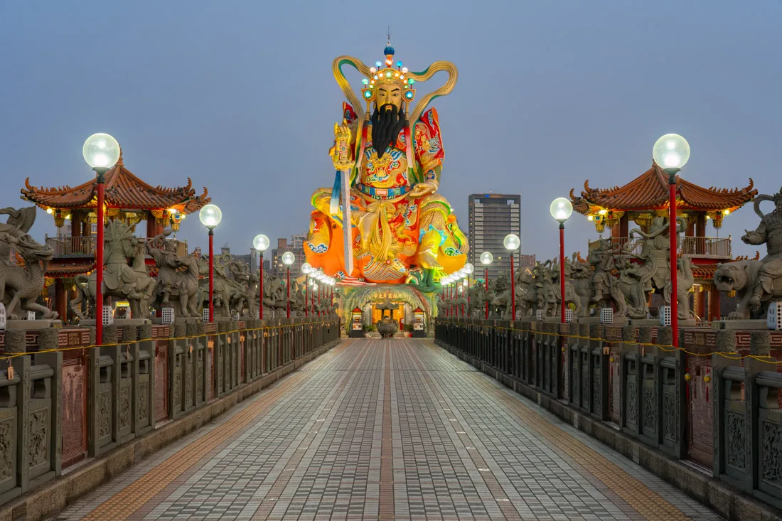
Lotus Pound.
Train Travel in Taiwan
The main railway line loops around the coast and is served by three train types:
- Local trains: Stop at all stations
- Fast local trains: Stop only at major stations
- T.C. Ltd. Exp. (Limited Express): Reserved seats only; tickets must be booked online or at stations
For local and fast local trains, just tap in and out with your EasyCard as if using a subway.
Apps and tools:
- Taiwan Railway e-booking (IOS, Android): Great for checking schedules and routes.
- Google Maps: Reliable for most planning.
- Taiwan Railway Timetables (IOS, Android): Combines both local and High-Speed Rail schedules.
High-Speed Rail (HSR)
Taiwan’s High-Speed Rail (HSR) runs along the west coast, linking Taipei to Kaohsiung. It has separate stations and a dedicated reservation system.
Booking options:
- Official HSR Website
- T Express App (IOS, Android)
Detailed guides are also available online to assist with reservations
Though I haven’t used the HSR personally, it’s considered fast, and efficient.
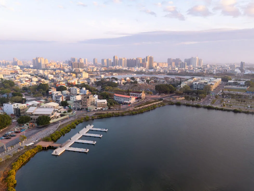
Tainan.
Buses in Taiwan
Where trains don’t go, buses fill the gap. Many destinations—including smaller towns and mountain areas—are reachable only by bus.
EasyCard usage: Remember to tap your card when boarding and again when getting off.
Helpful apps:
- Bus+ (IOS, Android): Recommended by locals; includes buses, trains, and YouBikes
- Google Maps: Mostly accurate, but sometimes off for bus times in rural areas
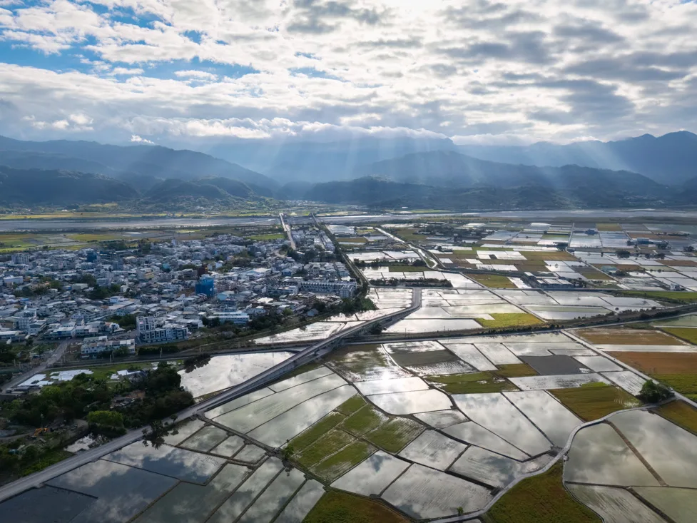
Yuli.
Renting a Car
Though I relied solely on public transport, renting a car is a good option if you want more flexibility. Roads are in excellent condition, and distances are manageable.
A typical road trip might involve renting a car in Taipei, circling the island, and returning it to the same location.
Note:
- An international driver’s license is required
- Most rental agencies are strict about scooters over 50cc
- For car rentals, check websites like Discover Cars
If you’re already abroad, it may be possible to obtain an international license online.
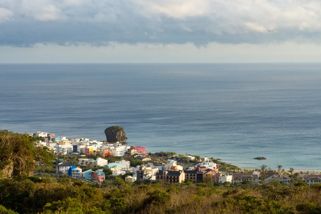
Kenting.
Taiwan by Bike
Cycling the island is surprisingly popular. I met several travelers doing full bikepacking trips, and there are resources available for planning this kind of adventure.
If you’re not up for a long-distance ride, bike-sharing services are common in cities.
YouBike is the most widely used service:
- Can be used with EasyCard
- Great for short city rides or scenic routes
- A step-by-step guide is available here
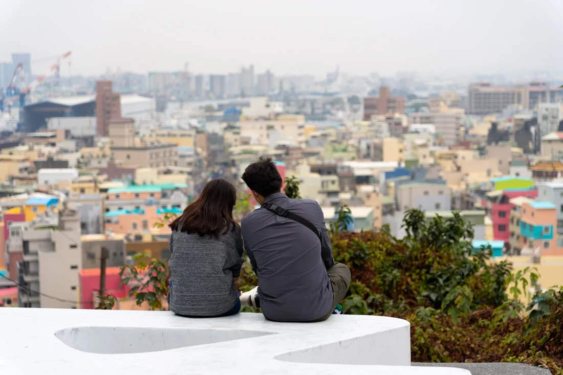
Taiwan by Scooter or Motorcycle
Scooters are another fun way to explore, particularly on smaller islands or in rural areas.
A friend of mine rented one for a few weeks from Bikefarm (Google Maps)—a shop well-known among travelers.
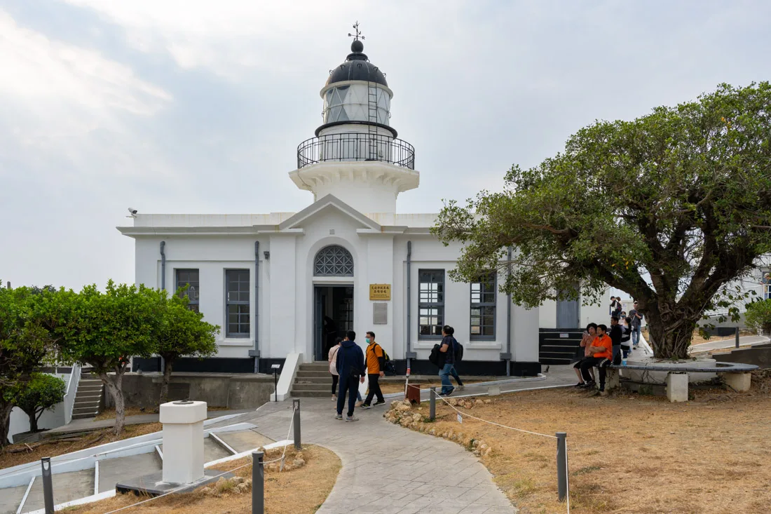
Kaohsiung Lighthouse.
Backpacking Taiwan: Costs
How much does a trip to Taiwan cost? Over my two-month stay (58 days, to be precise), I spent 2005.68€, which averages out to about 35€ per day. Naturally, for shorter trips or if you move around more frequently, your costs will increase. Additionally, not everyone prefers to travel as frugally as I did, but I can assure i never felt like I was missing anything, and the overall cost is quite manageable.

Lotus Pound.
Accommodation in Taiwan
Taiwan offers a wide selection of hostels and guesthouses, particularly in major tourist destinations. Hostels here are popular not just with international tourists, but with local travelers as well, which means high competition and good value for money.
Dormitory beds: A good quality dormitory bed typically costs around 15€ per night.
Private rooms: Outside the big cities, I found private rooms in guesthouses and small hotels for 10-15€ per night.
For couples or those sharing, private rooms are available almost everywhere for around 20-30€ per night (roughly 10-15€ per person).
While accommodation prices may rise on weekends due to local demand, overall, Taiwan offers excellent value.

Transportation in Taiwan
Public transportation in Taiwan is among the best I’ve encountered and is quite affordable by European standards. The island is well-connected, and if you rely mostly on local buses and regional trains, transportation won’t significantly impact your budget.

Food in Taiwan
Taiwanese food is not only delicious but also affordable. Eating out is extremely common, with many locals dining at food stalls or markets rather than cooking at home.
Meals at restaurants: A typical meal costs around 5-10€, with street food and night markets being much cheaper.
Convenience store meals: If you’re in a pinch or prefer something quick, 7-Eleven and Family Mart offer a wide selection of pre-packaged meals, which are quite tasty and affordable. Many locals also eat these meals, reheating them in-store, and there are seating areas where you can eat comfortably.
In short, eating well on a budget in Taiwan is definitely possible.
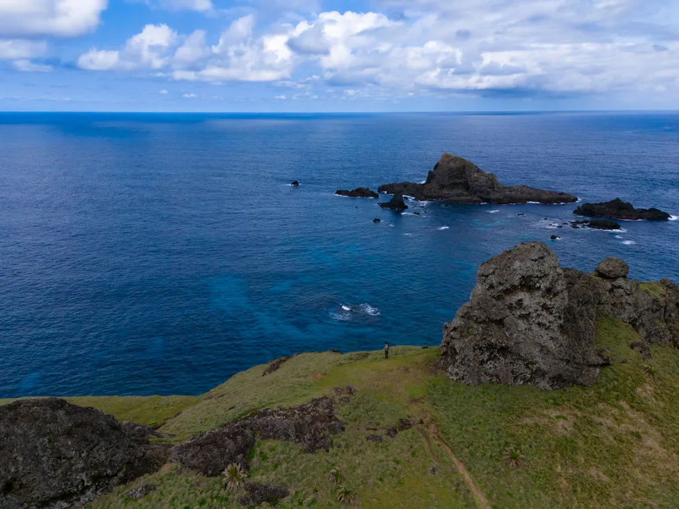
Green Island.
Other Costs (Withdrawals and SIM Cards)
ATM Withdrawals:
Taiwan offers relatively low ATM withdrawal fees, especially if you use the right cards.
Union Bank of Taiwan and Cathay United Bank allow withdrawals of up to TWD 20,000 per transaction without fees.
I frequently used Cathay United Bank ATMs, located in Family Marts around the country.
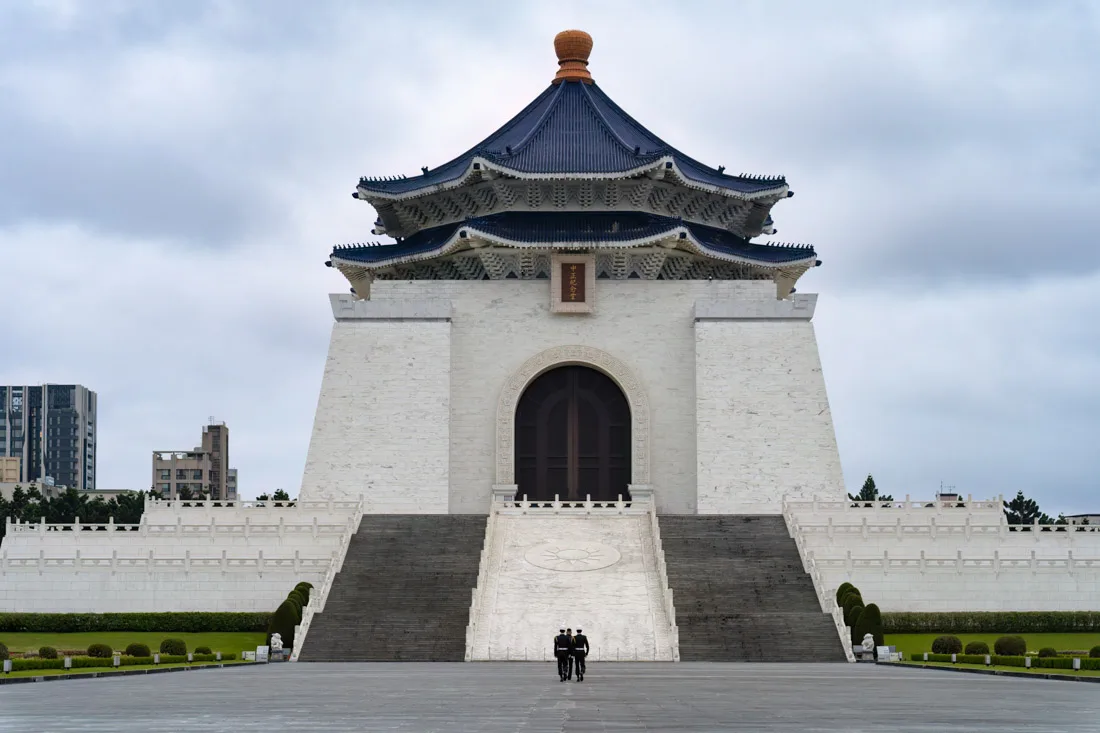
SIM Cards:
The best coverage in Taiwan is provided by Chunghwa Telecom. However, not all packages available online can be found at the airport.
I purchased a 60GB data package for 999 TWD (about 30€), which was valid for 60 days. This was available only at a store in Kaohsiung, not at the airport.
Airalo and Ubigi offer eSIM solutions if your phone supports it. However, these services tend to be more expensive than purchasing a local SIM card. While convenient, they may not always offer the best local coverage.
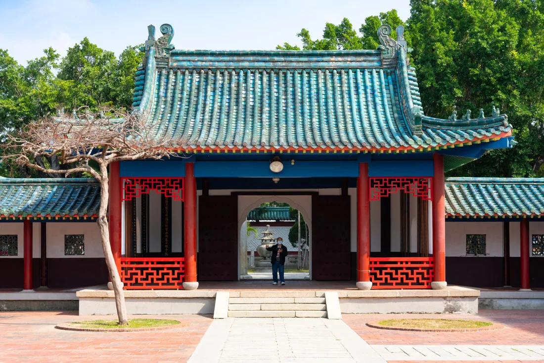
Backpacking Taiwan: Safety
Taiwan, alongside countries like Singapore, Japan, and Hong Kong, ranks as one of the safest places I’ve visited. While no destination is free from crime (including pickpockets), Taiwan is incredibly safe, even for families with young children. The risk of encountering dangerous situations is minimal.While it’s always wise to use common sense—especially in crowded areas—safety is certainly not something to worry about during your travels in Taiwan.
Are you planning a trip to Taiwan? Check out these posts:
Do you have any questions? Updated information? Feel free to leave a comment or message me on Instagram!
Since I no longer run ads, if you found this article helpful, please consider purchasing your travel insurance through one of the links on this site. Doing so supports my work at no additional cost to you. For EU and UK residents, I recommend True Traveller. For everyone else, I recommend HeyMondo, which offers a 5% discount. Thank you for your support!
For donations/pizzas and virtual beers 🙂
Did you like the post? Pin it!