Patagonia Travel Guide
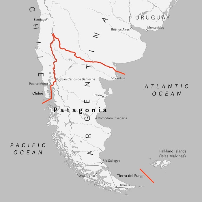
Divided between Argentina and Chile, Patagonia is a unique place in the world. Here, you will find the majestic Andes, glaciers, waterfalls, and glacial lakes, creating some of the most beautiful and wild landscapes on the planet.
I spent six weeks backpacking through both Chilean and Argentine Patagonia. In this guide, you will find a wealth of useful tips and information to help you plan your own trip to the far south of the American continent.
Quick menu
- When to visit Patagonia
- Chilean Patagonia
- Argentine Patagonia
- Travel itineraries in Patagonia
- How to get around Patagonia
- Backpacking Patagonia: costs
- Backpacking Patagonia: what to bring
- Backpacking Patagonia: safety
Torres del Paine national park, Chile.
When to visit Patagonia
Generally speaking, the best time to visit Patagonia is during the summer, which corresponds to winter in the Northern Hemisphere, from December to February. However, this period also sees considerably higher prices, and the popular parks, such as Torres del Paine, are crowded with tourists.
For these reasons, I strongly recommend considering spring and fall. While summer tends to have better weather, conditions in Patagonia can change quickly at any time of the year.
Spring (September to October): This season usually offers pleasant daytime temperatures and cool nights, lower prices, and fewer people.
Fall (March to May): Comparable to spring in terms of temperatures, prices, and crowd sizes, fall also features stunning foliage colors.
In my opinion, the best times to visit, balancing prices and weather, are October-November in spring and March-April in fall. September and May can be “complicated” months, especially in the far south of Patagonia where winter arrives earlier and lingers longer. Many tourism-related activities may not be fully operational or could be closed during these months. For example, some campgrounds in Torres del Paine open on October 1 and close on April 30.
Personally, I visited Chilean and Argentine Patagonia between March and April over the course of six weeks. During that time, the weather was generally kind to me, with some fluctuations, of course.
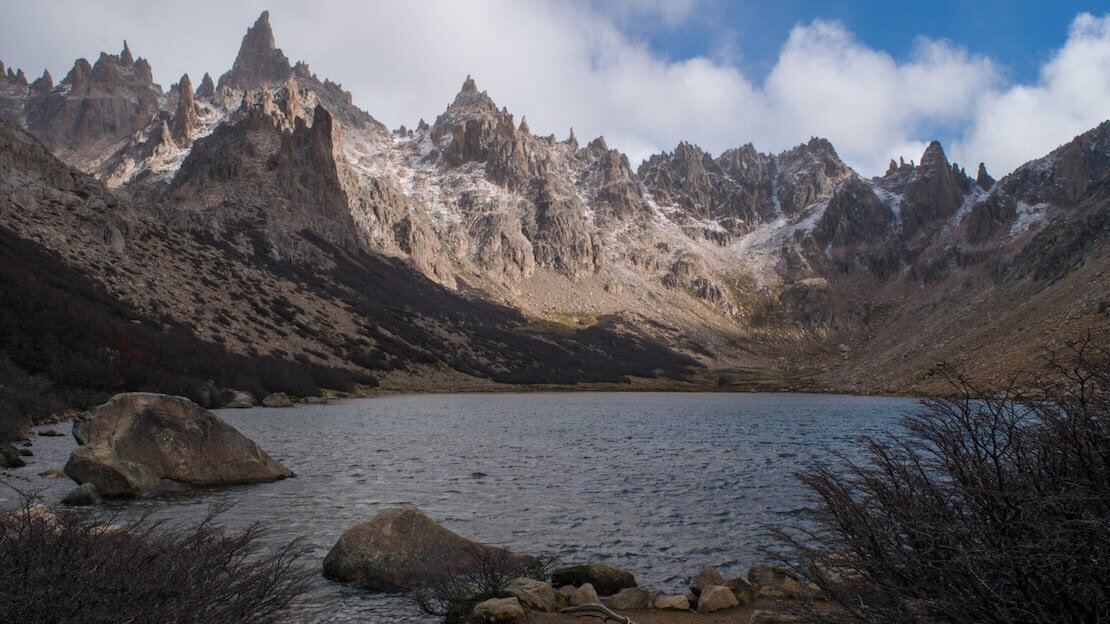
El Chaltén, Argentina.
Backpacking Patagonia: what to do and see
It should be noted that Patagonia is divided between Argentina and Chile, and although it is the same region, the climate, vegetation, and landscapes vary greatly between the two sides of the Andes Mountains, which essentially serve as the border.
Argentine or Chilean Patagonia?
Argentine Patagonia is largely covered by the “Pampas,” an immense plain devoid of forest that stretches from the foothills of the Andes to the Atlantic Ocean.
Chilean Patagonia is characterized by fjords and temperate forests that cover it almost entirely.
My Favorite? Undoubtedly, Chilean Patagonia. However, both sides of the Andes offer unique and breathtaking experiences. Below, you will find detailed information on what to do and see on both sides of the Andes, conveniently divided by region.
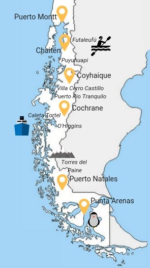
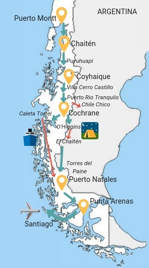
Backpacking Chilean Patagonia
As you see from the map above, Chilean Patagonia officially begins at Puerto Montt and therefore does not include the Lakes Region and Chiloe Island. If you are interested in visiting these regions as well take a look at my travel guide for Chile.
Puerto Montt
Puerto Montt is not a particularly pretty port city that, for most travelers, serves as a starting point for exploring the Carretera Austral, the nearby island of Chiloe, taking a fjord cruise to Puerto Natales, or simply ending their adventure in Chile and crossing the border to Bariloche in Argentina.
Regarding the Puerto Montt – Puerto Natales cruise, this is the reference site; the trip lasts four days and three nights, and prices vary greatly depending on cabin type and time of year but start at a minimum of $400 for a dormitory bed during high season.
From Puerto Montt to Bariloche it takes 6-7 hours by bus, costing 10,000-15,000 CLP.
Where to sleep in Puerto Montt?
Casa Perla is the cheapest option in town. The environment is homely, as the owners (amiable) live inside the house. It is not the best of accommodations, but for spending a night, it is just fine; the included breakfast is a bonus.
How to reach Puerto Montt?
From Pucon, it is about 6 hours, 10000 CLP with JAC. There are frequent minibus connections with Puerto Varas (800 CLP). From Santiago, if booked in advance, it is cheaper to fly. Also, flights to and from Punta Arenas (near Puerto Natales – Torres del Paine) are cheap if booked in advance.
Chiloé
Chiloé is the largest island in Chile and a popular tourist destination during the summertime. I haven’t personally visited the island due to time constraints, but it’s said to have an exceptional character, as confirmed by many other travelers.
In any case, I’ll leave you with this article, which will give you an idea about the island.
How to reach Chiloé?
Some buses leave practically at all hours of the day from Puerto Montt. It is about 3 hours, 6000 CLP.
Carretera Austral
The Carretera Austral is a 1240-kilometer-long road from Puerto Montt to Villa O’Higgins. Construction began in 1970 and is still a work in progress. Many sections are still unpaved and not in excellent condition. The road passes through spectacular landscapes in a sparsely populated area where wilderness still reigns.
With this mini-guide, I want to cover the most popular destinations and provide helpful information to enjoy this fantastic adventure to the fullest, always keeping an eye on the budget, as the whole area is costly compared to the rest of Chile, which is not a very low-cost country to begin with.
First, if you are really on a budget, I recommend stocking up on food in Puerto Montt, where there is a big supermarket. I also recommend withdrawing enough cash. There is a Banco Security counter in Puerto Montt, which, along with Banco Internacional, are the only two Chilean banks that do not charge any withdrawal fees.
Puerto Bertrand.
How to travel along the Carretera Austral?
There are four ways to travel along the road:
- Hitchhiking is extremely popular, especially among backpackers. It’s a widespread practice in Chile. However, especially during January and February, the competition among hitchhikers is high, with the risk of getting stuck in the middle of nowhere. Therefore, it’s advisable to bring a tent.
- Public transportation exists along the road, but it’s much more expensive than in the rest of the country, and for specific routes, it’s infrequent, requiring good planning. If you decide to rely on public transportation, I recommend buying tickets for the next destination asap, as there is a risk of running out of seats, especially during January-February is likely.
- Renting a car in Puerto Montt costs about 25-30€ per day, which isn’t that bad if split with a couple of people.
- Cycling is a popular option. It’s a destination favored by bicycle tourists worldwide, but some people do it on foot as well.
I used a combination of public transportation and hitchhiking. Below, I list the most popular stops along the way.
Chaiten
It is a small town at the beginning of Carretera Austral that was partially destroyed by the eruption of the nearby volcano in 2008.
The main attraction here is Parque Pumalin, which came into existence in 1991 after Douglas Tompkins (founder of “The North Face” brand) acquired about 42,000 acres. In the following years, he purchased another 700,000 acres, creating a series of trails, campgrounds, and publicly accessible facilities.
Here you can find all available trails, campground information, park history, etc.
I did the only trail to Chaiten Volcano (All Trails), which I recommend. It is a 2-3 hour round trip to get to the smoking base of the volcano and then down the same trail. The scenery, given the recent eruption, is awe-inspiring.
I reached the beginning of the trail, a few kilometers north of Chaiten, by hitchhiking. Still, a day tour of the volcano included transportation and a guide, which should cost about 5,000 CLP.
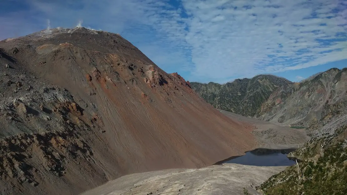
Chaiten volcano.
How to reach Chaiten?
From Puerto Montt, the bus leaves every morning at 7:00 am; the trip between fjords and snow-capped mountains is very scenic. It takes about 8 hours, including two ferry crossings, costing 14,000 CLP. There is also a ferry that arrives weekly from Chiloé.
Where to sleep in Chaiten?
I slept at Hostel Las Nalcas, which seems to be the cheapest option in town. The lady is friendly, and there is access to the kitchen. The cost is 10,000 CLP per night in the dormitory. All in all, I recommend it.
Futaleufu
It is a small village surrounded by mountains, only 16 km from the border with Argentina. Many people visit this small village nestled among the hills primarily for rafting; there are level 4 and 5 rapids along the beautiful river. The cost is about 45,000 CLP for a half-day tour.
In addition to rafting, there are a couple of scenic spots around town, including the nearby “Reserva Nacional Futaleufu,” which offers a couple of marked trails (free admission). The tourist office (Google Maps) near the plaza provides maps of the area’s trails.
How do I reach Futaleufu?
Two buses a day make the Chaiten-Futaleufu route. It takes about 4 hours, and the cost is only 2000 CLP (the state subsidises them).
From Esquel to Argentina, it is about 3 hours, 4500 CLP.
Where to sleep in Futaleufu?
Hostal y Cabanas Los Abuelos is the only real hostel in the village, and it costs 10,000 CLP for a dormitory bed. There are, however, plenty of accommodations scattered around the town that offer private rooms for the same price.
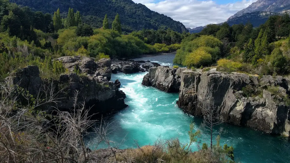
Futaleufu river.
Puyuhuapi
It is a small German-influenced town overlooking one of the many fjords characterizing the region. There isn’t much to do in the city except for a viewpoint (not too impressive either), but it serves as a good base for exploring the nearby Queulat National Park (11000 CLP), where you can see the majestic Ventisquero Colgante Glacier (hanging glacier). You have to book your visit on the official website. A little further south (Google Maps) you can visit the fascinating Bosque Encantado (3000 CLP).
Luckily, it is possible to hitchhike to both places on the same day, then return to Puyuhuapi to spend the night and depart for Coyhaique the following day. Theoretically, there is even a private bus that leaves if there are enough people interested in the Puyuhuapi -> Queulat -> Bosque Encantado -> Puyuhuapi “tour.”
From what I remember, only two buses a week run the Puyuhuapi -> Coyhaique route, but things may have changed, and it is worth talking to locals as some of these companies do not have websites.
How to reach Puyuhuapi?
From what I know, there are only two buses a week that travel the Chaiten -> Puyuhuapi route, and these typically run on Wednesdays and Sundays during the summer. In any case, I recommend checking the website. I hitchhiked the stretch of road.
Where to sleep in Puyuhuapi?
Hostel Evelyn on the left along the main road toward the end of the village is the cheapest option, at 8000 CLP, but in all honesty, it is not the best.
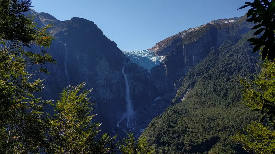
Ventisquero Colgante.
Coyhaique
It is the largest town along the Carretera Austral. There are two supermarkets here with decent prices compared to the rest of the region, so I recommend stocking up. Coyhaique National Reserve is not far from town, but from what I’ve read, it doesn’t seem to be anything spectacular. My advice is to take advantage of the supermarket, spend the night, and continue past it the next day.
How do you reach Coyhaique?
In addition to the two becker buses that run the Chaiten -> Puyuhuapi route a week, there should be another minibus that only runs the Puyuhuapi – Coyhaique route once a week. I hitchhiked this stretch of road.
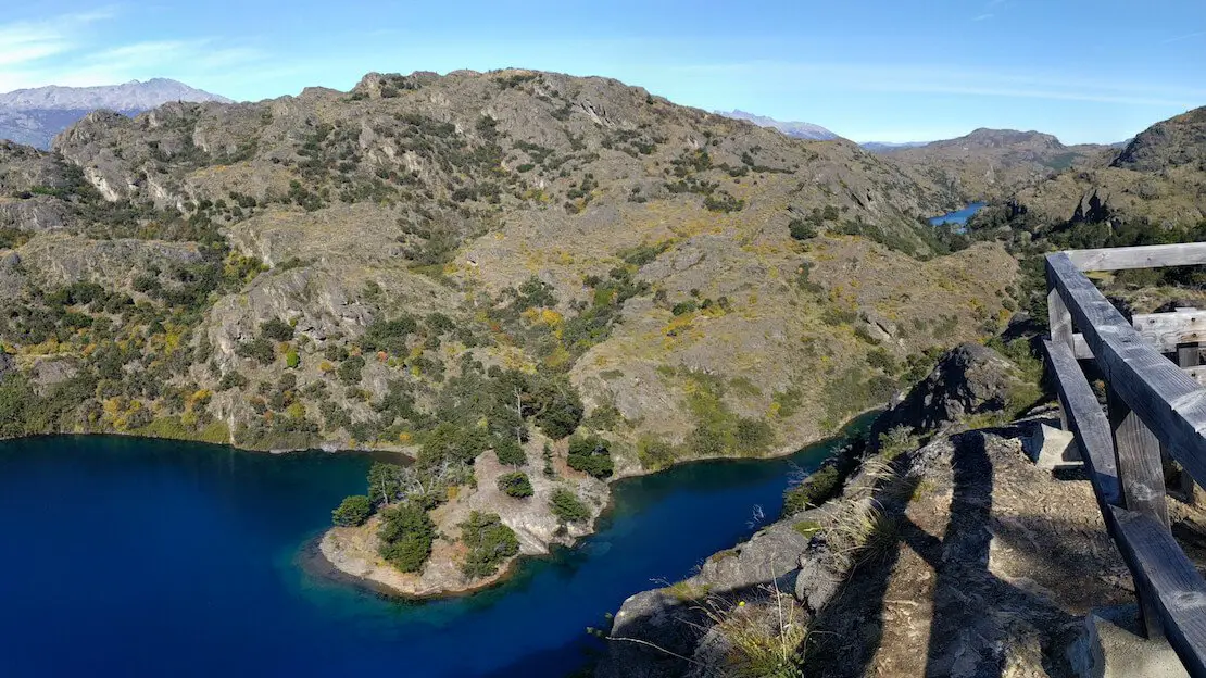
Villa Cerro Castillo
About 100 km south of Coyhaique, crossing the highest pass on the Carretera Austral at 1100 m, you’ll find the small town of Villa Cerro Castillo. Here, the main attraction is the nature reserve of the same name.
If you have camping gear, it is possible to complete some multi-day treks. Otherwise, I recommend the day hike to the lagoon below Cerro Castillo (All trails). The hike is spectacular and highly recommended. At an average pace, it is about 3-4 hours up and 2-3 hours down.
Entry to the reserve costs 5,000 CLP, but in early April, no one was there to collect the money.

Cerro Castillo.
Where to sleep in Villa Cerro Castillo?
Sendero Patagonia is by far the best hostel along the Carretera Austral: hot water, a nice kitchen, Wi-Fi, and a heated common area. Especially during the high season, I recommend booking well in advance on their website. They also allow camping. The owners are friendly and know the area very well, so they can give you all the information you need to spend one or more days trekking inside Cerro Castillo Reserve. Highly recommended.
How to reach Villa Cerro Castillo?
Some minibusses run the Coyhaique – Cochrane route daily; one company is called Buses Don Carlos, with daily departures at 9:30 am. You can find the complete list of companies here (day abbreviations are in Spanish). I hitchhiked this stretch of road.
Puerto Rio Tranquilo
It is located about three hours south of Villa Cerro Castillo. A visit to the “Capillas de Mármol” marble caves (Google Maps) is highly recommended here. The excursion costs between 5,000 and 10,000 CLP; the price is negotiable as many companies you find at the port compete and are willing to drop prices to fill the boat. Tours start at all hours of the day, so if possible, I recommend waiting for a sunny time so that the caves’ colors and the water render more vibrantly.
Many end or begin their adventure along the Carretera Austral in Puerto Rio Tranquilo and cross the border into Argentina. To do so, one must first head to Chile Chico, where a company operates the route daily (17,000 CLP). From the border, there is a minibus shuttle to Los Antiguos; the alternative is to walk for about an hour and a half. Once in Los Antiguos, buses along Ruta 40 are frequent.
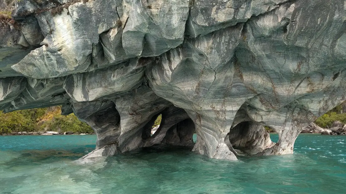
Capillas de Mármol.
Since I no longer run ads, if you found this article helpful, please consider purchasing your travel insurance through one of the links on this site. Doing so supports my work at no additional cost to you. For EU and UK residents, I recommend True Traveller. For everyone else, I recommend HeyMondo, which offers a 5% discount. Thank you for your support!
Where to sleep in Puerto Rio Tranquilo?
Hospedaje y camping bellavista is really good. The place has a clean, spacious common area, a well-stocked kitchen, hot water, and wifi. They have private rooms and dorms.
How to reach Puerto Rio Tranquilo?
From Argentina, follow the instructions above. When coming from Villa Cerro Castillo, you can take any minibus that runs the Coyhaique – Cochrane route daily. For this stretch of the road, after attempting to hitchhike for a couple of hours in Villa Cerro Castillo, I boarded the second bus of the day, paying around 7000 CLP.
Cochrane
The drive to Cochrane, the second largest town after Coyhaique along the Carretera Austral, is scenic. Once in town, there is a fairly large supermarket on either side of the main square, free wifi around the central park, and a bank. Here, I recommend stocking up on food if you need it.
About 5 km from town is the Tamango National Reserve, which can be easily visited in a day and offers many excellent, well-maintained trails. This is the trail I hiked.
For the more adventurous and prepared, a trail network allows you to cross the entire Tamango Reserve, enter Parque Patagonia further north, and reach Chile Chico in 3 to 5 days. Find a description of the hike here.
Cochrane Lake.
Where to sleep in Cochrane?
There are several accommodations and hostels scattered around the city. I was approached by a lady who offered me a private room for 8000 CLP while using the wifi in the plaza. The address should be 200 Teniente Merino. In any case, there is no shortage of options.
How to reach Cochrane?
This is the same bus “line” that covers Villa Cerro Castillo and Puerto Rio Tranquilo, so you can take any minibus that runs the Coyhaique – Cochrane route daily. I hitchhiked early in the morning; after 10 minutes, a couple of Chilean tourists headed to Caleta Tortel gave me a ride.
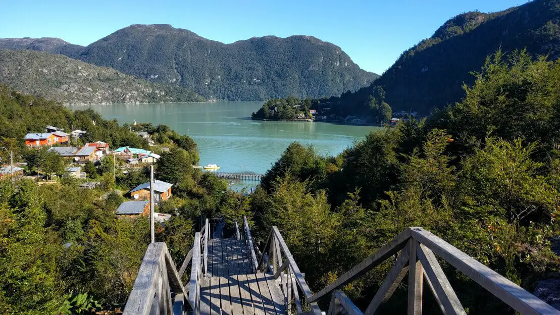
Caleta Tortel
It’s an attractive little town, picturesque and unique because there are no roads, only a system of wooden boardwalks connecting various points. The town was first connected by land to the rest of Chile only in 2003 and immediately became a significant tourist attraction.
In addition to strolling along the boardwalks and savoring the magical atmosphere of this small village lost in the Chilean fjords, I recommend climbing to the Mirador Cerro Vijia (Google Maps), which overlooks the town on the left and the mouth of the Rio Cochrane on the right, with the mountains in the background.
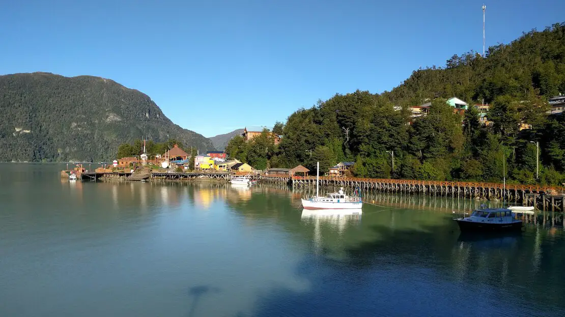
Caleta Tortel.
From here, you have two options to continue your journey south, besides, of course, turning back to Chile Chico and crossing the border, or perhaps reaching Puerto Montt to fly to Punta Arenas (or whatever other route you have in mind!):
- Reaching Villa O’Higgins (where the Carretera Austral officially ends), theoretically, there is also a direct bus that covers the Caleta Tortel – Villa O’Higgins route, but I am not sure. There isn’t much to do here, and getting there is simply a matter of principle for many. Crossing the border into El Chalten in Argentina is possible, but it’s not easy. There are no roads, and the only way to do it is by taking a ferry (plus an optional second one) that leaves only a couple of times a week during the summer season and then walking a minimum of 22km (34km if you do not take the second ferry). The whole thing is generally done in two days and thus requires camping gear. An extremely detailed article with prices and route descriptions can be found here.
- The second option is a spectacular trip through the fjords aboard a ferry that covers the Puerto Yungay – Caleta Tortel – Puerto Natales (Torres del Paine) route in about two days. The trip costs 125,000 CLP, including food. Departures vary depending on the time of year, and booking in advance during peak season is highly advisable. This is the reference site.
Where to sleep in Caleta Tortel?
Hospedaje Giselle is the cheapest option in the village; the common area where the kitchen is located is well heated, there is a hot shower, and overall, it is a reasonable accommodation, 10000 CLP.
How to reach Caleta Tortel?
At least 2-3 companies cover the Cochrane – Caleta Tortel route almost daily. During the high season, I recommend you inquire and buy your ticket when you arrive in Cochrane. I took the bus for fear of missing the ferry I had already paid for, but as always, hitchhiking was an option.
What has been described so far are the most popular stops along the Carretera Austral, but they’re not the only ones. If your budget allows, plenty of tours, such as the one to the San Rafael Lagoon from Puerto Rio Tranquilo or the O’Higgins Glacier, would be spectacular.
Caleta Tortel.
Punta Arenas
It is the largest city in southern Chile. Many travelers use it solely as an arrival point to move on to Puerto Natales and visit nearby Torres del Paine National Park since flights from Santiago and Puerto Montt are quite cheap.
I haven’t been to Punta Arenas as my ferry from Caleta Tortel went directly to Puerto Natales, where I was to meet my sister flying in from Santiago. While waiting, she visited Porvenir by ferry, a small fishing village on the other side of the Strait of Magellan. Nothing exceptional, apparently, but an excellent way to spend a day, perhaps while waiting to catch a plane.
Another popular excursion from Punta Arenas is to Magdalena Island, which has a massive colony of penguins. However, the ferry is quite expensive.
How to get to Punta Arenas?
There are frequent buses to Puerto Natales, which is about 3 hours away, while to Ushuaia is about 12 hours. As I said before, flights from Santiago and Puerto Montt can be cheap.
Where to sleep in Punta Arenas?
Hostel Entre Vientos is an excellent hostel with breakfast.
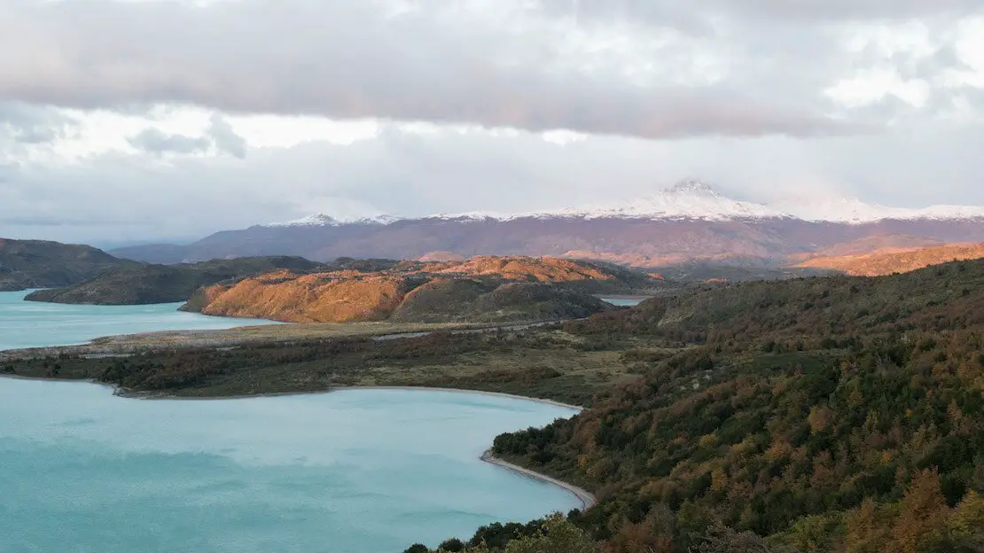
Puerto Natales
If you want to explore the famous Torres del Paine National Park, you will likely have to go through Puerto Natales sooner or later. Here, you can find several stores that rent camping gear in case you need it, and a supermarket with reasonable prices where you can stock up.
This is an excellent guide for independently organizing your trek to Torres del Paine.
Grey Glacier, Torres del Paine.
I want to stress that campsites/refugios should be booked VERY far in advance and, if possible, avoid January and February, when the park is overrun with tourists.For the rest, consult the guidebook that was just mentioned.
That being said, the park is truly stunning. I strongly recommend doing at least the W circuit. Still, if for whatever reasons you were not able to (physical condition or complete campsites/refuges, for example), then there is always the option of visiting the park in the day and seeing at least Grey Glacier and the towers, returning to Puerto Natales for the night.
Where to sleep in Puerto Natales?
Hostel 53 Sur is an excellent family-run hostel that offers a delicious breakfast buffet at an extremely cheap price.
How to reach Puerto Natales?
From Punta Arenas, buses are frequent, about 3 hours. Buses from El Calafate and El Chalten in Argentina are also frequent. From Caleta Tortel, you can travel along the Carretera Austral by ferry.
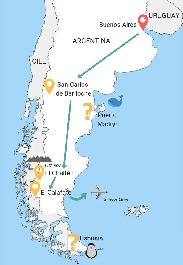
Backpacking Argentine Patagonia
While Argentina’s Patagonia officially begins further north, many consider Bariloche near the Chilean border or Puerto Madryn on the Atlantic coast as their first stops within the region. If you’re interested in visiting destinations further north, such as Iguazu Falls and others, I recommend checking out my travel guide to Argentina.
Puerto Madryn
It’s a fairly popular summer destination despite not being part of the “classic itinerary”. Here are some of the most beautiful stretches of coastline in the country, but it’s especially a great base for exploring the nearby Valdes Peninsula, where you can observe a lot of marine wildlife.
What to do and see in Puerto Madryn
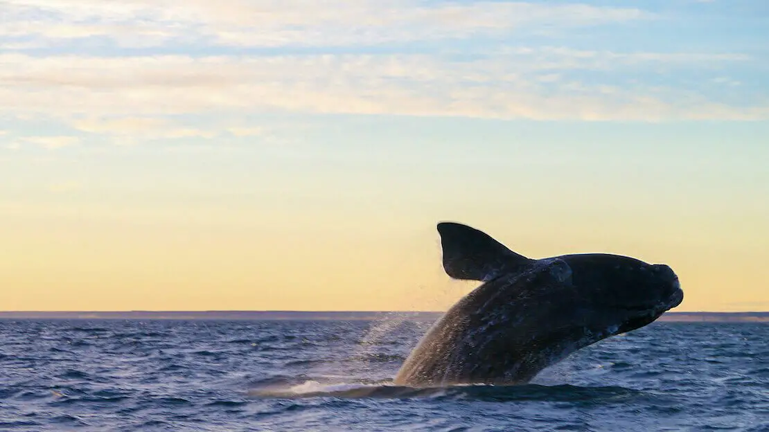
As mentioned earlier, the real attraction is the nearby Valdes Peninsula, a UNESCO site for its unique wildlife and geology. Here, it’s possible to observe some penguin colonies from October to March, while whale season is from June to mid-December. Among the many other species present are sea lions, seals, armadillos, guanacos, maras, gray foxes, and, with any luck, killer whales that attack the seals on shore at Punta Norte in April.
The most popular way to visit the peninsula is via a tour from Puerto Madryn; the tour starts around 7:30 am and ends around 7 pm, with stops at Puerto Pirámides (for whales), Caleta Valdés (penguins), and Punta Norte. Many travelers rent a car in Puerto Madryn to explore the peninsula without being tied to a tour. If you are only interested in whales, you could take a bus to Puerto Pirámides and get a boat tour. However, this is the only option with public transportation, and you would end up missing the rest of the peninsula.
Puerto Piràmides, Valdes peninsula.
Where to sleep in Puerto Madryn?
Hostel La Casa de Tounens is a really good hostel and among the cheapest in town. Breakfast is included, and the owners are extremely friendly. La Tosca is another excellent hostel with plenty of private rooms.
How to reach Puerto Madryn?
There are direct connections to Buenos Aires and Mar de la Plata to the north, Rio Gallegos to the south, and Esquel to the west.
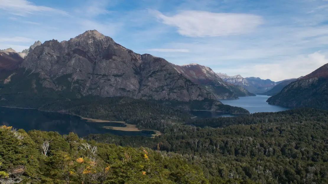
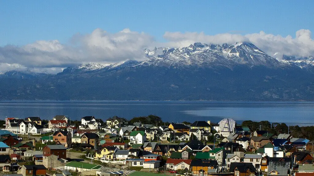
San Carlos de Bariloche
This town in the foothills of the Andes, built on the shores of Lake Nahuel Huapi and surrounded by the national park of the same name, is trendy throughout the year with tourists and locals. When the hiking season ends, the skiing season begins. Here you can find the largest ski resort in South America, Cerro Catedral, only 20 km from the center of Bariloche.
What to do and see in Bariloche
As mentioned above, the main activities are hiking and skiing. Additionally, the city is famous for its chocolate and craft beer production, offering plenty to do. Now, let’s look at some of the most popular excursions.
N.B. To use public transportation in Bariloche, you need to purchase a prepaid card called “SUBE.” It is the same one in operation in Buenos Aires, so if you already have it, keep it.
Laguna Escondida, Circuito Chico.
Chico Circuit
This is about a 60 km route that can be done by bike or bus (line 10). After talking with the hostel owner, however, I decided to do only the northern part of the circuit since, in his opinion, the next section is not as pleasant. Of course, I cannot confirm this, but I decided to trust him! Besides, the northern part of the circuit can be done on foot thanks to a system of well-marked and maintained trails that keep you away from the main paved road where all the traffic is. To do the northern part of the Chico Circuit on foot, follow these steps:
- Download organic maps. It works offline, and unlike Google Maps, all trails are plotted. With a map in front, the following directions will be much clearer.
- Take bus number 20 to Hotel Llao Llao and get off at the second-to-last stop; the last stop is the hotel itself, and then the bus turns around and returns. If, like me, you tend to “sleep,” then get off at the hotel and walk back; it’s a few hundred meters.
- Instead of heading up toward the hotel from the penultimate stop, take a right and walk along the paved road for about 1 km before finding a path on your left leading to Mirador Lago Moreno (Google Maps).
- Continue along the path until you reach the main road. Follow it for a few hundred meters before taking the path to the right. At the fork, turn left toward Laguna Escondida (Google Maps).
- You can return along the same path and continue to Mirador Del Tacul once you reach the fork where you turned left.
- I then went down to the shores of the lake to have lunch, but you can proceed straight to the Mirador del Cerro Llao Llao (Google Maps) if you prefer.
- Once you descend from the Cerro, take a right and follow the path back to the main road, not far from where you turned left to Mirador Lago Moreno earlier in the day. From here, walk to the bus stop.
The whole thing is straightforward, especially with the support of organic maps and undoubtedly a great way to spend the day.
Mirador del Cerro Llao Llao.
Cerro Campanario
Cerro Campanario (Google Maps) offers excellent views of the lakes and the mountains surrounding Bariloche. It is located along the same road that leads to the Chico circuit and can, therefore, be conveniently visited on the same day. From the bus stop, it’s about a 30-minute walk. Alternatively, you can take the cable car. To return from here to downtown Bariloche, you can take buses 10 and 21.
Refugio Frey
This lovely day hike (All Trails) can be done by taking the bus to Villa Catedral (line 55, approximately every hour). Once you arrive at the parking lot, position yourself in front of the mountain, and you will find the beginning of the trail at the bottom of the parking lot on the left; there is a sign that says “Frey.” From there, the trail that goes through the woods and leads to the hut is well-marked and maintained, as it is plotted on organic maps.
Other excursions in and around Bariloche
These hikes listed so far are the ones I’ve had a chance to do and would recommend, but there are plenty of other one- or multi-day hikes in the surrounding area. You can sleep in shelters (especially during the high season, they should be booked in advance) or in a tent if you bring one with you. If you’re an avid trekker and you have time on your hands, I recommend you check out this site.
Ruta de Los siete Lagos (the road of the seven lakes)
This is the name of road 234 between San Martin De Los Andes and Villa La Angostura. The 107-kilometer-long road passes through Lanin and Nahuel Huapi National Parks and, as you might have guessed, gives access to several lakes. One-day tours are offered from Bariloche, but many travelers prefer to rent a car for a couple of days and camp, while others hitchhike; the choice is yours. You can find an account of the circuit done by car here.
If interested, you could spend a few nights between San Martin De los Andes and Villa La Angostura. I was told there is not much to do, however, both are picturesque villages where you could spend a few days relaxing.
Laguna Toncek, Refugio Frey.
Where to sleep in Bariloche?
Bariloche Hostel is a great budget hostel near the center of Bariloche; it has friendly and helpful staff, a well-equipped kitchen, and a common area overlooking the lake.
How to reach Bariloche?
From here, there are direct buses to Buenos Aires, Mendoza, Cordoba, and all destinations south along Ruta 40 (Esquel, El Bolson, El Calafate, El Chalten). You can also take buses to continue your trip in Chile to Puerto Montt and Osorno, which are not far away or go to Santiago.
El Bolsón
It is a small village near Bariloche that is particularly popular with hippies worldwide, Argentine students, and travelers. There are many self-sustaining communities and more general ecotourism-related activities.
What to do and see in El Bolsón
As you may have already guessed, many people come simply to relax and spend a few “alternative” days in this small town scattered among the mountains, tasting artisanal beer and ice cream, visiting the local market, practising yoga, etc. For trekking lovers, many one- or multi-day hikes allow them to sleep in shelters starting from El Bolsón. For information on this, you can check out this site or, once you arrive, visit the tourist center directly.
Where to sleep in El Bolsón
Hostel “La Casita Naranja” is an excellent hostel near downtown, with a relaxed atmosphere.
How to get to El Bolsón
The village is literally crisscrossed by Ruta 40, so all the buses going south from Bariloche pass through there. From the coast, there are connections to Trelew.
Esquel
The town is about 150 kilometers south of El Bolsón and is an ideal base for visiting the nearby Los Alerces National Park. Although not very popular, it is considered among the best in the country and is definitely worth a visit.
N.B. Esquel is only 60 km from the Chilean border, and there are daily buses to the border, where you then connect to the not-so-distant Futaleufu in Chile itself. From here, you can continue your journey southward into Chile along the Carretera Austral and avoid the great expanse of nothingness that separates Esquel from El Chalten. You can then re-enter Argentina, for example, from Chile Chico.
What to do and see in Esquel
The town itself is nothing special, and as mentioned above, the only worthwhile reasons to visit are the nearby national park and short excursions in the surrounding area.
Los Alerces national park.
Los Alerces National Park
The park can be visited in a day, or you can opt to camp overnight. There are equipped campsites for a fee and some lodges that offer various services at different price points. I had planned to spend a few nights in a tent, but unfortunately, due to the time of year (May), many trails were closed or under maintenance.
In any case, a company operates the route from the bus terminal to the park with several daily departures (schedules vary depending on the time of year; upon arrival at the bus terminal, inquire for information immediately). The minibus stops at the entrance for about ten minutes, allowing passengers to disembark and visit the ranger’s office for a map or any necessary information. I also received a brief lesson on the park’s flora and fauna from the friendly ranger. It was then that I learned that many trails were closed, prompting me to turn my visit into a day hike and forego paying the entrance fee, perhaps due to it being the off-season when many trails were closed.
For a day hike, I recommend returning to the bus and disembarking at the start of the trail to the Laguna Verde Mirador, where a lovely viewpoint awaits. Afterward, return to the road and head toward Puerto Chucao, crossing the bridge. Along the way, you’ll encounter an approximately 300-year-old larch tree (indicated by a sign). Upon reaching the pier, the trail continues, eventually completing a loop that leads back to the bridge. Then, return to the main road and proceed to Laguna Escondida before making your way back to the road, where you can catch the first bus back to Esquel. All the trails and points of interest just mentioned are plotted on organic maps.
There are plenty of other, more or less strenuous trails within the park. If you visit during the high season, there is a ‘combined boat and hike’ from Puerto Limonao to a larch-only forest where you can see “El Abuelo,” a specimen about 2,600 years old.
On the way to Laguna Escondida.
Where to sleep in Esquel?
Dormís Acá is a somewhat expensive hostel, but there is not much competition in town. Still, the service offered is great, and breakfast is included.
How to reach Esquel?
There are daily buses to Buenos Aires, Puerto Madryn, Bariloche, and the Chilean border. However, connections to the south (El Chalten, El Calafate) are often every other day, especially in the low season.
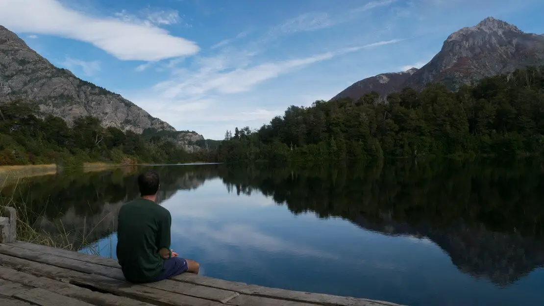
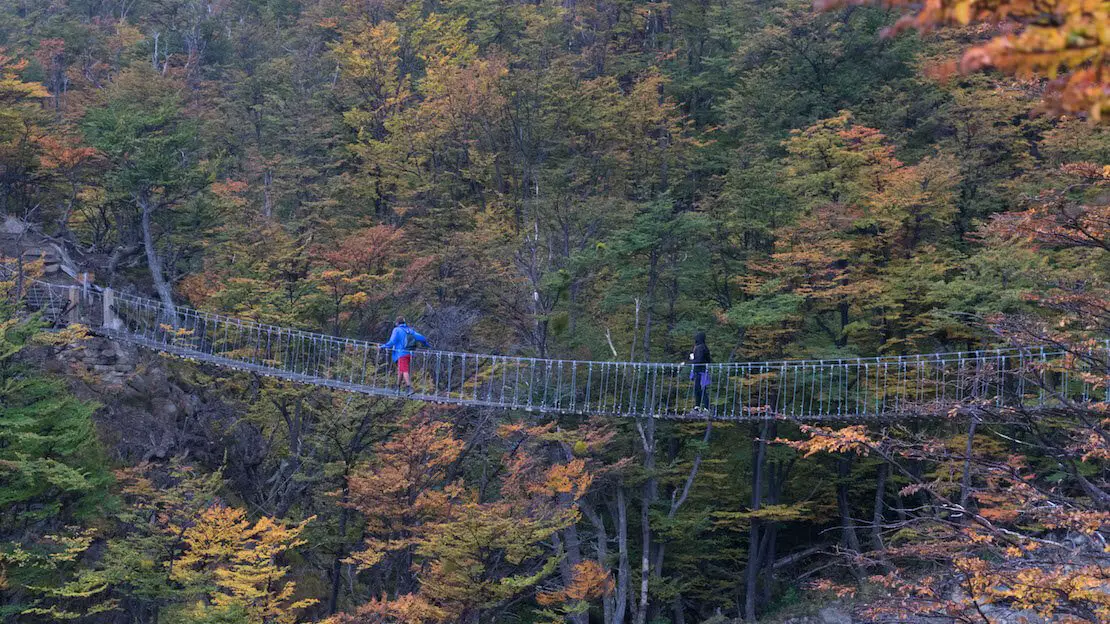
El Chalten
The small town, which began as an Argentine outpost in the late 1970s to anticipate possible territorial claims by Chile, has become a significant tourist hub over the years due to its proximity to two of the most famous peaks in the Andes: Cerro Torre and Mount Fitz Roy.
What to do and see in El Chalten
As you may have already guessed, the main activity is trekking. Coming from El Calafate, our bus stopped at the tourist center before entering the village (I think this is standard procedure). Here we got tips and information for visiting the park (free of charge) before boarding the bus back to the terminal.
There are many one-day and multi-day hikes around El Chalten, and it is possible to camp for free in dedicated areas along the trails. Below, I list the most popular ones. The trails are well marked, and as always, you can find them well mapped out organic maps.
Mount Fitz Roy and Laguna de Los Tres
Los Tres Lagoon is located at the famous Fitz Roy Mountain base. This is a genuinely spectacular trek and not particularly challenging except for the last kilometer and a half, which is entirely uphill. From the center of El Chalten, it is about 22 kilometers round trip and 800 meters of elevation gain, taking 6-8 hours depending on the pace (All Trails); my advice is to leave early to avoid the crowds and especially the clouds that often obscure the summit later in the day. If you have a tent, you can camp at “Campamento Poincenot,” at the base of the last climb. By leaving early the next day and with any luck, you can watch the first light of day hit this spectacular peak and have your postcard photo.
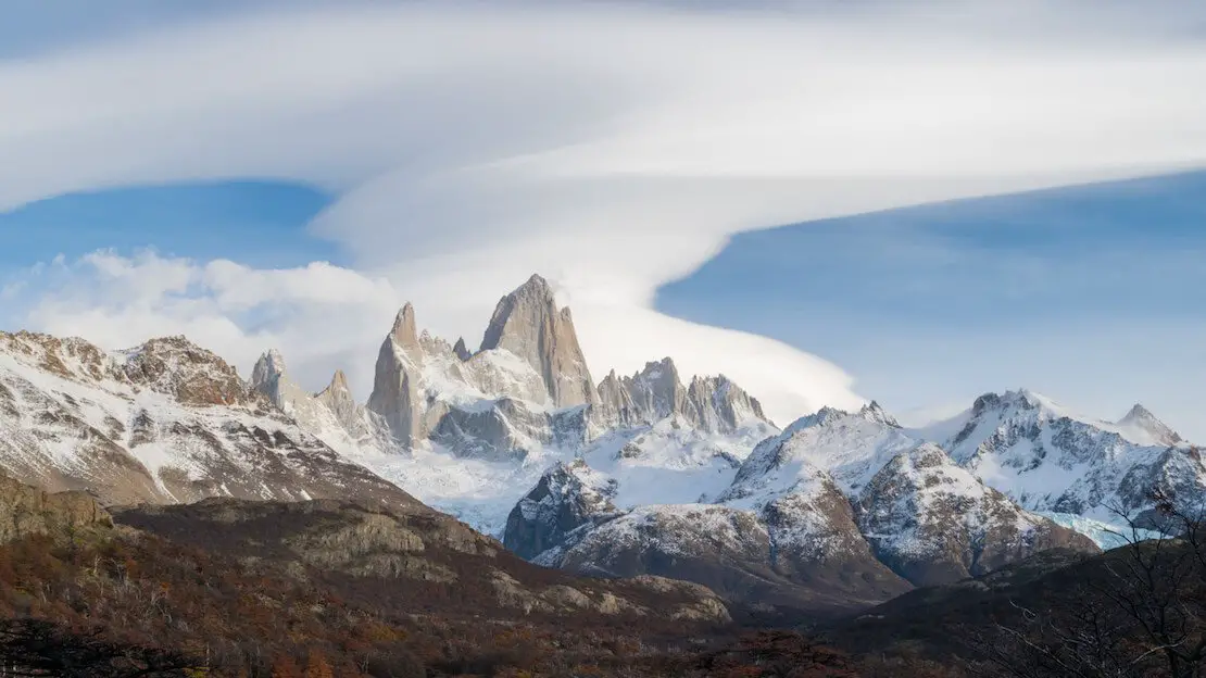
Fitz Roy.
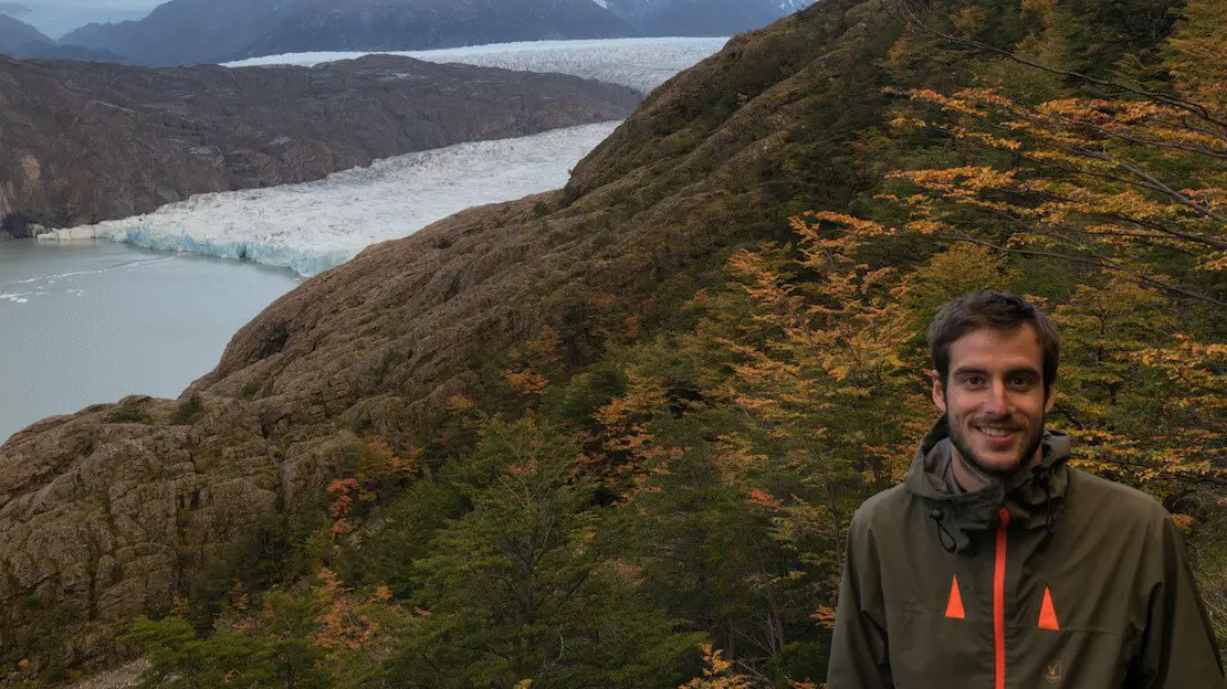
Cerro Torre and Laguna Torre
Cerro Torre is a legendary peak among mountaineers worldwide because of its controversial history and especially the fact that despite being only 3128 meters high, it remains one of the most challenging mountains to climb. Trekking to the Torre Lagoon, which lies at the base of this legendary peak, is another excellent El Chalten classic. From the village center to the lagoon is about a 19 km round trip, mostly flat; it is only 250 meters of elevation gain (All Trails). Again, the peak shrouded in perennial ice is often surrounded by clouds, so I recommend leaving early in the morning; as you can see from the photo, I had no luck this time. If you are up for a long day, you can combine both trails as described here.
These are by far the two most popular treks I recommend in El Chalten; other short hikes to do, perhaps between days to rest or perhaps while waiting for the night bus as I did, are those to Mirador Condor and Mirador Las Aguilas (Google Maps) – the two hills behind the tourist office. The Chorillo del Salto waterfall (All Trails) is a pretty waterfall that is only 5 km completely flat from the center of El Chalten.
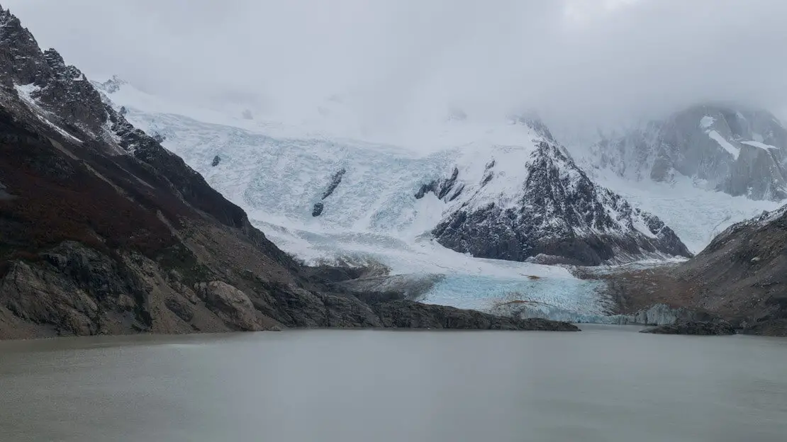
Laguna Torre.
Where to sleep in El Chalten?
As you can tell by the fall colors in the photos, I visited El Chalten during the off-season. With my sister and a couple of friends, we booked an apartment inside a house with a heated pool for just over 10 euros a night. If you travel alone Rancho Grande Hostel seems to be a good budget hostel.
How to reach El Chalten?
From Bariloche northward, there are daily buses during the high season (about 24 hours). All pass through El Bolson, Esquel, Perito Moreno (the town, not the glacier), and Los Antiguos, where you can cross the border into Chile Chico in Chile.
From El Calafate, there are several buses a day, it takes a little over two hours.
N.b. If you are coming from the south and want to continue your journey north along the Carretera Austral in Chile, you can cross the border to Villa O’Higgins by combining ferries and trekking. This article covers everything.
El Calafate
It is a small town not far from El Chalten that has become a regular stop for those visiting Argentine Patagonia over the years because the famous Perito Moreno glacier is about 80 km from the city.
What to do and see in El Calafate
There are many excursions offered in the town, glacier trekking, boat tours, 4×4, and even helicopter tours, but I honestly don’t have any information about them. I assure you they are not low-cost, so I will only talk about the visit to Perito Moreno, which in itself is not cheap.
Perito Moreno Glacier
If you’re traveling alone, the most convenient way to reach the park is by one of the many mini buses departing from the bus terminal. Alternatively, hitchhiking, especially during high season, can be a viable option.
For those traveling in a group or as a couple, consider the following options: a round-trip taxi with a 2-hour stopover. With four people, this was cheaper than taking the bus. During that trip, I was accompanied by my sister, two friends, and another person interested in sharing expenses, so we opted to rent a car from a local agency. This was a lot cheaper cheaper and more convenient than taking the minibus. In summary, do the math. Admission to the park is 10000 ARS.
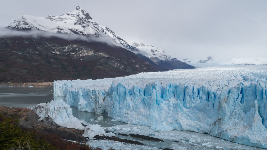
Ghiacciaio Perito Moreno.
The park is well-maintained, with a series of boardwalks, similar to those at Iguazu Falls, leading to various viewpoints offering different perspectives of the glacier, allowing visitors to get relatively close. Upon arrival, I recommend consulting the map to plan your route. Bringing a packed lunch is advisable. Although the site is impressive, a couple of hours are typically sufficient to explore the various trails and admire the glacier.
Where to sleep in El Calafate?
Again, thanks to the low season, we slept four at Apart Hotel el Jardin de los Presentes for about 10 euros each. It is a charming mini apartment on two floors, but I doubt it is that cheap in high season. If you are traveling alone, Bla Guesthouse seems to be a reasonably inexpensive facility.
How to reach El Calafate?
To El Chalten (to the north), connections are frequent, 2 1/2 hours. Puerto Natales in Chile (to the south), where Torres del Paine is located, is about 5 hours away by bus. In fact, if you intend to reach Ushuaia by land from here, you have to cross a piece of Chile.
Ushuaia
Here we are at the “end of the world.” Located in the so-called “Tierra del Fuego,” it is considered by many to be the southernmost city in the world; this is more of a tourist slogan because, technically, the record would belong to Puerto Williams in Chile. You can take a look at the curious ranking here.
What to do and see in Ushuaia
I will preface this by saying that I stopped in Puerto Natales without going that far south, partly because of time issues, partly because of budget issues (the city is costly), but mainly because I was told that the city does not have much to offer, unless you can afford a cruise to Antarctica – it starts at a minimum of 4000€ for a last-minute one! The nearby Tierra del Fuego National Park was described to me as the least spectacular in the whole of Patagonia, the entrance is 12000 ARS, prices updated in July 2024, all the trails can be completed in one day. In short, in my opinion, for many, it is more a matter of saying, “I have been there.”
Ushuaia.
Where to sleep in Ushuaia?
In high season, expect to pay around 20 euros per night for a dorm bed; you can take a look here.
How to reach Ushuaia?
There are daily buses to and from Rio Gallegos in Argentina. From there, there are connections to all destinations in Argentine Patagonia. From Punta Arenas in Chile, there are frequent connections to Puerto Natales. By air, there are several flights a day to and from Buenos Aires.
Since I no longer run ads, if you found this article helpful, please consider purchasing your travel insurance through one of the links on this site. Doing so supports my work at no additional cost to you. For EU and UK residents, I recommend True Traveller. For everyone else, I recommend HeyMondo, which offers a 5% discount. Thank you for your support!
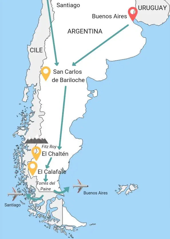
Recommended travel routes in Patagonia
Below I list some travel itineraries ranging from Chilean or Argentine Patagonia alone, and a few itineraries that touch both regions. Of course, take the following itineraries as inspiration and modify them according to your interests and what you have read so far.
Itinerary Patagonia 15 days
This is the “classic itinerary” that covers the major tourist destinations, from the Perito Moreno Glacier to Torres del Paine National Park, passing through El Chaltén. These are the highlights of Patagonia.
The itinerary can be easily followed starting from either Santiago or Buenos Aires. There are direct buses from both capitals to Bariloche (the first stop), and the travel time is similar. If you prefer to fly or intend to visit Puerto Madryn, then Buenos Aires is more convenient.
Buenos Aires/Santiago (1 night)
Day 1:
I recommend spending the day in Santiago or Buenos Aires and taking the night bus the next day.
Bariloche (3 nights)
Day 2:
Transfer to Bariloche.
Day 3:
Chico Circuit. Cerro Campanario.
Day 4:
Trekking to the Frey Refuge.
El Chalten (3 nights)
Day 5:
Overnight bus to El Chalten in the afternoon.
Day 6:
Trekking to Laguna de los Tres (Fitz Roy Mountain).
Day 7:
Trekking to Laguna Torre.
El Calafate (1 night)
Day 8:
Transfer to El Calafate in the morning. Visit Perito Moreno in the afternoon.
Puerto Natales (5 nights)
Day 9:
Transfer from El Calafate to Puerto Natales. Preparation for next day’s trek.
Day 10:
Day one of the W trek in Torres del Paine.
Day 11:
Day two of Trekking W in Torres del Paine.
Day 12:
Day three of Trekking W in Torres del Paine.
Day 13:
Day four of Trekking W in Torres del Paine.
Day 14:
Day 5 of Trekking W in Torres del Paine. Return to Puerto Natales and possibly spend the night in Punta Arenas if you need to return to Santiago or Río Gallegos if you need to return to Buenos Aires.
Day 15:
Flight Punta Arenas – Santiago or Río Gallegos – Buenos Aires.
Patagonia Argentina backpacking itinerary (2 weeks)
If, for any reason, you prefer to limit yourself to Argentine Patagonia alone, I suggest following the previously described itinerary starting in Buenos Aires. Instead of visiting Torres del Paine National Park, once you arrive in El Calafate, continue to Ushuaia.
You also have enough time to visit Puerto Madryn at the beginning of the trip, either before or after Bariloche.
Chilean Patagonia backpacking Itinerary (20 days)
This itinerary includes the Carretera Austral. If you have a few extra days, I also recommend visiting the lakes region further north, especially Pucon, Puerto Varas, and Chiloe Island, which I discuss in my travel guide for Chile. If you are not interested in traveling the Carretera Austral, I suggest visiting the lakes region and, once you arrive in Puerto Montt, either fly to Punta Arenas or take the ferry.
Santiago (1 night)
Day 1:
Spend the day in Santiago and take a bus to Puerto Montt the next day.
Puerto Montt (1 night)
Day 2:
There is not much to do in town, the only thing I recommend is to get your ticket as soon as you arrive for the 7:00 a.m. bus the next day to Chaiten.
Chaiten (2 nights)
Day 3:
Transfer to Chaiten.
Day 4:
Short trek to the volcano.
Puyuhuapi (2 nights)
Day 5:
Transfer to Puyuhuapi.
Day 6:
Visit the nearby Ventisquero Colgante Glacier and Bosque Encantado.
Villa Cerro Castillo (2 nights)
Day 7:
Transfer to Villa Cerro Castillo via Cochrane.
Day 8:
Trekking to Cerro Castillo.
Puerto Rio Tranquilo (1 night)
Day 9:
Transfer to Puerto Rio Tranquilo, visit the marble caves in the afternoon.
At this point you could continue on to Caleta Tortel from where you can take the ferry to Puerto Natales (it leaves once a week and if you can fit the timing in I recommend it!), make the adventurous crossing to Villa O’higgins or as many do-and I illustrate in this itinerary-cross the border to Los Antiguos in Argentina and, since you are on the way, stop in El Calafate and potentially even El Chalten.
EL Calafate (2 nights)
Day 10:
Transfer to Los Antiguos and overnight bus to El Calafate.
Day 11:
Visit the Perito Moreno Glacier.
Puerto Natales (5 nights)
Day 12:
Transfer from El Calafate to Puerto Natales. Preparation for next day’s trek.
Day 13:
Day one of the W trek to Torres del Paine.
Day 14:
Day two of Trekking W in Torres del Paine.
Day 15:
Day three of Trekking W in Torres del Paine.
Day 16:
Day four of Trekking W in Torres del Paine.
Day 17:
Day five of Trekking W in Torres del Paine. Return to Puerto Natales.
Day 18-19:
Transfer to Punta Arenas. Return to Santiago. Return to Italy.
Theoretically you have one day left, but it is good to have some margin in case something does not go according to plan.
Torres del Paine.
How to get around Patagonia
Buses in Patagonia
In both Chilean and Argentine Patagonia, buses are by far the most popular and cheapest way to get around. During the high season departures are frequent (less so along the Carretera Austral) but there are also a lot of people so I recommend buying tickets for the next destination as soon as you get somewhere.If you wanted you could buy some tickets online on sites like Busbud but especially in Argentina it is normally much cheaper to buy the ticket at the terminal.
For long distances there are different types of buses: “cama” are the most comfortable and have only three rows of seats, are extremely spacious and recline up to 160 degrees. Often double-decker buses have the second floor with cama seats while the second with semi-cama seats, which, in addition to being narrower (classic rows of 4), recline less.
Flights in Patagonia
As far as Chilean Patagonia is concerned, along the Carretera Austral the only busy airport is Coyhaique, while further south the airport of choice is Punta Arenas. Flights, if booked in advance, are quite cheap. I recommend checking out LATAM, Sky Airline and JetSMART.
While in Argentine Patagonia the two main ones are Rio Gallegos and Ushuaia, Aerolineas Argentinas, Latam, Andes, Avianca are the companies that operate domestic flights. Flybondi is a new low-cost airline that covers several routes; it is worth a look.
LADE is a small state-subsidized company that operates flights mainly in Patagonia and offers really competitive prices, often lower than the cost of buses.
Check their website for times and routes, but make reservations at the office or by phone because the website often shows availability when there isn’t any. It is best to ask a local to call or book for you, as they have priority over foreigners.
Hitchhiking in Patagonia
Hitchhiking is an extremely common and safe practice in this part of the world, both in Argentina along Ruta 40 and in Chile along the Carretera Austral. Competition, however, is really high especially during the high season.
Ferry Caleta Tortel – Puerto Natales.
Backpacking Patagonia: costs
How much does a trip to Patagonia cost?
Much depends on the time of year and travel style. If you travel with a tent, camp every chance you get, make your own food, and hitchhike, Patagonia can be a relatively inexpensive place to travel.
But in general the whole region is expensive with a dormitory bed that can easily cost even more than 20€ per night during January and February. Even bus travel is quite expensive, especially in Argentina.
That said, as a backpacker you should have no problem with a daily budget of about 30-40€ per day as long as you sleep in hostels, cook most of your meals and get around by bus. If you then, as mentioned above, hitchhike and sleep in a tent whenever possible, then you can safely go down to 15-20€ per night.
In the cost section concerning Argentina, it’s important to note the exorbitant fees associated with ATM withdrawals. Unlike other countries I’ve visited in Central and South America, Argentina lacks banks that offer free withdrawals. Each transaction at ATMs incurs a fee of approximately 4-5 € on top of your bank’s charges, with a maximum withdrawal limit of just over 100€. The most practical solutions are to bring cash (euros or dollars), which can be exchanged at more favorable rates than the official exchange rate. Whenever possible, opt for card payments to avoid these high fees.
By law in both countries, payments for lodging (excluding food or additional services) made with a foreign credit/debit card (including U.S. dollars in Chile) are exempt from VAT (21% in Chile and 19% in [Argentina]). Despite this, some establishments may incorrectly claim otherwise or assert that their card reader is ‘out of order.’ If the requirement to pay in cash (‘efectivo only’) was not specified at the time of booking, ensure to clarify. On several occasions, I have successfully avoided paying VAT after a brief discussion—it’s your entitlement.”
Torres del Paine.
Patagonia Patagonia: What to bring
To get started, I recommend checking out my list of essential items for your trip. This list also includes camping equipment, which I strongly suggest if you plan on trekking for several days. However, keep in mind that renting equipment is always an option, allowing you to avoid carrying unnecessary weight.
Don’t worry too much about the cold. Personally, even in late April, I managed well by layering a thermal shirt, sweater, and sweatshirt. Essentially, try to travel as light as possible.
Backpacking Patagonia: safety
South America does not have the best reputation when it comes to safety, particularly in countries like Chile and especially Argentina, where the big cities can be concerning. However, Patagonia stands out as an exception. In this region, crime is virtually nonexistent, the people are extremely welcoming and hospitable, and the chances of being robbed or encountering an unpleasant situation are much lower than in any large western city. If you want to read some tips and tricks on traveling without worries, I recommend this article.
As always when traveling it is important to use common sense and not take unnecessary risks, I invite you to read my tips on how to travel safely anywhere in the world but you will see that during your trip to Patagonia the safety issue will not be a problem at all!
Do you have any questions? Updated information? Feel free to leave a comment or message me on Instagram!
Since I no longer run ads, if you found this article helpful, please consider purchasing your travel insurance through one of the links on this site. Doing so supports my work at no additional cost to you. For EU and UK residents, I recommend True Traveller. For everyone else, I recommend HeyMondo, which offers a 5% discount. Thank you for your support!
For donations/pizzas and virtual beers 🙂
Did you like the post? Pin it!
