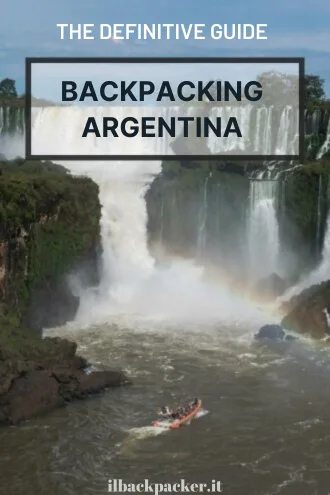
Argentina Travel Guide
Argentina has always been one of the most popular countries to visit in South America. From the vibrant atmosphere of Buenos Aires, to natural wonders like Iguazu Falls and the Perito Moreno Glacier in Patagonia, and culminating with the vineyards of Mendoza and delectable meat dishes, the country offers something for everyone.
Unfortunately, I only had a few weeks to explore this vast country, which ranks as the eighth-largest in the world by area. Nevertheless, I had the pleasure of experiencing its natural beauty, cuisine, and hospitality.
This travel guide is perfect for a backpacking adventure, but I’m confident it will also be useful for independent travellers seeking a bit more comfort, especially in terms of lodging.
Quick menu
- When to visit Argentina
- Documents and vaccinations to enter Argentina
- What to do and see in Argentina
- Suggested itineraries Argentina
- How to get around Argentina
- Backpacking Argentina: costs
- Backpacking Argentina: safety
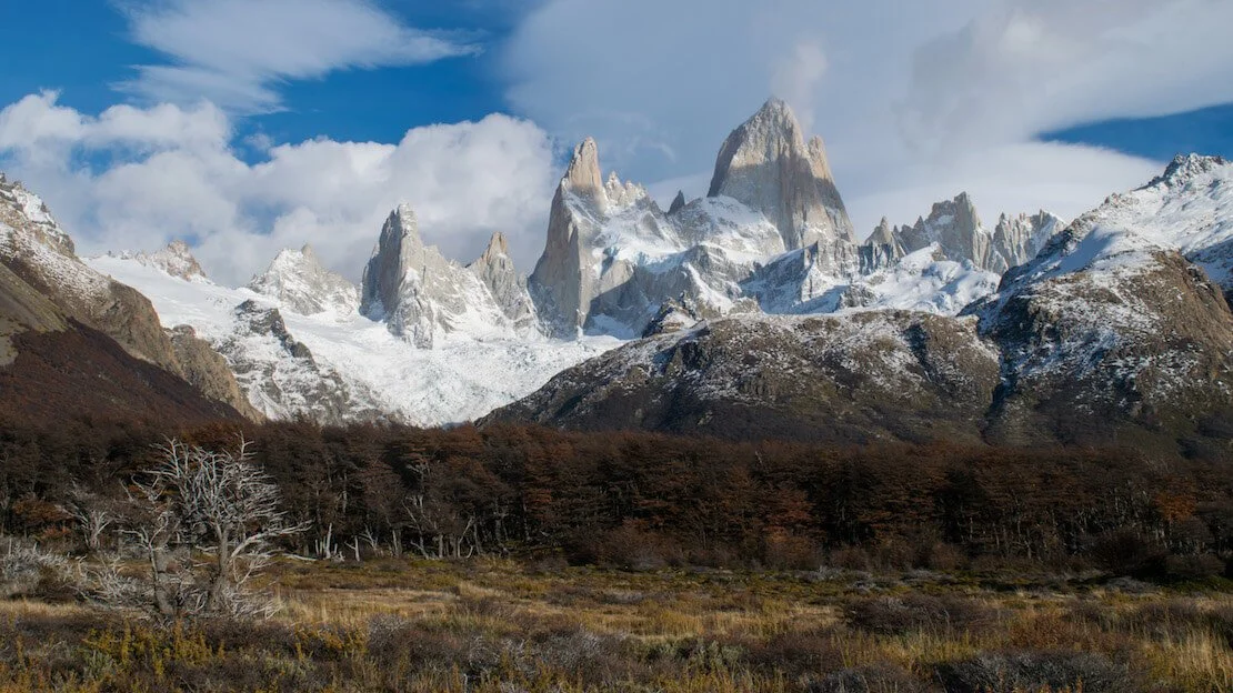
Fitz Roy, El Chaltén.
When to visit Argentina
Given the size of the country, it would be a mistake to talk about the climate in general, but there is one period that is undoubtedly the best time for a trip to Argentina: spring. During the spring period, from September to November, the weather is excellent everywhere, except for the far south, where it may still be a bit cold but far less crowded with tourists. For Patagonia and the peaks of the Andes, such as Aconcagua, the best time is definitely summer, which runs from December to February. During this time, the north of the country is extremely rainy, and it is very hot and humid in Buenos Aires.
Autumn from March to April is a good time to visit Patagonia, the region is less busy and you can enjoy the fall foliage. In the wine region, it is harvest time.
Winter from June to August is a great time to ski around Bariloche, but not Tierra del Fuego, where the weather is prohibitive, and almost all tourist facilities are closed. In the north, on the other hand, the climate is pleasant.
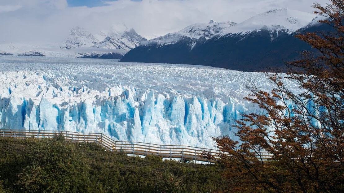
Perito Moreno, El Calafate.
Documents and vaccinations to enter Argentina
Most nationalities receive a 90-day tourist visa when they enter the country.
You can renew your visa for another 90 days simply by leaving the country even for only one day, the so-called “visa run” or by paying 27000 Argentine pesos in the immigration office during your first 60 days of visa, 40000 pesos in case you are in the last 30. The fine for overstaying your visa is 40500 pesos. (due to crazy inflation, prices are not up to date)
This is the official Argentine immigration website.
Argentina does not require any mandatory vaccinations, but Hepatitis A and Hepatitis B are recommended.
What to do and see in Argentina
Below, you will find information and tips on all the major tourist destinations so you can get a good idea of what to expect and how best to plan your trip to Argentina.
In this guide, prices are expressed in the local currency called “Argentine Pesos,” often abbreviated to “ARS.” The exchange rate at the time of publication of this article is 1€ = 32 ARS. For the current exchange rate, I suggest you look at this page; given the high inflation, the currency’s value changes VERY quickly.
N.B. You will often find bus/activity prices, etc., in my guides. Unfortunately, due to the persistent inflation in Argentina, the value of the peso and, consequently, the prices are constantly changing, making it difficult to keep them up to date. So, I have preferred to omit them with a few exceptions.
Buenos Aires
Buenos Aires is not the typical city with attractions that are considered must-sees, so much so that many will tell you to simply walk its streets. That said, below, I list some of the things I think are most interesting.
What to do and see in Buenos Aires
As in every city I visit, I participate in the free walking tour. This is a good way to learn about the history of the city and visit some interesting sites.
La Boca Neighborhood
It is said that in this very neighborhood, Tango was born. It is considered the most colorful neighborhood in the city. Here, in addition to “La Bombonera” stadium (Google Maps) of the team of the same name, which can only be visited by a tour, there is a particularly famous street called “Caminitos” full of colorful buildings, restaurants, and bars (Google Maps). The place is touristy but worth a visit. From the center, it is about a 5km walk; alternatively, take the bus line 26 or a cab.
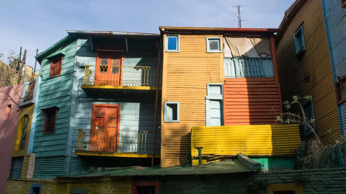
Caminito a La Boca, Buenos Aires.
San Telmo Neighborhood
This is another charming neighborhood. Every Sunday from 10:00 am to 5:00 pm, there is a market (Google Maps) where they sell everything from antiques to clothes, and you can wander around it for hours. I strongly recommend visiting Plaza Dorrego (Google Maps), especially in the afternoon after 3:00 pm, particularly on Sundays. Here, some couples perform in the middle of the small square surrounded by bars and restaurants, in exchange for tips. It is only 3 km from the center, but you can take the metro or bus depending on where you are staying.
El Ateneo Bookstore
A former theater (Google Maps) was converted into a bookstore in 2007; it is considered one of the most beautiful bookstores in the world. Depending on your relationship with books, you might spend a few minutes or hours there, but it is worth going in. It is located at 1860 Avenida Santa Fe, and the nearest metro station is Callao (line D).
La Recoleta Cemetery
This is the cemetery of Buenos Aires’ VIPs (Google Maps), including the famous Eva Peron. Strongly recommended by many guidebooks, I did not find it particularly interesting, even though some graves are real works of art. Admission used to be free, now they charge a couple of dollars. It is located at 1760 Junín Street near the Retiro (line C) and Callao (line D) metro stops, open daily from 7:30 am to 5:30 pm.
The Palermo district
This is considered the “coolest” and most expensive neighborhood in the city. It is home to all the big brand boutiques, numerous bars, restaurants, and some of the best places to go out at night. The neighborhood is extremely photogenic and “clean” compared to the rest of the city. Whether it is for coffee, walking, or going out at night, I recommend visiting it. The Palermo metro station (line D) is the closest.
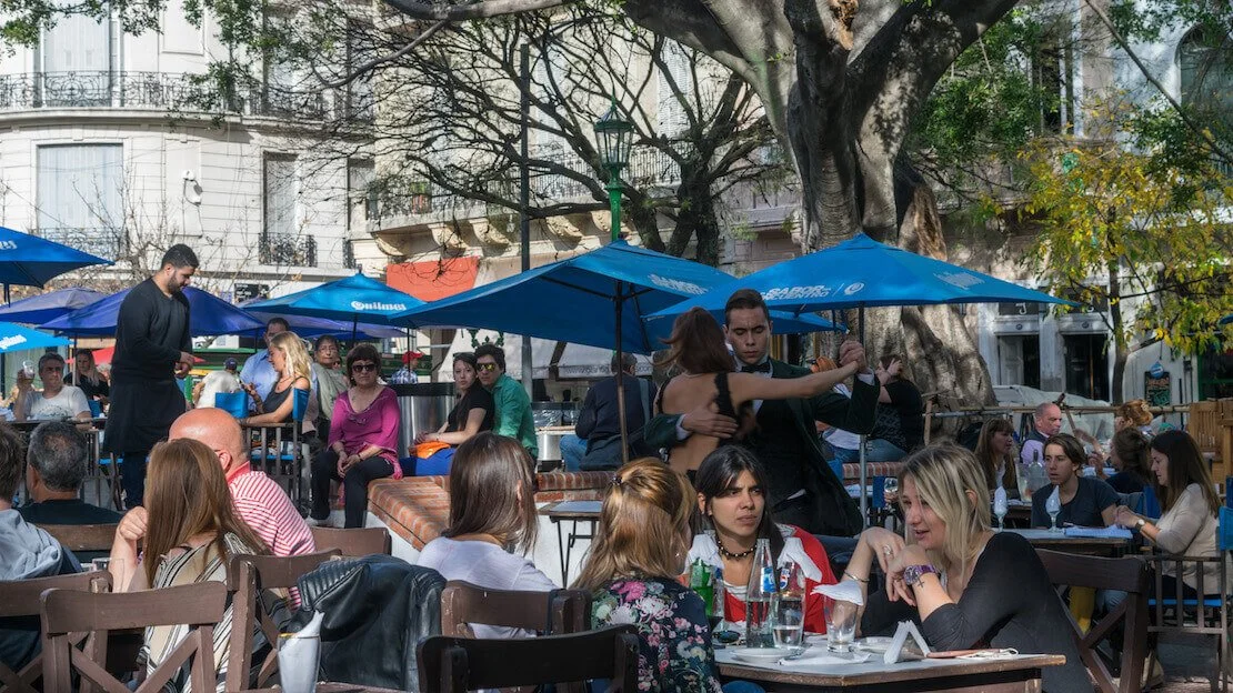
Plaza Dorrego.
Where to sleep in Buenos Aires?
Cambacuá è un buon ostello non troppo caro. Milhouse Hostel hopes is considered the best party hostel in town. If you are looking for an excellent hostel with a more relaxed atmosphere, I recommend America del Sur.
How to get to Buenos Aires?
The cheapest way to get to the city from the airport is by bus number 8 marked AEROPUERTO (there is an 8 express bus that takes about an hour). To and from neighboring Uruguay, the fastest way is by taking a ferry, the cheapest company being Coloniaexpress. There are direct buses to Buenos Aires from all major Argentine cities.
Rosario
Rosario is Argentina’s third-largest city and is considered the country’s liberal capital. It is also said to have the most attractive women in Argentina and has been the birthplace of both Che Guevara and Lionel Messi.
The city is not part of the “classic itinerary”, especially if you are short on time; I skipped this stop, but should you decide to visit, these are some points of interest.
What to do and see in Rosario
The monument to the flag (Google Maps), a vast column placed on the banks of the Parana River, the house where Ernesto Che Guevara was born (Google Maps), the beach along the Parana River called “La Florida” (Google Maps) which is extremely popular during the warmer months, and finally, Parque Independencia (Google Maps), which is one of the largest parks in the country.
The monument to the flag, Rosario.
Where to sleep in Rosario?
Hostel Posada Juan Ignacio is one of the best options in town.
How to reach Rosario?
The city is well connected to all major Argentine cities, but buses also go to Brazil, Chile, Peru, and Bolivia. From Buenos Aires, the train is more convenient than the bus, but the service is slow and often not very comfortable.
Puerto Iguazu
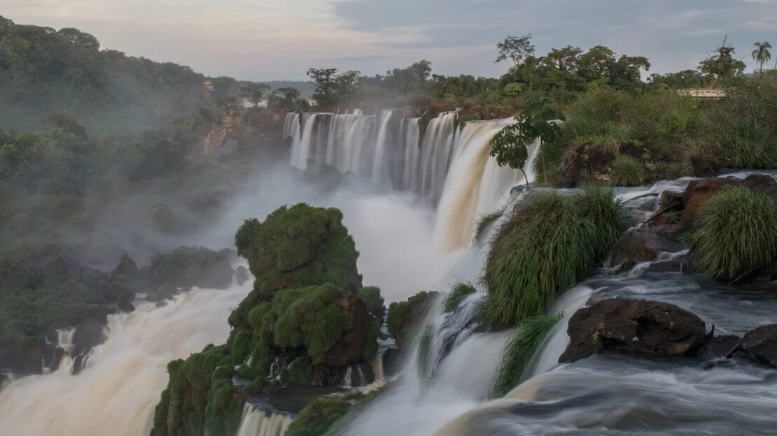
The city does not have much to offer, and the only reason to go to Puerto Iguazu is to visit the nearby Iguazu Falls. These about 275 individual waterfalls form what is considered one of the seven wonders of nature. Just to be clear, Iguazu Falls has two sides, the Argentine and Brazilian, which are distinct and should be visited separately.
What is the difference between the Brazilian and Argentine sides of Iguazu Falls?
The Argentine side, with its system of footbridges, takes you “inside” the falls and allows you to savor their power up close, while the Brazilian side gives a panoramic view. Both sides have their reasons, and if you have the chance, I recommend visiting both. However, if you have to make a choice due to time or budget constraints, then I recommend the Argentine side.
It is possible to visit both sides on two separate days using Puerto Iguazu as a base and crossing the border. There is a bus company that offers the route Terminal Puerto Iguazu – Brazilian side Iguazu Falls. But let us now return to the Argentine side.
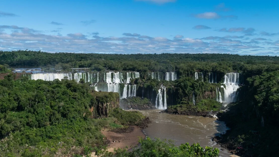
Iguazú falls, brazilian side.
How to visit Iguazu Falls (Argentine side)
The most economical way to reach the falls is by taking one of the frequent buses departing approximately every 20 minutes from the bus terminal starting at 7 am. Entrance to the falls costs 20000 ARS (as of January 2024). If you plan to return the next day, remember to get your ticket stamped on the way out to receive a 50 percent discount on the following day’s admission. Note that only cash is accepted.
Once inside the park, plan to spend at least 5-6 hours exploring. Pick up a map at the entrance or take a photo of it, then head to the train station. Disembark at the first stop (there are two) and follow the lower path, where you can also take a boat (included in the ticket price) to San Martin Island. From there, you’ll have a frontal view of the falls (the last boat leaves at 3:15 p.m. or when 1,000 passengers are reached, so consider doing this first). You also have the option to take another boat from the same pier to the base of the falls, where you can get soaked, for a fee.
After completing the lower route, continue along the upper route before returning to the stop where you disembarked and board the train to the Garganta del Diablo (Devil’s Throat), where the walkways come within a few meters of what I believe is the largest waterfall, allowing you to witness the force of nature up close—an unforgettable experience.
To conclude your visit, simply board the train again and ride it back to the entrance. I recommend starting early in the morning and bringing a packed lunch, as food inside the park is expensive.
Iguazú falls, Argentine side.
Where to sleep in Puerto Iguazu?
Hostel Iguazu Falls is an good hostel, well-located, with friendly staff and a well-equipped kitchen. It also has a swimming pool, which, given the tropical temperatures, can be really nice.
How to reach Puerto Iguazu?
A direct bus from Buenos Aires takes about 18 hours; direct buses are also available from Salta, Mendoza, and Cordoba. From Foz de Iguazu in Brazil, some buses run about every 20 minutes. By air from Buenos Aires, there are several flights daily, with Aerolineas Argentina and LAN Chile.
Salta
For many travelers, this is the last stop before continuing their journey to Bolivia to the north or Chile to the west. The city springs up in the middle of the desert area that characterizes northern Argentina. It is also renowned for its wine, second only to Mendoza in Argentina.
What to do and see in Salta
Explore the city
The city is certainly not a metropolis and can be easily walked around. As always, if, I recommend joining the free walking tour. In the city, I strongly recommend visiting the Iglesia San Francisco (Google Maps) and the Catedral de Salta (Google Maps). Finally, I recommend climbing Cerro San Bernardo (Google Maps), either by cable car from Parque San Martin or by climbing the 1070 steps near the Güemes statue just north of the cable car station.
Quebrada de las Conchas and Cafayate
This nature reserve is located within the Calchaquíes Valleys surrounding Salta; it is a collection of spectacular rock formations, including La Garganta del Diablo (Devil’s Gorge), El Anfiteatro (The Amphitheater), El Sapo (The Toad), El Fraile (The Friar), Los Castillos (The Castles), and Las Ventanas (The Windows). Numerous tours leave Salta; if you want to do it independently and inexpensively, I recommend taking a bus to Cafayate, which is about 4 hours to the south of Salta.
Cafayate is a small town nestled among vineyards and is a great place to spend a night or two visiting a few wineries and the nearby Quebrada de las Conchas reserve. Again, several companies offer tours of the reserve, but my advice is to rent a bike. For the more adventurous, it is possible to pedal to Garganta del Diablo and then back. I think it is better to take the bus on the way out and pedal on the way back; it is about 50 km, mostly flat or slightly downhill. Theoretically, there are two buses, one at 8:30 am and one at 10:30 am, but I suggest you inquire. Remember to take plenty of water with you.
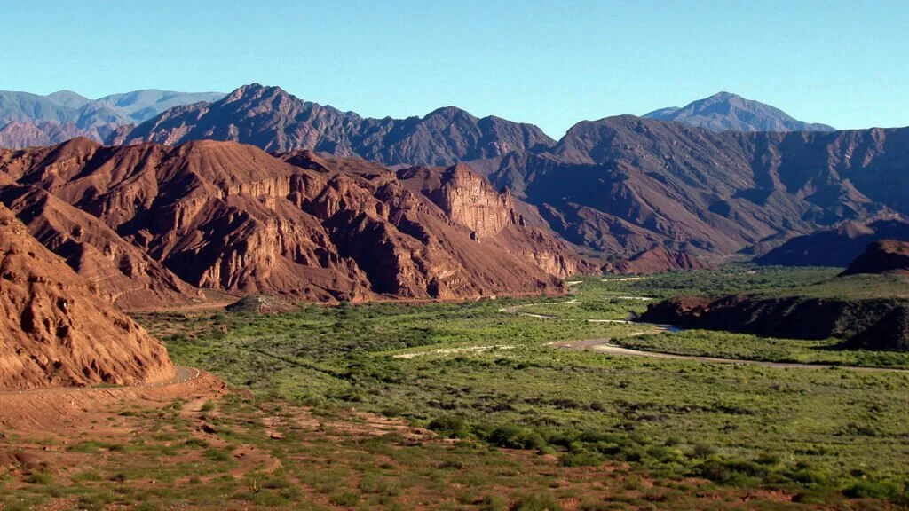
Valles Calchaquies.
Cloud Train (Tren a Las Nubes)
As the name implies, it is a day trip by train through the mountains to La Povorilla at 4220 meters, so you might get altitude sickness. The train runs from April to November once a week (on Saturdays), with extra services during the high season (Easter and summer vacations). The cost is US$120 to US$140 and can be booked online at this website. You leave at 7:00 am from Salta and return around 11:00 pm. Only breakfast and a small snack are included, but you can bring a packed lunch (food on board is available but expensive). I have not personally taken the train because of the cost, but it is said to be one of the most scenic in the world.
Other noteworthy attractions within a short distance of Salta are Las Salinas Grandes (Google Maps) and the Quebrada de Humahuaca (Google Maps) where the Cerro de los Siete Colores, or Mountain of the Seven Colors, is located.
Where to sleep in Salta?
LEAD Pods Hostel is a good hostel in downtown Salta.
How to reach Salta?
There are direct buses from all significant Argentine cities. Buenos Aires (20 hours), Cordoba (13 hours), Puerto Iguazu (24 hours), Mendoza (18 hours).
If you arrive or continue your journey to Bolivia, then I recommend the following:
- Bus to La Quiaca (7-8 hours).
- Walk to the border (15 minutes) or cab.
- Go through Argentine and Bolivian immigration.
- Walk to the bus terminal in Villazon (15 minutes) or take a cab.
- Bus to Tupiza (2 hours).
I recommend leaving early in the morning as it is about 11-12 hours of travel between buses and various waits.
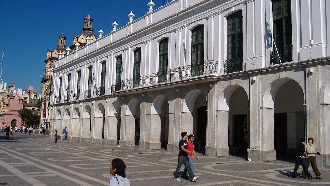
Cordoba
Cordoba is Argentina’s second-largest city and is located in the heart of the Argentine territory of Pampas. The city is mainly known for its many buildings dating back to colonial times. It is also home to many universities that house more than 200,000 students.
What to do and see in Cordoba
As always, in a big city, I recommend joining one of the many free walking tours. In any case, in Cordoba, there is not much to do except explore the center and savor the city’s atmosphere; there are many colonial buildings, many of them built by Jesuits between the 17th and 18th centuries. These include the Manzana de los Jesuitas (Google Maps), an entire block declared a UNESCO World Heritage Site. That being said, if you are short on time, I would skip Cordoba.
Cordoba.
Where to sleep in Cordoba?
Alvear Hostel is recommended.
How to reach Cordoba?
Given its geographical location, Cordoba is not too far from other major cities in northern Argentina. It is about 10 hours from Buenos Aires, 12 from Salta, and 6 from Rosario.
Mendoza
The city is located in the middle of the Cuyo desert region. Still, thanks to an extensive artificial irrigation system, vineyards that produce some world-famous wines, including Malbec, can be grown there. It is also close to Mount Aconcagua, which, at 6962 meters, is the highest peak in the world outside the Himalayas.
What to do and see in Mendoza
I have not personally visited the city, but the center seems unattractive. The most popular activity is visiting some of the nearby wineries. You can find reviews of some of the wineries here.
For Aconcagua and the surrounding national park, I recommend contacting an agency locally; even accessing the park for simple trekking requires permits that are not exactly cheap.
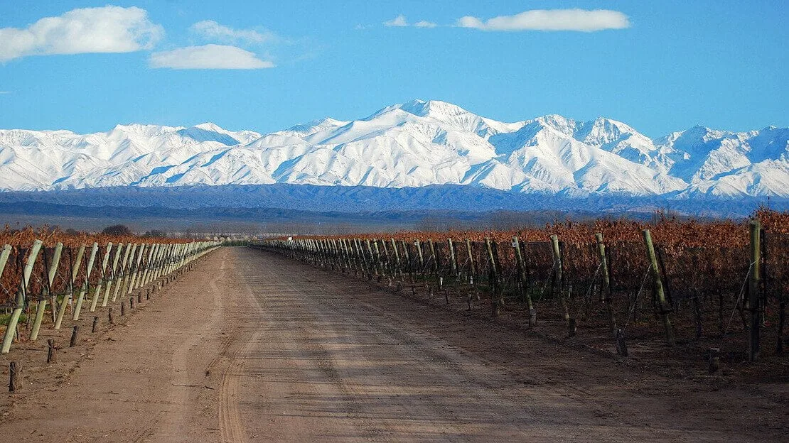
Mendoza vineyards.
How to reach Mendoza?
There are direct connections to all significant Argentine cities, including Bariloche to the south (18 hours). It is possible to cross the border and continue the journey into Chile towards Santiago (7 hours of genuinely scenic travel through the Andes); however, be careful during the winter period from late May to early September when the pass may be closed due to snow.
Where to sleep in Mendoza?
Fuxia House Hostel seems to be a really good hostel.
Mar del Plata
I haven’t visited this city myself, but based on descriptions from other travelers and some friends in Buenos Aires, it seems to be the classic overdeveloped beach destination. This is the stretch of sea (not even too beautiful, by the way) where all the capital’s inhabitants flock during their summer vacation. Maybe I’m wrong, but coming all the way to Argentina to visit such a place seems like a waste of time.
Puerto Madryn
It’s a fairly popular summer destination despite not being part of the “classic itinerary”. Here are some of the most beautiful stretches of coastline in the country, but it’s especially a great base for exploring the nearby Valdes Peninsula, where you can observe a lot of marine wildlife.
What to do and see in Puerto Madryn
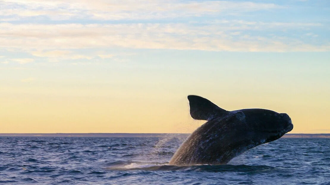
As mentioned earlier, the real attraction is the nearby Valdes Peninsula, a UNESCO site for its unique wildlife and geology. Here, it’s possible to observe some penguin colonies from October to March, while whale season is from June to mid-December. Among the many other species present are sea lions, seals, armadillos, guanacos, maras, gray foxes, and, with any luck, killer whales that attack the seals on shore at Punta Norte in April.
The most popular way to visit the peninsula is via a tour from Puerto Madryn; the tour starts around 7:30 am and ends around 7 pm, with stops at Puerto Pirámides (for whales), Caleta Valdés (penguins), and Punta Norte. Many travelers rent a car in Puerto Madryn to explore the peninsula without being tied to a tour. If you are only interested in whales, you could take a bus to Puerto Pirámides and get a boat tour. However, this is the only option with public transportation, and you would end up missing the rest of the peninsula.
Puerto Piràmides.
Since I no longer run ads, if you found this article helpful, please consider purchasing your travel insurance through one of the links on this site. Doing so supports my work at no additional cost to you. For EU and UK residents, I recommend True Traveller. For everyone else, I recommend HeyMondo, which offers a 5% discount. Thank you for your support!
Where to sleep in Puerto Madryn?
Hostel La Casa de Tounens is a really good hostel and among the cheapest in town. Breakfast is included, and the owners are extremely friendly. La Tosca is another excellent hostel with plenty of private rooms.
How to reach Puerto Madryn?
There are direct connections to Buenos Aires and Mar de la Plata to the north, Rio Gallegos to the south, and Esquel to the west.
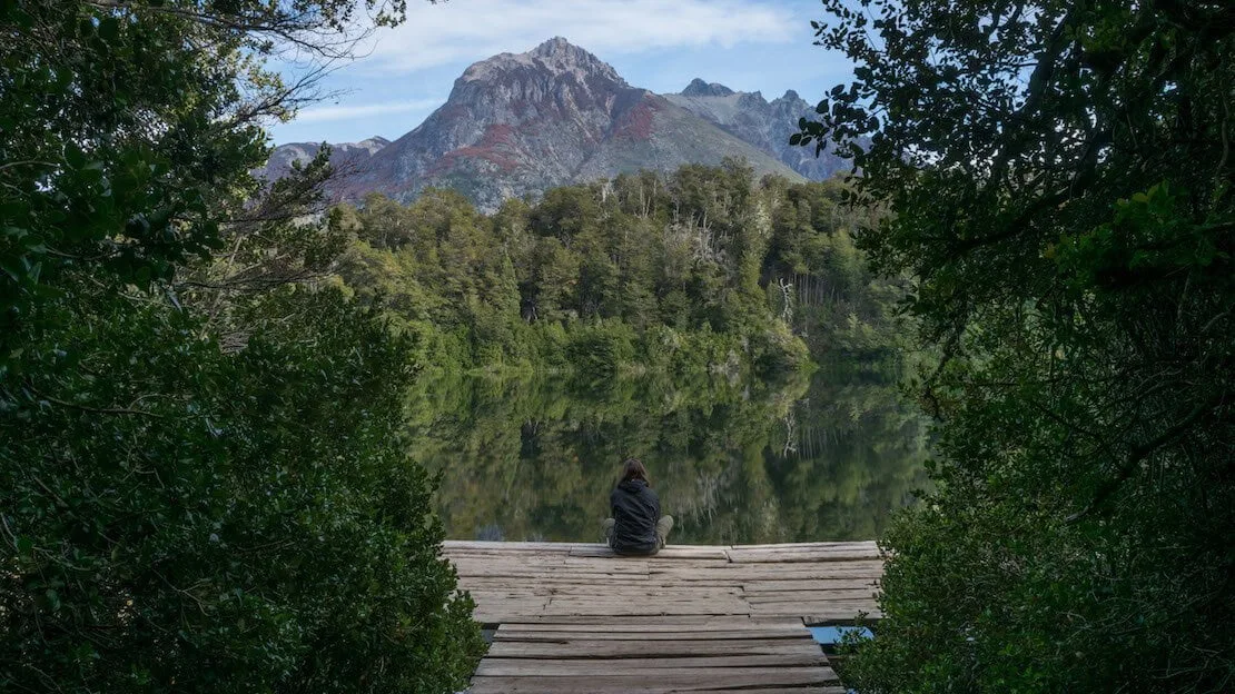
San Carlos de Bariloche
This town in the foothills of the Andes, built on the shores of Lake Nahuel Huapi and surrounded by the national park of the same name, is trendy throughout the year with tourists and locals. When the hiking season ends, the skiing season begins. Here you can find the largest ski resort in South America, Cerro Catedral, only 20 km from the center of Bariloche.
What to do and see in Bariloche
As mentioned above, the main activities are hiking and skiing. Additionally, the city is famous for its chocolate and craft beer production, offering plenty to do. Now, let’s look at some of the most popular excursions.
N.B. To use public transportation in Bariloche, you need to purchase a prepaid card called “SUBE.” It is the same one in operation in Buenos Aires, so if you already have it, keep it.
Laguna Escondida.
Chico Circuit
This is about a 60 km route that can be done by bike or bus (line 10). After talking with the hostel owner, however, I decided to do only the northern part of the circuit since, in his opinion, the next section is not as pleasant. Of course, I cannot confirm this, but I decided to trust him! Besides, the northern part of the circuit can be done on foot thanks to a system of well-marked and maintained trails that keep you away from the main paved road where all the traffic is. To do the northern part of the Chico Circuit on foot, follow these steps:
- Download organic maps. It works offline, and unlike Google Maps, all trails are plotted. With a map in front, the following directions will be much clearer.
- Take bus number 20 to Hotel Llao Llao and get off at the second-to-last stop; the last stop is the hotel itself, and then the bus turns around and returns. If, like me, you tend to “sleep,” then get off at the hotel and walk back; it’s a few hundred meters.
- Instead of heading up toward the hotel from the penultimate stop, take a right and walk along the paved road for about 1 km before finding a path on your left leading to Mirador Lago Moreno (Google Maps).
- Continue along the path until you reach the main road. Follow it for a few hundred meters before taking the path to the right. At the fork, turn left toward Laguna Escondida (Google Maps).
- You can return along the same path and continue to Mirador Del Tacul once you reach the fork where you turned left.
- I then went down to the shores of the lake to have lunch, but you can proceed straight to the Mirador del Cerro Llao Llao (Google Maps) if you prefer.
- Once you descend from the Cerro, take a right and follow the path back to the main road, not far from where you turned left to Mirador Lago Moreno earlier in the day. From here, walk to the bus stop.
The whole thing is straightforward, especially with the support of organic maps and undoubtedly a great way to spend the day.
Mirador Cerro Llao Llao.
Cerro Campanario
Cerro Campanario (Google Maps) offers excellent views of the lakes and the mountains surrounding Bariloche. It is located along the same road that leads to the Chico circuit and can, therefore, be conveniently visited on the same day. From the bus stop, it’s about a 30-minute walk. Alternatively, you can take the cable car. To return from here to downtown Bariloche, you can take buses 10 and 21.
Refugio Frey
This lovely day hike (All Trails) can be done by taking the bus to Villa Catedral (line 55, approximately every hour). Once you arrive at the parking lot, position yourself in front of the mountain, and you will find the beginning of the trail at the bottom of the parking lot on the left; there is a sign that says “Frey.” From there, the trail that goes through the woods and leads to the hut is well-marked and maintained, as it is plotted on organic maps.
Other excursions in and around Bariloche
These hikes listed so far are the ones I’ve had a chance to do and would recommend, but there are plenty of other one- or multi-day hikes in the surrounding area. You can sleep in shelters (especially during the high season, they should be booked in advance) or in a tent if you bring one with you. If you’re an avid trekker and you have time on your hands, I recommend you check out this site.
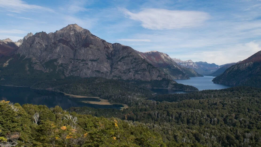
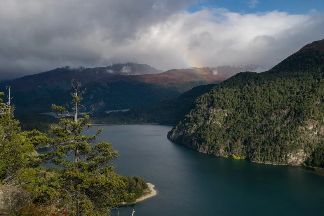
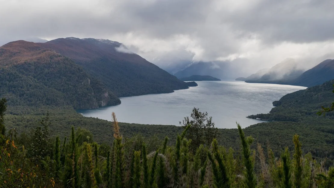
Ruta de Los siete Lagos (the road of the seven lakes)
This is the name of road 234 between San Martin De Los Andes and Villa La Angostura. The 107-kilometer-long road passes through Lanin and Nahuel Huapi National Parks and, as you might have guessed, gives access to several lakes. One-day tours are offered from Bariloche, but many travelers prefer to rent a car for a couple of days and camp, while others hitchhike; the choice is yours. You can find an account of the circuit done by car here.
If interested, you could spend a few nights between San Martin De los Andes and Villa La Angostura. I was told there is not much to do, however, both are picturesque villages where you could spend a few days relaxing.
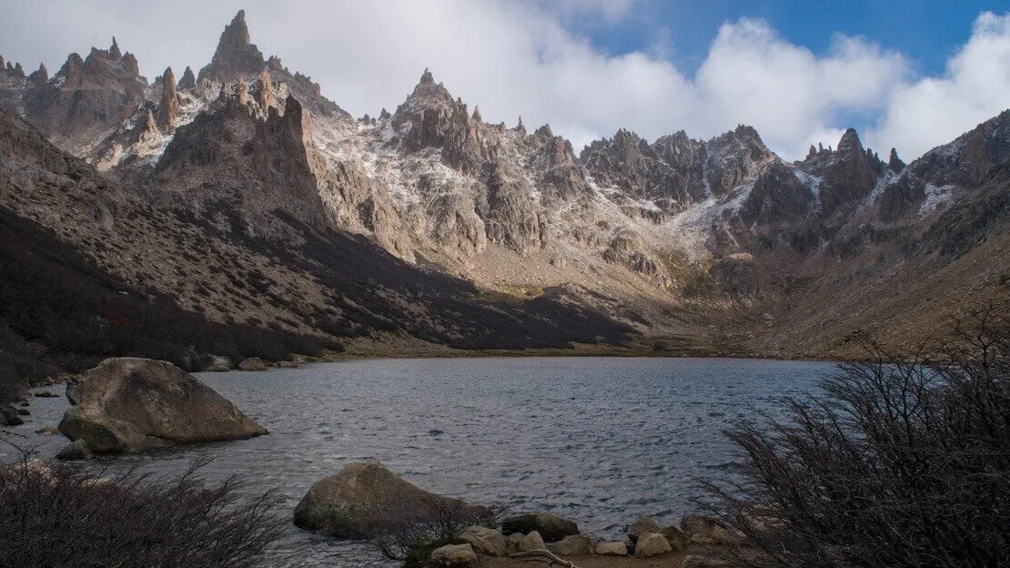
Laguna Toncek, refugio Frey.
Where to sleep in Bariloche?
Bariloche Hostel is a great budget hostel near the center of Bariloche; it has friendly and helpful staff, a well-equipped kitchen, and a common area overlooking the lake.
How to reach Bariloche?
From here, there are direct buses to Buenos Aires, Mendoza, Cordoba, and all destinations south along Ruta 40 (Esquel, El Bolson, El Calafate, El Chalten). You can also take buses to continue your trip in Chile to Puerto Montt and Osorno, which are not far away or go to Santiago.
El Bolsón
It is a small village near Bariloche that is particularly popular with hippies worldwide, Argentine students, and travelers. There are many self-sustaining communities and more general ecotourism-related activities.
What to do and see in El Bolsón
As you may have already guessed, many people come simply to relax and spend a few “alternative” days in this small town scattered among the mountains, tasting artisanal beer and ice cream, visiting the local market, practising yoga, etc. For trekking lovers, many one- or multi-day hikes allow them to sleep in shelters starting from El Bolsón. For information on this, you can check out this site or, once you arrive, visit the tourist center directly.
Where to sleep in El Bolsón?
Hostel “La Casita Naranja” is an excellent hostel near downtown, with a relaxed atmosphere.
How to get to El Bolsón?
The village is literally crisscrossed by Ruta 40, so all the buses going south from Bariloche pass through there. From the coast, there are connections to Trelew.
Esquel
The town is about 150 kilometers south of El Bolsón and is an ideal base for visiting the nearby Los Alerces National Park. Although not very popular, it is considered among the best in the country and is definitely worth a visit.
N.B. Esquel is only 60 km from the Chilean border, and there are daily buses to the border, where you then connect to the not-so-distant Futaleufu in Chile itself. From here, you can continue your journey southward into Chile along the Carretera Austral and avoid the great expanse of nothingness that separates Esquel from El Chalten. You can then re-enter Argentina, for example, from Chile Chico.
What to do and see in Esquel
The town itself is nothing special, and as mentioned above, the only worthwhile reasons to visit are the nearby national park and short excursions in the surrounding area.
Laguna Verde, Los Alerces national park.
Los Alerces National Park
The park can be visited in a day, or you can opt to camp overnight. There are equipped campsites for a fee and some lodges that offer various services at different price points. I had planned to spend a few nights in a tent, but unfortunately, due to the time of year (May), many trails were closed or under maintenance.
In any case, a company operates the route from the bus terminal to the park with several daily departures (schedules vary depending on the time of year; upon arrival at the bus terminal, inquire for information immediately). The minibus stops at the entrance for about ten minutes, allowing passengers to disembark and visit the ranger’s office for a map or any necessary information. I also received a brief lesson on the park’s flora and fauna from the friendly ranger. It was then that I learned that many trails were closed, prompting me to turn my visit into a day hike and forego paying the entrance fee, perhaps due to it being the off-season when many trails were closed.
For a day hike, I recommend returning to the bus and disembarking at the start of the trail to the Laguna Verde Mirador, where a lovely viewpoint awaits. Afterward, return to the road and head toward Puerto Chucao, crossing the bridge. Along the way, you’ll encounter an approximately 300-year-old larch tree (indicated by a sign). Upon reaching the pier, the trail continues, eventually completing a loop that leads back to the bridge. Then, return to the main road and proceed to Laguna Escondida before making your way back to the road, where you can catch the first bus back to Esquel. All the trails and points of interest just mentioned are plotted on organic maps.
There are plenty of other, more or less strenuous trails within the park. If you visit during the high season, there is a ‘combined boat and hike’ from Puerto Limonao to a larch-only forest where you can see “El Abuelo,” a specimen about 2,600 years old.
Viewpoint on the way to Laguna Escondida.
Where to sleep in Esquel?
Dormís Acá is a somewhat expensive hostel, but there is not much competition in town. Still, the service offered is great, and breakfast is included.
How to reach Esquel?
There are daily buses to Buenos Aires, Puerto Madryn, Bariloche, and the Chilean border. However, connections to the south (El Chalten, El Calafate) are often every other day, especially in the low season.
El Chalten
The small town, which began as an Argentine outpost in the late 1970s to anticipate possible territorial claims by Chile, has become a significant tourist hub over the years due to its proximity to two of the most famous peaks in the Andes: Cerro Torre and Mount Fitz Roy.
What to do and see in El Chalten
As you may have already guessed, the main activity is trekking. Coming from El Calafate, our bus stopped at the tourist center before entering the village (I think this is standard procedure). Here we got tips and information for visiting the park (free of charge) before boarding the bus back to the terminal.
There are many one-day and multi-day hikes around El Chalten, and it is possible to camp for free in dedicated areas along the trails. Below, I list the most popular ones. The trails are well marked, and as always, you can find them well mapped out organic maps.
Mount Fitz Roy and Laguna de Los Tres
Los Tres Lagoon is located at the famous Fitz Roy Mountain base. This is a genuinely spectacular trek and not particularly challenging except for the last kilometer and a half, which is entirely uphill. From the center of El Chalten, it is about 22 kilometers round trip and 800 meters of elevation gain, taking 6-8 hours depending on the pace (All Trails); my advice is to leave early to avoid the crowds and especially the clouds that often obscure the summit later in the day. If you have a tent, you can camp at “Campamento Poincenot,” at the base of the last climb. By leaving early the next day and with any luck, you can watch the first light of day hit this spectacular peak and have your postcard photo.
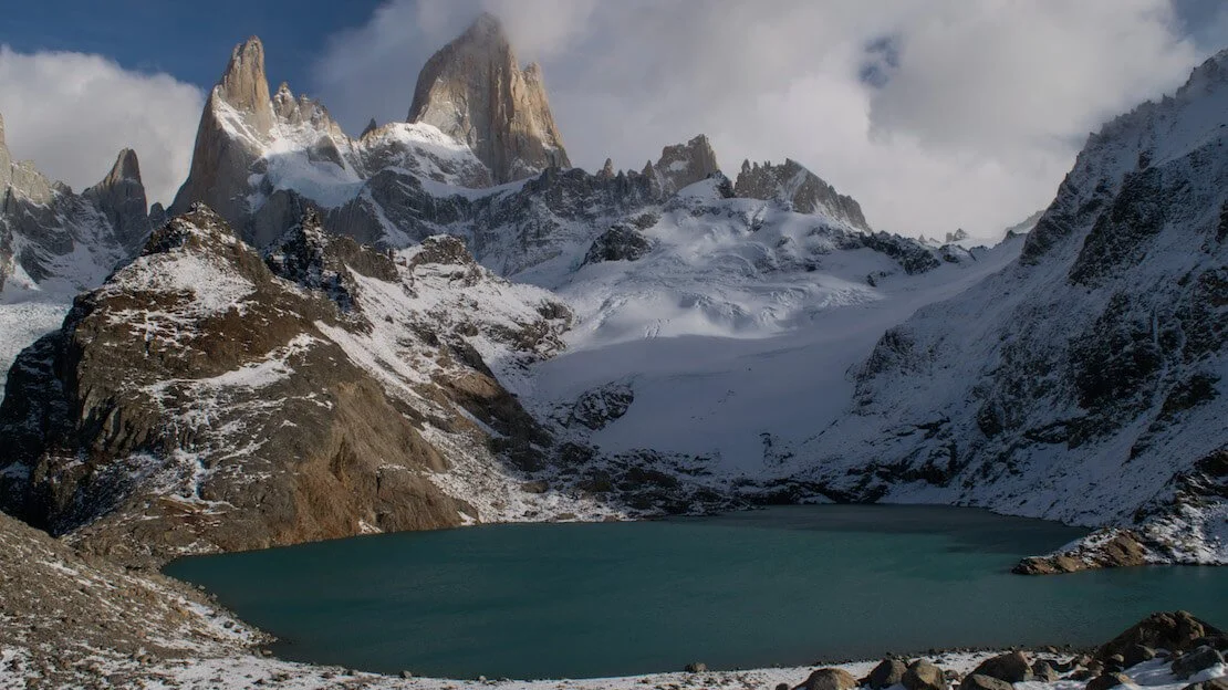
Laguna de Los Tres.
Cerro Torre and Laguna Torre
Cerro Torre is a legendary peak among mountaineers worldwide because of its controversial history and especially the fact that despite being only 3128 meters high, it remains one of the most challenging mountains to climb. Trekking to the Torre Lagoon, which lies at the base of this legendary peak, is another excellent El Chalten classic. From the village center to the lagoon is about a 19 km round trip, mostly flat; it is only 250 meters of elevation gain (All Trails). Again, the peak shrouded in perennial ice is often surrounded by clouds, so I recommend leaving early in the morning; as you can see from the photo, I had no luck this time. If you are up for a long day, you can combine both trails as described here.
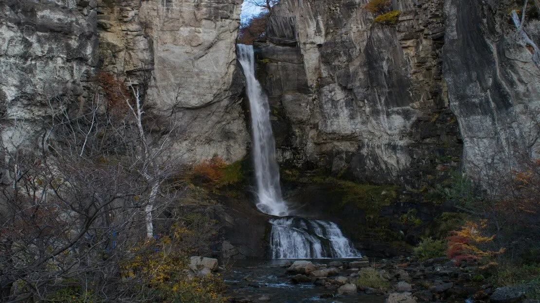
These are by far the two most popular treks I recommend in El Chalten; other short hikes to do, perhaps between days to rest or perhaps while waiting for the night bus as I did, are those to Mirador Condor and Mirador Las Aguilas (Google Maps) – the two hills behind the tourist office. The Chorillo del Salto waterfall (All Trails) is a pretty waterfall that is only 5 km completely flat from the center of El Chalten.
Laguna Torre.
Where to sleep in El Chalten?
As you can tell by the fall colors in the photos, I visited El Chalten during the off-season. With my sister and a couple of friends, we booked an apartment inside a house with a heated pool for just over 10 euros a night. If you travel alone Rancho Grande Hostel seems to be a good budget hostel.
How to reach El Chalten?
From Bariloche northward, there are daily buses during the high season (about 24 hours). All pass through El Bolson, Esquel, Perito Moreno (the town, not the glacier), and Los Antiguos, where you can cross the border into Chile Chico in Chile.
From El Calafate, there are several buses a day, it takes a little over two hours.
N.b. If you are coming from the south and want to continue your journey north along the Carretera Austral in Chile, you can cross the border to Villa O’Higgins by combining ferries and trekking. This article covers everything.
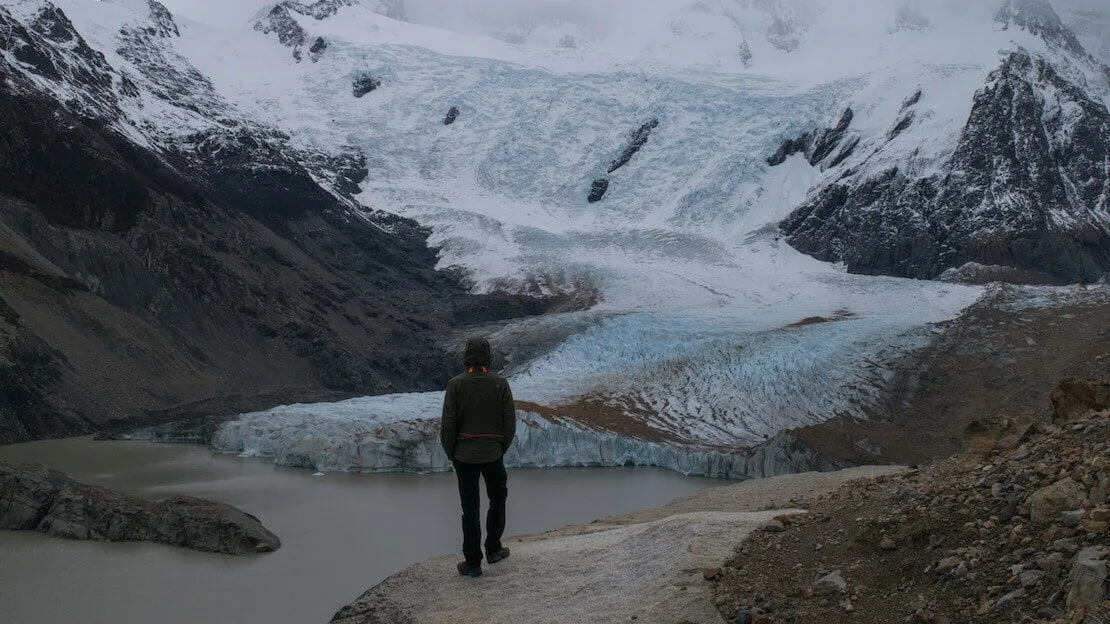
El Calafate
It is a small town not far from El Chalten that has become a regular stop for those visiting Argentine Patagonia over the years because the famous Perito Moreno glacier is about 80 km from the city.
What to do and see in El Calafate
There are many excursions offered in the town, glacier trekking, boat tours, 4×4, and even helicopter tours, but I honestly don’t have any information about them. I assure you they are not low-cost, so I will only talk about the visit to Perito Moreno, which in itself is not cheap.
Perito Moreno Glacier
If you’re traveling alone, the most convenient way to reach the park is by one of the many mini buses departing from the bus terminal. Alternatively, hitchhiking, especially during high season, can be a viable option.
For those traveling in a group or as a couple, consider the following options: a round-trip taxi with a 2-hour stopover cost 1300 ARS in April 2017, negotiable. With four people, this was cheaper than taking the bus. During that trip, I was accompanied by my sister, two friends, and another person interested in sharing expenses, so we opted to rent a car from a local agency for 1100 ARS, including gasoline. Each of us ended up paying about 250 ARS. In summary, do the math. Admission to the park was 500 ARS in April 2017.
The park is well-maintained, with a series of boardwalks, similar to those at Iguazu Falls, leading to various viewpoints offering different perspectives of the glacier, allowing visitors to get relatively close. Upon arrival, I recommend consulting the map to plan your route. Bringing a packed lunch is advisable. Although the site is impressive, a couple of hours are typically sufficient to explore the various trails and admire the glacier.
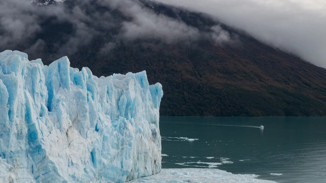
Perito Moreno.
Where to sleep in El Calafate?
Again, thanks to the low season, we slept four at Apart Hotel el Jardin de los Presentes for about 10 euros each. It is a charming mini apartment on two floors, but I doubt it is that cheap in high season. If you are traveling alone, Bla Guesthouse seems to be a reasonably inexpensive facility.
How to reach El Calafate?
To El Chalten (to the north), connections are frequent, 2 1/2 hours. Puerto Natales in Chile (to the south), where Torres del Paine is located, is about 5 hours away by bus. In fact, if you intend to reach Ushuaia by land from here, you have to cross a piece of Chile.
Ushuaia
Here we are at the “end of the world.” Located in the so-called “Tierra del Fuego,” it is considered by many to be the southernmost city in the world; this is more of a tourist slogan because, technically, the record would belong to Puerto Williams in Chile. You can take a look at the curious ranking here.
What to do and see in Ushuaia
I will preface this by saying that I stopped in Puerto Natales without going that far south, partly because of time issues, partly because of budget issues (the city is costly), but mainly because I was told that the city does not have much to offer, unless you can afford a cruise to Antarctica – it starts at a minimum of 4000€ for a last-minute one! The nearby Tierra del Fuego National Park was described to me as the least spectacular in the whole of Patagonia, the bus to get there costs 500 ARS (round trip, 15 km or so), the entrance is 350 ARS, prices updated in January 2018, all the trails can be completed in one day. In short, in my opinion, for many, it is more a matter of saying, “I have been there.”
Ushuaia.
Where to sleep in Ushuaia?
In high season, expect to pay around 20 euros per night for a dorm bed; you can take a look here.
How to reach Ushuaia?
There are daily buses to and from Rio Gallegos in Argentina. From there, there are connections to all destinations in Argentine Patagonia. From Punta Arenas in Chile, there are frequent connections to Puerto Natales. By air, there are several flights a day to and from Buenos Aires.
Since I no longer run ads, if you found this article helpful, please consider purchasing your travel insurance through one of the links on this site. Doing so supports my work at no additional cost to you. For EU and UK residents, I recommend True Traveller. For everyone else, I recommend HeyMondo, which offers a 5% discount. Thank you for your support!
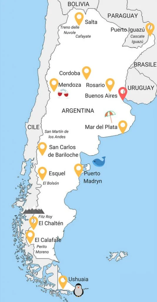
Possible itineraries Argentina
To visit all the places I have mentioned so far requires at least 5-6 weeks, but below I list possible itineraries of 2, 3, 4, or more weeks. There is no perfect itinerary given a time frame, especially for countries the size of Argentina, where some might come to visit only Patagonia, while others might only want to see the north. So take what follows as inspiration and modify or create the itinerary according to your interests and budget! Especially when it comes to travel, I often talk about buses. Sometimes it is the only choice, but usually, there are internal flights that would save you quite a bit of time, although they are more expensive than buses.
Argentina 15-day itinerary in between north and south
This itinerary is designed to visit what I think are the country’s most iconic places, from Iguazu Falls in the far north to Perito Moreno in the south. For obvious reasons, this itinerary involves some air travel and can be done indicatively only during the period from October to April, as it would otherwise be too cold in the south.

Buenos Aires (3 nights)
Day 1:
Arrival in Buenos Aires. Recover from jet lag and explore the city.
Day 2:
In the morning, visit Boca and the “Caminos”. Spend the afternoon in San Telmo and Dorrego Square.
Day 3:
Visit the “El Ateneo” bookstore, la Recoleta cemetery, and the Palermo neighborhood. In the evening, take a night bus to Puerto Iguazu. N.B. If booked in advance, a flight could be really cheap.
Puerto Iguazu (1 night)
Day 4:
If you arrive early in the morning by bus, my advice is to visit Iguazu Falls right away to optimize your time. Spend the night in Puerto Iguazu.
Rio Gallegos (1 night)
Day 5:
On this day, taking the Puerto Iguazu -> Buenos Aires -> Rio Gallegos flight is necessary.
N.b. Planes to Rio Gallegos from Buenos Aires all seem to arrive at night, so you will probably have to spend the night here.
El Calafate (1 night)
Day 6:
In the morning, take the Rio Gallegos – El Calafate bus. Spend the afternoon in El Calafate.
Day 7:
Visit to Perito Moreno. Transfer to El Chalten in the late afternoon/evening.
El Chalten (3 nights)
Day 8:
Trekking to the Laguna de Los Tres.
Day 9:
Trekking at Laguna Torre.
Day 10:
Mirador Condor, Mirador Las Aguilas, and the Chorillo del Salto waterfall. Night bus to Bariloche.
Bariloche (2 nights)
Day 11:
Afternoon of relaxation in Bariloche. Chocolate, and craft beer.
Day 12:
Chico Circuit and Cerro Campanario.
Day 13:
Bus to Buenos Aires. That’s almost 24 hours.
N.B. If booked in advance, a flight could be quite cheap and give you almost a full day to spend in Bariloche.
Day 14:
Leave Argentina.
3 weeks backpacking in Argentina between north and south
In my opinion, three weeks is the ideal length to follow the two-week itinerary just described, moving at a more relaxed pace and spending a few more days along the various destinations.
If you are interested, as an additional stop from Bariloche, you might consider Mendoza or Puerto Madryn to break up the long bus ride to Buenos Aires.
Itinerary Argentina 15 days only north
This itinerary can be completed throughout the year, including during summer, as it does not include any destinations in the south of the country.
Buenos Aires (3 nights)
Day 1:
Arrival in Buenos Aires. Recover from jet lag and briefly explore the city.
Day 2:
In the morning, visit Boca, and the “Caminos” and spend the afternoon in San Telmo and Dorrego Square.
Day 3:
Visit the “El Ateneo” bookstore, la Recoleta cemetery, and the Palermo neighborhood. In the evening, take a night bus to Puerto Iguazu.
N.B. If booked in advance, a flight could be really cheap.
Puerto Iguazu (1 night)
Day 4:
If you take the bus in the afternoon from Buenos Aires and then arrive early in the morning, my advice is to leave your things in the hostel/hotel and visit Iguazu Falls right away to optimize your time. Spend the night in Puerto Iguazu.
Cordoba (2 nights)
Day 5:
Bus Puerto Iguazu -> Cordoba (about 22 hours).
Day 6:
Explore Cordoba.
Day 7:
Take an overnight bus to Salta.
Salta ( 4 nights)
Day 8:
Spend the day in Salta and go up to Cerro San Bernardo for sunset.
Day 9:
Transfer to Cafayate in the afternoon to relax.
Day 10:
Visit the Quebrada de las Conchas.
Day 11:
Another long day by bus. Cafayate -> Tucuman (6 hours) Tucuman -> Mendoza (15 hours).
Mendoza (2 nights)
Day 12:
Day among the wineries of Mendoza.
Day 13:
Night bus to Buenos Aires.
Day 14:
Return home.
As you see, with only two weeks to spare, you run the risk of spending a lot of time on the bus, mostly at night, which could be tiring. Alternatively, you could skip Salta and head directly from Cordoba to Mendoza.
Itinerary 4 weeks in Argentina
With four or more weeks to spare, from October to April, I recommend following the first route described. Once you arrive in Bariloche, continue to Mendoza, Salta, and Cordoba instead of returning to Buenos Aires.
Chorillo del Salto, El Chaltén.
How to get around Argentina
Buses in Argentina
Buses are by far the most popular and cheapest way to travel long distances. Most companies offer good service, and the buses are comfortable, clean, on time, and quite modern, although they are really expensive compared to the rest of South America.
Busbud, Plataforma 10, and Omnilineas are three of the major comparison sites for checking costs and departure times, but I strongly recommend buying your ticket at the terminal as it is cheaper. If paid in cash, many companies offer a discount of up to 20% off the ticket price.
There are different types of buses for long distances. The “Cama” is the most comfortable and has only three rows of seats. It is extremely spacious and seats recline up to 160 degrees. Often, double-decker buses have the first floor with cama seats, while the second has semi-cama seats, which, in addition to being narrower (classic rows of 4), recline less.
Planes in Argentina
Aerolineas Argentinas, Latam, Andes, and Avianca are the main companies that operate domestic flights. Flybondi is a new low-cost airline that covers several routes; it is worth a look.
LADE is a small state-subsidized company that operates flights mainly in Patagonia and offers competitive prices, often lower than the cost of buses.
Take a look at their website for times and routes, but make reservations at the office or by phone because often the website shows availability when, in fact, it does not. It is best to ask a local to call/book because they have priority over foreigners.
Cab in Argentina
Cabs are legally required to use a taximeter, although it is always good to know how much a particular route should cost, perhaps by asking your hostel/hotel. A helpful site for roughly determining the cost is viajoentaxi.
Tourists fall prey to many tricks by taxi drivers, such as lengthening the route for no reason, using lower denomination bills that look alike, etc.
In large cities, Uber works and is probably the cheapest and safest option.
Hitchhiking in Argentina
This is a fairly common practice in Argentina, but there is a vast difference between the northern and southern parts of the country.
In the north, where most of the big cities are located, finding a ride is really tough. In Patagonia, on the other hand, it is an extremely common and safe practice, especially along the legendary Ruta 40, although you may end up waiting quite a while.
Buenos Aires.
Backpacking Argentina: costs
In the costs section, it is essential to mention the absurd costs of withdrawing cash at the ATM, as Argentina is the only country among all the ones I visited between Central and South America to have no banks that offer free withdrawals. We are talking about at least 4-5 € per transaction, in addition to your bank’s costs, and a very low maximum amount per transaction, which is normally around 100€. The only solution is to bring cash (euros or dollars) that is easy to change, often at a better rate than the official exchange rate. Alternatively, you can use services like Azimo and Xoom. You can also pay by card whenever possible.
Finally, remember that prices for transportation, lodging, and food differ greatly between the north and south of the country. The further down you go, the higher the prices.
Transport
As already mentioned, buses are probably the most expensive in South America, and the distances involved certainly don’t help. If you have a clear itinerary, then it is really worth booking domestic flights well in advance. You could save money and certainly time.
Consider traveling by train between Buenos Aires, Rosario, Tucuman, and Cordoba. Trains are much cheaper than buses, although slower. Trenes Argentinos operates most trains.
Food
The food is also quite expensive. I almost always cooked. As with Chile, my advice is to go for the delicious empanadas, especially if you don’t feel like cooking and are looking for a low-cost alternative.
That said, indulge in some typical Argentine Asado and, more generally, taste the infamous Argentine meat. Before saying goodbye to my sister back in Italy, we treated ourselves to an El Boliche de Alberto dinner in Bariloche, about 20€ each; the meat was nothing short of delicious.
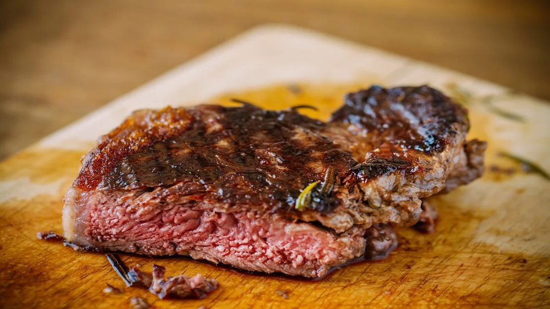
Asado.
Accommodation
Due to high inflation, hostel, and hotel prices are often quoted in U.S. dollars. Expect to pay $8-10 for a dormitory bed and at least $20 for a hotel room.
In big cities, I recommend taking a look at Airbnb.
N.b. By law, all payments for lodging only, no food or extra services, made with a foreign credit/debit card are not subject to VAT (21%). Many facilities pretend otherwise; others claim to have the reader “out of order.” If not specified when booking with a “cash only” or “cash only,” stick to it. On at least two occasions, after a brief discussion, I have saved myself the VAT; it is your right.
Activities
Activities are no exception and are much more expensive than in the rest of South America. Many national parks have entrances of 10-20€, not to mention organized tours; a one-day tour to Perito Moreno with 2 hours of kayaking costs about 200€.
Backpacking Argentina: safety
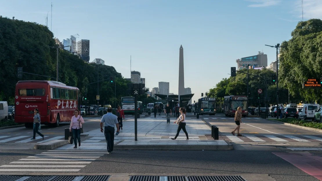
Is Argentina safe? In principle, yes. However, big cities and certain areas can be dangerous. In Buenos Aires, for example, you have to be especially careful in the evening, even in fairly central areas, and the whole area around the Retiro bus station is certainly not recommended during the daytime either.
Don’t be afraid. As always, with a little common sense, you shouldn’t have any problems. If you want to read some tips and tricks on traveling without worries, I recommend this article.
Are you planning a trip to Argentina? Check out these posts:
Do you have any questions? Updated information? Feel free to leave a comment or message me on Instagram!
Since I no longer run ads, if you found this article helpful, please consider purchasing your travel insurance through one of the links on this site. Doing so supports my work at no additional cost to you. For EU and UK residents, I recommend True Traveller. For everyone else, I recommend HeyMondo, which offers a 5% discount. Thank you for your support!
For donations/pizzas and virtual beers 🙂
Did you like the post? Pin it!