La Palma Travel Guide
La Palma is a mountainous island that offers excellent trails for all hiking enthusiasts, lush forests, colonial towns, and a more authentic atmosphere than other more popular Canary Islands.
As if that were not enough, thanks to its geographical location, land morphology and regulations to limit light pollution as much as possible, the island is one of the best places in the world for stargazing. The only negative note is perhaps the beaches, not exactly the most beautiful in the archipelago.
I visited La Palma over the course of a two-month trip during which I explored all the major islands of the archipelago except El Hierro.Whether it’s a backpacking adventure, a road trip or an all-inclusive vacation, you’ll find plenty of useful tips and insights in this guide to help you plan your trip to the fullest.
Quick menu
- When to visit La Palma
- Documents and vaccinations for going to La Palma
- What to do and see in La Palma
- Suggested itineraries in La Palma
- How to get around La Palma
- Backpacking La Palma: costs
- Backpacking La Palma: safety
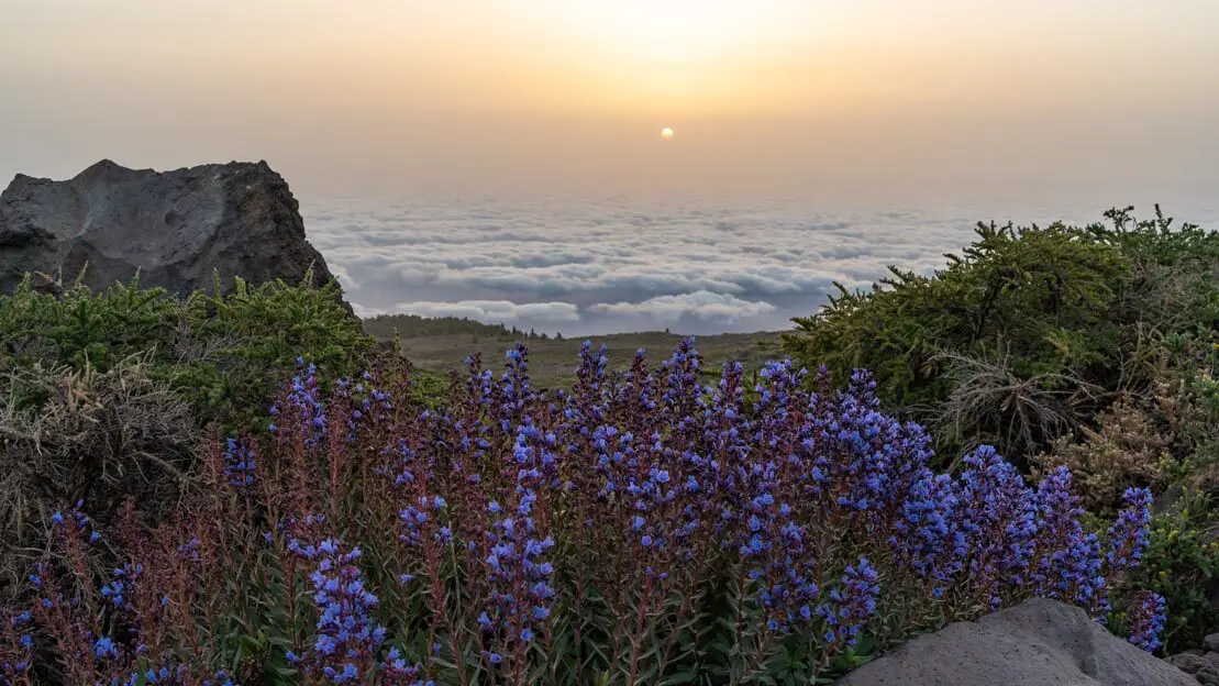
Sunrise at Roque de los Muchachos.
When to visit La Palma
La Palma, like the rest of the Canary Islands, enjoys a good climate throughout the year and can therefore be appreciated in all seasons.
La Palma in spring
During the spring months, temperatures typically range from 22 to 23 degrees Celsius, occasionally reaching a few degrees higher towards the end of May. Notably, precipitation, which may occasionally occur in March and April, is practically absent in May. This makes May a particularly ideal time for those looking to avoid the crowds and higher prices that characterize the peak summer season. It’s important to note that at higher altitudes (the island’s highest point reaches 2426 meters), minimum temperatures may drop to just a few degrees above zero, especially in early spring.
La Palma in summer
In La Palma and the Canary Islands in general June, July and August are considered high season. The weather is excellent and rainfall is absent. Toward the end of July the ocean water also begins to warm up. Of course, this is also the busiest and most expensive time of the year.
La Palma in autumn
September is a great month to visit the island. The weather is pleasant and the summer crowds have thinned, especially in the latter half of the month. While the chance of precipitation increases in October and November, along with a gradual drop in temperatures, it can still be an enjoyable time to explore the island.
La Palma in winter
Even in the middle of winter (December, January, and February), La Palma can be an appealing destination. However, it’s important to remember that December typically sees the highest precipitation, which gradually decreases until May.
Despite this, rainfall remains relatively low, and unless you’re particularly unlucky, you should still be able to fully enjoy your stay. However, it’s worth noting that temperatures can drop significantly at higher altitudes, potentially resulting in snow and restricted access to certain roads and trails. In fact, a record low of -8 degrees Celsius was recorded on the summit of Roque de los Muchachos in January 1990.
Mirador de la Concepción.
Documents and vaccinations for going to La Palma
The Canary Islands are, for all intents and purposes, part of Spain, and therefore, like any other country within the European Union, Schengen Area visa policy applies.
What to do and see in La Palma
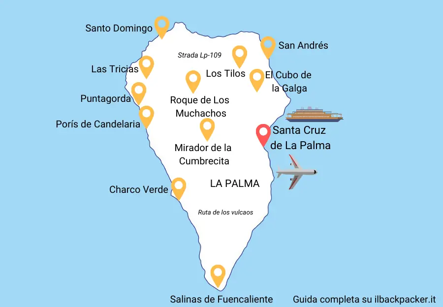
For your convenience, the points of interest are listed counterclockwise, starting from Santa Cruz. This is the order I chose for my visit, but you’re welcome to follow a different route. However, I believe exploring the island in the order described optimizes travel time and efficiency.
N.b. Several times throughout the guide you will find links to https://www.alltrails.com/. If you want to use offline navigation directly from the Alltrails app you need to upgrade to the pro version. However, you can get around this by downloading the coordinates from the desktop version of the site in “Google Earth KML” format and then uploading them to Organic Maps, which is by far one of my favorite travel apps.
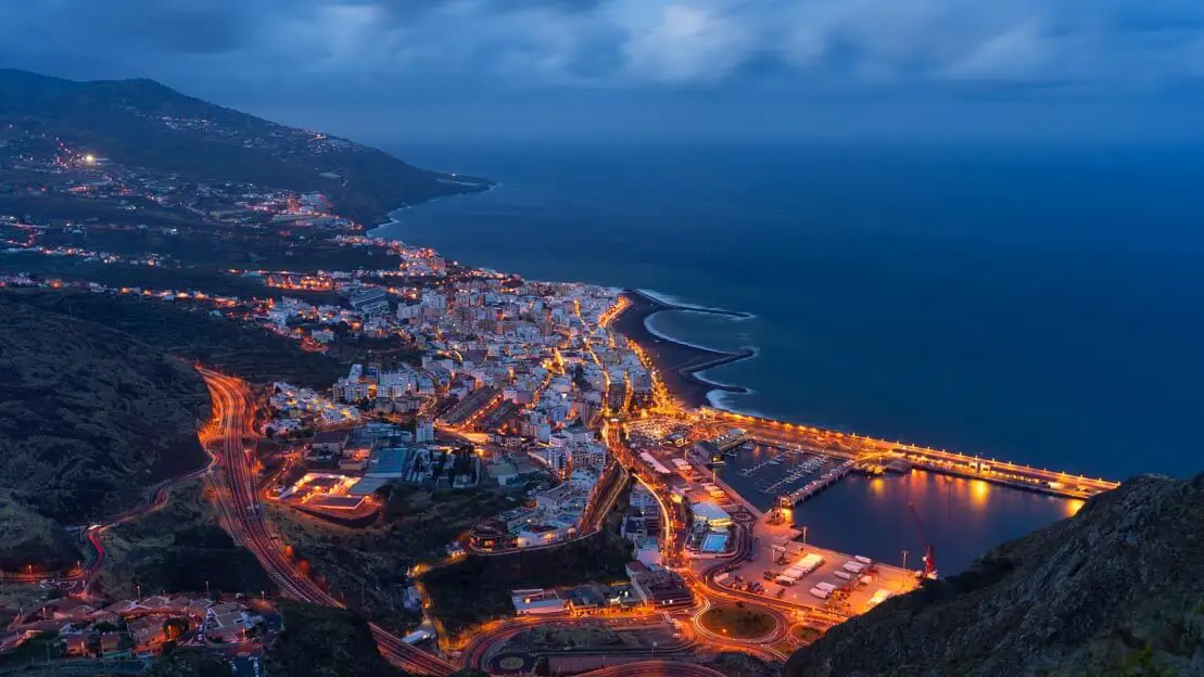
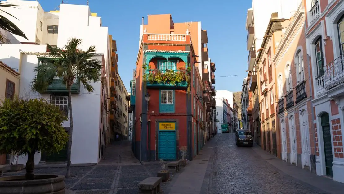
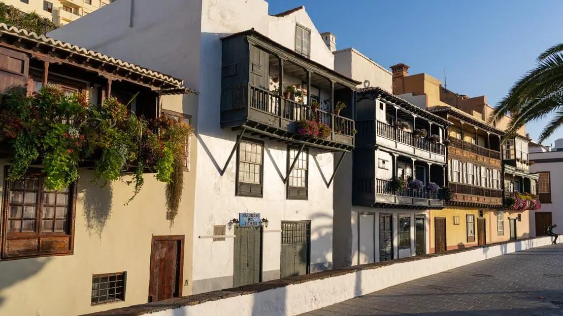
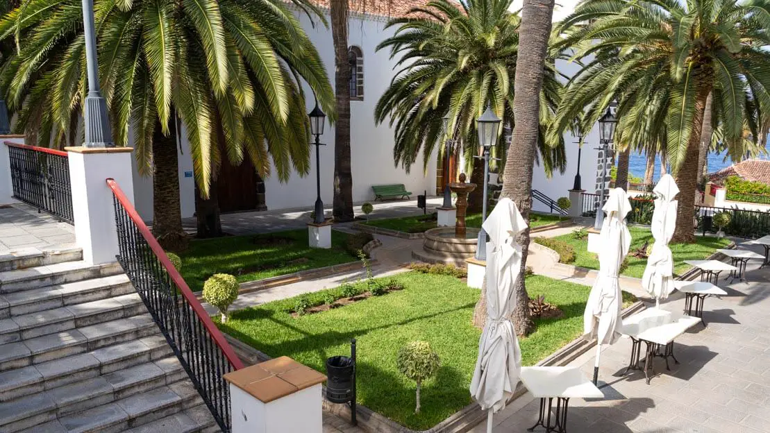
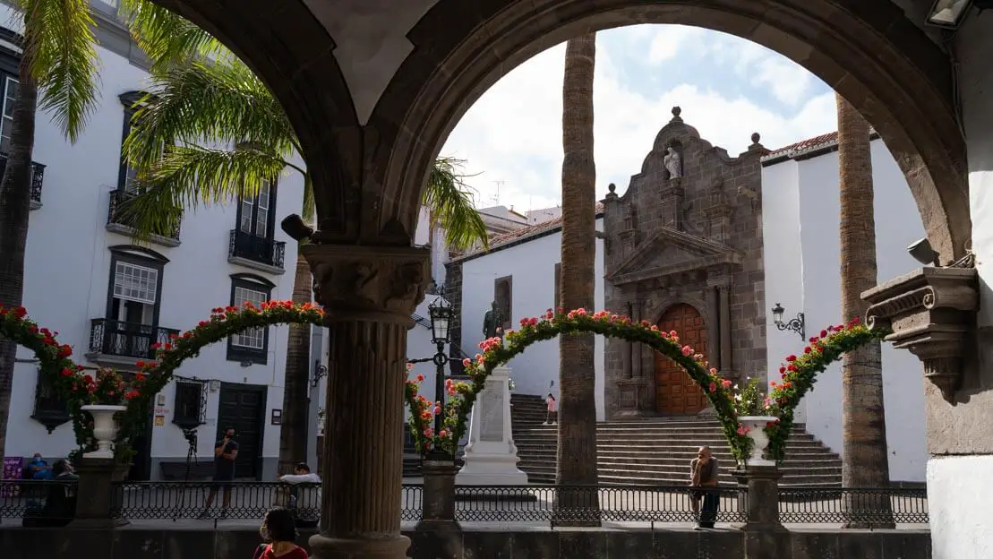
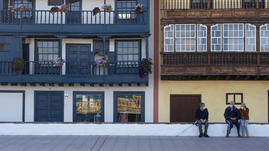
Santa Cruz de La Palma
Given that both the airport and the port are located here, Santa Cruz—the island’s capital—is an inevitable starting point for any trip to La Palma. This is fortunate, as it’s arguably the most beautiful city in the entire archipelago. The colonial-style old town is remarkably well-preserved, and strolling through its streets feels like stepping back in time.
Plaza de España and the Balcones de la Avenida Marítima are probably the two most iconic places to visit and photograph. Anyway, the city is really compact. In a couple of hours you can easily get around the center. Walking along the main street Calle O’Daly, and the adjacent side streets, is a treat for the eyes.
Santa Cruz.
While the town beach (Playa de Santa Cruz de La Palma) isn’t exceptional, its convenient location within walking distance of the center makes it a practical option. For a more adventurous experience, head north to Playa de Nogales, accessible via a short trail. This secluded beach is popular with surfers, though it’s not ideal for swimming. Alternatively, Playa los Cancajos, located south of town, is a popular and easily accessible beach with amenities such as restaurants, lifeguards, and umbrellas.
Finally, don’t miss the Mirador de la Concepción: this vantage point dominates the city from above and offers breathtaking views. The Mirador de la Concepción is a great place to enjoy breathtaking views of the city, especially in the evening when the city comes alive or at sunrise. If you don’t have a car, you can also reach it by bus, the 302 and 303 lines pass really close to it.
Balcones de la Avenida Marítima.
How to reach Santa Cruz de La Palma?
The airport is connected to the center by the 500 bus line. Departures are frequent and the stop is right in front of the exit. The island has daily ferry connections with La Gomera and Tenerife. If you travel light from the port to the city center you can easily walk.
Where to sleep in Santa Cruz de La Palma?
Pension La Cubana is an excellent inexpensive solution inside a historic building. There is also a small kitchenette where you can prepare some meals. Right in the center, another cheap option is Hostelit. If you are willing to spend a little more, check out El Hotelito 27.
Playa los Cancajos.
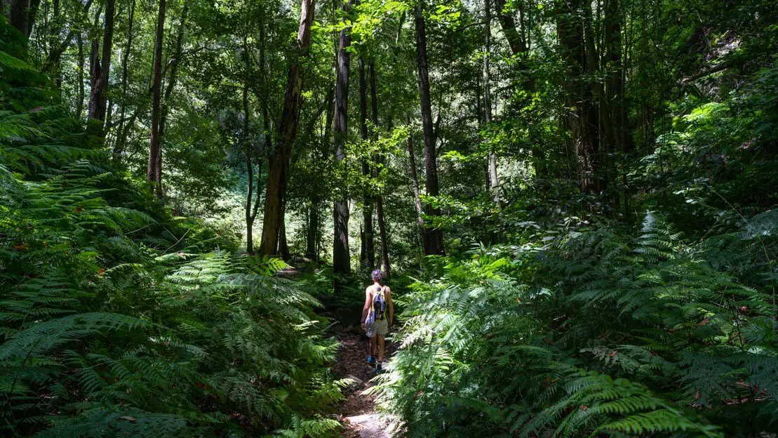
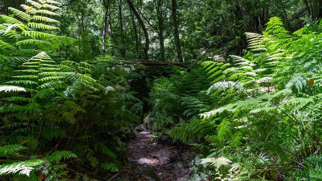
El Cubo de la Galga
This delightful excursion takes you into a barranco, a type of gorge formed along the slopes of a volcanic cone. The unique environment traps moisture, creating small ecosystems where the vibrant green laurissilva (laurel) forest flourishes. This surreal landscape stands in stark contrast to other parts of the island.
El Cubo de la Galga.
The route I followed is as described and at this page where you can download the gps coordinates. It is about 8.5km and 2-3 hours of walking. If you don’t feel like walking that much I still recommend doing a few kilometers and then going back without completing the circuit that leads to the Mirador de Somada Alta. Looking at the map it should be clear what I mean. The car is parked at this point where there is also a small information center.
Mirador de Somada Alta.
San Andrés
The small village of San Andrés is one of the most charming on the island. While it can be explored in less than half an hour, it’s worth lingering to admire the picturesque town square, encircled by colorful historic buildings and inviting bars and restaurants. Here, you can relax and soak in the beauty of this quaint old town.
San Andrés.
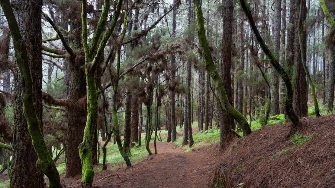
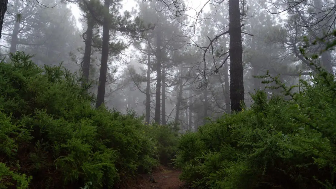
Los Tilos
Continuing north, we reach what is arguably the most popular hike on the island. Unfortunately, I was unable to experience it firsthand, as the access road to the barranco was closed for construction during my visit. However, the landscape is said to be quite similar to that of the Cubo de La Galga hike, with the trail winding through the lush laurissilva forest.
There are various trails of different lengths, but the “classic” route, detailed on this page, covers just over 5 km and can be completed in approximately an hour and a half. For the more adventurous, there’s also a challenging 20+ km option with over 1300 meters of elevation gain – not exactly a walk in the park!
It was precisely in Los Tilos, given its almost fairy-tale atmosphere, that some scenes of the TV series the Witcher were filmed. You can park your car at the end of the street at this spot, and if you really don’t feel like hiking you can simply walk to the nearby Cascada De Los Tilos.
Barranco vegetation.
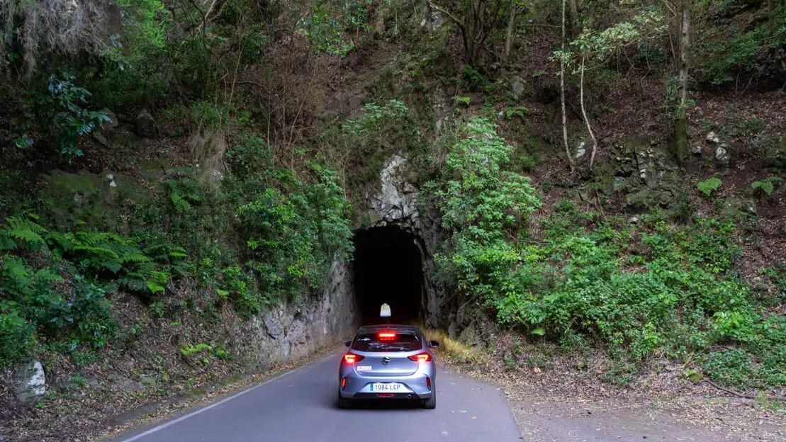
Lp-109 road and natural pools of La Fajana
Between Los Tilos and the western side of the island, don’t miss the Piscinas naturales de La Fajana and especially the Lp-109. The latter is a really scenic mountain road that makes its way through the forest while also passing through a few tunnels carved into the rock. There are also a couple of really nice viewpoints: Mirador de las Mimbreras and Mirador de Los Poleos.
Lp-109.
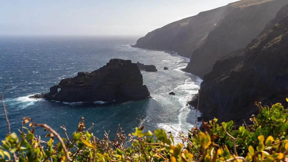
Santo Domingo de Garafía
Again, somewhat like San Andrés, this is a really small town that you can get around in no more than half an hour. Probably not as pretty but if you’re not in a hurry I think it’s an interesting place to stop for a bite to eat or just stretch your legs before continuing on to Roque de los Muchachos or down the west coast. If you decide to visit Santo Domingo, I would also recommend going down to the Mirador Roque de Santo Domingo where you have beautiful views of the coast and the rocky islets that characterize it.
Mirador Roque de Santo Domingo.
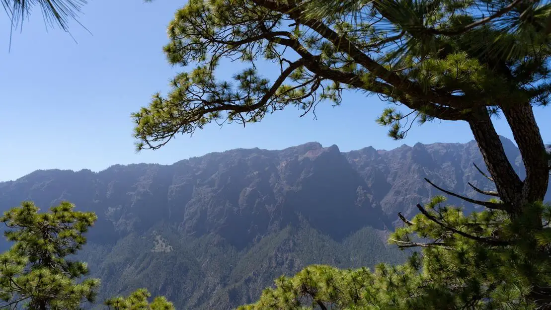
Roque de Los Muchachos
Roque de los Muchachos is undeniably one of the island’s top attractions. At 2426 meters above sea level, it offers not only fantastic panoramic views of the giant caldera, the ocean, and other islands in the archipelago but also houses one of the world’s most important astronomical observatories just below its summit. The numerous telescopes operated by various nations create a surreal, otherworldly atmosphere.
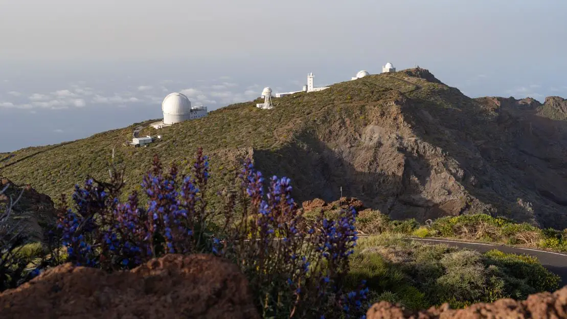
Some of the astronomical observatories.
What to do and see in Roque de Los Muchachos
Once you reach the parking lot at the summit, I recommend a short walk to the viewpoint for breathtaking views with minimal effort. Please note that the access gate to the road leading to the Roque de Los Muchachos summit is closed from 8 pm to 7 am, so plan your visit accordingly. Apart from enjoying the stunning vistas, there are no other activities at the summit itself.
Visiting an astronomical observatory
Unfortunately I visited La Palma right after the pandemic and tours inside the facilities were suspended. On this page you will find all the relevant information and if interested you can book your own guided tour. It is recommended to book well in advance.
Roque de Los Muchachos.
Stargazing
La Palma, a designated “Starlight Reserve,” boasts regulations that minimize light pollution, such as the use of extremely dim, reddish street lighting. This, combined with the low humidity and altitude, makes it an ideal location for both astronomical observation and stargazing with the naked eye. Spending a night, or even just a few hours, admiring the stars around Roque de Los Muchachos can be a truly unforgettable experience.
While I personally opted to sleep in my car by the roadside at this spot, those who prefer not to can wake up early or stay out late to witness the celestial display. Remember, it’s crucial to consider the moon phase when planning your stargazing excursion, with new moon nights offering the darkest skies and most brilliant starlight.
For the more adventurous, I met two German guys who spent the night inside the Cueva del Morro de Las Cebollas. It’s a really cool spot and especially valuable at over 2400 meters where temperatures can plummet. However, it’s important to note that sleeping in the cave is technically illegal. I’ll discuss this in more detail later in the guide.
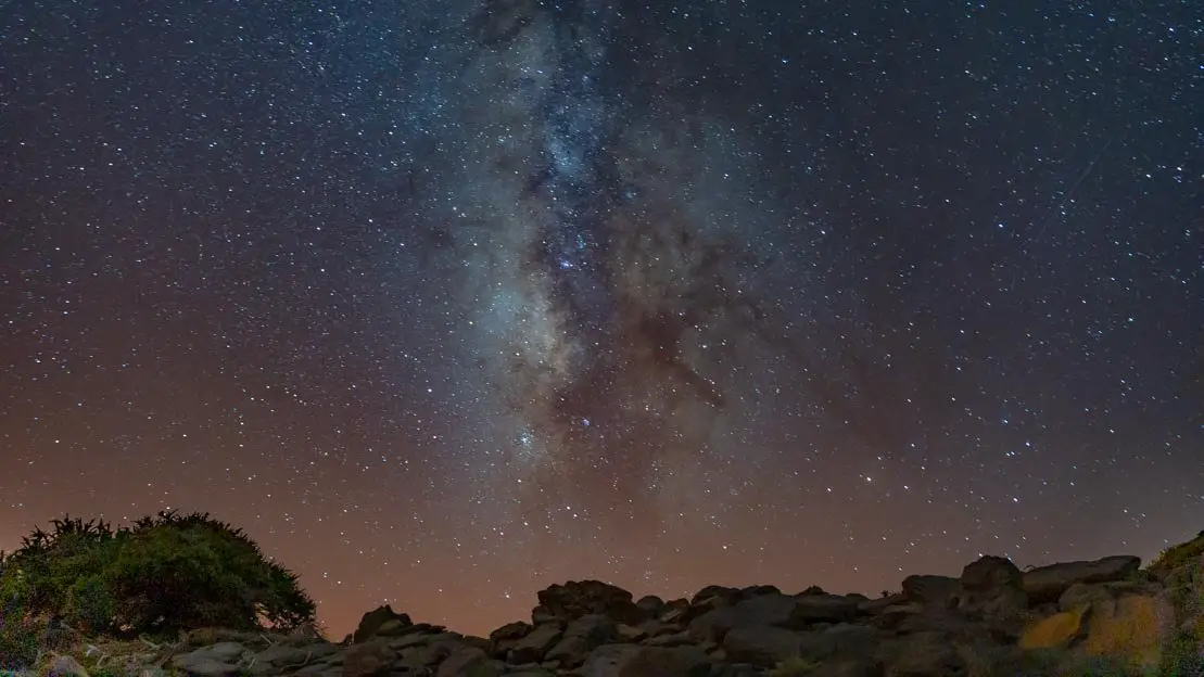
Milky Way, Roque de Los Muchachos.
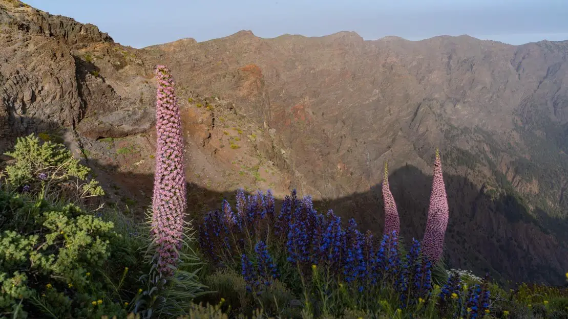
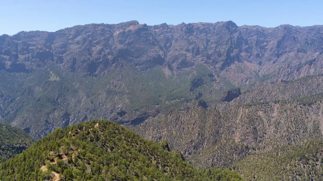
Cresteria de la Caldera
This is a scenic trail that runs all along the ridge of the caldera. You can start walking from the parking lot of Roque de Los Muchachos or alternatively from one of the points where the trail almost intersects with the road (LP-4) like here and here.
Many people, myself included, decide to hike up to Pico de La Nieve (but you can also go further if you want): starting from the parking lot on the top of Roque de Los Muchachos, it is about 20 km total, you go and come back by the same trail, 4:30-6 hours depending on the pace. The trail is really easy to follow and mostly flat. Anyway, you can find the GPS coordinates at this page.
Cresteria de la Caldera.
Even if you opt for a shorter version of the route in all honesty you are not missing anything as the view does not change much. In any case I recommend avoiding the middle hours of the day especially in summer. It can get very hot. It is also good to remember that if you decide to start walking from the parking lot on the top of Roque de Los Muchachos you should definitely return by 8:00 pm as from 8:00 pm to 7:00 am the access bar to the road leading to the top of Roque de Los Muchachos (this point) is closed!
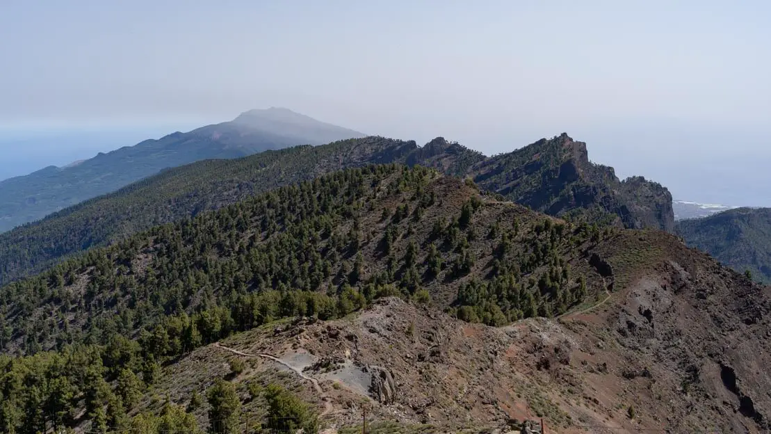
Pico de la Nieve.
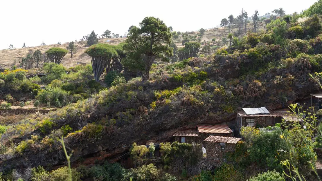
Las Tricias
A really nice and not too long trail starts from the small village of Las Tricias. It is in fact a little over 4 km in total, about an hour and a half. Right where the trail starts at this point along the road there is room for a couple of cars, otherwise park in the village and walk down.
The trail is as described on this page and passes through many really nice dwellings and dragon trees with the sea in the background. At point 2 you can see the Buracas or cave-houses that were used by the first humans to settle on the island. Not far away is a small bar where you can have a drink before heading back to the car. Certainly not a must-do excursion but undoubtedly a nice way to spend a couple of hours.
Along the trail.
Punta Gorda
The town of Punta Gorda in itself does not have much to offer other than being an ideal base for exploring the northwest of the island. In any case, around the town you can go to the Mirador de Izcagua which is very close to the El Fayal recreational area, a pine forest equipped with barbecue benches and bathrooms, not far away is also the Mercadillo del Agricultor which can be an interesting visit. I, however, could not match the time as it is only open on Saturdays and Sundays. Finally, you can go down to the Puerto de Puntagorda where at the end of a flight of steps there is a small pool and a series of small houses carved out of the rock; if you want, you can go down to the sea to swim.
Where to sleep in Punta Gorda?
Albergue Puntagorda is one of the few hostels on the island. If you are looking for an inexpensive solution without going far south this is probably the best option.
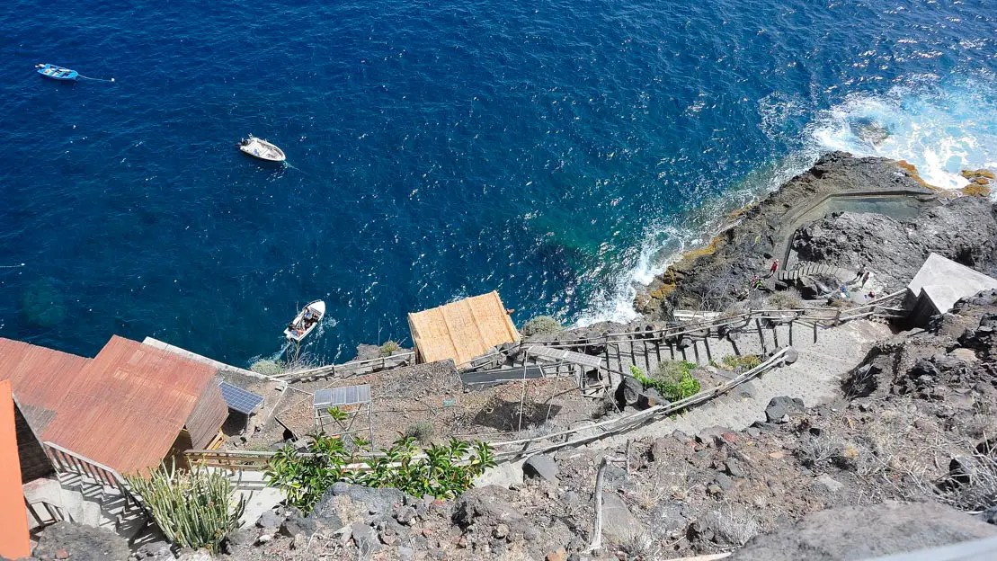
Steps leading to the Punta Gorda pool.
Porís de Candelaria
This is another spot I sadly missed because, just like Los Tilos, the access road was closed due to construction. But from what I’ve heard, it’s a super unique place that’s definitely worth checking out. This little fishing village has houses built right inside a giant cave, which is also a part of the structures themselves.
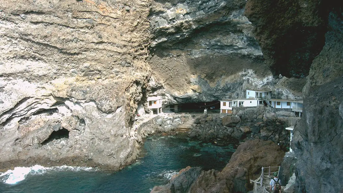
Porís de Candelaria.
Mirador de la Cumbrecita
Mirador de la Cumbrecita is probably along with Roque de Los Muchachos one of the most iconic places in La Palma and the Caldera de Taburiente National Park. It is nothing more than a vantage point at the top of the crater on the opposite side from Roque de Los Muchachos from where a series of trails start.
You can go up with your own car but if you intend to go between 8:30 a.m. and 4 p.m. it is essential to reserve parking online or at the visitor center. This is completely free but since there are only about 20 parking spaces to avoid traffic jams it was decided to implement this reservation system. Alternatively, you can get in a cab, the fare (one way or return) is fixed, 9€ every day except Sundays and holidays when the price rises to 10€. If you don’t feel like paying you could just hitchhike or walk up, in the end it’s only about 7 km with 500 meters of elevation gain. Taxis have a dedicated parking lot behind the visitor center.
Mirador de La Cumbrecita.
Once you arrive at the parking lot of La Cumbrecita there are several options. The first is to enjoy the view directly from the parking lot without the slightest effort. The second is to do a short circuit of about 3 km with very little elevation gain, about an hour. The circuit is described at this link and takes you to see two viewpoints: Mirador Lomo de las Chozas and the Mirador de Los Roques. Both are really nice, the trail is really accessible and there are also some benches along the way where you can relax and admire the view.
A much more challenging alternative is to climb Pico Bejenado, the trail is described on this page. It is just over 8 km total with 550 meters of elevation gain. At a brisk pace I climbed in an hour and a half and descended in an hour but if you are particularly slow it can take up to 4 hours. From the top of Pico Bejenado you have better views than the other viewpoints further down and the trail is really pretty but if for whatever reason you don’t feel like going up, don’t despair, the views are not that different.
Finally, it is possible to descend into the interior of the crater by following PR trail LP 13.1. In this case, however, given the distances involved, it is recommended that you spend the night at the campground located within the national park, which should be booked on this page. Should you decide to complete the trail, you will also have to arrange for transportation via taxi since you cannot leave your car for two days at the La Cumbrecita parking lot. You could also combine this excursion with the one to Cascada de Los Colores described below.
View of the Caldera along the trail to Pico Bejenado.
Cascada de los Colores
This is a hike I would have liked to do but partly because of time constraints, partly because you have to take a shuttle-taxi that costs 51€ I preferred to do something else. In any case on this page you will find the “classic” trail that starts at the Mirador de Los Brecitos where, however, parking is prohibited. What you are basically forced to do is to park your car there and then go up to the Mirador with the shuttles that leave from here and as anticipated it costs 51€ but if you are lucky and show up between 9:00 and 11:00 you should be able to share the ride with someone else (taxis operate from 8:00 to 12:00).
Once you reach the Mirador you can follow the “classic trail” at the end of which you return exactly where you left the car and took the taxi. As anticipated I have not completed this hike but it is really popular so I guess there is a good reason.
Where to sleep?
To climb the Mirador de la Cumbrecita or otherwise visit the central part of the island there are three really inexpensive options to use as a base, Casa Encantada and Casa Tranquila in El Paso a few kilometers from the visitor center and Hostel Vagamundo in Los Llanos.
Mirador de Los Roques.
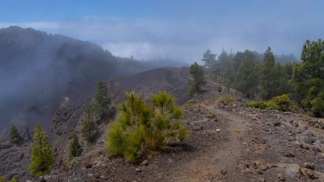
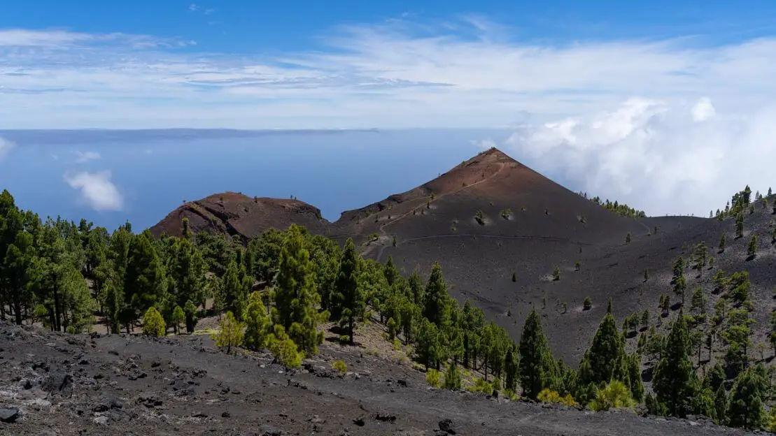
Ruta de los Vulcanos
This is without a doubt my favorite hike of all those done in La Palma. It is quite long and challenging as you start from a minimum of 17 km to over 20 km if you decide to climb to the top of any of the volcanoes you encounter along the way, which as the name of the trail suggests are several. On this page you will find the gps coordinates of the “classic” version.
Fortunately, most of the trail, if completed as I recommend, is downhill except for the relatively short initial part where you climb for a few kilometers. The scenery is really varied and impressive, starting out walking among pine trees and then moving to a volcanic moonscape until you almost reach the sea. At a brisk pace with lunch break included we completed the trail in about five hours.
Ruta de los Vulcanos.
The downside of this trail is that it’s not a loop, so you’ll need to grab a taxi at some point to get back to your starting point. Considering that it is absolutely preferable to complete the trail downhill, my advice is to leave the car at the visitor center and from there take a taxi to Refugio El Pilar (there is no public transportation to the refuge), the fare again is standard, 13€ one way and as explained earlier, there is a dedicated taxi stand behind the visitor center.
In case there were no taxis, as happened to us, just call the number found at the parking lot. In less than ten minutes a taxi driver arrived from El Paso, in this case you also pay for the call, we paid 16.60€. Once you get to Los Canarios where the Ruta de los vulcanos ends, to retrieve the car you can take public transportation-to be precise, line 210 to Tajuya and then line 210 to the visitor center, 2.40€ and 1.50€ respectively (use the public transportation mode on google maps to look up the schedule, indicatively there is a bus every hour).
Ruta de los Vulcanos.
This is in my opinion the best and cheapest option if you exclude hitchhiking. If you are staying in El Paso you could take a taxi to the Refugio El Pilar without going through the visitor center or perhaps take another taxi instead of public transportation once you finish the trail. In short, it’s up to you but what is described above is generally considered the cheapest option.
Ruta de los Vulcanos.
Puerto Naos and Charco Verde
Puerto Naos and Charco Verde are two nice beaches not far from each other where you can spend some time and relax between excursions. Both are equipped beaches with plenty of showers and kiosks. There are also beach volleyball courts at Charco Verde. In short, don’t expect some remote beach all to yourself but when it comes to beaches these are among the best options La Palma has to offer. Of the two I personally recommend Charco Verde.
Charco Verde.
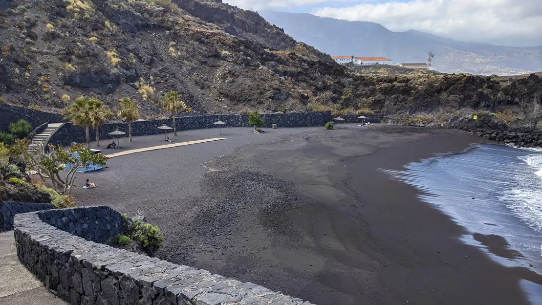
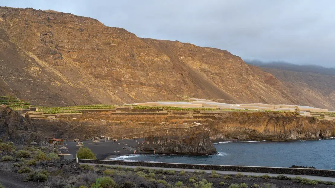
Salinas de Fuencaliente and Playa de Echentive
The south of the island doesn’t have much to offer. A day should be more than enough time to explore what is a particularly barren region lacking in attractions compared to the rest of the island. The salt flats of Fuencaliente and the lighthouse are definitely worth a visit, and if you still haven’t had enough of walking and climbing to the top of volcanoes, starting from the salt flats you could reach the top of Teneguía volcano.
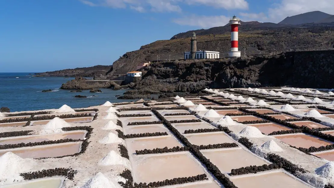
The salt flats of Fuencaliente.
Of course you are free to go down and up the same path but the circuit described on this page seems to be an interesting option. My friend and I preferred to spend the afternoon at nearby Playa de Echentive where there is a really nice natural pool that is perfect for cooling off without worrying about the sea current.
In conclusion, if you are looking for more information and insights on things to do and see, I recommend checking out the official Visit La Palma website. For hiking or biking and camping, senderos de palma is probably the ultimate resource while a really interesting blog with accurate descriptions of some of the most popular treks to do on the island is Pico Barro.
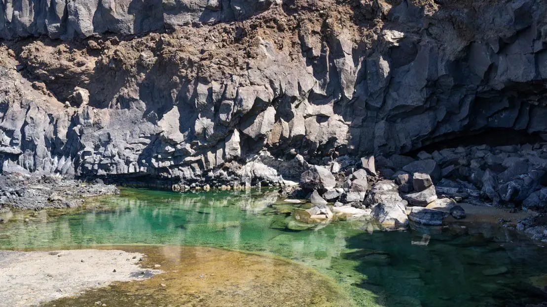 Playa de Echentive.
Since I no longer run ads, if you found this article helpful, please consider purchasing your travel insurance through one of the links on this site. Doing so supports my work at no additional cost to you. For EU and UK residents, I recommend True Traveller. For everyone else, I recommend HeyMondo, which offers a 5% discount. Thank you for your support!
Suggested itineraries in La Palma
If you’re not a big hiker, you can easily explore La Palma in just a few days. But for those of you who love to hit the trails, here are a few itinerary ideas depending on how much time you have. Use these as a starting point and customize your own trip using the info I’ve already shared.
5-day itinerary in La Palma
Within five days you can easily see all the highlights of the island.
Santa Cruz de La Palma (1 night)
Day 1:
Arrival in La Palma. Spend the day exploring the city and climb to the Mirador de la Concepción for sunset or sunrise the next day.
Puntagorda (2 nights)
Day 2:
In the morning choose between hiking to Cubo de la Galga and hiking to Los Tilos. Visit the small village of San Andrés and go to spend the night in Punta Gorda (or surroundings) via the Lp-109 road. If you have the will/time, in the afternoon before going to Punta Gorda you may as well go to the natural pools of La Fajana or go down to Santo Domingo.
Day 3:
Go to Roque de Los Muchachos. Walk along the Cresteria de la Caldera or perhaps visit one of the observatory.
El Paso (1 night)
Day 4:
Go up to the Mirador de la Cumbrecita and choose from one of the possible circuits.
Day 5:
Complete the Ruta de los Vulcanos. Return to Santa Cruz.
Plaza de España, Santa Cruz.
7-day itinerary in La Palma
With a week to spare, one can add some trekking in or perhaps spend a relaxing day at the beach.
Santa Cruz de La Palma (1 night)
Day 1:
Arrival in La Palma. Spend the day exploring the city and climb to the Mirador de la Concepción for sunset or sunrise the next day.
Puntagorda (2 nights)
Day 2:
In the morning choose between hiking to Cubo de la Galga and hiking to Los Tilos. Visit the small village of San Andrés and go to spend the night in Punta Gorda (or surroundings) via the Lp-109 road. If you have the desire/time, in the afternoon before going to Punta Gorda you may as well go to the natural pools of La Fajana or go down to Santo Domingo.
Day 3:
Go to Roque de Los Muchachos. Walk along the Cresteria de la Caldera or perhaps visit the economic observatory.
El Paso (3 nights)
Day 4:
Go up to the Mirador de la Cumbrecita and choose from one of the possible circuits.
Day 5:
Relaxing day at the beach in Charco Verde or trekking to Cascada de los Colores.
Day 6:
Complete la Ruta de los Vulcanos.
Day 7:
Visit the Salinas de Funicalantes and spend the rest of the day at Playa de Echentive. Return to Santa Cruz in the evening.
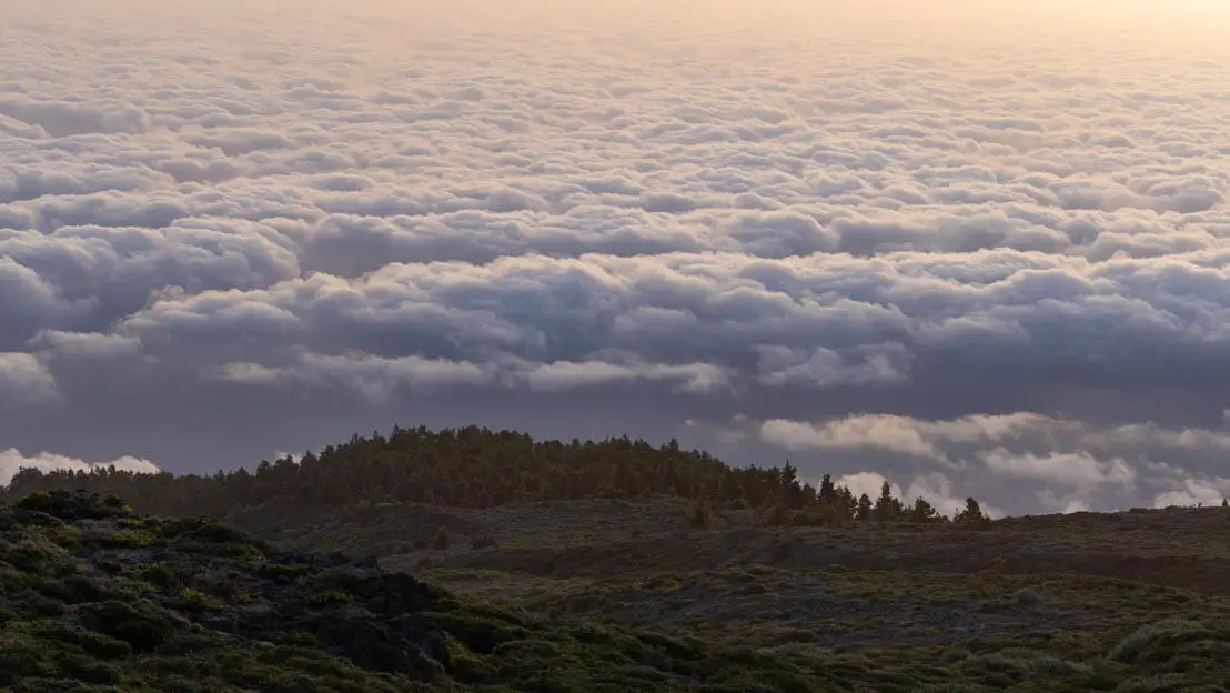
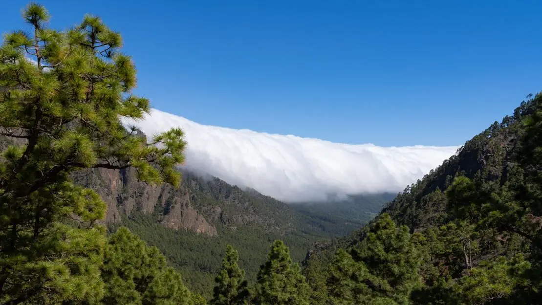
Sunrise above the clouds at Roque de los Muchachos.
10-day itinerary in La Palma
With ten or more days to spend on the island, I recommend following the one-week itinerary just described adding perhaps a day to spend in Santa Cruz, the town is really nice and if you want to fill the day, you can take a short trip out of town to Playa de Nogales or Playa los Cancajos.
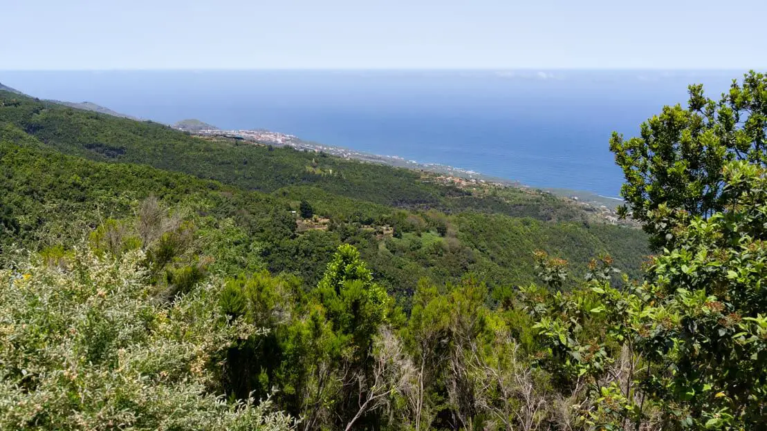
Another day could be spent in the northeast of the island between the natural pools of La Fajana and Los Tilos/Cubo de la Galga. Finally, another day you could visit Santo Domingo, Puerto de Puntagorda, Porís de Candelaria and complete the excursion to Las Tricias.
How to get around in La Palma
Although the island is quite small, being mostly mountainous, travel between destinations can take quite some time especially from east to west and vice versa.
In the Canaries in general, but especially in La Palma, although public transportation is not that bad I think renting a car is by far the best way to get around.
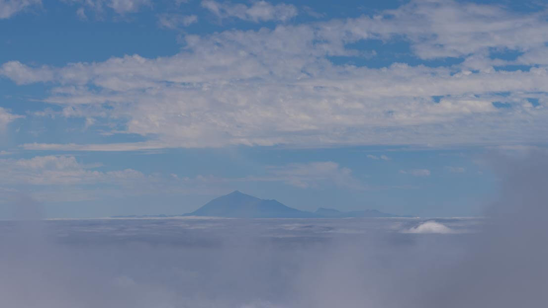
La Gomera as seen from La Palma.
Rent a car in La Palma
During my trip to the Canary Islands, I almost always rented my car with Cicar: the prices are competitive, you can easily pay without a credit card, no deposit is required, insurance is included and there are no deductibles, but most importantly, they have offices at all the ports and airports on the islands, which is really practical for those who are planning a touring trip.
Many other companies, on the other hand, have offices only at the airport, which is really inconvenient if instead of getting on a plane you want to drop your car off at the port and get on a ferry to another island.
In short, if you have an inter-island road trip on your mind or for whatever reason you don’t want to drop your car off at the airport, Cicar is probably the best option. In all other cases, it’s definitely worth considering other car rentals by checking out sites like Discover Cars. In any case, whether it’s Cicar or any other company, if you have specific dates, I recommend booking the car a few weeks in advance; doing so can really save you a lot compared to last-minute bookings.
It should be noted that virtually all rental companies technically do not permit driving on dirt roads. Despite this, we have driven on dirt roads several times, but you might get in trouble if something happens.
Furthermore, some companies technically allow you to take your rental car to another island via ferry, provided you return it to the original island. Many rental agreements explicitly prohibit leaving the island altogether. My advice, if needed, is to consider renting a separate car for each island you visit or at the very least inquire about the specific rental policies regarding inter-island travel.
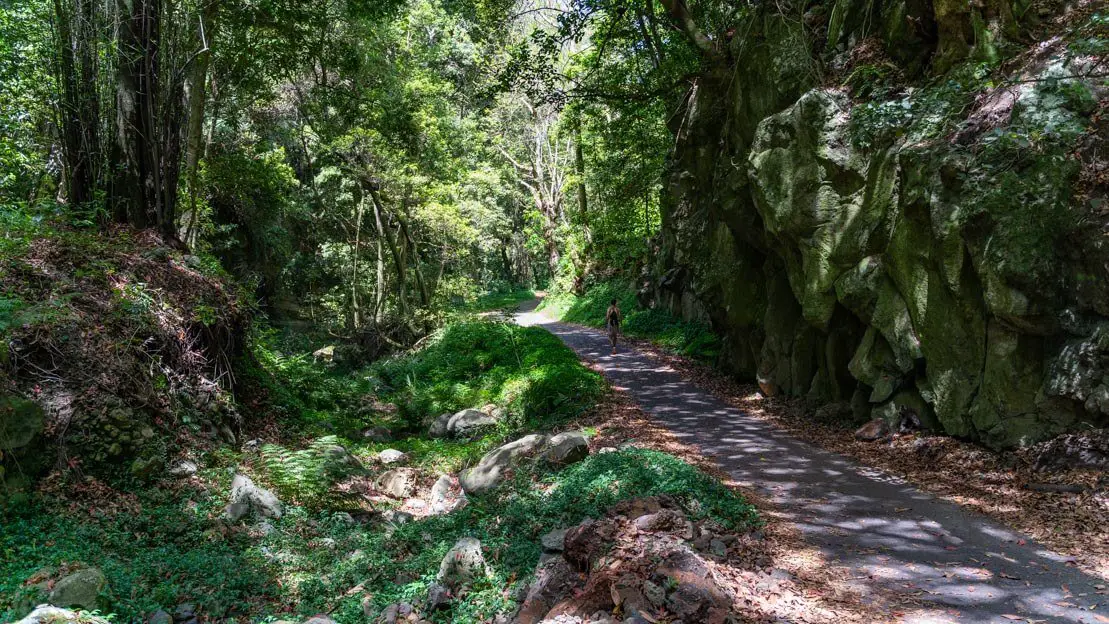
Along Lp-109.
Buses in La Palma
If you are traveling alone and want to save money compared to the cost of renting a car, have only a few excursions on your mind that you can arrange with some organized tours, don’t feel like driving or for any other reason don’t want to rent a car, public transportation is not bad at all and you can reach virtually any destination on the island with a little planning. On this page you will find the various routes and ride schedules.
The one time we took the bus, the “public transportation” function of google maps also proved reliable, but it is always best to check out the official website (there is also an app if you want).
Domestic Flights
The only two airlines operating domestic flights between the islands are CanaryFly and BinterCanarias. Prices tend to be very similar but in general Binter seems to be slightly cheaper and even has special fares for the under 29s. In any case I recommend taking a look at both and if possible booking at least a few weeks in advance for the best deals.
Ferries to La Palma
The cheapest alternative to flights and especially the most practical for moving between adjacent islands are ferries. As a rule of thumb, as long as it is the closest island or at most the next one, so in the case of La Palma, moves to Tenerife and especially La Gomera, not only do you save money by taking the ferry but it is also much more convenient as you do not have to show up at the airport two hours earlier but can simply go to the port an hour earlier or even less, buy your ticket and board without necessarily booking your trip in advance.
Basically, if you don’t have a well-established itinerary, moving by ferry gives you much more flexibility. However, if for example you want to get to Lanzarote from La Palma, it is clear that taking the plane is not only much faster but also cheaper. In any case, there are several ferry companies that operate between the islands, Direct Ferris is a site that aggregates all the companies and you can use to book your tickets if you wish.
Specifically, La Palma has daily departures from Santa Cruz to San Sebastián de La Gomera and Los Cristianos to Tenerife with Fred Olsen and Naviera Armas, Santa Cruz de Tenerife and Las Palmas to Gran Canaria with Transmediterranea.
Santa Cruz.
Backpacking La Palma: costs
How much does a trip to La Palma cost? Obviously it depends on a lot of factors, those who regularly read my blog know that I travel frugally and my trip to the Canary Islands was no exception, in fact I managed to maintain a budget of 1000€ per month or a little more than 30€ per day all inclusive during my two months on the archipelago.
However, I understand that not everyone is willing or interested in the backpacker’s lifestyle. The good news is that the Canary Islands remain relatively inexpensive by European standards. Prices are generally lower than mainland Spain because the islands are considered a special region where VAT is only 7 percent, and on many consumer goods, you pay no VAT at all. For example, the cost of gasoline is around 1€ per liter, and a meal at a restaurant, if you’re not too demanding, costs about 10€ or slightly more. In short, while they may not be as cheap as Latin America, by European standards, one can hardly complain about the prices.
Since we’re talking about costs I think it’s good to say a few words about what is certainly a great way to contain them-that is, camping. Wild camping in La Palma as on the other islands is technically illegal, but in reality it is widely tolerated. If you pitch your tent away from prying eyes you should not have any kind of problem, even better if, given the very low rainfall that characterizes the summer period, you don’t pitch your tent at all.
During my stay in La Palma, all the nights I spent “camping,” I always just inflated my camping mat when it was time for bed. At Charco Verde beach on a Saturday night there were even a couple of local families with children. But again, it’s technically illegal, so the choice is yours.
If you want to stay on the right side of the law, there are five official campsites available. I would also like to point out that for the two free campsites (the one inside the caldera and the one at Refugio el Pilar) you need to get a permit at the visitor center or alternatively at the Medio ambiente office in Santa Cruz.
Finally, to find places to camp I recommend the park4night app, designed especially for those who want to spend the night in an RV, minivan or car it is also a fantastic resource for those who simply want to find a secluded place to pitch their tent or simply put down a sleeping pad as we often did.
Cubo de la Galga.
Backpacking La Palma: safety
La Palma, and the Canary Islands in general, are super safe places with very low crime rates, making them perfect for families with kids. Of course, like anywhere else, it’s smart to use common sense and follow basic safety tips. Just be extra careful when swimming, as some beaches have strong currents, especially rip currents that can pull you out to sea. Many secluded beaches don’t have lifeguards, so it’s best to be cautious if you’re not a strong swimmer. And if you rent a car, don’t leave any valuables inside when you’re not around.
Are you planning a trip to Gran Canaria? Check out these posts:
Do you have any questions? Updated information? Feel free to leave a comment or message me on Instagram!
Since I no longer run ads, if you found this article helpful, please consider purchasing your travel insurance through one of the links on this site. Doing so supports my work at no additional cost to you. For EU and UK residents, I recommend True Traveller. For everyone else, I recommend HeyMondo, which offers a 5% discount. Thank you for your support!
For donations/pizzas and virtual beers 🙂
Did you like the post? Pin it!

2 Comments
Austeja
Hey, I am planing to go camping in la Palma. And I was wondering is there any not to expensive shops to buy a tent?
ilbackpacker
Hey! I had my own gear when I went, but you shouldn’t have trouble finding a cheap tent in La Palma. Check out local sports stores or big supermarkets; they often have affordable camping gear. Safe travels 🙂